Severe thunderstorms are forecast through this weekend along a slow moving cold front and secondary storm system that will impact areas from the southern Plains to the Great Lakes. Large hail and isolated damaging wind gusts are the main threats with these storms along with a risk for heavy to excessive rainfall which could bring flooding. Read More >
| Winter Weather Event February 25-26 |
|
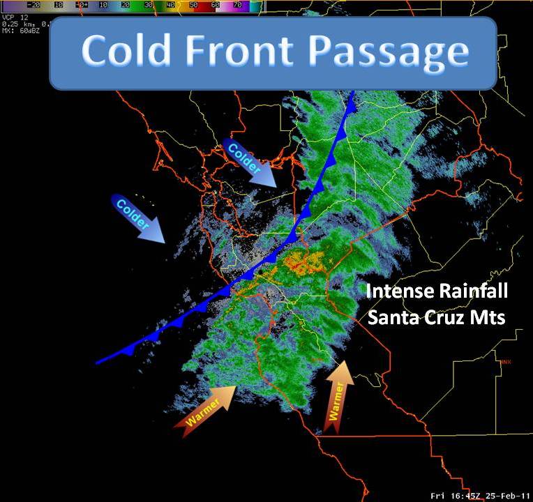
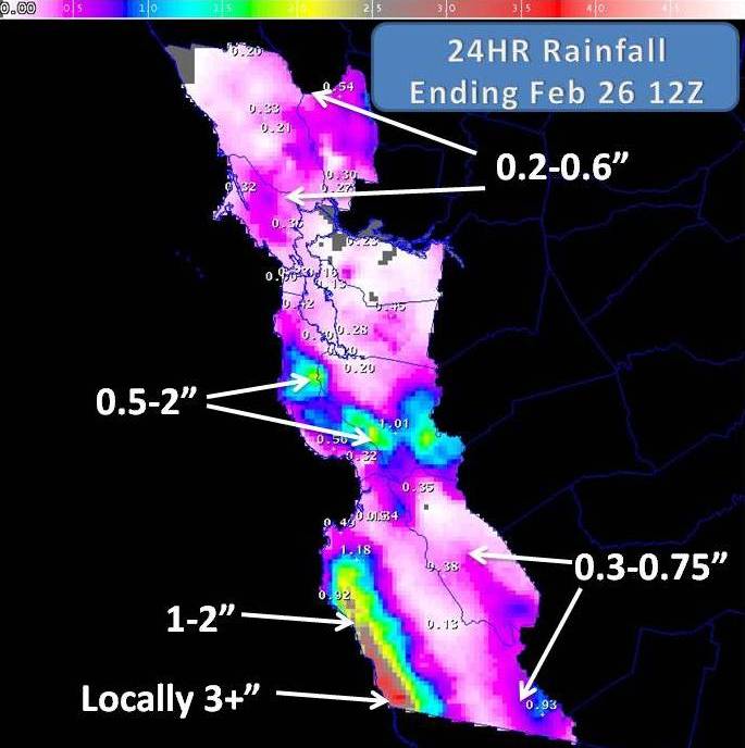
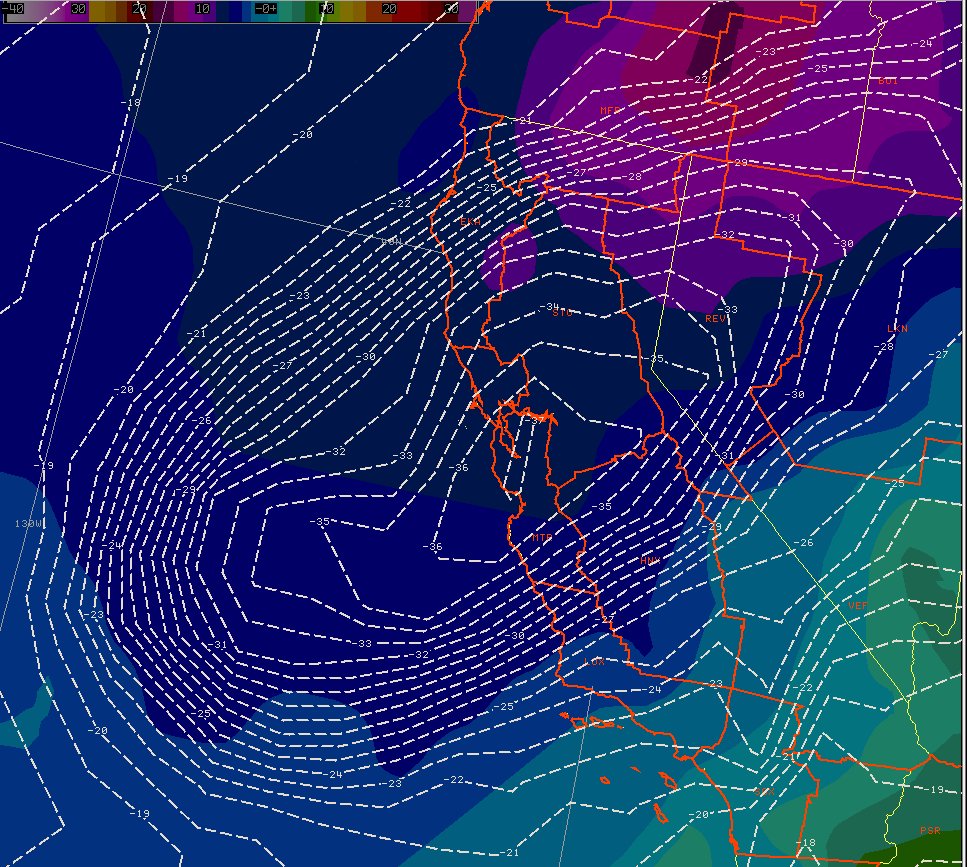
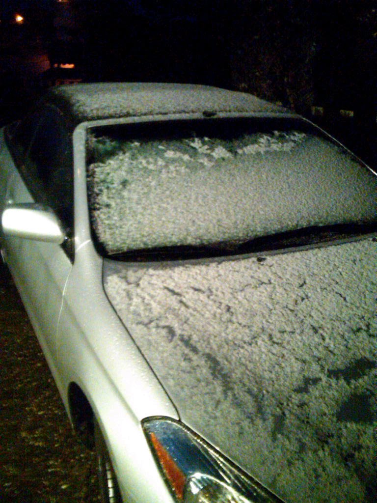
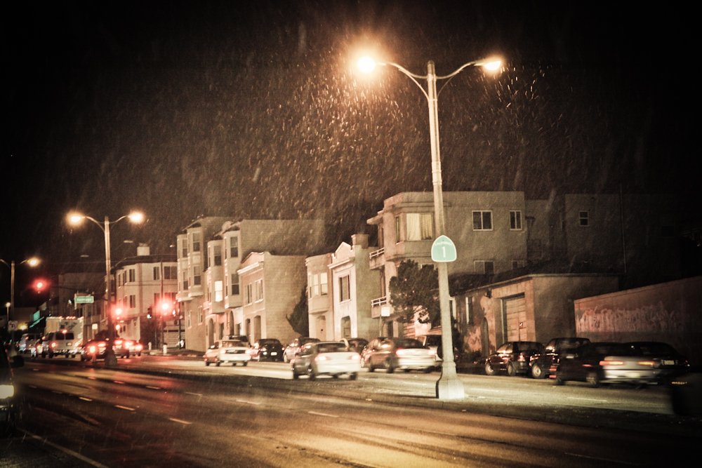
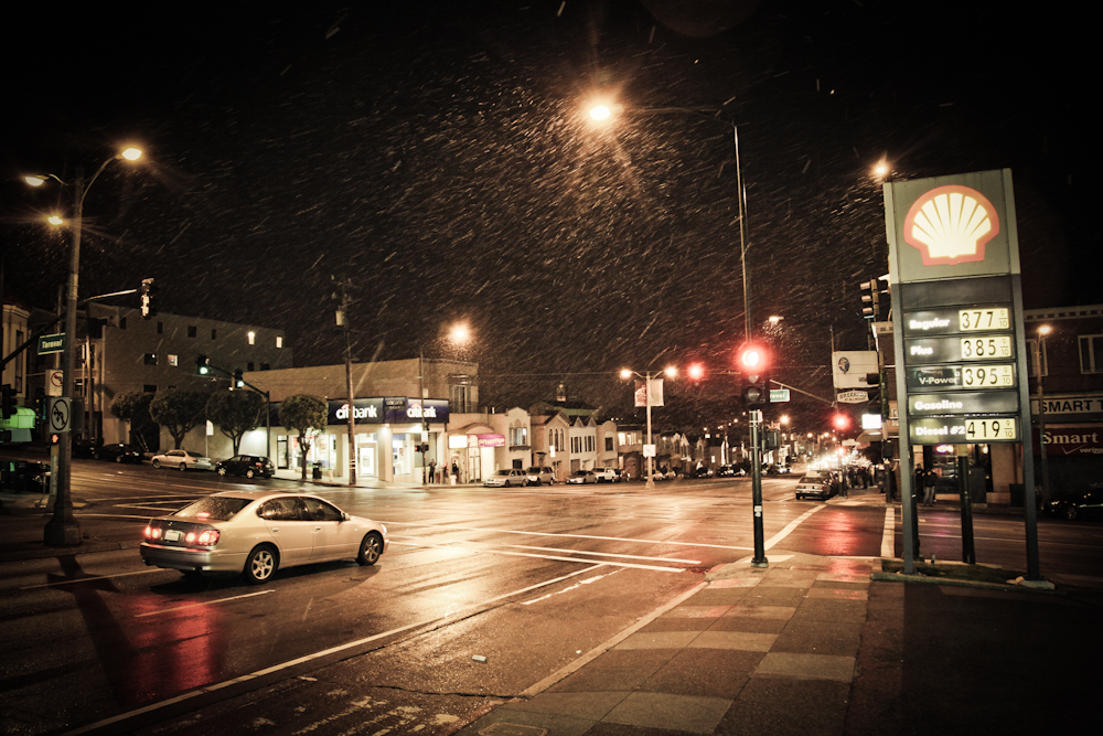
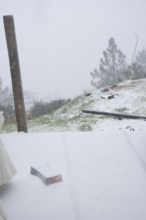
A potent and unseasonably cold storm system moved through the Bay Area February 25th and 26th bringing a mixed bag of weather to much of the region. Simply put, this system brought a one two punch to the region with a cold front first followed by record breaking cold weather with the possiblity of snow. The storm system began to impact the region on February 25th as a cold front traversed from northwest to southeast. The frontal boundary brought very heavy rain, gusty winds, small hail and storm damage to parts of the area. Interesting to note, as the front moved south through Santa Cruz County it began to stall over the mountains producing locally higher rainfall amounts resulting in mudslides and minor flooding. Behind the front, flow would quickly become northwest allowing one of the coldest air masses seen in quiet some time to move toward the Bay Area. Profiler data located north of San Francisco along the coast inidcated that snow levels were dropping rapidly behind the front. GOES Satellite sounder data indicated that 500 MB temperatures associated with the polar core were -36° C on Febrauary 25th. This was confirmed further as model guidance initialized on February 26th at 12Z with a -36° C core right over San Francisco. The million dollar question was how much precipitation would be around when the cold air and low snow levels finally moved in? As it turns out, a few showers did linger during the early morning hours of February 26th to allow for snow all the way down to sea level. However, only trace snowfall was reported around San Francisco. Therefore the last measurable snowfall in San Francisco still remains 1976. Farther south toward Monterey, light snowfall dustings were also reported. Higher peaks above approximately 2000 feet received more measurable snowfall with a few inches, which is not unusual for this time of year. The overall airmass remained rather unstable during the afternoon of February 26th which resulted in convective rain and snow showers across the region. Several weather spotters reported snow down to sea level once again, but no accumulation was noted.
|
|
Pictures
|
| Local Storm Report (LSR) - Storm damage with cold front |
 NWUS56 KMTR 252013
 LSRMTR

 PRELIMINARY LOCAL STORM REPORT
 NATIONAL WEATHER SERVICE SAN FRANCISCO CA
 1213 PM PST FRI FEB 25 2011

 ..TIME...   ...EVENT...      ...CITY LOCATION...     ...LAT.LON...
 ..DATE...   ....MAG....      ..COUNTY LOCATION..ST.. ...SOURCE....
             ..REMARKS..

 0650 AM     DOWNBURST        NE SAN FRANCISCO        37.78N 122.41W
 02/25/2011                   SAN FRANCISCO      CA   TRAINED SPOTTER

             VERY HEAVY RAINFALL,.11 INCHES IN 5 MIN TIME FRAME
             ACCOMPANIED BY 35 MPH WIND.

 0700 AM     HAIL             4 WSW BENICIA           38.05N 122.23W
 02/25/2011  M0.25 INCH       CONTRA COSTA       CA   TRAINED SPOTTER

             SMALL HAIL WITH STRONG WINDS AND INTENSE RAINFALL

 0810 AM     HAIL             5 W CUPERTINO           37.31N 122.14W
 02/25/2011  M0.25 INCH       SANTA CLARA        CA   CO-OP OBSERVER

             SMALL HAIL, WIND GUSTS TO 39MPH, 2.15 INCHES PRECIP PAST
             24 HOURS. RUNNING WATER OVER TERRAIN. SKYLINE RIDGE
             PRESERVE

 0810 AM     HEAVY RAIN       7 ESE LOS GATOS         37.20N 121.84W
 02/25/2011  M0.32 INCH       SANTA CLARA        CA   TRAINED SPOTTER

             .32 INCH PER HOUR RAIN RATE WITH WIND GUSTS 20 TO 30 MPH.
             ALSO SIGNIFICANT WATER RUNOFF NOTED
|
| Record Event Report (RER) - Record Low Temperatures |
 SXUS76 KMTR 261841 RRA
 RERMTR

 RECORD EVENT REPORT
 NATIONAL WEATHER SERVICE SAN FRANCISCO BAY AREA
 1030 AM PST SAT FEB 26 2011


 THE FOLLOWING SITES SET A NEW RECORD LOW TEMPERATURE FOR THIS DATE

                           LOW            PREVIOUS    YEAR OF
 SITE                      TEMPERATURE    RECORD      PREVIOUS RECORD

 NAPA                      27             30          1945
 OAKLAND                   34             38          1987
 OAKLAND INTL ARPT         32             34          1962
 SFO INTL ARPT             35             36          1971
 SAN RAFAEL                28             32          1996

 THE FOLLOWING SITES TIED PREVIOUS RECORD LOW TEMPERATURES

                           LOW                        YEAR OF
 SITE                      TEMPERATURE                PREVIOUS RECORD

 SAN FRANCISCO             37                         1962
 MOUNTAIN VIEW             34                         1962
 SAN JOSE                  33                         1897
 Click image for morning lows. |
MMEHLE