Active spring pattern across the center of the nation with several rounds of severe thunderstorms in the forecast through the weekend. The regions under the greatest threats are the southern Plains into the Mississippi Valley. Meanwhile, dry and breezy conditions with dry fuels are aiding in wildfires across the western High Plains and the Southeast. Wind and some snow for northern Rockies. Read More >
| Waterspouts & Tornadoes January 6, 2019 |
|
Since waterspouts and tornadoes do not occur very often in the Bay Area here is a little refresher:
Even though tornadoes and waterspouts are somewhat rare in the San Francisco Bay Area they do occur. Over the past 20 years 24 tornadoes have been reported in the Monterey WFO County Warning Area (CWA). The vast majority of these tornadoes were ranked EF0 to EF1 on the Enhanced Fujita Scale. However, on May 15, 1998, a F2 (original Fujita Scale) occurred in Sunnyvale, CA causing and estimated 3.8 million dollars in damage. Generally speaking, unlike 'Tornado Alley', most tornadoes in the Monterey WFO CWA are associated with low topped/mini supercells (<~15k feet) or along narrow cold frontal rainbands. Given the shallow nature of these storms, it should be noted that in some cases tornadic storms cells can be hard to detect on WSR-88D KMUX, which is at an elevation of 3,469 feet MSL. That is why the general public and trained storm spotters are invaluable in relaying severe weather reports to the National Weather Service. For a climatology of tornadoes in the state of California from 1950-2012 visit here |
|
January 6 Overview
|
|
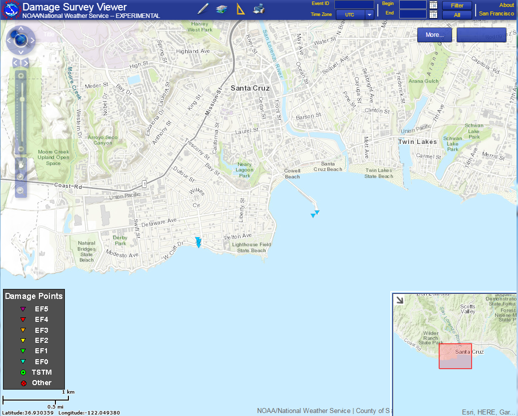
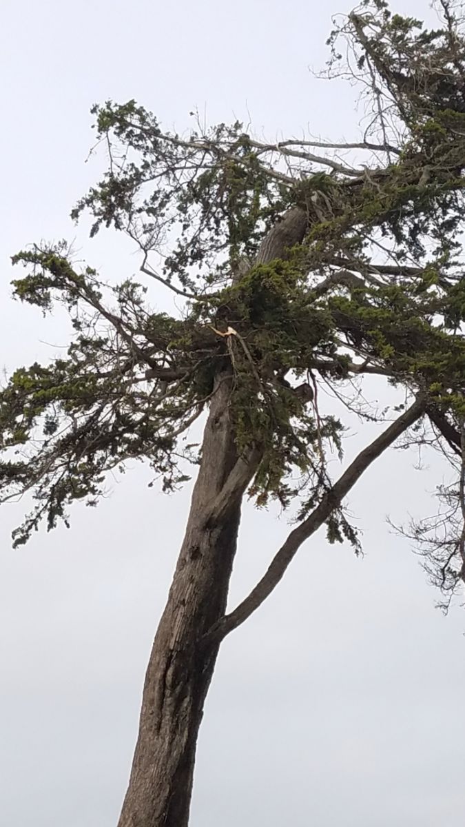
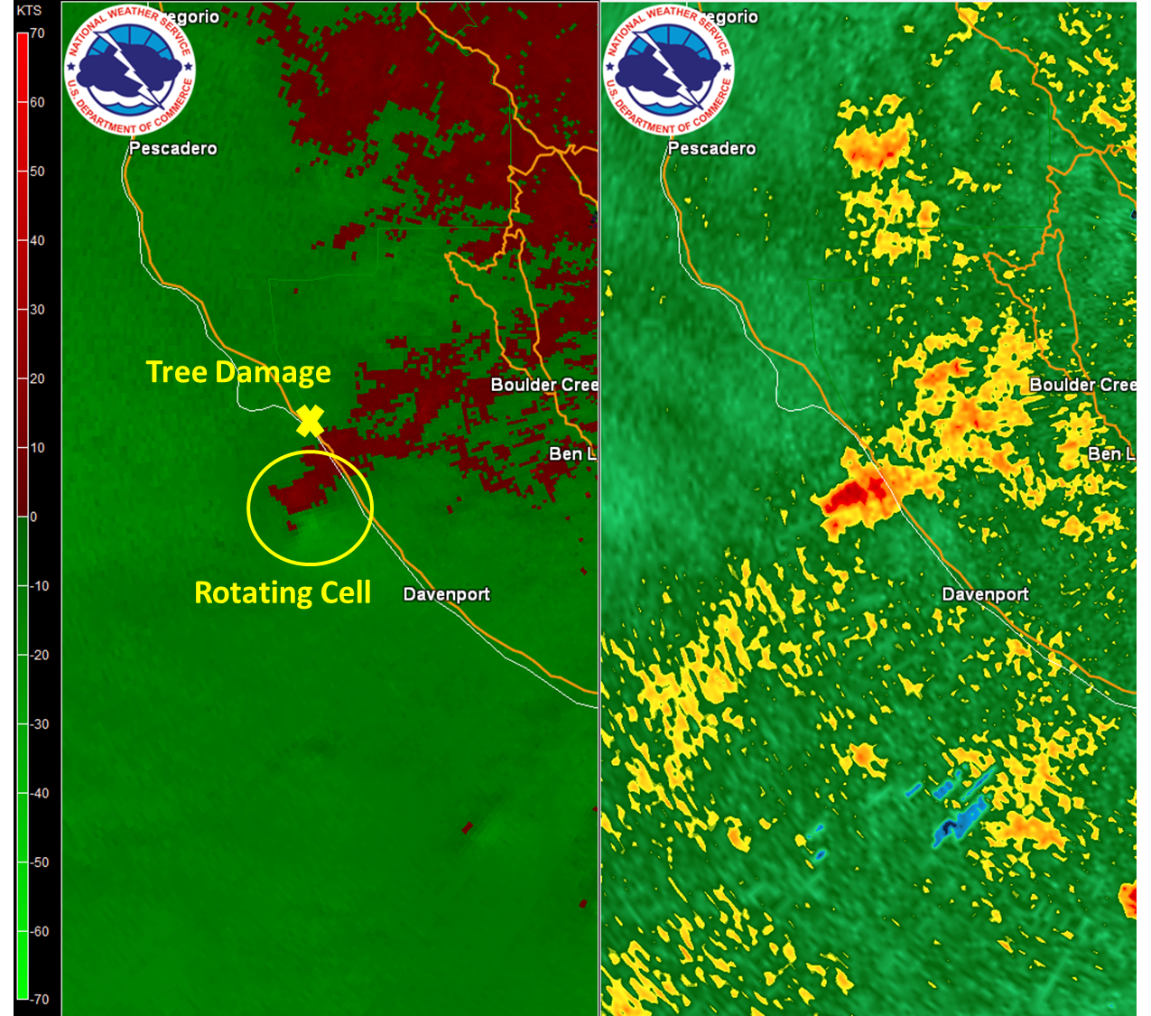
A vigorous cold front swept through California on January 5, 2019, bringing rain and wind to the region. The airmass became increasingly unstable behind the frontal passage leading to scattered convective showers. A second impulse took aim at the Bay Area on January 6, 2019, and was on track to bring more widespread rainfall to the region. The Oakland upper air sounding on the morning of January 6, 2019, indicated weak instability with weak low level shear. WSR-88D KMUX quickly revealed the instability and low level shear was sufficient as scattered low topped thunderstorms developed, some of them rotating, over the coastal waters. A group of cells ultimately developed off the Monterey Bay Coast tracking northeast toward Santa Cruz (see radar below). These fast moving cells held steady and a Significant Weather Advisory was issued for the Santa Cruz Coast prior to making landfall highlighting potential impacts. Two waterspouts developed (see video below) and made landfall as tornadoes: the first near West Cliff Drive and the second on the Santa Cruz Wharf. A National Weather Service Damage Survey Team analyzed the damage at both locations and determined these tornadoes were EF-0 strength. Damage included: broken trees, broken tree limbs, roof damage, and damage to agave cacti. A third area of damage was surveyed north of Santa Cruz, but later determined to be straight-line winds and not a tornado. The full Damage Survey Report can be found below.
|
|
...NWS Damage Survey For 1/06/19 Wind and Tornado Event in Santa Cruz County...
|
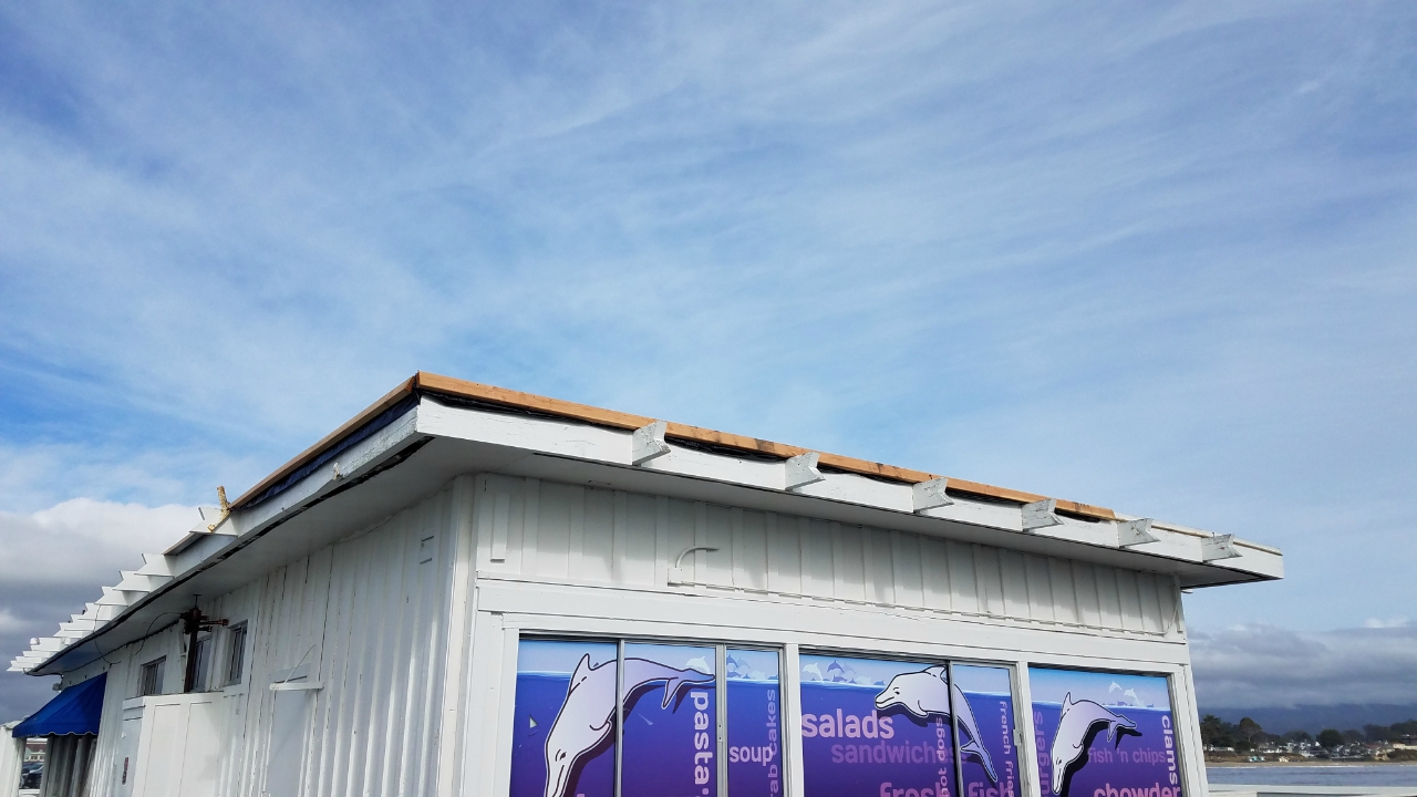
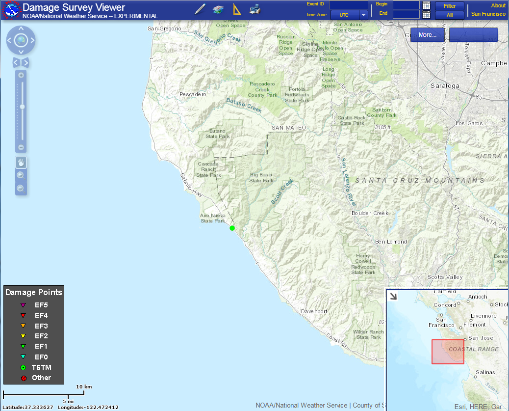
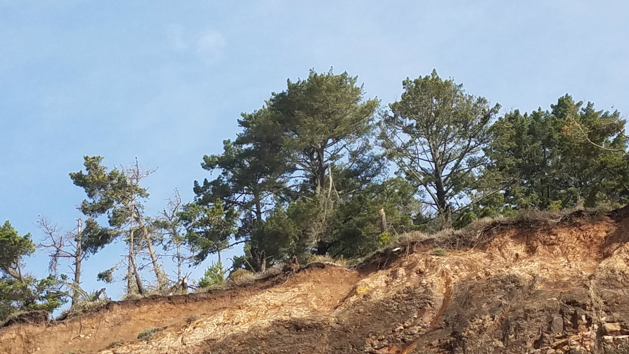
Public Information Statement
National Weather Service San Francisco Bay Area
405 PM PST Mon Jan 7 2019

 ...NWS Damage Survey For 1/06/19 Wind and Tornado Event in Santa
 Cruz County...

 .Straight Line Wind #1 Santa Cruz County
 Estimated Peak Wind:    65-70 mph
 Date:                   1/06/2019
 Time:                   11:50 AM PST
 Location:               8.6 NW Davenport / Santa Cruz County
 Lat/Lon:                37.1076 / -122.2913

 Storm Summary: Several trees showed indications of small and large
 limb damage along the ridge line. One tree may have been topped.

 .Tornado #1 Santa Cruz - West Cliff Drive
 Rating:                 EF-0
 Estimated Peak Wind:    65-70 mph
 Path Length /statute/:  125 yards
 Path Width /maximum/:   20 feet
 Fatalities:             0
 Injuries:               0

 Start Date:           1/06/2019
 Start Time:           11:59 AM PST
 Start Location:       1.7 SSW Santa Cruz / Santa Cruz County
 Start Lat/Lon:        36.9528 / -122.0378

 End Date:             1/06/2019
 End Time:             12:01 PM PST
 End Location:         1.65 SSW Santa Cruz / Santa Cruz County
 End Lat/Lon:          36.9537 / -122.038

 Storm Summary: Waterspout moved onshore along West Cliff Drive,
 just west of Woodrow Ave. As it moved onshore, it picked up a
 construction sign, and tossed it into the mailbox across the
 street. It also topped two agave cacti in the driveway, before
 hitting two trees, stripping several small and large limbs off of
 these trees before dissipating.

 .Tornado #2 Santa Cruz - Santa Cruz Wharf
 Rating:                 EF-0
 Estimated Peak Wind:    80-85 mph
 Path Length /statute/:  95 yards
 Path Width /maximum/:   20 feet
 Fatalities:             0
 Injuries:               0

 Start Date:           1/06/2019
 Start Time:           12:19 PM PST
 Start Location:       1.57 SSE Santa Cruz / Santa Cruz County
 Start Lat/Lon:        36.9569 / -122.0181

 End Date:             1/06/2019
 End Time:             12:20 PM PST
 End Location:         1.56 SSE Santa Cruz / Santa Cruz County
 End Lat/Lon:          36.9574 / -122.0174

 Storm Summary: Waterspout crossed the Santa Cruz Wharf, striking
 the Dolphin Restaurant and removing approximately 35 percent of
 its roof. The tornado also moved several picnic tables a few feet
 from their original position. The Dolphin general manager said
 that it felt like an earthquake struck the building at the peak of
 the lunch hour, but that the tornado dissipated shortly after
 striking the wharf.

 * EF Scale: The Enhanced Fujita Scale classifies tornadoes into
 the following categories.

 EF0...Weak......65 TO 85 mph
 EF1...Weak......86 TO 110 mph
 EF2...Strong....111 TO 135 mph
 EF3...Strong....136 TO 165 mph
 EF4...Violent...166 TO 200mph
 EF5...Violent...>200mph

 NOTE:
 The information in this statement is preliminary and subject to
 change pending final review of the event and publication in
 NWS Storm Data.

 $$
Palmer/Garcia
|
MMEHLE