Severe thunderstorms are forecast through this weekend along a slow moving cold front and secondary storm system that will impact areas from the southern Plains to the Great Lakes. Large hail and isolated damaging wind gusts are the main threats with these storms along with a risk for heavy to excessive rainfall which could bring flooding. Read More >
| Severe Weather Event April 27, 2016 | |||||||||||
|
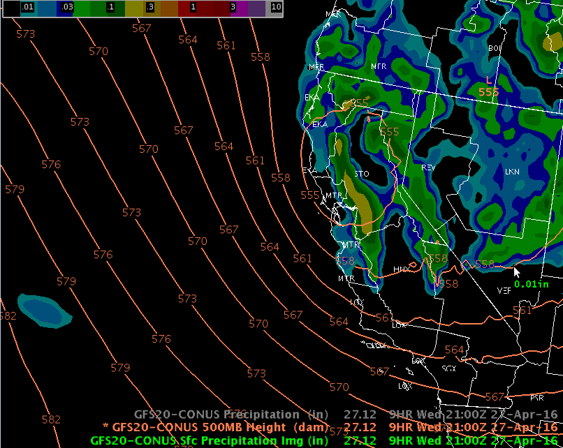
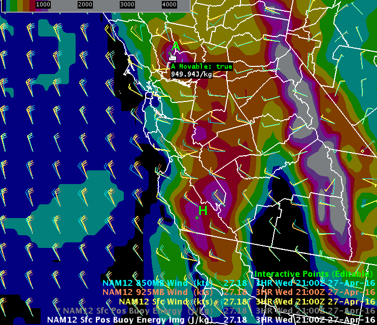
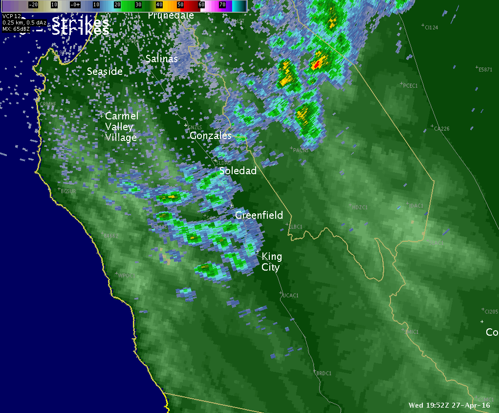
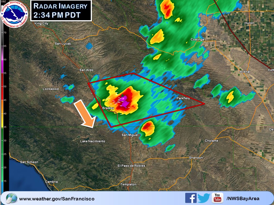
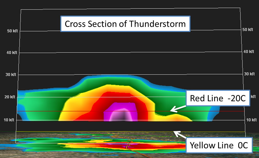
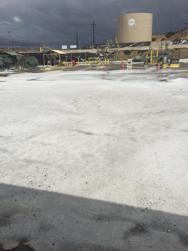
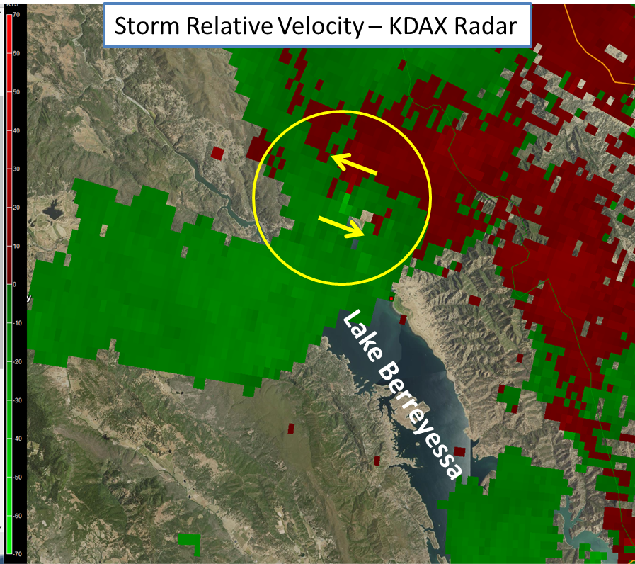
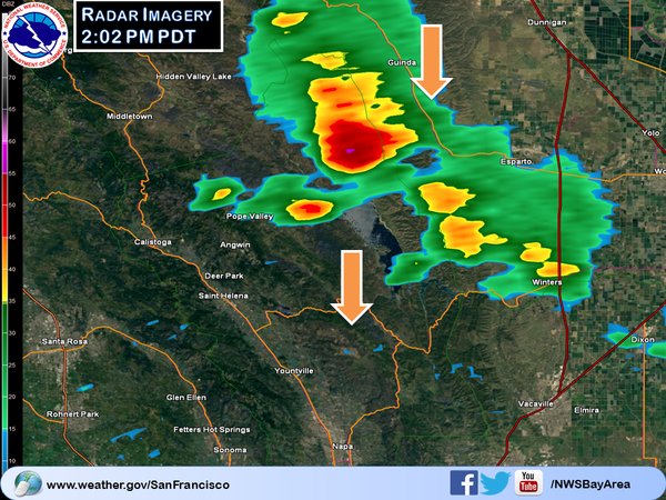
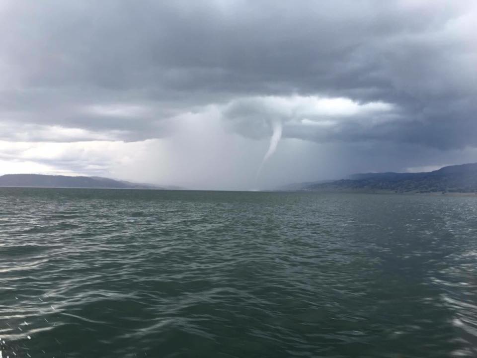
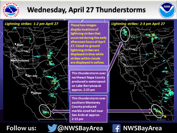
A storm swept through the Bay Area on the 27th of April, bringing showers, thunderstorms and even a waterspout. An upper level trough and associated cold front entered the North Bay early in the day and then moved southward through the entire Bay Area by the afternoon. The passing frontal boundary and cold air aloft help to set the stage for afternoon thunderstorms. Computer weather models forecasted the mid to late afternoon thunderstorm potential rather well. The GFS model imagery below depicts the passage of the upper level trough/low and associated precipitation. The NAM model imagery below depicts forecast surface based convective available potential energy (CAPE). In other words, CAPE is the measure of instability in the lower atmosphere (full definition here). Note the higher values of CAPE over northern Napa County and southern Monterey/San Benito Counties. The cold frontal passage earlier in the day brought mostly stratiform rain to the Bay Area impacting the morning commute. However, after noon enough instability was present and thunderstorms began to develop over Monterey/San Benito Counties. See the radar animation below. These developing thunderstorms continued to track south and develop even further (remember the NAM CAPE forecast). Through radar interrogation it was determined that this particular thunderstorm contained hail. The question was, how big? After utilizing dual pol radar imagery and radar cross sections evidence was growing that larger hail could be present. One technique meteorologists use for analyzing hail is the strength of the radar returns above 0C and especially - 20C. In the image below, higher returns were easily seen above the 0C line and -20C. As a result, a Severe Thunderstorm Warning was issued with the main threats being hail of one inch and wind gusts to 60 mph. We had one report of hail associated with thunderstorm. Enough hail fell to cover the ground white and make it look like it snowed (picture). Another notable thunderstorm that developed during the afternoon was located over northern Napa County (remember the NAM CAPE forecast). Thunderstorms developed north of Lake Berryessa and began tracking south(see radar image below). This particular thunderstorm eventually began to indicate weak rotation. The rotation detected on the KDAX radar ended up being a short-live waterspout. Confirmation of the waterspout was eventually reported via social media (see picture). In short, a waterspout is a tornado over water (full definition here).
|
|||||||||||
|
MMEHLE/WBLIER