
A heat wave over the Southwest will intensify late week, peaking and expanding into the Intermountain West and northern High Plains this weekend. Severe thunderstorms and heavy rain are expected over portions of the Plains and Mississippi Valley tonight, which will shift to parts of the Upper Midwest and mid-Mississippi Valley Friday. Monsoonal showers and flooding persist in the Desert Southwest. Read More >
San Francisco Bay Area, CA
Weather Forecast Office
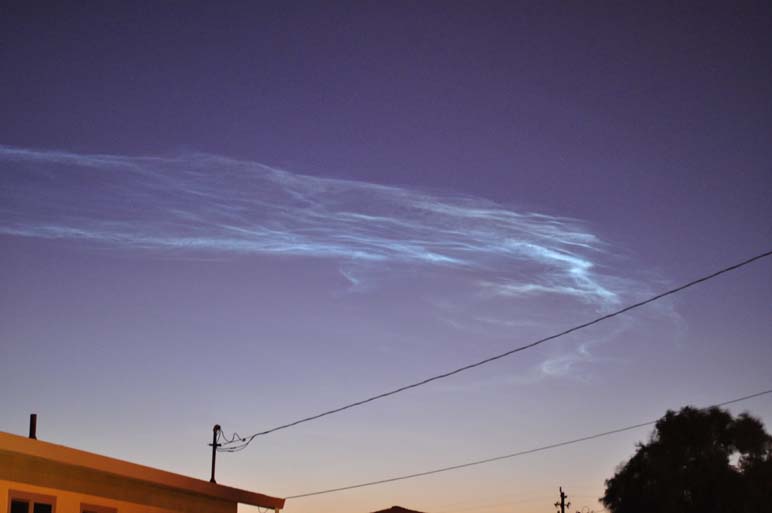
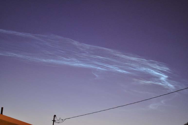
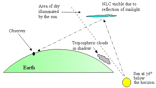
On the morning of October 28th,rare noctilucent clouds were visible over Monterey. Noctilucent clouds are thin silvery-blue cirrus-like clouds frequently seen during summer twilight conditions at high latitudes (above 50°) in both hemispheres. These clouds are primarily composed of ice crystals at heights 50-70 miles above the earth's surface. (source) However, the clouds seen this morning were formed by the launch of the NPOESS Preparatory Project spacecraft from Vandenberg Air Force Base, Calif.
Below are two images of the noctilucent clouds.
US Dept of Commerce
National Oceanic and Atmospheric Administration
National Weather Service
San Francisco Bay Area, CA
21 Grace Hopper Ave, Stop 5
Monterey, CA 93943-5505
(831) 656-1725
Comments? Questions? Please Contact Us.

