Severe thunderstorms are forecast through this weekend along a slow moving cold front and secondary storm system that will impact areas from the southern Plains to the Great Lakes. Large hail and isolated damaging wind gusts are the main threats with these storms along with a risk for heavy to excessive rainfall which could bring flooding. Read More >
| Heat Event August 31- September 4, 2017 | |||||||||
|
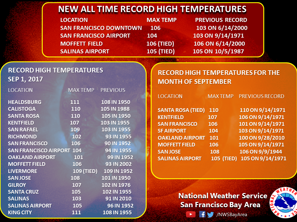
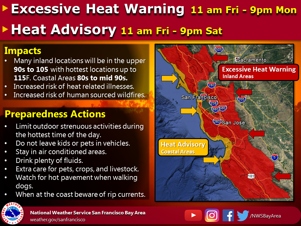
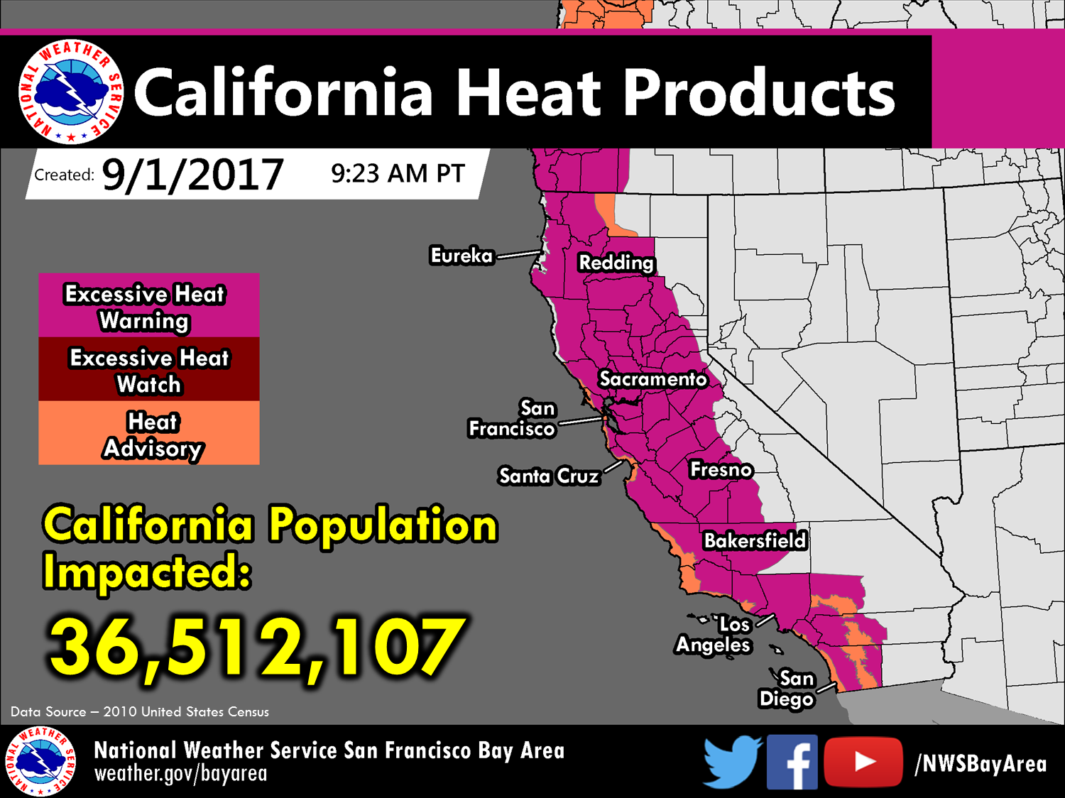
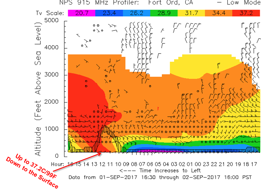
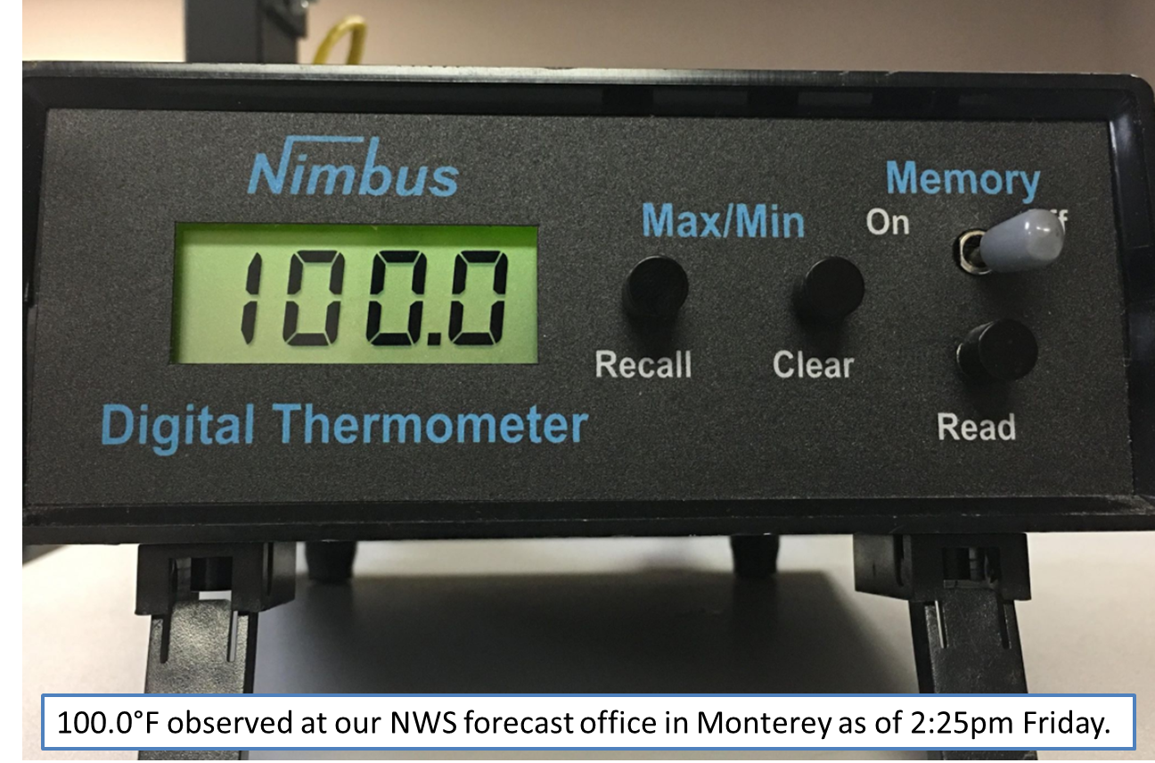
Widespread hot temperatures impacted the greater San Francisco Bay Area leading up to and through the Labor Day Holiday weekend, which set numerous daily and monthly records. In fact, a few climate stations around the Bay Area even set new all-time record maximum temperatures on September 1st and 2nd (see records below). Given decent consistency in the forecast weather models for several days, an Excessive Heat Watch was issued early Tuesday morning for much of the region. Subsequent Heat Advisories and Excessive Heat Warnings were issued through the weekend to highlight the risk of heat related illnesses, especially for sensitive populations(see below). A very strong upper-level ridge developed and moved over Northern California and Oregon by the afternoon of September 1st. (see weather model below). This ridge of high pressure completely compressed the marine layer by the evening hours on Thursday the 31st. With this, generally light and variable to weak offshore flow developed region-wide cutting off the marine influence from the Pacific Ocean (our region’s natural air conditioning). Under mainly clear skies Friday morning, temperatures rapidly climbed into the 90s regionwide with downtown San Francisco reporting a temperature of 95°F at noon local time. With no substantial sea-breeze, the city eventually reached 106°F between 3 PM and 4 PM PDT on Friday, breaking the all-time record high temperature for San Francisco dating back to 1874 of 103°F. Several other daily, monthly, and all-time records were broken on Friday with temperatures exceeding 100°F near the coast and 110°F inland that afternoon. The heat continued Friday night and into Saturday, the 2nd as most areas around the Bay Area cooled off just into the upper 60s to 70s overnight, with locations in the higher elevations only cooling into the 80s. With surface temperatures already off to a warm start Saturday morning, conditions quickly warmed once again through the afternoon with coastal areas exceeding 100°F and inland areas going over 110°F. By sunset Saturday evening, at least ten locations broke record high temperatures for the month of September (five of which surpassed values from the day before). In addition, six locations including downtown San Francisco, San Jose, Santa Cruz and Salinas set all-time record warm overnight low temperatures from Friday night into Sunday. The record breaking heat event came to an end during the day of Sunday, September 3rd, as onshore flow increased in response to the high pressure system shifting away from the region. While the oppressive heat ended, above average temperatures both during the afternoon and overnight hours persisted into Labor Day. |
|||||||||
|
GASS/BELL/MEJIA/MMEHLE