Severe thunderstorms are forecast through this weekend along a slow moving cold front and secondary storm system that will impact areas from the southern Plains to the Great Lakes. Large hail and isolated damaging wind gusts are the main threats with these storms along with a risk for heavy to excessive rainfall which could bring flooding. Read More >
| Heat Event June 17-23, 2017 | |||||||||||
|
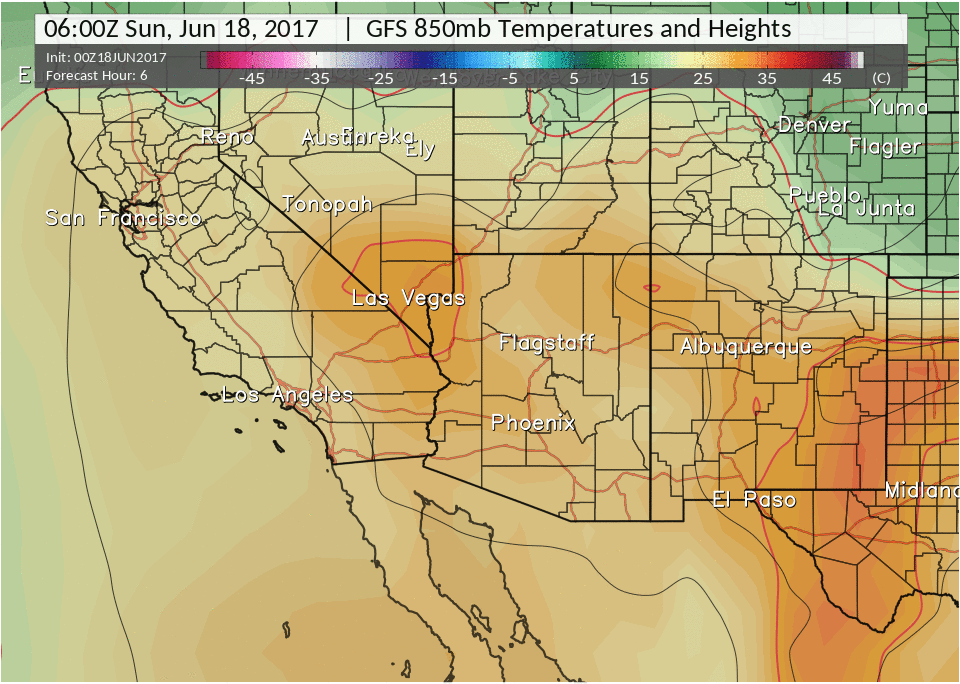
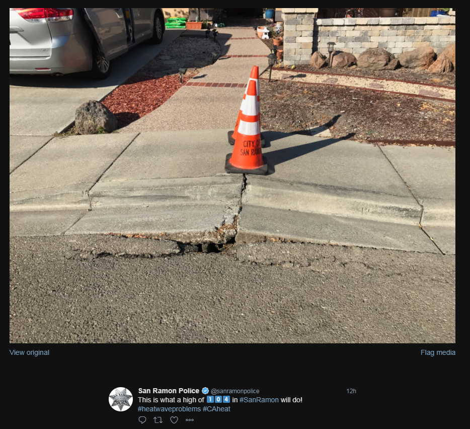
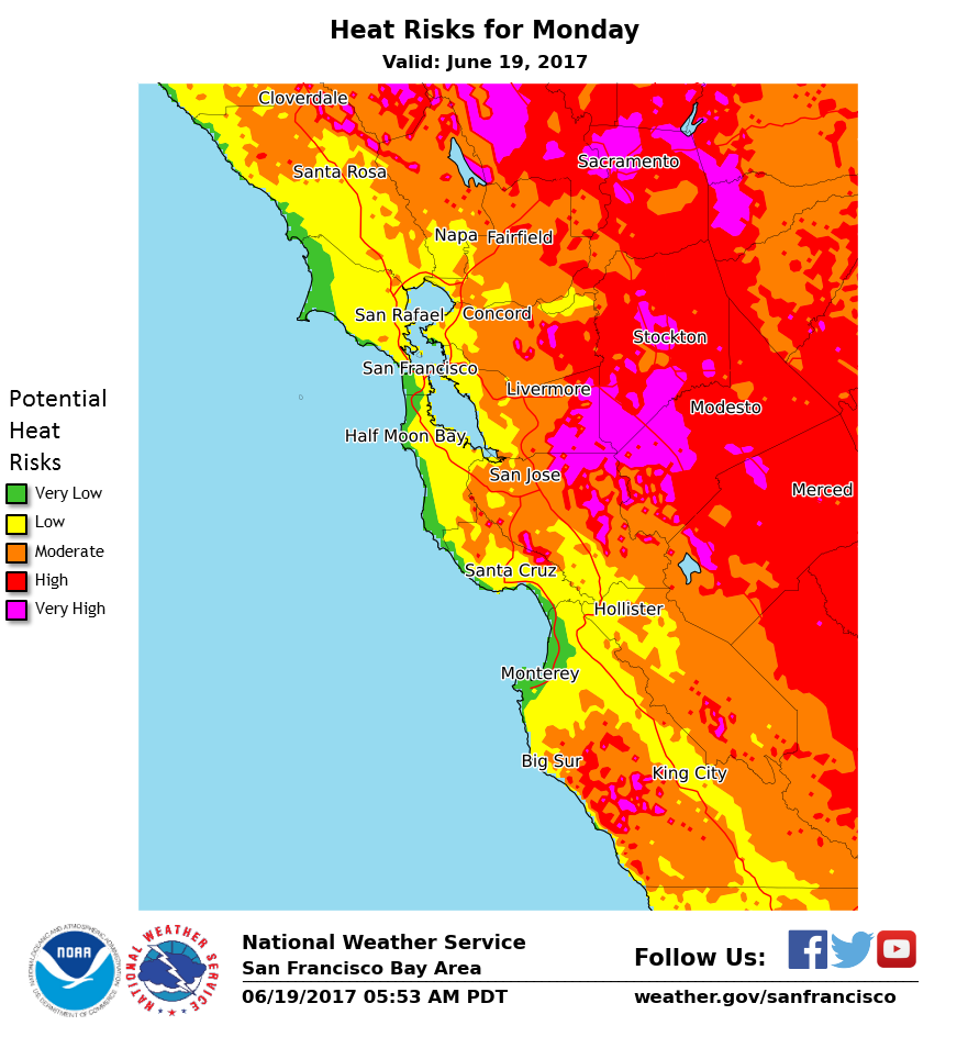
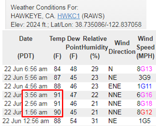
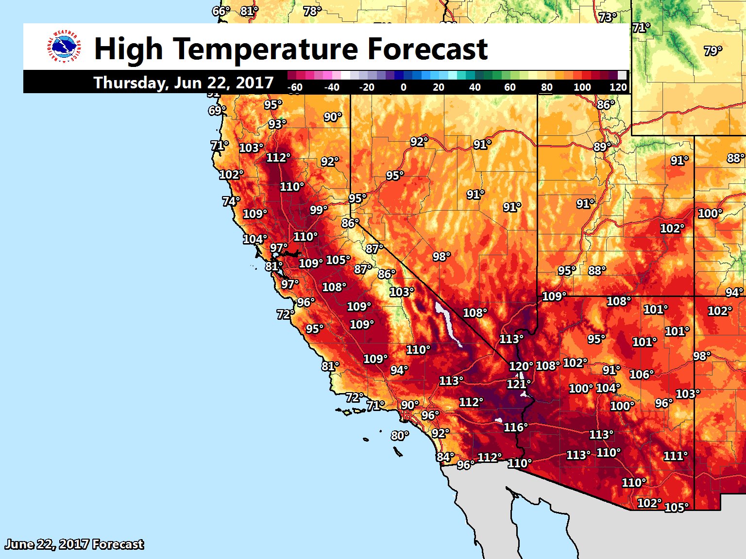
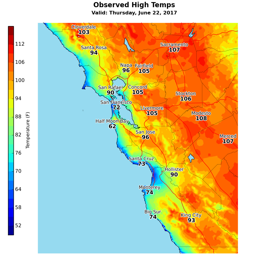
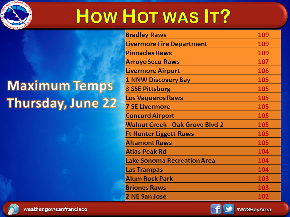
As the Bay Area approached the summer solstice, the forecast called for the first real heat wave of the summer season. Yes it's summer and yes it gets hot this time of year, but why was the forecast calling for dangerous heat with Heat Advisories and Excessive Heat Warnings? Simply put, strong area of high pressure. Computer weather models were in agreement depicting building high pressure coupled with developing offshore flow (NE and E winds). As meteorologists we use pattern recognition to predict the weather and we know this pattern is perfect for record heat, similar to the 2006 and 2008 heat events. An Excessive Heat Watch was first issued on June 15 to highlight the upcoming potential for heat risks to sensitive populations . The watch was eventually upgraded to a Heat Advisory. Lastly, the cumulative effect likely took a toll at some locations and the Heat Advisory was finally upgraded to an Excessive Heat Warning for Thursday. It should also be noted that the heat didn't just impact the Central Coast, but much of California and the Desert Southwest. Here is a snapshot of the all heat related hazards issued by the NWS. Locally, the peak heating came in two waves due to strong offshore flow, which led to record warmth on Sunday and near record warmth on Thursday. Except for Sunday, lingering low clouds and patchy fog along the coast kept the coastal areas much cooler. Away from the coast was a completely different story where triple digit highs were common place. The warmest conditions were observed across the interior portions of the North Bay, East Bay and Monterey/San Benito counties. Daytime temperatures were so hot roads and sidewalks buckles. Below is a picture of one such sidewalk. In addition to the dangerous daytime heat, temperatures remained impressively hot at night. Many locations over the higher terrain remained in the 70s and 80s. In fact, one location was still 91 degrees! at 3 AM. |
|||||||||||
|
|||||||||||
| Record Even Report (RER) - Record Temperatures | |||||||||||
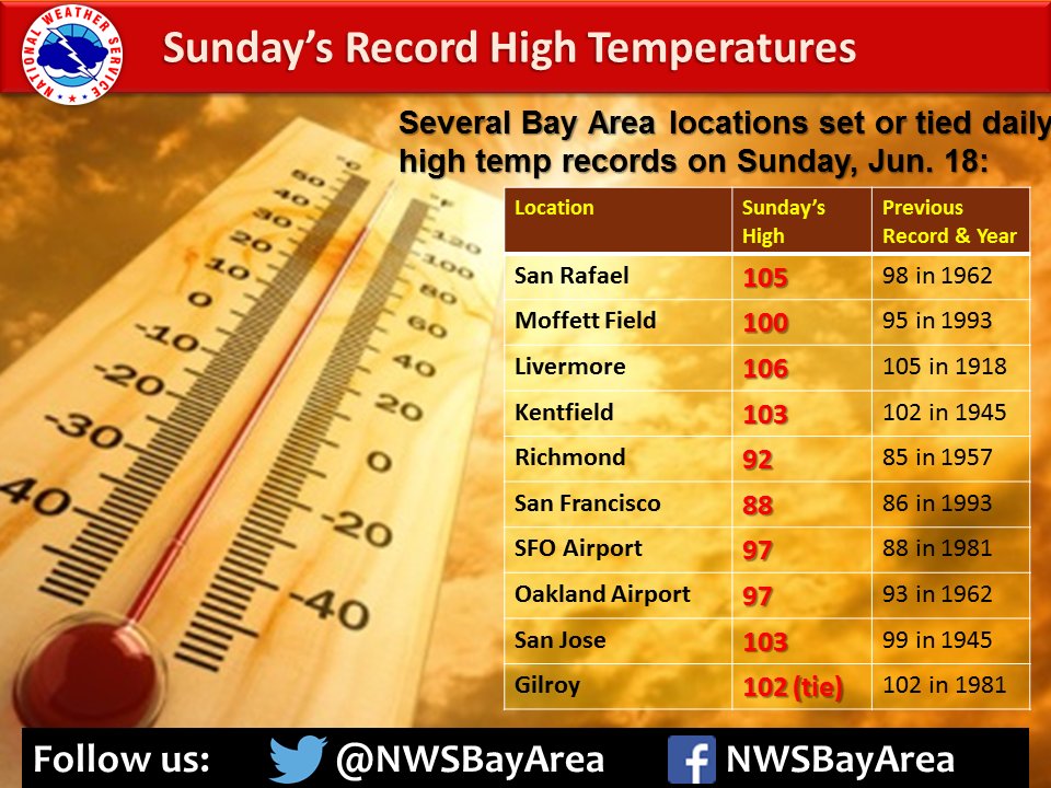
Below are two RERs issued for Record Temperatures RECORD EVENT REPORT NATIONAL WEATHER SERVICE SAN FRANCISCO BAY AREA. 608 PM PDT SUN JUNE 18 2017 ...NEW RECORD HIGHS ESTABLISHED TODAY JUNE 18, 2017... LOCATION MAX TEMP PREVIOUS RECORD --------------------------------------------------------- KENTFIELD 103 102 IN 1945 SAN RAFAEL 105 98 IN 1962 SAN FRANCISCO 88 86 IN 1993 SAN FRANCISCO AIRPORT 97 88 IN 1981 OAKLAND AIRPORT 97 93 IN 1962 RICHMOND 92 85 IN 1957 LIVERMORE 106 105 IN 1918 MOFFETT FIELD 100 95 IN 1993 SAN JOSE 103 99 IN 1945 GILROY 102 (TIED) 102 IN 1981 THE LOW TEMPERATURE FOR THE DAY THUS FAR IN SAN FRANCISCO HAS BEEN 62. IF THIS LOW TEMPERATURE HOLDS FOR THE CALENDAR DAY IT WILL TIE THE RECORD HIGHEST MINIMUM TEMPERATURE SET IN 1993.
|
MMEHLE