Severe thunderstorms are forecast through this weekend along a slow moving cold front and secondary storm system that will impact areas from the southern Plains to the Great Lakes. Large hail and isolated damaging wind gusts are the main threats with these storms along with a risk for heavy to excessive rainfall which could bring flooding. Read More >
|
Hail Storm - April 16, 2018 |
||||||||
|
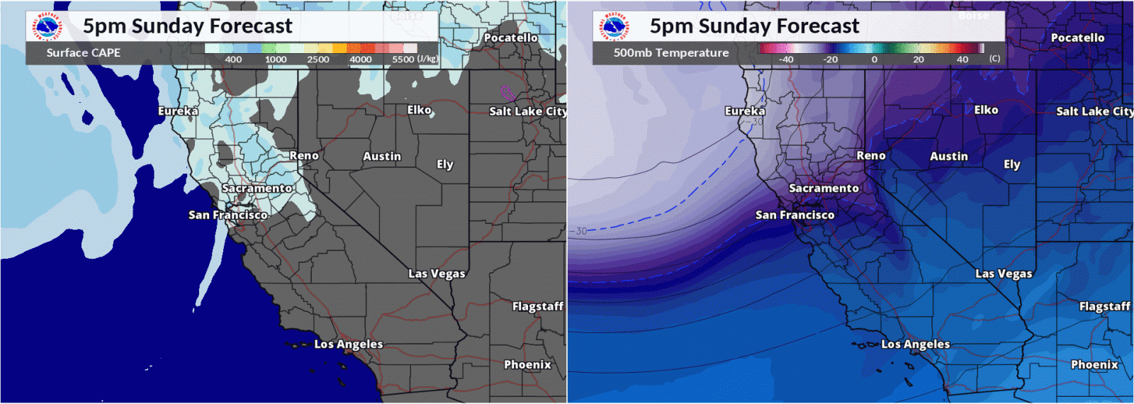
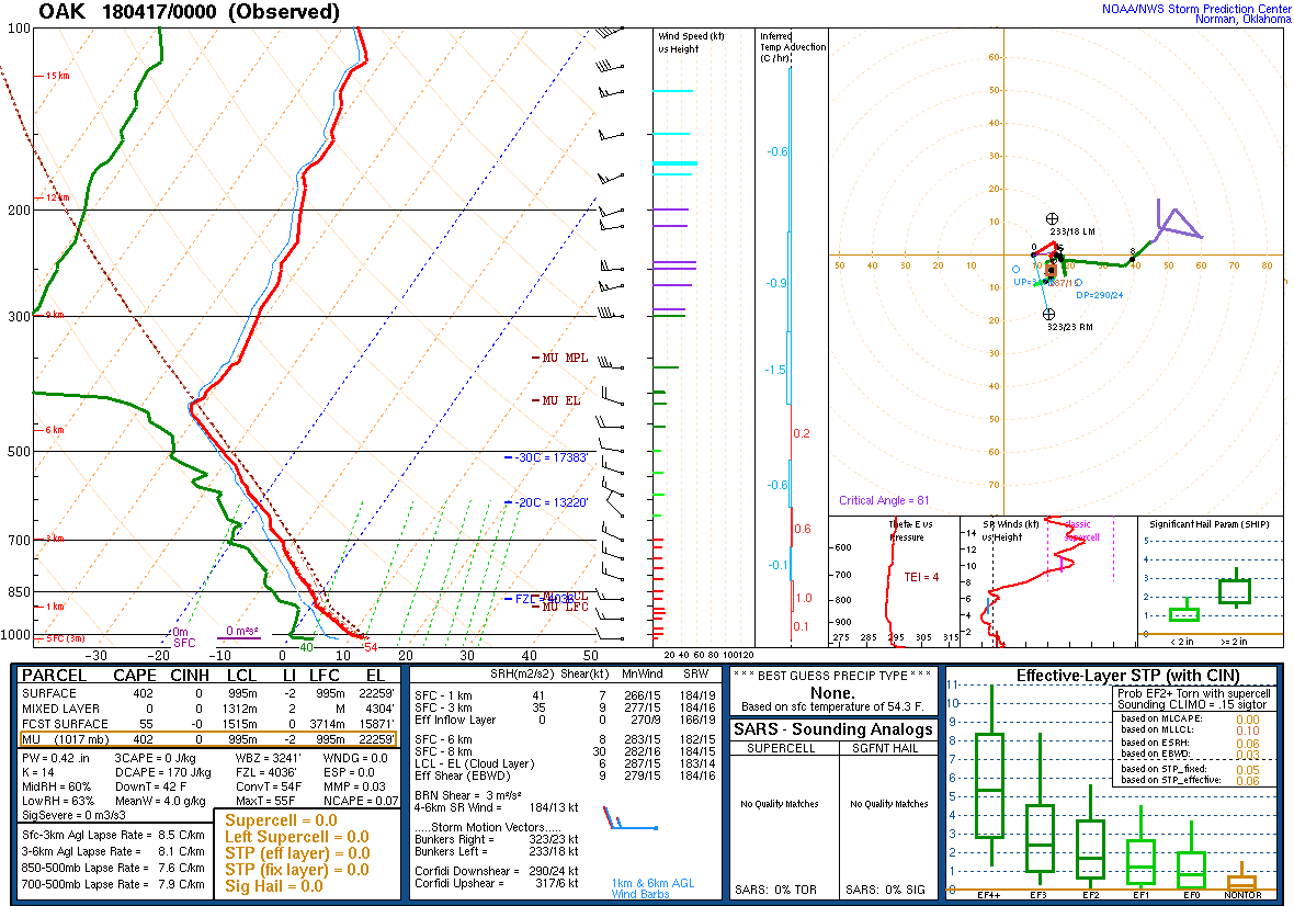
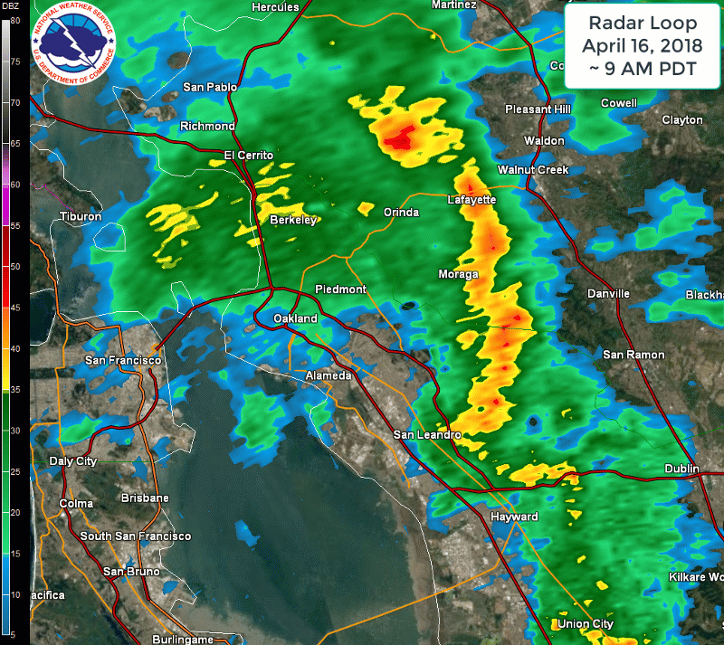
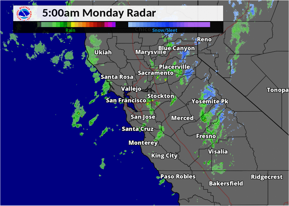
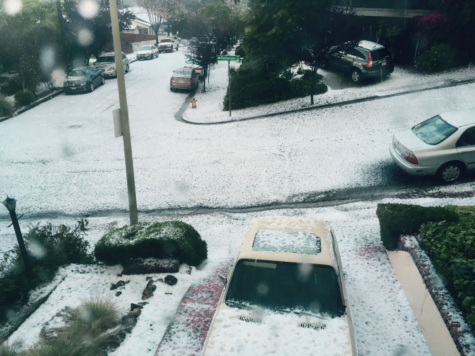
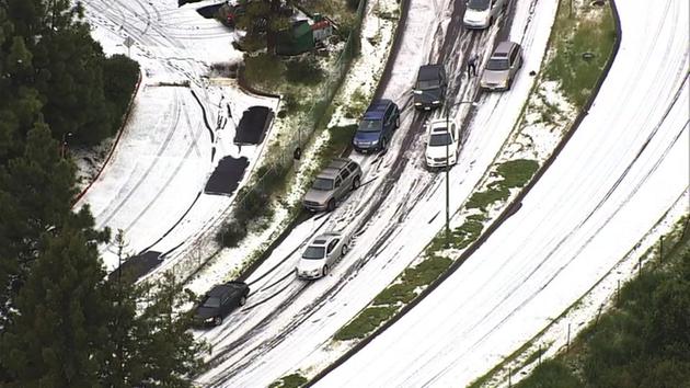
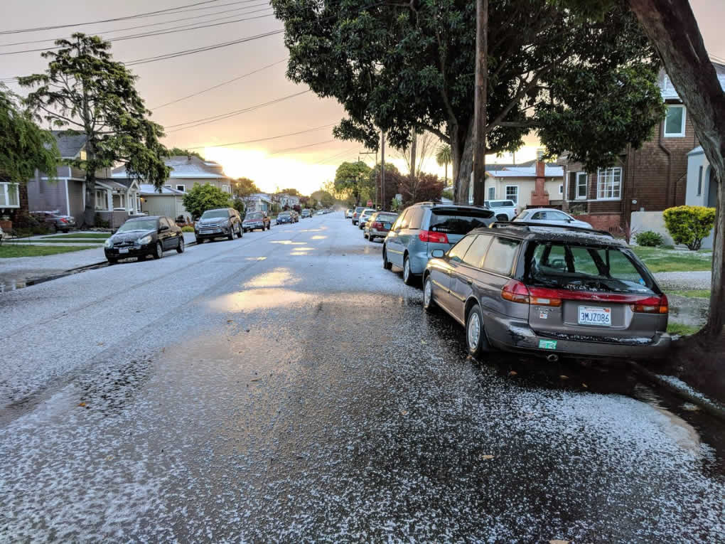
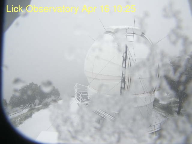
A spring storm system swept through the Bay Area bringing wild weather that included: copious amounts of small hail, gusty wind, higher elevation snow and scattered thunderstorms. A cold upper level low pressure system originating off the British Columbia Coast moved southward and ultimately pivoted across California. As the colder air aloft moved over the Bay Area it helped to destabilize the atmosphere. Below is one computer model depicting the passing cold air aloft and increased instability at the surface. (See NAM forecast animation ). The model forecast was ultimately verified by the Oakland balloon sounding, which showed a CAPE 402 J/kg. Showers developed on April 15, but increased in coverage and intensity on April 16, as the cold core moved overhead. See the regional radar loop below showing widely scattered showers and thunderstorms passing through the much of Northern California. One of the more notable storm cells popped up in San Francisco Bay and tracked eastward into the Oakland Hills area. See the local radar loop below showing the storm cell passing into the Oakland Hills area. Given the low freezing levels near 4,000 feet it's not too much of a surprise that a developed cell like this one could produce ample hail. Numerous reports from the media and on social media indicated that this hail covered the ground making driving dangerous. The NWS office in Monterey received hail reports through out the entire day ranging from pea size to dime size. To alert the general public and agency partners Significant Weather Advisories were issued to highlight stronger storm cells. (see example below)Lots of hail pictures are posted below. Snow was also reported in the Santa Cruz Mountains and the East Bay Hills. The Ham Cam on Mount Hamilton showed a Winter Wonderland at the Lick Observatory. |
||||||||
|
NAM Computer model forecast (L: Sfc CAPE R: 500mb temp/height)
|
||||||||
| Significant Weather Advisory | ||||||||
 Special Weather Statement
 National Weather Service San Francisco CA
 532 PM PDT MON APR 16 2018

 CAZ506-507-170100-
 North Bay Mountains CA-North Bay Interior Valleys CA-
 532 PM PDT MON APR 16 2018

 ...SIGNIFICANT WEATHER ADVISORY FOR EASTERN NAPA COUNTY UNTIL 600 PM
 PDT...

 At 531 PM PDT, Doppler radar was tracking a heavy thunderstorms 9
 miles west of Winters, or 14 miles northwest of Vacaville, moving
 southeast at 15 mph.

 Pea to dime size hail will be possible with these storms.

 Locations impacted include...
 Napa, Atlas Peak Raws and Angwin.

 PRECAUTIONARY/PREPAREDNESS ACTIONS...

 Heavy rainfall is also occurring with these storms, and may lead to
 localized flooding. Do not drive your vehicle through flooded
 roadways.

 Occasional cloud to ground lightning is occurring with these storms.
 Lightning can strike 10 miles away from a thunderstorm. Seek a safe
 shelter inside a building or vehicle.

 &&

 LAT...LON 3864 12216 3862 12217 3862 12215 3861 12214
       3851 12210 3842 12212 3837 12208 3833 12206
       3832 12207 3832 12221 3827 12219 3827 12221
       3826 12222 3826 12219 3825 12221 3822 12220
       3821 12222 3864 12250 3872 12224
 TIME...MOT...LOC 0031Z 335DEG 13KT 3851 12216

 $$
|
MMEHLE