A heat wave over the Southwest will intensify this week, peaking and expanding into the Intermountain West and northern High Plains this weekend. Critical to extremely critical fire weather conditions are forecast from the Northwest and the northern Great Basin this weekend. Particularly Dangerous Situation Red Flag Warnings have been issued. Read More >
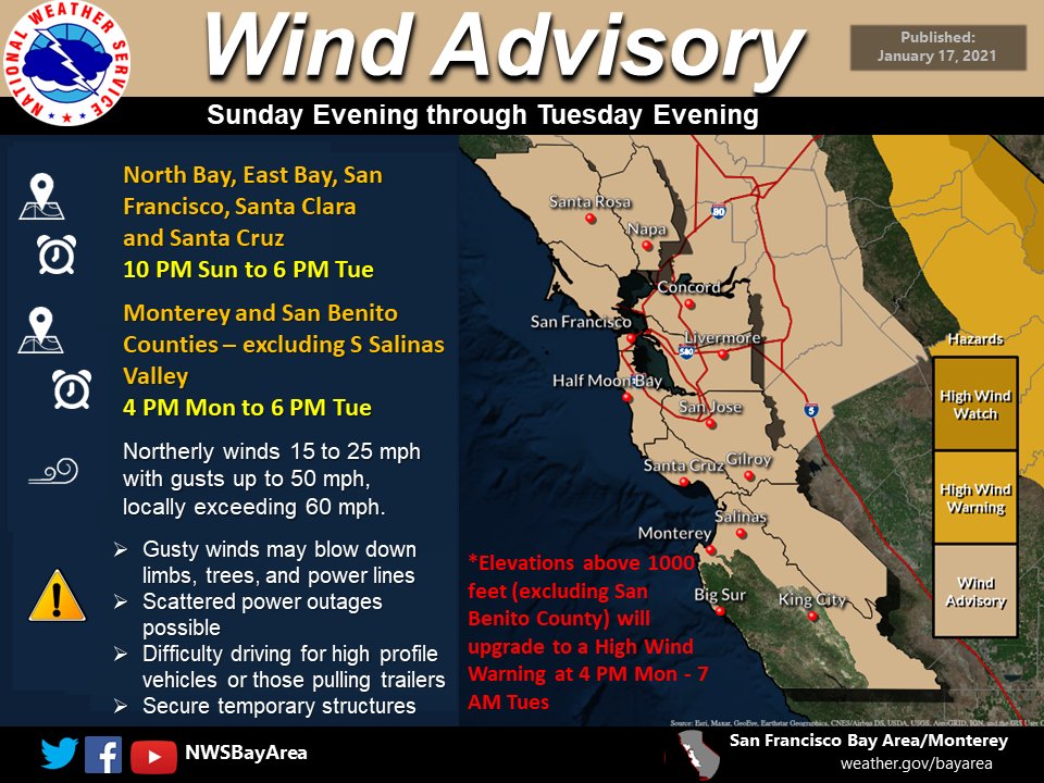
Overview - Damaging Wind Event Impacts Bay Area and Central Coast
|
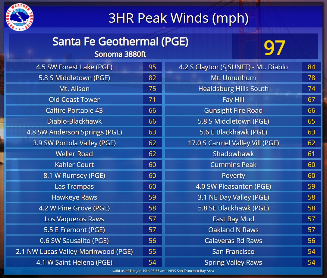
Many in the Bay Area and Central Coast had to do a double take at the calendar, is it January or October? Why you ask? The region experienced a unusual offshore flow event in duration and coverage. To make it even more unusual, these offshore flow events typically occur during late summer and early fall. This particular event brought extreme offshore winds, several days of record breaking heat, and increased fire weather concerns, all in mid-January. Offshore flow began to slowly develop January 15-16, 2021. The developing offshore flow helped to dry out the airmass (lower relative humidity) and raise temperatures. In fact, the downsloping/warming wind resulted in numerous records being tied or broken several days in a row. Offshore flow was forecast to develop further and have two "bursts" of north to northeast winds. The first notable offshore flow "burst" was the night of Sunday, January 16. A second, and much stronger, "burst" was the night of Monday, January 17. Both offshore pushes resulted in impressive winds across the region, especially the Bay Area peaks. The second round of offshore winds were way more widespread and powerful. Higher elevation mesonet stations recorded gusts in the 60-80 mph with two sites at 90+mph. Lower elevation locations also recorded notable gusts in excess of 40 mph. Needless to say, the strong winds resulted in tree damage, downed trees, and downed powerlines resulting in power outages. While wildfire season had been officially declared "over" in December the lack of rain since October had kept much of the region well below normal for precipitation. Locally, the North Bay and Santa Cruz Mts to some extent, had received early season rainfall increasing fuel moisture. Increased fuel moisture helped to mitigate some fire weather concerns due to the offshore flow, but Monterey and San Benito counties didn't see the fuel moisture increase with much less rainfall. The combination of very strong offshore flow, lower relative humidity, and low fuel moisture led to a rare issuance of a January Red Flag Warning for Monterey and San Benito counties. The previous January Red Flag Warning was issued in 2014. The end result ended up being roughly 12 wildfires in the Santa Cruz Mts with two fires growing to notable size for January. Composed by: MMehle |
Water Vapor Imagery overlaid with weather model imagery showing the two disturbances that helped create the strong offshore flow. |
|
|