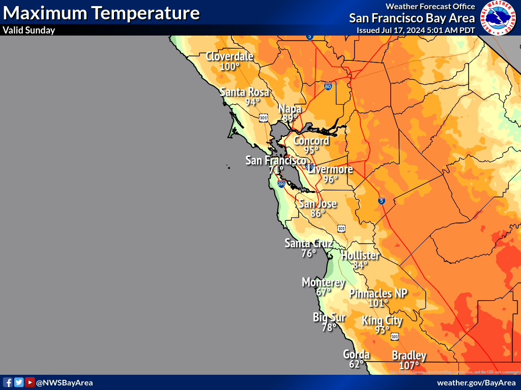
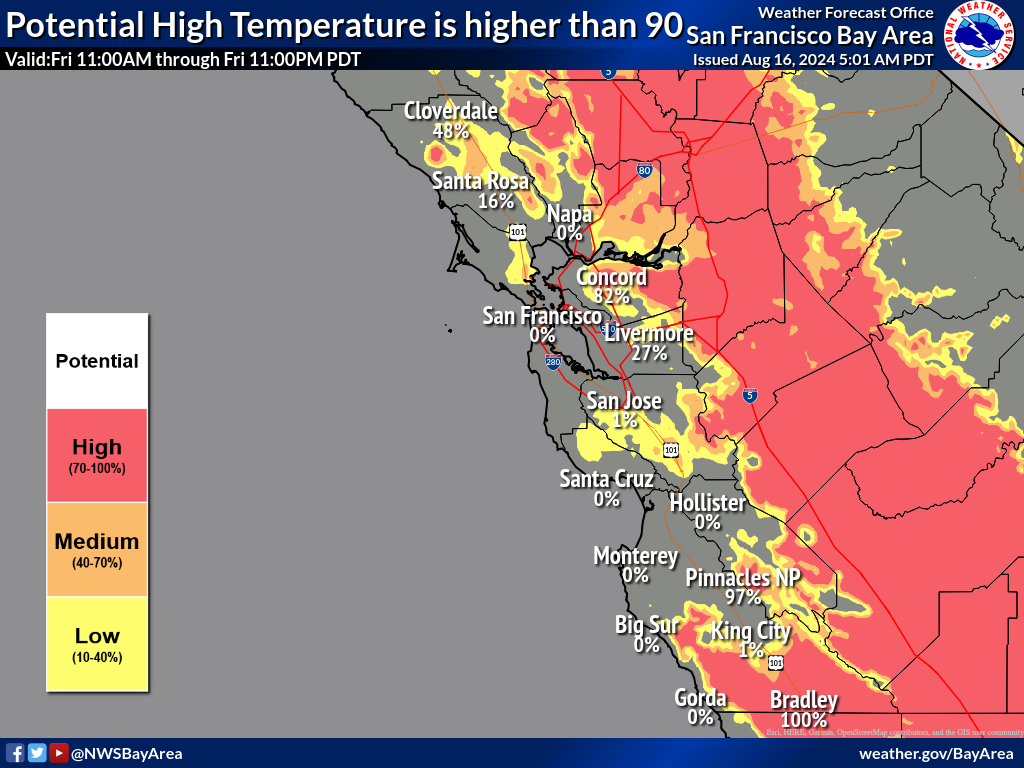
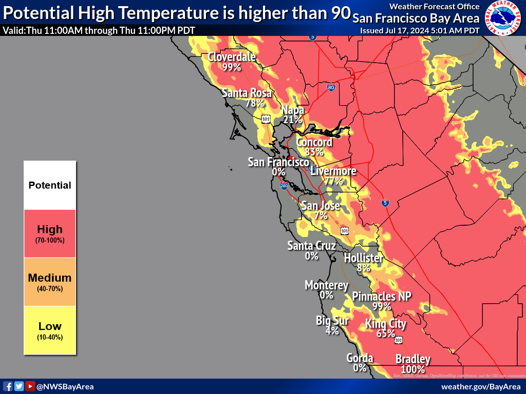
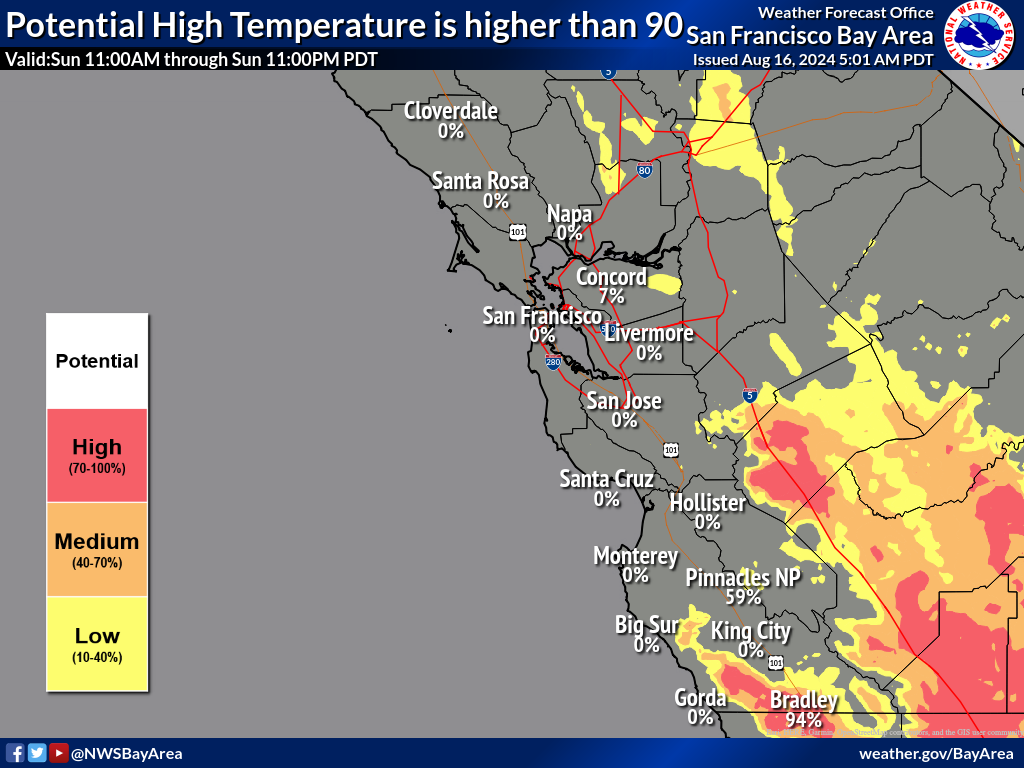
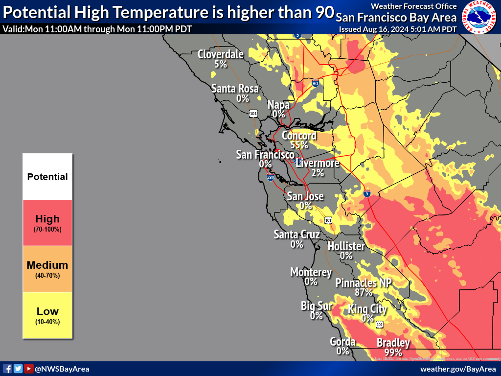
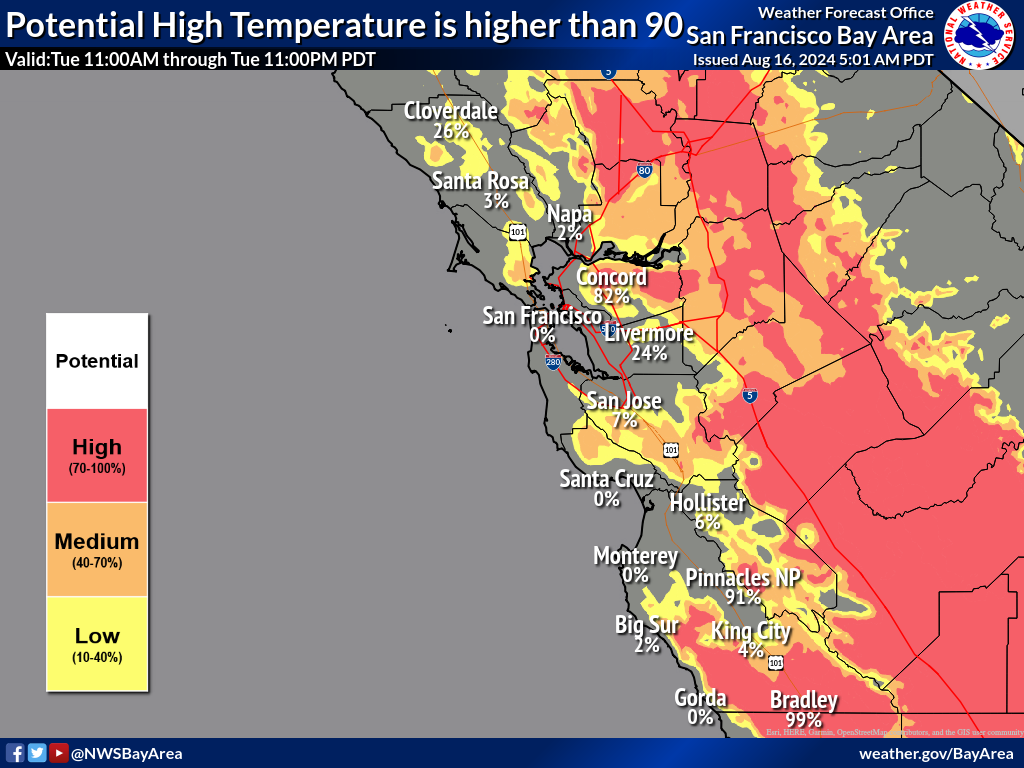
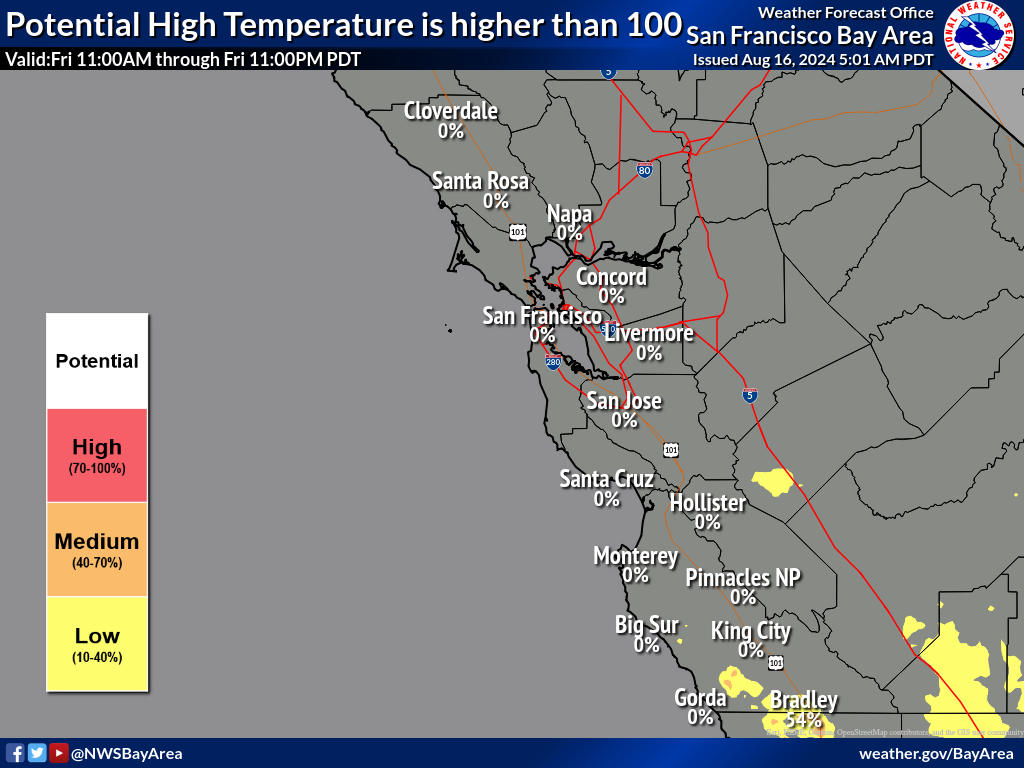
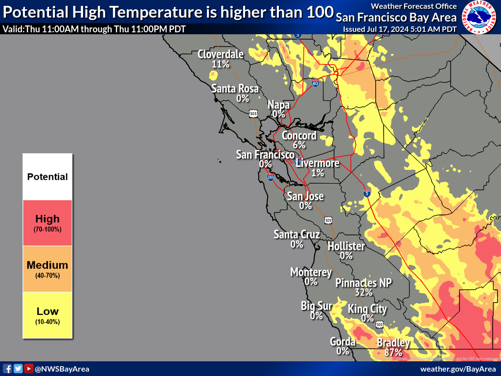
National Weather Service United States Department of Commerce

Heavy Rainfall in the Southwest and Southeast This Weekend; Monitoring Tropical Cyclone Formation Which Could Impact the Southeast U.S.

Heavy rainfall from monsoon thunderstorms may bring isolated flash and urban flooding to the Desert Southwest. A near-stationary front will bring numerous showers and thunderstorms to much of the Mid-Atlantic and Southeast. Tropical wave (AL94) is likely to become a depression. Significant uncertainty remains in the track and intensity, but chances for impacts to the Southeast are increasing. Read More >

Welcome to the National Weather Service San Francisco Bay Area Decision Support Services Page!

 
This page is maintained by the National Weather Service San Francisco Bay Area/Monterey Bay Region.
Forecasts on this page are generally updated twice per day by 5:00 AM and 5:00 PM.


This page was developed as a decision tool for our partners to make more informed decisions due to potential weather impacts. This page is not an official forecast product and graphics may not always be update. 
 
Probabilistic Precipitation Graphics


Hover over links below to view larger image.
MaxT Day 1 Day2 Day3 Day4 Day5
Probability MaxT > 90 Day 1 Day2 Day3 Day4 Day5
Probability MaxT > 100 Day 1 Day2 Day3 Day4 Day5
Probability Graphic


Hover over links below to view larger image.
MinT Day 1 Day2 Day3 Day4 Day5
Probability MinT < 32 Day 1 Day2 Day3 Day4 Day5
Probability MinT < 28 Day 1 Day2 Day3 Day4 Day5
Probability Graphic


Hover over links below to view larger image.
Max Gust Day 1 Day2 Day3 Day4 Day5
Probability Max Wind Gust 25 mph or More Day 1 Day2 Day3 Day4 Day5
Probability Max Wind Gust 40 mph or More Day 1 Day2 Day3 Day4 Day5
Probability Graphic