Very isolated showers and a storm or two are possible with lightning being the primary hazard. Small hail and gusty winds are also possible. There’s a 10-15% chance for thunderstorms across the North Bay and higher terrain of eastern San Benito and adjacent parts of Monterey County (Gabilan Range). The likely hazards are gusty winds to 35 mph, small accumulating hail, and isolated lightning strikes associated with thunderstorms. Stay weather aware and check back for updates. Remember: when thunder roars go indoors!


 Social Media
 San Francisco Radar
 Sacramento Radar
 Satellite
 Weather Map
 Local Graphical Forecast
 U.S. Graphical Forecasts
 Forecast Weather Tables
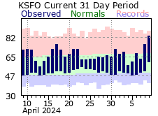 Recent MTR Temperatures
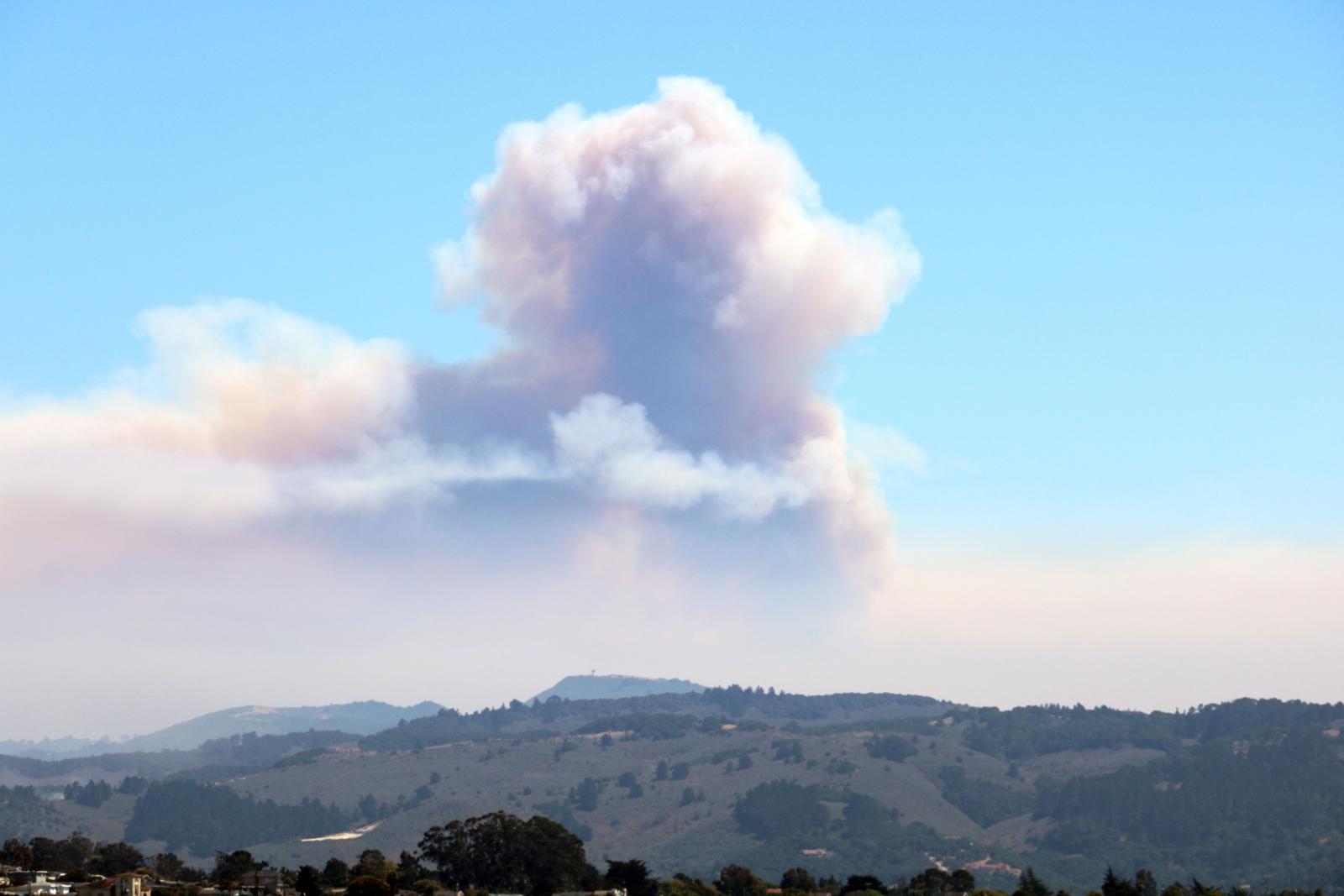 Fire Weather
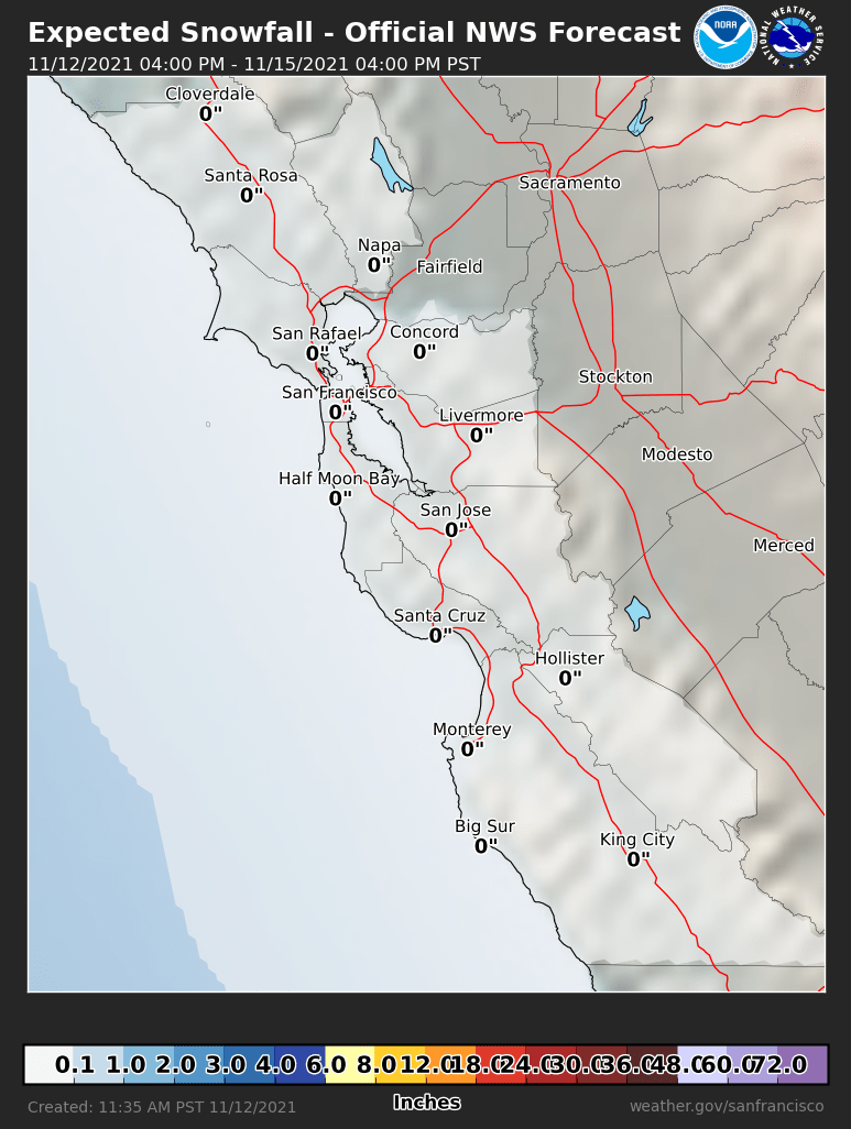 Probabilistic Snowfall Forecasts
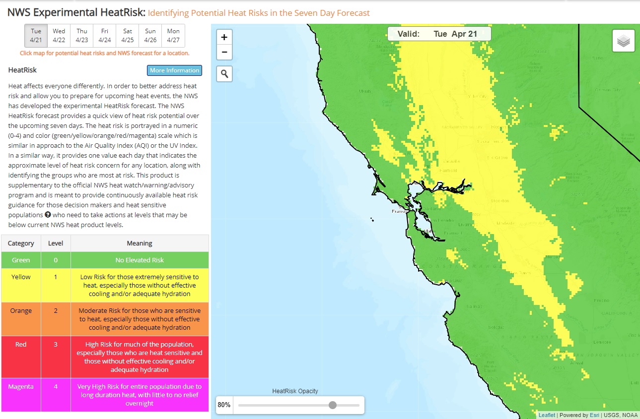 Heat Risk Link