
A Pacific storm will continue to bring strong winds, heavy rain with a risk for flooding to northern and central California, and heavy mountain snow in the Sierras, southern Cascades, and northern Rockies through Friday. A series of winter storms will impact the Central and Eastern U.S. through next week with locally heavy rain, and a combination of snow, sleet, and freezing rain. Read More >
Last Map Update: Fri, Feb 7, 2025 at 2:40:44 am PST


|
Text Product Selector (Selected product opens in current window)
|
|


 Social Media
 San Francisco Radar
 Sacramento Radar
 Satellite
 Weather Map
 Local Graphical Forecast
 U.S. Graphical Forecasts
 Forecast Weather Tables
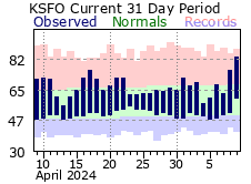 Recent MTR Temperatures
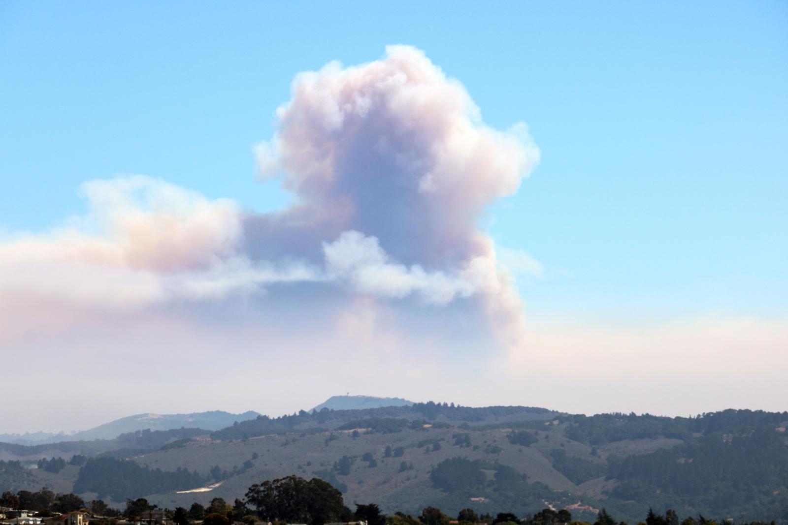 Fire Weather
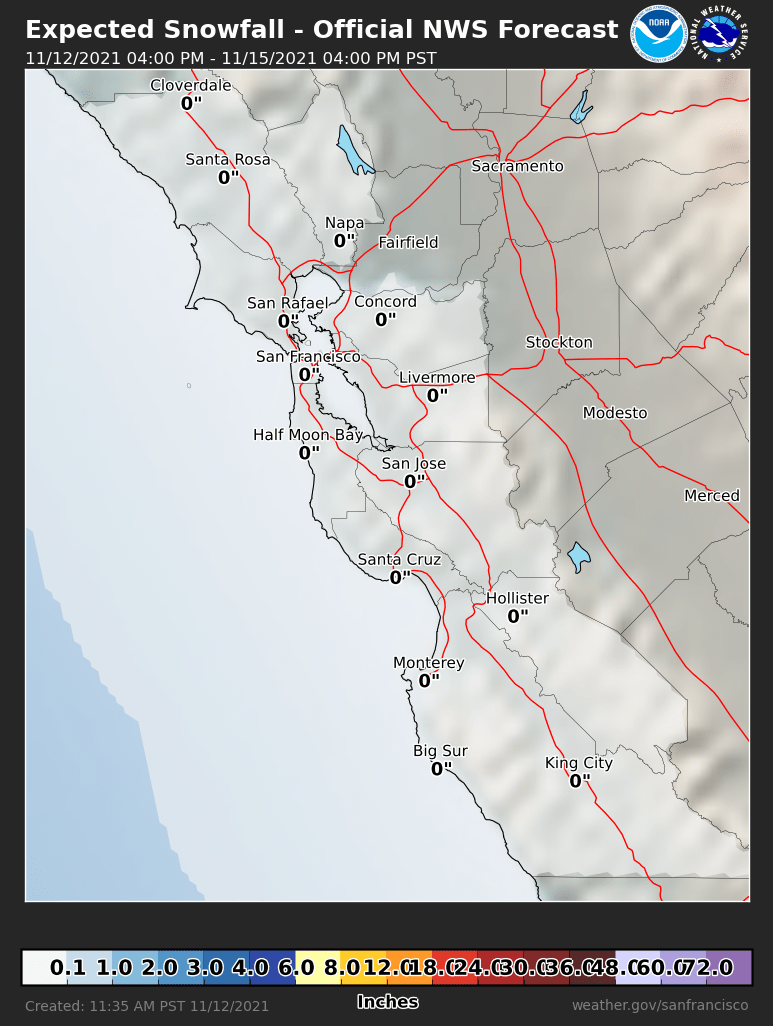 Probabilistic Snowfall Forecasts
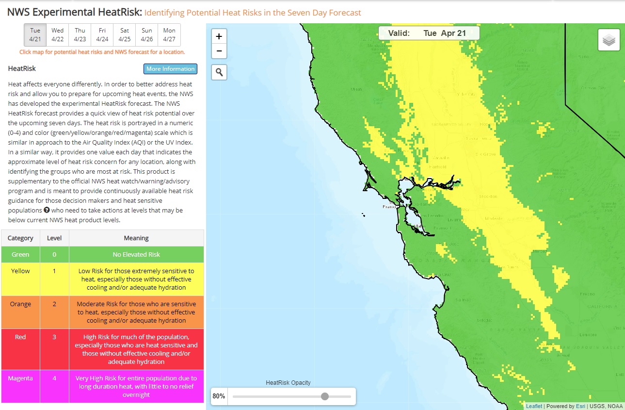 Heat Risk Link