
A strong storm will move across the Intermountain West into the Northern Great Plains bringing widespread high winds with increasing snow. An intense and fast-moving line of severe storms is expected across the Mississippi Valley into the Ohio Valley beginning Friday afternoon. A wildfire outbreak is possible across parts of the southern and central Plains due to strong winds and dry conditions. Read More >
Last Map Update: Thu, Mar 13, 2025 at 8:40:11 pm PDT


|
Text Product Selector (Selected product opens in current window)
|
|


 Social Media
 San Francisco Radar
 Sacramento Radar
 Satellite
 Weather Map
 Local Graphical Forecast
 U.S. Graphical Forecasts
 Forecast Weather Tables
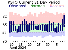 Recent MTR Temperatures
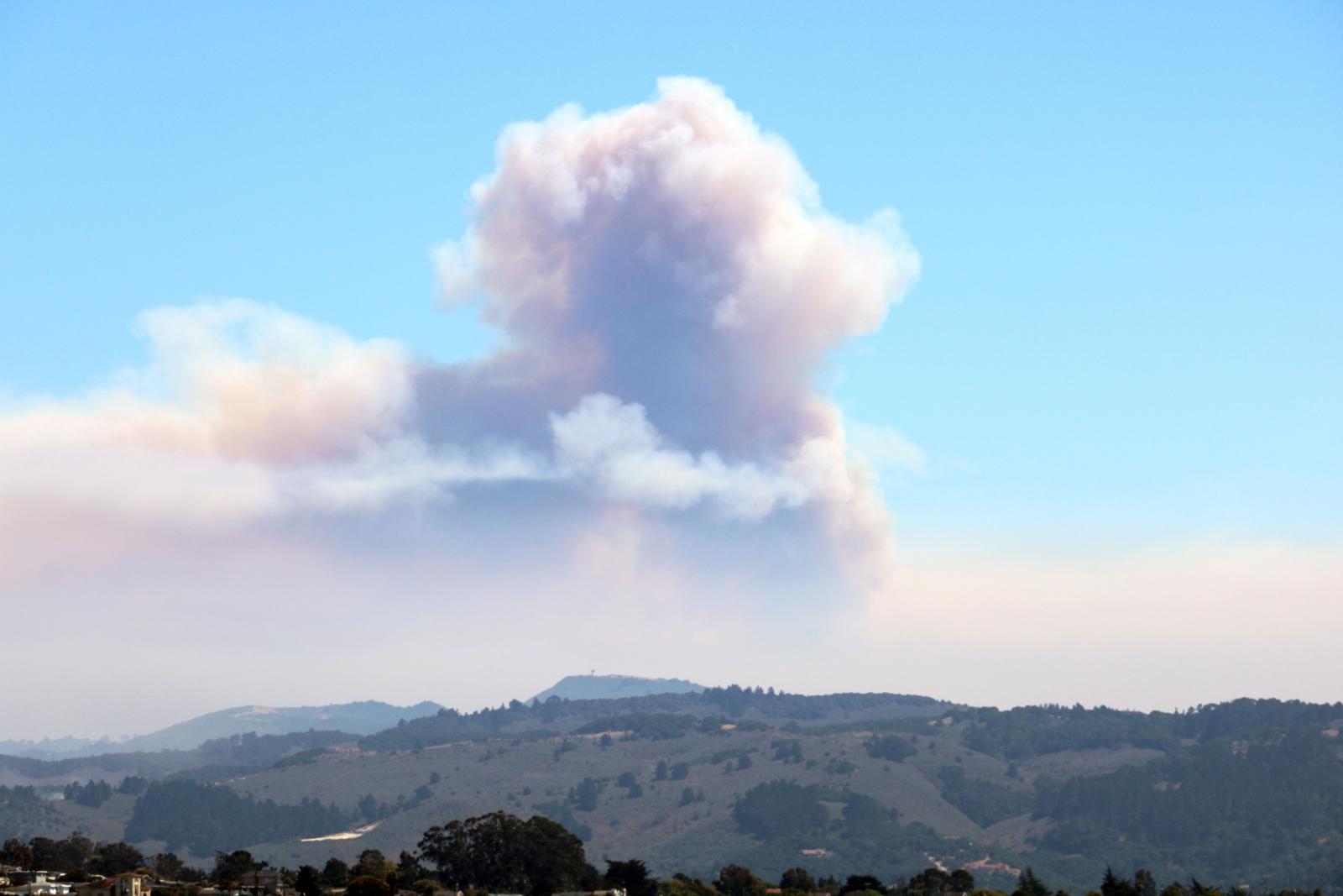 Fire Weather
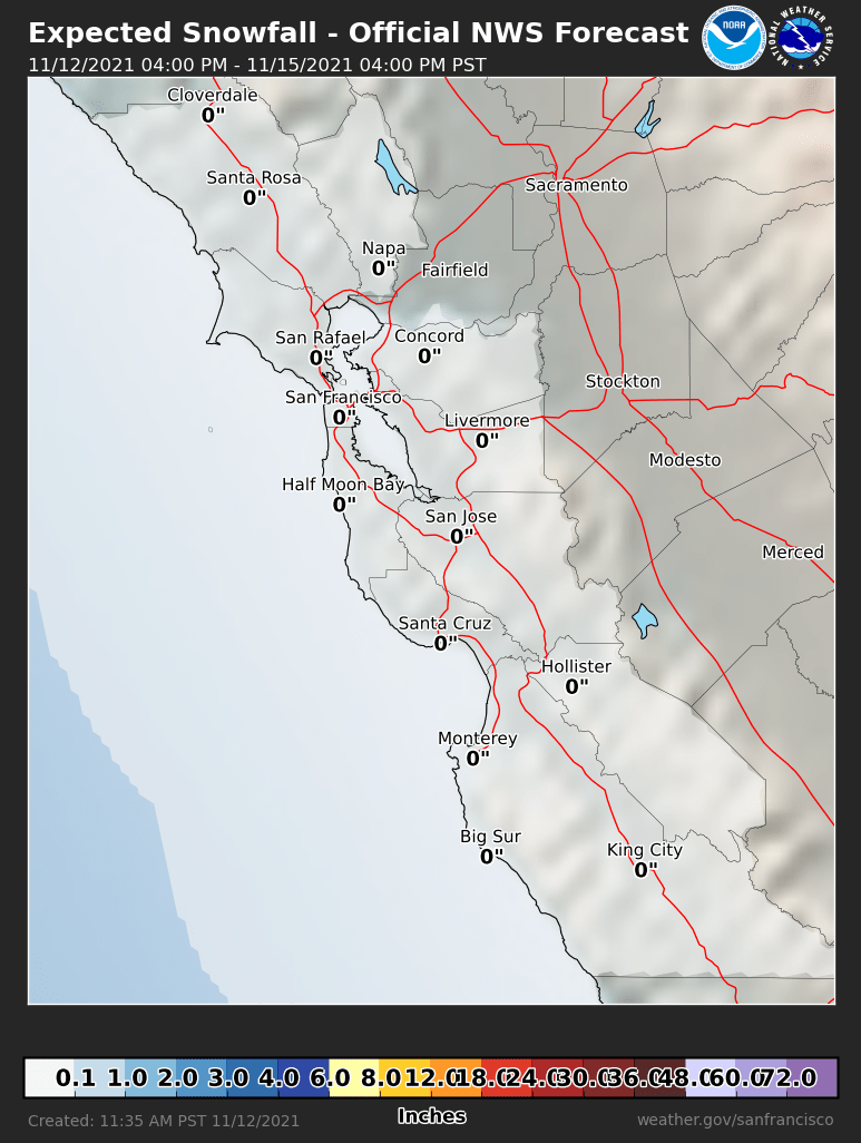 Probabilistic Snowfall Forecasts
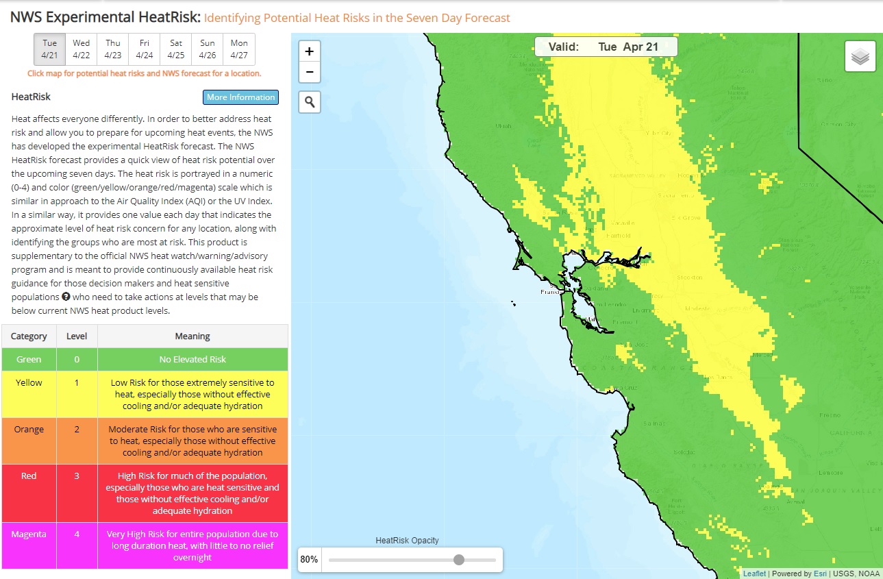 Heat Risk Link