Lake effect snow will impact the Great Lakes region through the day. Gusty winds will pick up across the Midwest, Northeast and Mid-Atlantic beginning this afternoon following a cold front. Elevated fire weather conditions will persist across the Desert Southwest today, with critical fire weather conditions developing Wednesday and Thursday in the Southern Plains. Read More >
Justification for splitting WFO SF Bay Area / Monterey Bay Public/Fire Zones
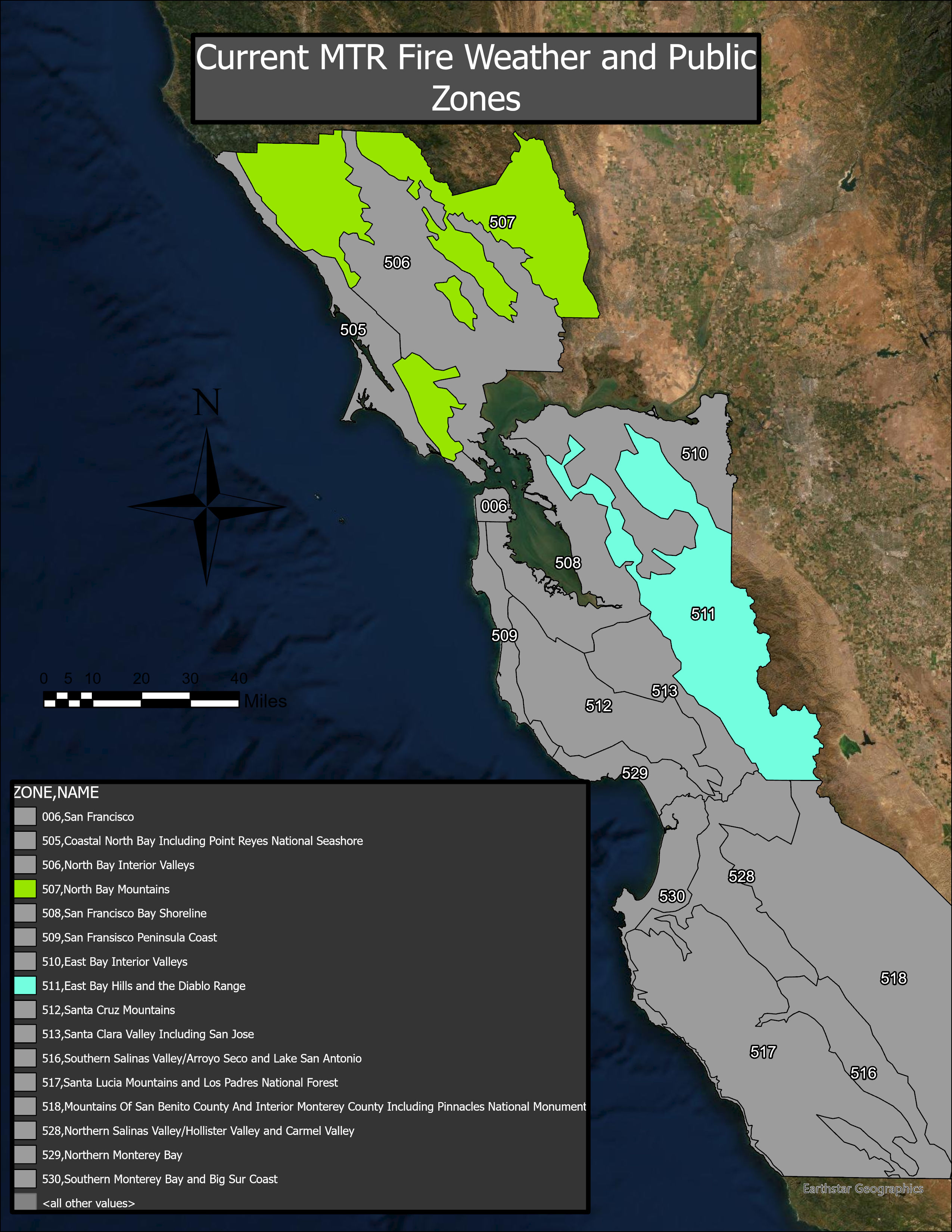
CAZ507 split from one (1) to three (3) zones - CAZ511 split from one (1) to two (2) zones
California Public/Fire Weather Zone 507
Zone 507 is being proposed for a split at the request of the SF North Bay Emergency Managers in Napa, Sonoma, and Marin Counties. It is also requested to better reflect multi-seasonal climatology. Over the past couple years, MTR has been requested by Woody Baker-Cohn of Marin County OES that their portion of zone 507 be split out from the remainder of the zone. This would significantly limit the number of red flag warnings, wind advisories/warnings, etc, for Marin County. Upon this request, MTR WCM approached Sonoma and Napa Counties to discuss potential changes. Through conversations with EMs, fire agencies, and others, it became clear that more of a split would be needed. After conversations with partners, the decision was settled upon to split CAZ507 into the North Bay Interior Mountains, which take care of the two prominent ranges, Vaca and the Mayacamas, Coastal Sonoma Mountains, and Coastal Marin Mountains. All zones will continue to be at the 1000 foot elevation and upward.
California Public/Fire Weather Zone 511
Zone 511 is being proposed for a split based on the climatological wind patterns across the East Bay Hill. The current zone runs from Contra Costa County southward through eastern Santa Clara County. This covers an approximate distance of 80 miles, latitudinally. Within this zone WFO MTR has documented numerous instances when the northern portion of the zone is more than two times windier than the same elevation and aspect of sites in the southern portion. In order to provide better information to our partner agencies, the media, and the public, we are proposing a west-east break in this long north-south zone at the Alameda County / Santa Clara County border. This will allow our meteorologist to more discreetly target areas of greatest threat. These zones will retain the elevation delineation of a 1000 feet and upward.
All changes have been coordinated with our neighboring offices, our primary and secondary service backup sites, and NWS AFS.
Read the Service Change Notice for more information and links to updated shapefiles.