National Weather Service United States Department of Commerce

Inclement Weather in the Northwest; Elevated Fire Weather Conditions in the High Plains

In the Pacific Northwest into northern California, areas of heavy rain for the coastal ranges and heavy snowfall over the higher elevations of the Cascades are expected into Friday. Dry and windy conditions may produce elevated fire weather conditions in the central and southern High Plains and the Upper Midwest. Windy conditions and scattered rain and snow showers will continue in the Northeast. Read More >

Click a location below for detailed forecast.

Last Map Update: Thu, Nov 6, 2025 at 4:16:20 pm EST


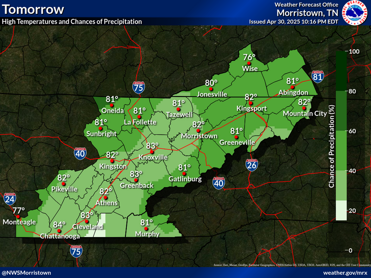
A cold front will bring in showers and thunderstorms Friday evening and Friday night. Gusty winds are the primary hazard expected.
Cold fronts over the weekend will dramatically drop temperatures next week. With morning lows expected to be below freezing for multiple days.
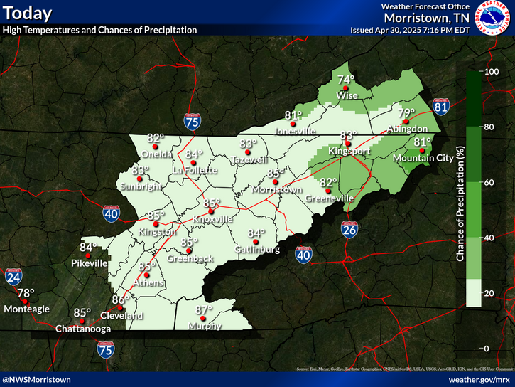
High pressure will provide mostly sunny weather today with a pleasant afternoon. Showers and storm chances return Friday night, with much colder temperatures expected early next week.
Each observation point is apart of our COOP program (Cooperative Observer Program). Each site has a 24 hour observation period that ends and begins at 8 am local time. Each site records temperature, precipitation, and snowfall data. More information about the COOP program can be found here www.nws.noaa.gov/om/coop/ Data began being collected at: Cades Cover on 01/01/1999 || Mount LeConte on 07/01/1987 || Newfound Gap on 01/01/1991 || Sugarlands Visitor Center on 12/01/1921

 Current Weather Observations...
Location Time
(EST)
Weather Vsby.
(SM)
Temp.
(ºF)
Dewpt.
(ºF)
Hum.
(%)
Wind
(mph)
Wind Chill / Heat Index
(ºF)
Pres.
(in)
Abingdon VA15:35Clear10602626VRB 7-30.15
Andrews-Murphy NC15:41Clear10753322W 6-30.09
Chattanooga TN14:53Clear10723930NNW 9-30.11
Crossville TN14:53Clear10672823SE 6-30.14
Dalton GA15:35Clear10744738NW 5-30.06
Knoxville TN (McGhee-Tyson)15:53Mostly Clear10683226NE 12-30.09
Middlesboro KY15:35Clear10662722CALM-30.14
Monroe Cnty TN15:35Clear10693528NE 6-30.10
Morristown TN15:35Clear10642825ENE 5-30.13
Oak Ridge TN15:53Clear10693326VRB 5-30.12
Tazewell Cnty VA15:35Clear10562225CALM-30.17
Tri-Cities TN15:53Mostly Clear10622625NNW 5-30.15
Wise VA15:35Clear10571720WNW 3-30.19
Greeneville, TN15:35Clear10642422NNW 7-30.13


Local Weather History For November 6th...
In 1977, 6 counties in northeast TN declared disaster areas. Over 3" of rain fell. 1 drowned.


Briefing Hydrology Past Weather Events Graphical Hazardous Weather Outlook for East Tennessee East Tennessee Observations
Decision Support Hydrology Past Weather Events GHWO Observations Gridded Forecast
Daily Climate for Middle Tennessee Local East Tennessee Climate Tornado Database Tropical Weather Information NOAA Weather Radio
IDSS Point Forecasts Daily Climate Local Climate Tornado Database Tropical Weather Radio
Daily Climate for Middle Tennessee Probabilistic Data for East Tennessee Virtual Tour of the NWS Morristown Office Skywarn Spotter Training for East Tennessee  
Being Prepared Estar Perparado Probabilistic Virtual Tour Spotter Training