
A few severe thunderstorms with large hail, are expected across parts of the middle and upper Mississippi River Valley tonight through early morning. Snow and a wintry mix overnight in the Upper Midwest into the Great Lakes can cause hazardous travel conditions. Fire weather concerns continue for a large portion of the central and southern High Plains and Four Corners region this evening. Read More >
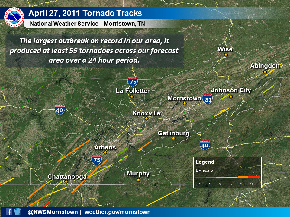
The Historic Tornado Outbreak of April 27, 2011 across East Tennessee and Southwest VirginiaTornado track map across the WFO Morristown County Warning Area on April 27
|
|
This outbreak began with the first wave of severe thunderstorms that moved across middle Tennessee and northern Alabama in the early morning hours of April 27, 2011. These storms continued into east Tennessee before weakening in central east Tennessee.
NOTE: these radar loops have missing frames and will skip in places.


After this initial line of severe thunderstorms weakened, additional supercells (i.e. rotating thunderstorms) redeveloped over middle Tennessee and Alabama in the afternoon.
NOTE: these radar loops have missing frames and will skip in places.


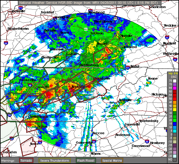
The incredibly strong wind field kept additional supercells (i.e. rotating thunderstorms) redeveloping over east Tennessee and southwest Virginia late into the evening.
NOTE: these radar loops have missing frames and will skip in places.


 Local Radar
 Huntsville Radar
 Regional Satellite
 Graphical Forecast
 Weather Map