
A Moderate Risk of severe thunderstorms (level 4 of 5) is in the outlook across portions of the Midwest today. Damaging winds, a few tornadoes and frequent lightning with heavy rainfall are in the forecast. Meanwhile, dangerous heat across the southern Plains into the Great Lakes, mid-Atlantic and Northeast will expand into Friday. Risk for wildfires for the central Rockies and Sacramento Valley. Read More >
Overview
Photos
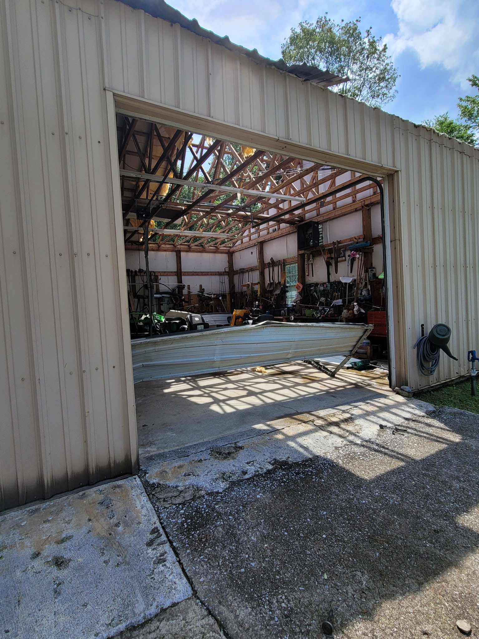
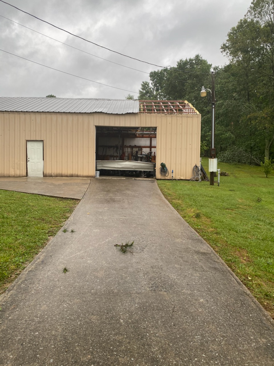
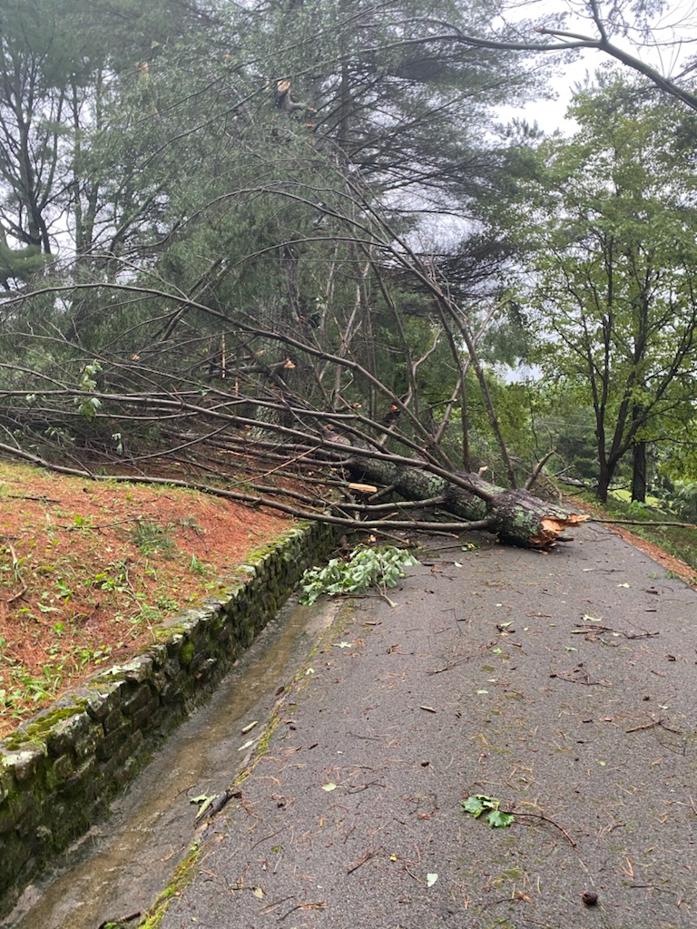
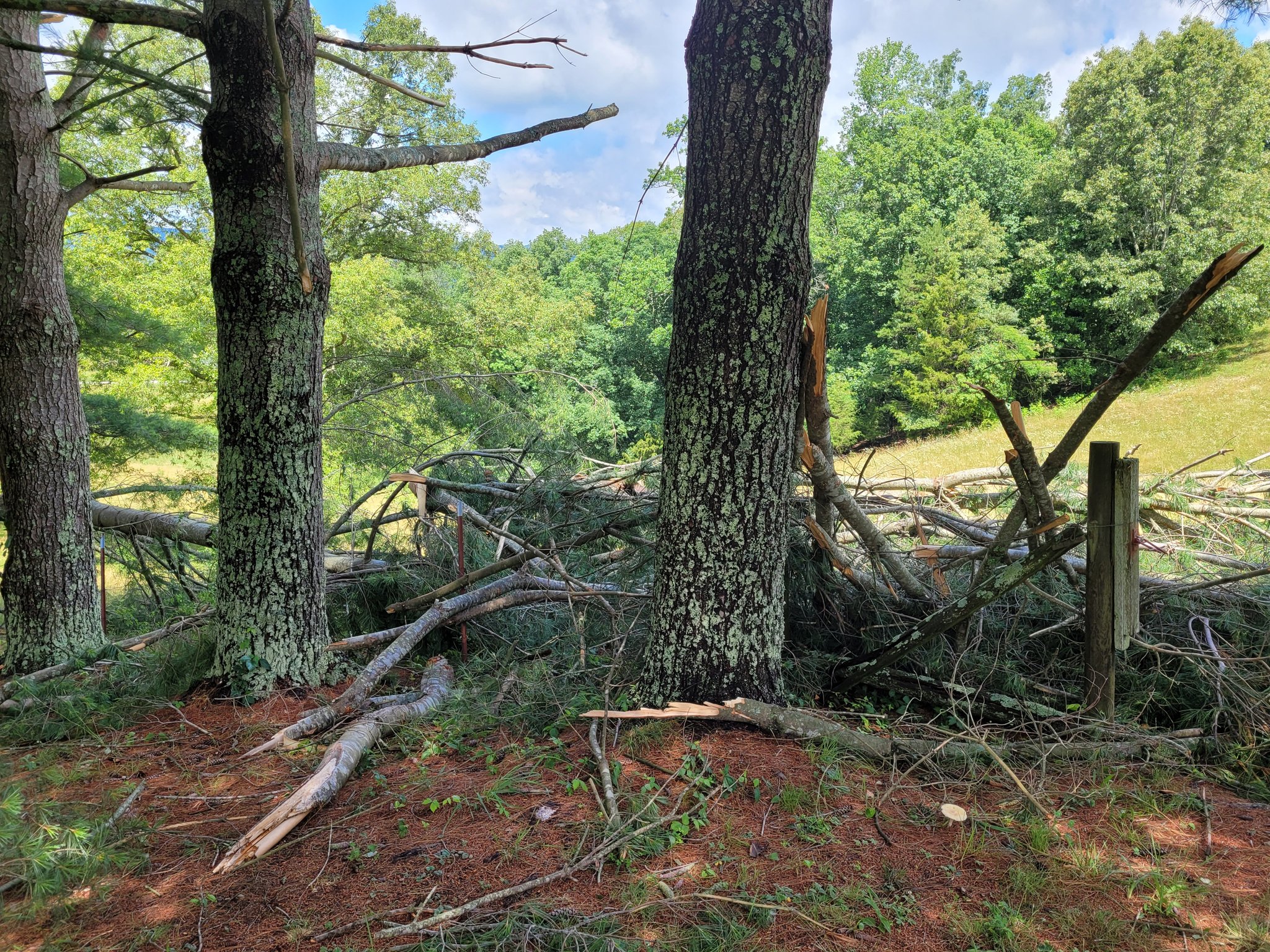
Storm Damage in Speedwell, TN
 |
 |
 |
 |
| Storm Damage in Speedwell (Mike Stanley) |
Storm Damage in Speedwell (Mike Stanley) |
Storm Damage in Speedwell (Mike Stanley) |
Storm Damage in Speedwell (Mike Stanley) |
Radar
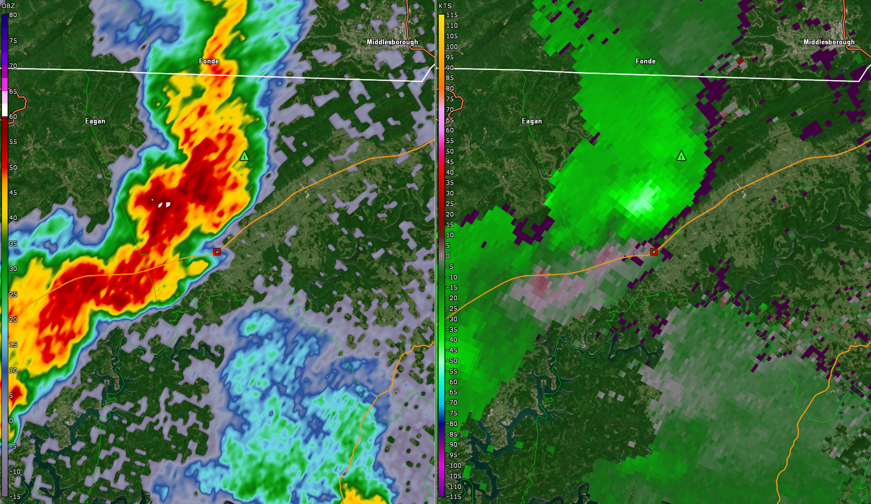 |
| Speedwell, TN Base Reflectivity and Base Velocity |
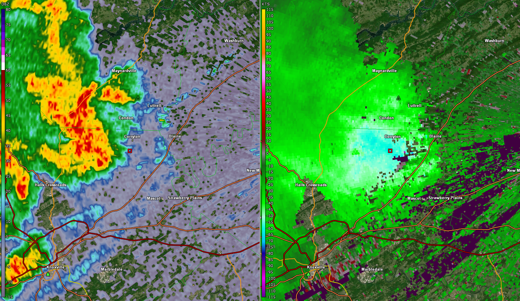 |
| Northern Knox County Base Reflectivity and Base Velocity |
Storm Reports
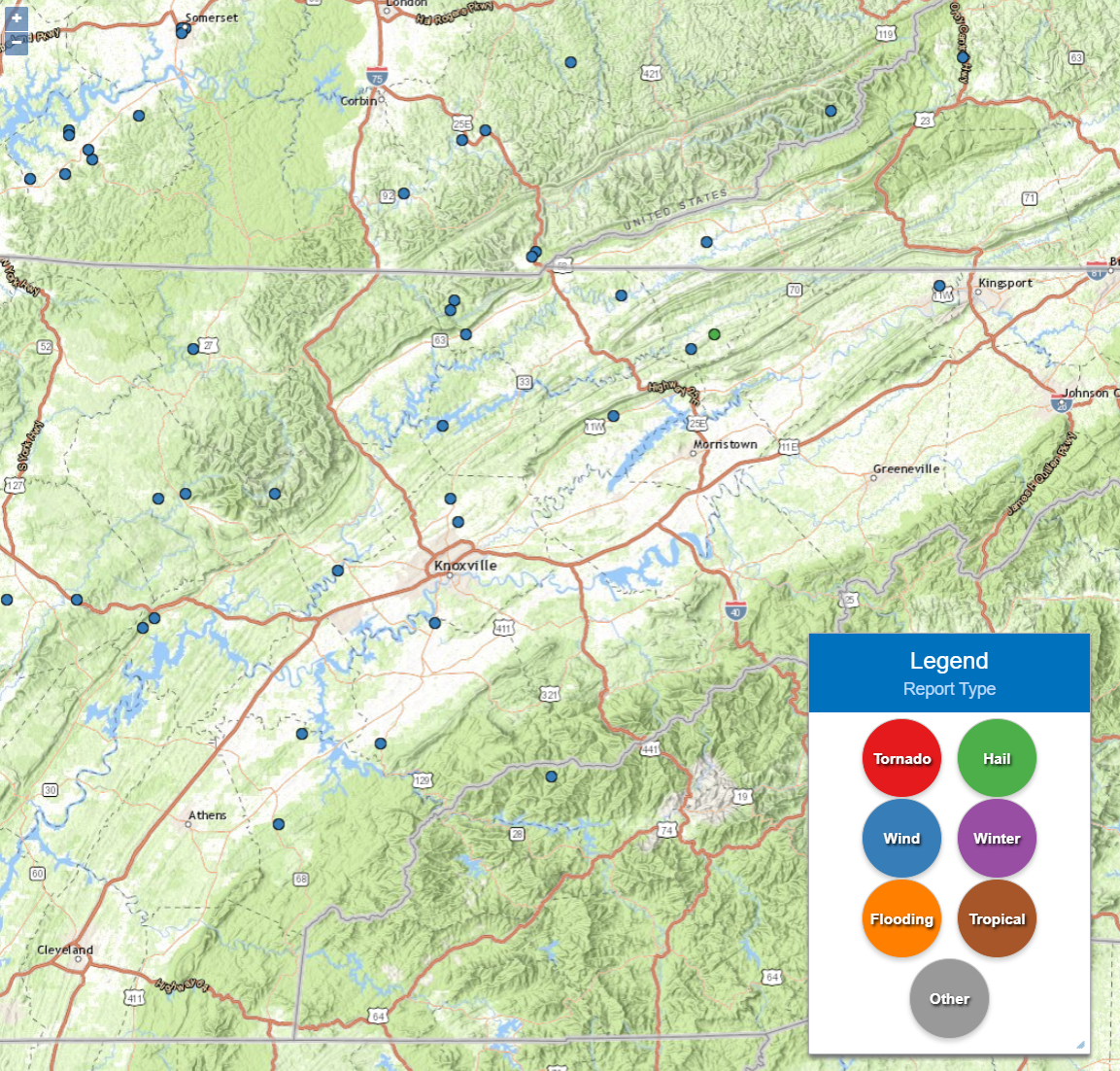
PRELIMINARY LOCAL STORM REPORT...SUMMARY
NATIONAL WEATHER SERVICE MORRISTOWN TN
709 PM EDT WED JUN 23 2021

..TIME...   ...EVENT...      ...CITY LOCATION...     ...LAT.LON...
..DATE...   ....MAG....      ..COUNTY LOCATION..ST.. ...SOURCE....
            ..REMARKS..

0445 PM     TSTM WND DMG     5 WNW WARTBURG          36.12N 84.67W
06/21/2021                   MORGAN             TN   LAW ENFORCEMENT

            A FEW TREES DOWN.

0508 PM     HAIL             3 N TREADWAY            36.46N 83.24W
06/21/2021  M1.50 INCH       HANCOCK            TN   PUBLIC


0509 PM     TSTM WND DMG     2 NNW WARTBURG          36.13N 84.60W
06/21/2021                   MORGAN             TN   LAW ENFORCEMENT

            A FEW TREES DOWN.

0515 PM     TSTM WND DMG     3 SSW ROSEDALE          36.13N 84.37W
06/21/2021                   ANDERSON           TN   LAW ENFORCEMENT

            A FEW TREES DOWN.

0524 PM     TSTM WND DMG     4 WNW TREADWAY          36.43N 83.30W
06/21/2021                   HANCOCK            TN   PUBLIC

            COUPLE TREES DOWN.

0525 PM     TSTM WND DMG     SPEEDWELL               36.46N 83.88W
06/21/2021                   CLAIBORNE          TN   EMERGENCY MNGR

            SCATTERED TO NUMEROUS TREES DOWN THROUGHOUT
            THE COUNTY IN ADDITION TO DOWNED POWERLINES.

0528 PM     TSTM WND DMG     5 W HUNTSVILLE          36.43N 84.58W
06/21/2021                   SCOTT              TN   LAW ENFORCEMENT

            SEVERAL TREES DOWN ACROSS THE SOUTH END OF
            THE COUNTY.

0529 PM     TSTM WND DMG     3 SE CLAIRFIELD         36.51N 83.92W
06/21/2021                   CLAIBORNE          TN   PUBLIC

            FEW TREES DOWN.

0550 PM     TSTM WND DMG     3 NNE HALLS             36.12N 83.92W
06/21/2021                   KNOX               TN   PUBLIC

            NUMEROUS TREES DOWN ACROSS NORTH KNOX
            COUNTY.

0551 PM     TSTM WND DMG     2 ESE HALLS             36.07N 83.90W
06/21/2021                   KNOX               TN   LAW ENFORCEMENT

            A FEW TREES DOWN.

0551 PM     TSTM WND DMG     MOUNT CARMEL            36.56N 82.66W
06/21/2021                   HAWKINS            TN   PUBLIC

            REPORT FROM MPING: 1-INCH TREE LIMBS BROKEN;
            SHINGLES BLOWN OFF.

0607 PM     TSTM WND DMG     2 SW NORRIS LAKE        36.27N 83.94W
06/21/2021                   UNION              TN   LAW ENFORCEMENT

            A FEW TREES DOWN.

0612 PM     TSTM WND DMG     2 NE RUTLEDGE           36.29N 83.50W
06/21/2021                   GRAINGER           TN   LAW ENFORCEMENT

            SEVERE TREES DOWN.

0617 PM     TSTM WND DMG     6 NW HOWARD QUARTER     36.54N 83.48W
06/21/2021                   CLAIBORNE          TN   LAW ENFORCEMENT

            SEVERAL TREES DOWN ACROSS THE COUNTY.

0618 PM     TSTM WND DMG     3 ESE CLAIRFIELD        36.53N 83.91W
06/21/2021                   CLAIBORNE          TN   PUBLIC

            SEVERAL TREES DOWN NEAR THE CLAIRFIELD AREA.

0630 PM     TSTM WND DMG     3 SSE ROSE HILL         36.65N 83.26W
06/21/2021                   LEE                VA   PUBLIC

            A FEW TREES DOWN.

0635 PM     TSTM WND DMG     4 WNW VONORE            35.63N 84.30W
06/21/2021                   MONROE             TN   LAW ENFORCEMENT

            SEVERAL TREES DOWN ACROSS NORTHERN MONROE
            COUNTY.

0706 PM     TSTM WND DMG     2 N MOUNT VERNON        35.44N 84.36W
06/21/2021                   MONROE             TN   PUBLIC

            REPORT FROM MPING: 1-INCH TREE LIMBS BROKEN;
            SHINGLES BLOWN OFF.

0712 PM     TSTM WND DMG     5 N ALCOA               35.86N 83.96W
06/21/2021                   BLOUNT             TN   LAW ENFORCEMENT

            SEVERAL TREES DOWN ACROSS THE COUNTY.

0713 PM     TSTM WND DMG     5 NNW TALASSEE          35.61N 84.10W
06/21/2021                   BLOUNT             TN   LAW ENFORCEMENT

            TREES DOWN ACROSS THE AREA.

0721 PM     TSTM WND DMG     4 NNW WISE              37.03N 82.60W
06/21/2021                   WISE               VA   LAW ENFORCEMENT

            NUMEROUS TREES DOWN ACROSS THE COUNTY.

0735 PM     TSTM WND DMG     ROCKWOOD                35.87N 84.68W
06/21/2021                   ROANE              TN   LAW ENFORCEMENT

            NUMEROUS TREES AND POWERLINES DOWN
            THROUGHOUT THE COUNTY, ROCKWOOD AREA HIT THE
            HARDEST.

0742 PM     TSTM WND DMG     2 SW ROCKWOOD           35.85N 84.71W
06/21/2021                   ROANE              TN   LAW ENFORCEMENT

            SEVERAL TREES DOWN NEAR THE ROCKWOOD AREA.

0805 PM     TSTM WND DMG     5 E OAK RIDGE           35.97N 84.21W
06/21/2021                   KNOX               TN   LAW ENFORCEMENT

            TREE DOWN ON CAMPBELL STATION RD AND
            POWERLINES DOWN ON GUINN RD.
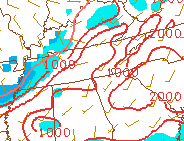
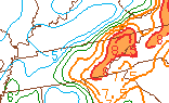
Environment
 |
 |
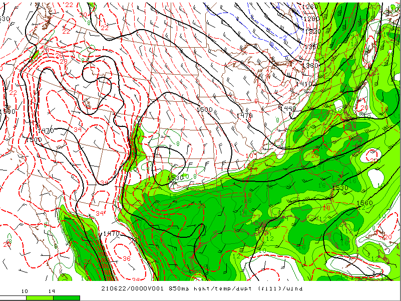 |
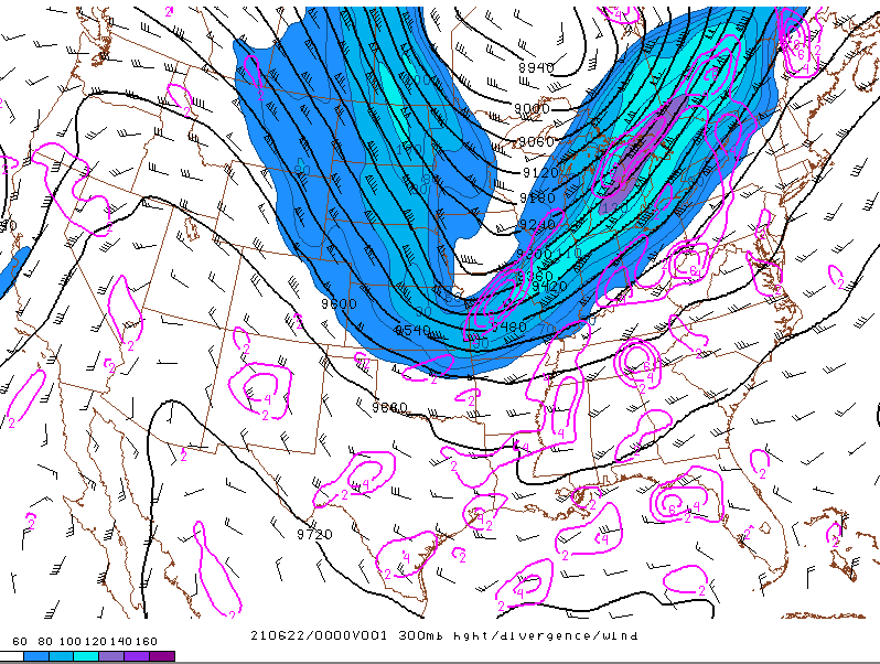
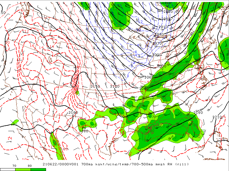
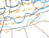
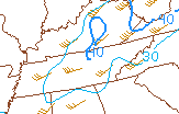
| Figure 1: 300 mb Heights, Divergence, and Winds | Figure 2: 700 mb Heights, Winds, Temps, and Mean RH | Figure 3: 850 mb Heights, Temps, and Dew Points |
 |
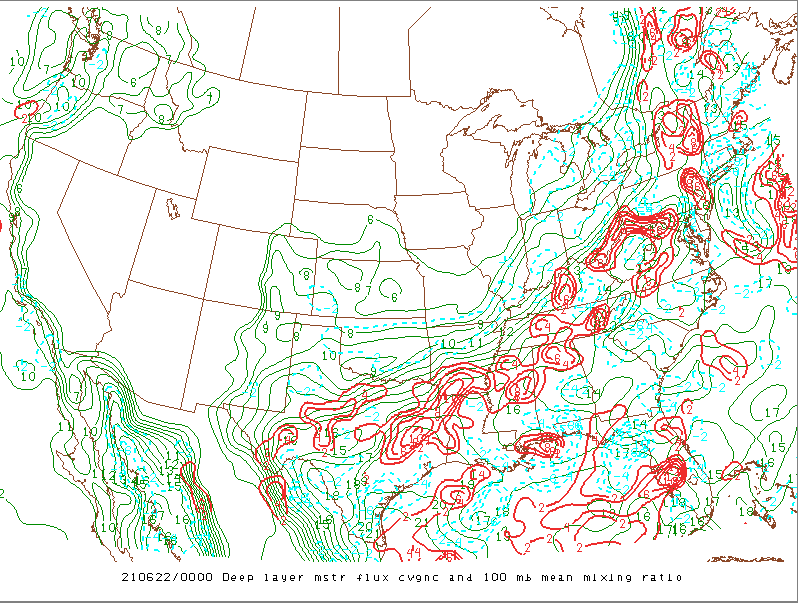 |
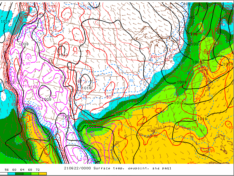
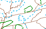
| Figure 4: Surface Temps, Dew Points, and Mean Sea Level Pressure | Figure 5: Deep Layer Moisture Flux, Convergence, and 100 mb Mean Mixing Ratio |
 |
 |
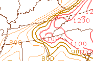 |
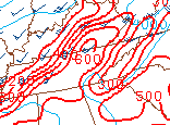
| Figure 6: MLCAPE and MLCIN | Figure 7: Low Level (0-3 Km) Lapse Rates | Figure 8: DCAPE |
 |
 |
 |
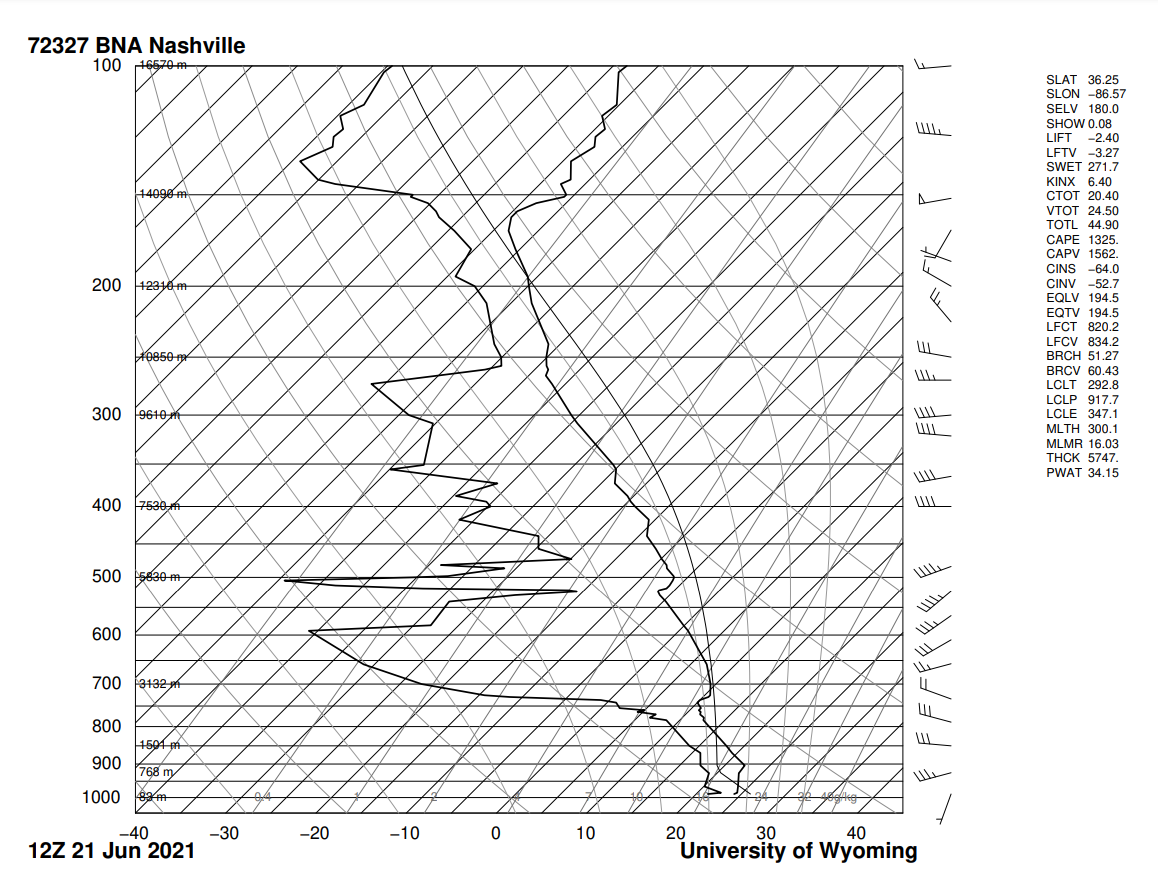
| Figure 9: 12Z Observed Nashville Sounding | Figure 10: Deep Layer (0-6 Km) Shear | Figure 11: Effective Bulk Shear |
 |
 |
| Figure 12: Mid-Level (700-500 mb) Lapse Rates | Figure 13: -10 to -30 C CAPE, Freezing Levels, and 0-6 Km Shear |
 |
Media use of NWS Web News Stories is encouraged! Please acknowledge the NWS as the source of any news information accessed from this site. |
|


 Local Radar
 Huntsville Radar
 Regional Satellite
 Graphical Forecast
 Weather Map