
Excessive rainfall continues to produce life-threatening, locally catastrophic flash flooding along the central Gulf Coast. Isolated to scattered dry thunderstorms may cause lightning-ignited fires and erratic behavior due to gusty winds across parts Oregon, California, and the Great Basin into the weekend. Read More >
Overview
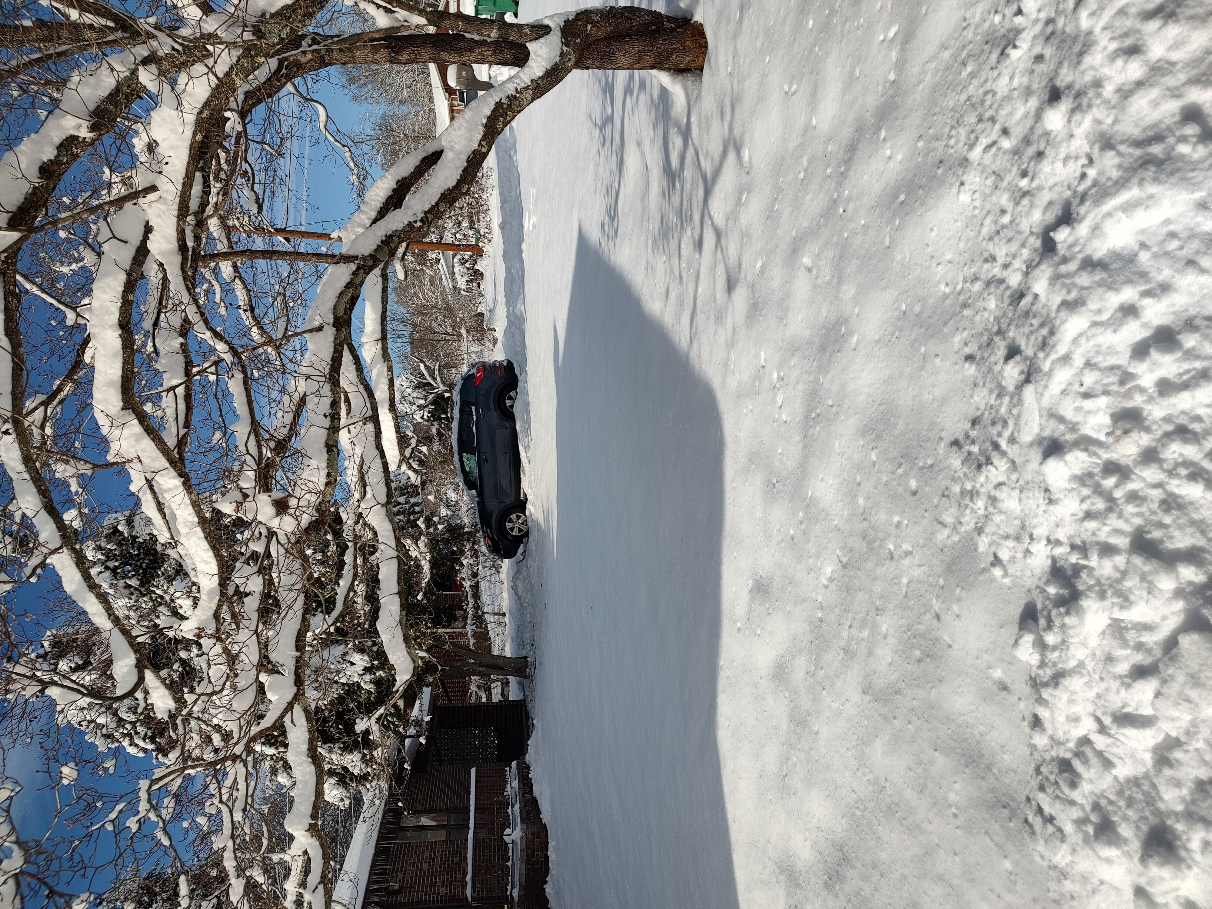
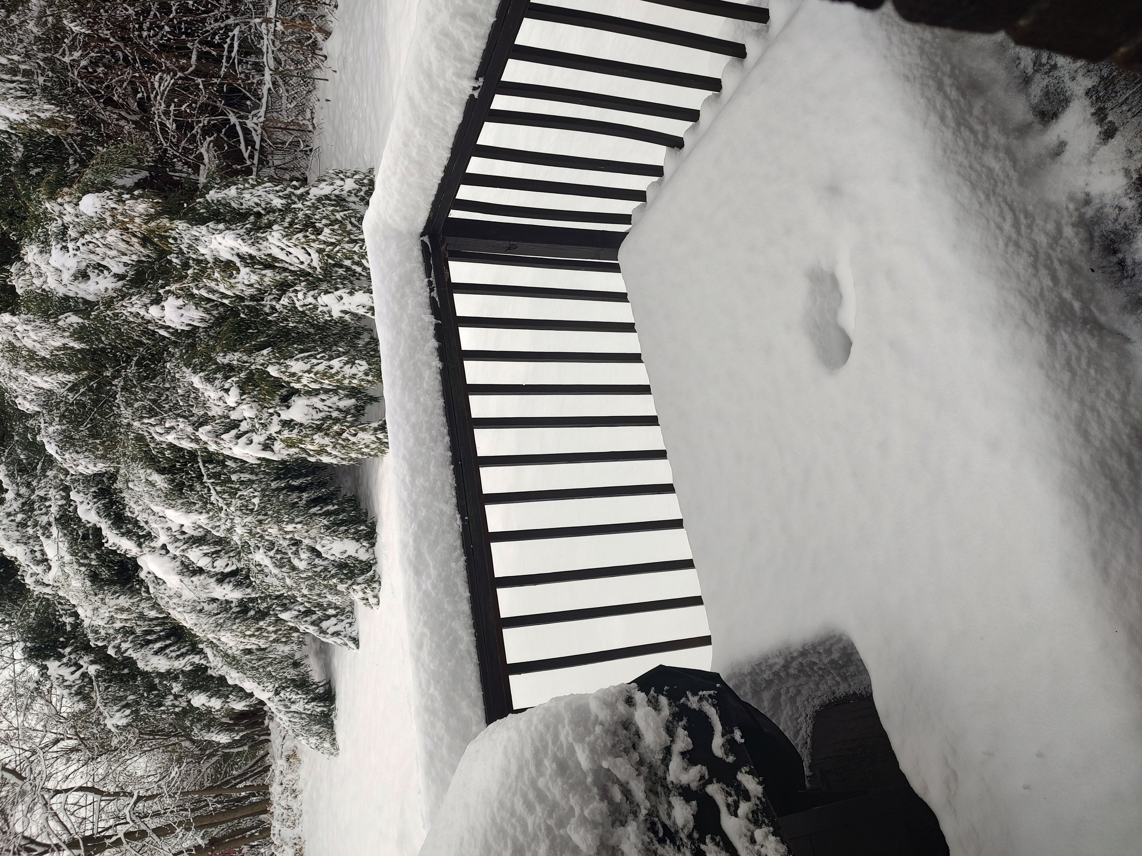
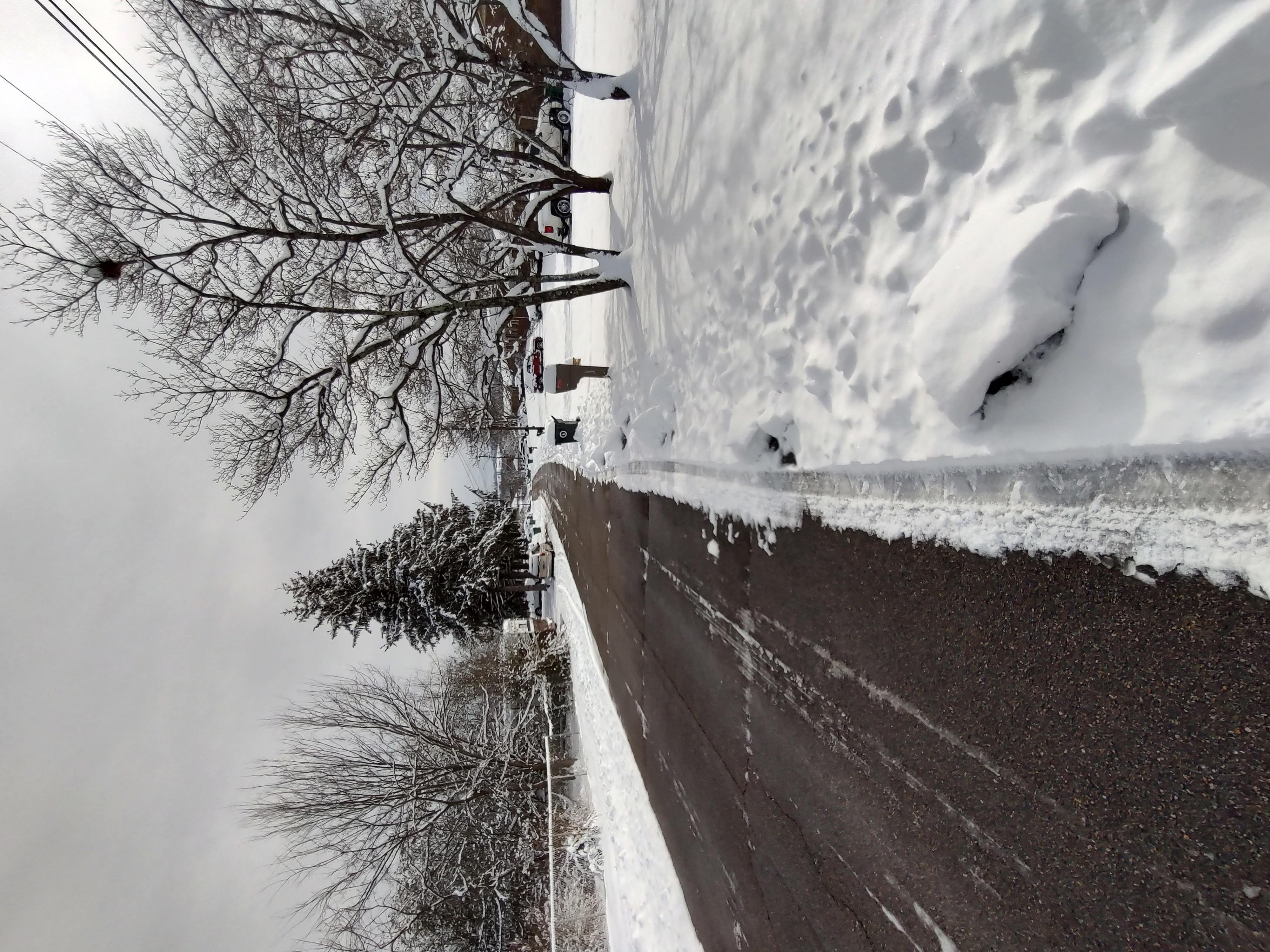
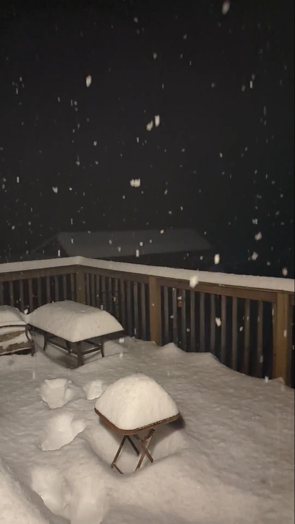
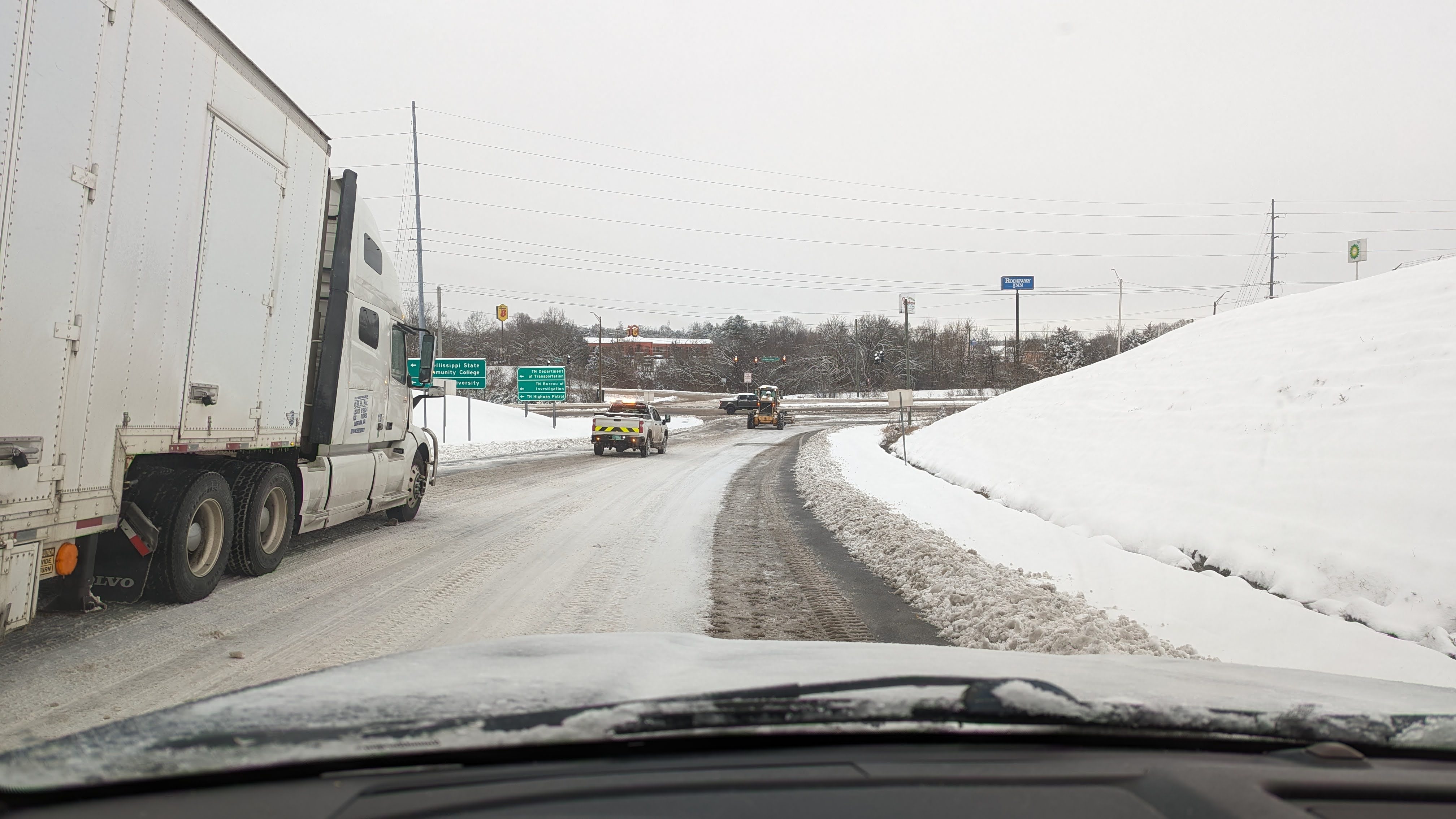
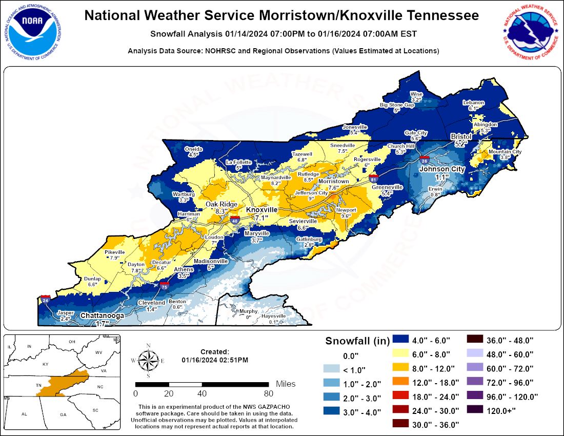
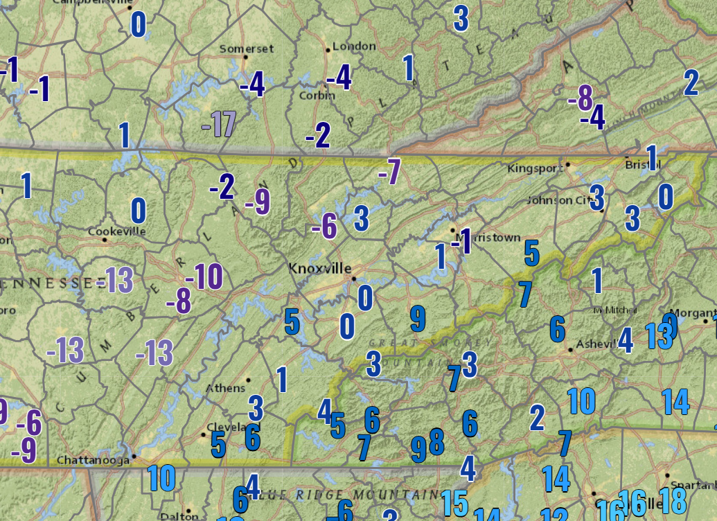
On January 14th, a system impacted much of the area with moderate to heavy snow, followed by extremely cold air. Cold air was already in place with most places starting out as snow, even in the Valley. This continued for the overnight period and the day of the 16th before tapering off by the evening. Places closer to the foothills and southeast Tennessee to southwest North Carolina saw more mixed precipitation due to warmer air in the lower levels. Many places from the southern Plateau through the central and northern Valley saw in excess of 6” of snow with some in the 10” range. This caused significant travel impacts and numerous weather-related car crashes. For the Knoxville area, this was the most snowfall in an event since the Blizzard of ‘93 and the most significant in the Morristown area since the February 2-3, 1996 snowfall event. For Chattanooga, this event alone served as the most snowfall in January since 2011. Extreme cold also set in with lows by the morning of the 17th falling to near or below 0 in many places. Knoxville saw the coldest air temperature in 10 years at 0°. Freezing rain and snow moved into the area on Friday, the 19th, which was followed by similar extreme cold during the weekend. The persistence of snow cover and cold proved to be a once-in-a-century event: Knoxville recorded 7 consecutive days with 4" or more of snow depth, which is the longest streak with depth data going back to 1910. The same was proven at our NWS office, but records here only go back to the winter of 1995-1996.
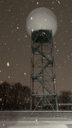
Photos & Video
 |
 |
 |
 |
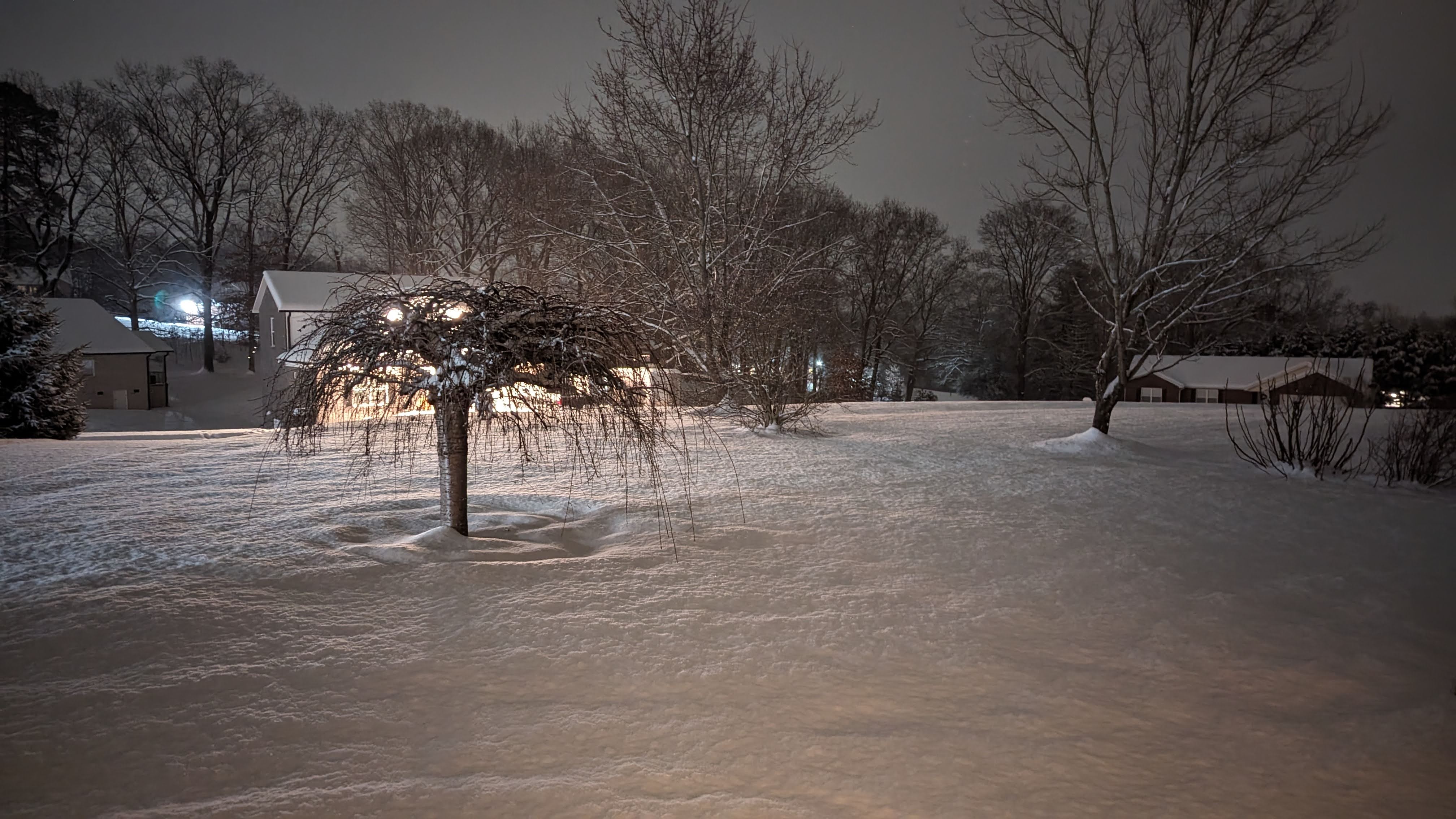
| Morristown, TN (NWS Employee) |
Morristown, TN (NWS Employee) |
Morristown, TN (NWS Employee) |
Strawberry Plains, TN (NWS Employee) |
 |
 |
 |
| I-40 exit east of Knoxville on Tuesday Morning (NWS Employee) |
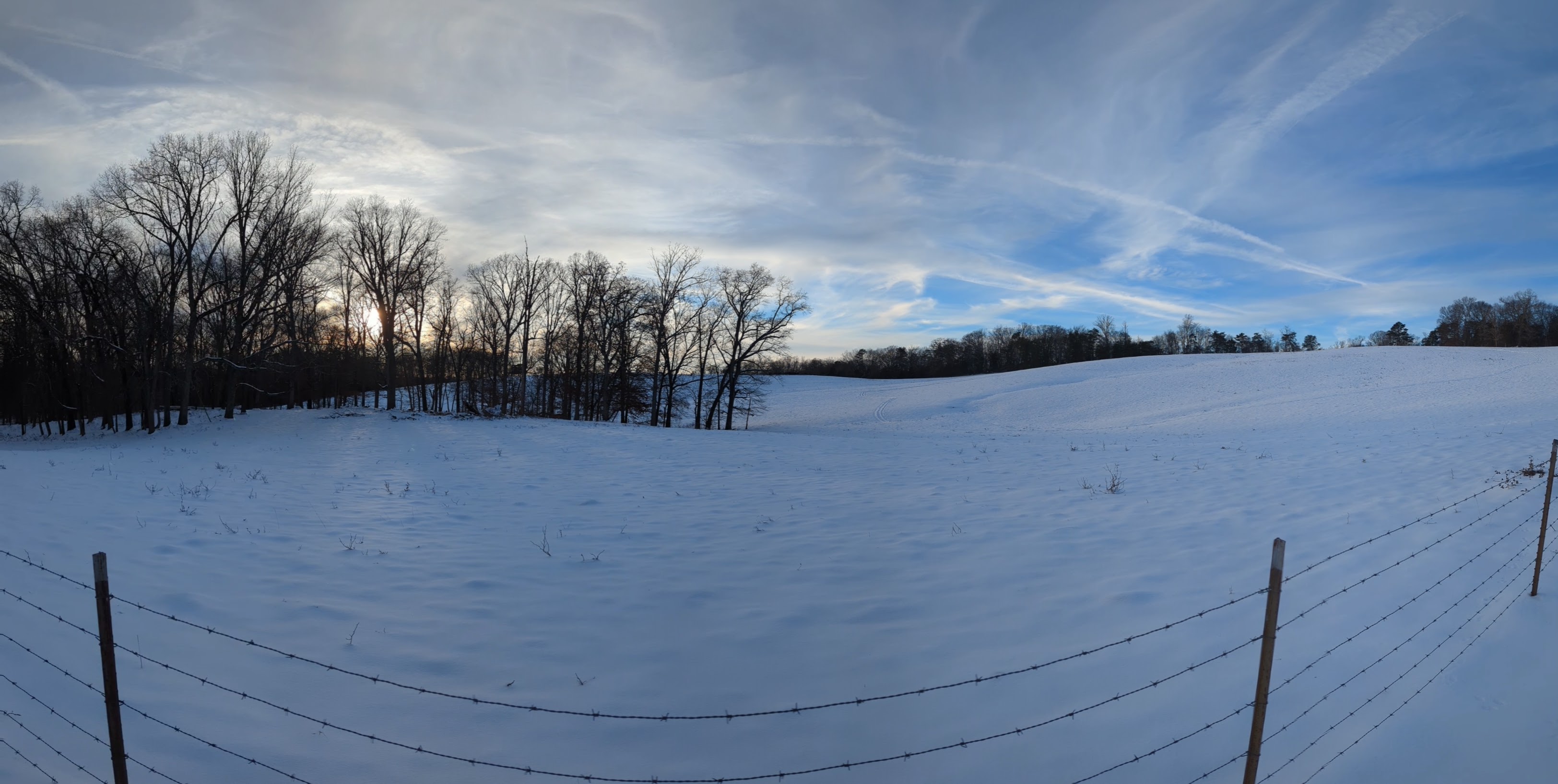
Strawberry Plains, TN (NWS Employee) |
Strawberry Plains 1 full week after snow started (NWS Employee) |
 |
 |
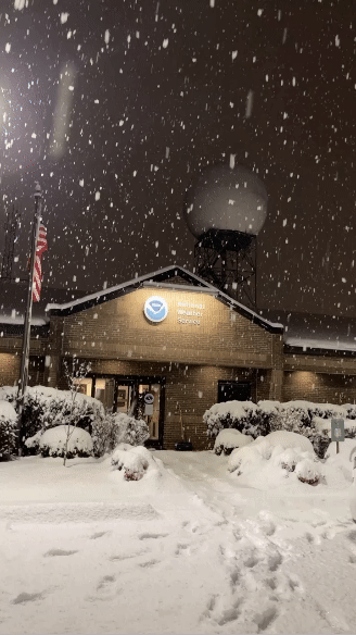
| Reversing Loop of Snow Falling at the NWS Office on January 15th (NWS Employee) |
Snow Falling at the NWS Office on January 15th (NWS Employee) |
Satellite and Radar
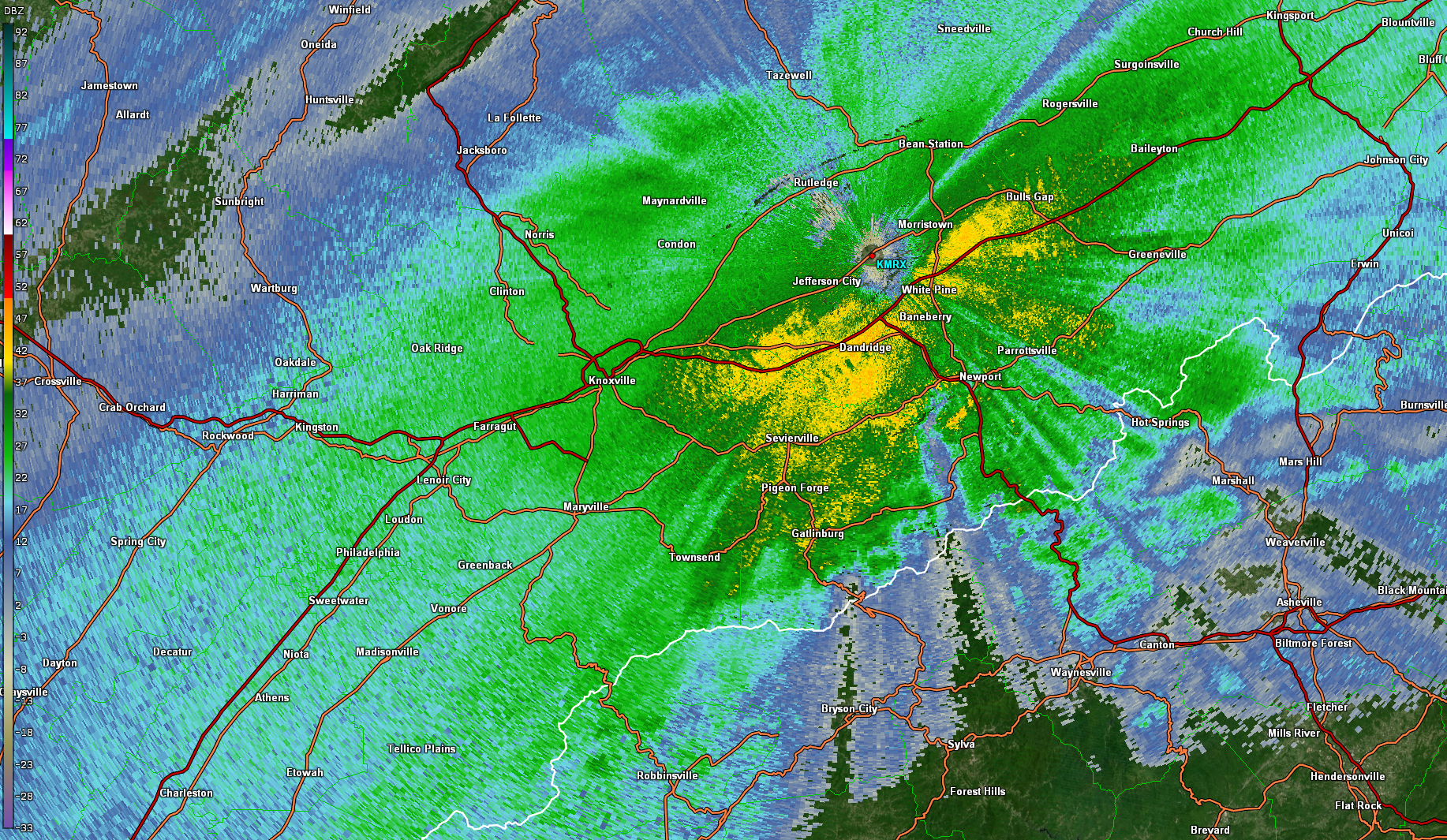
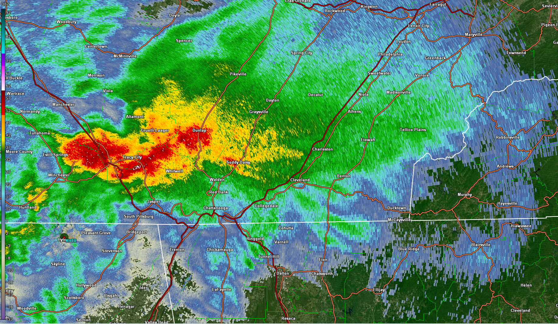
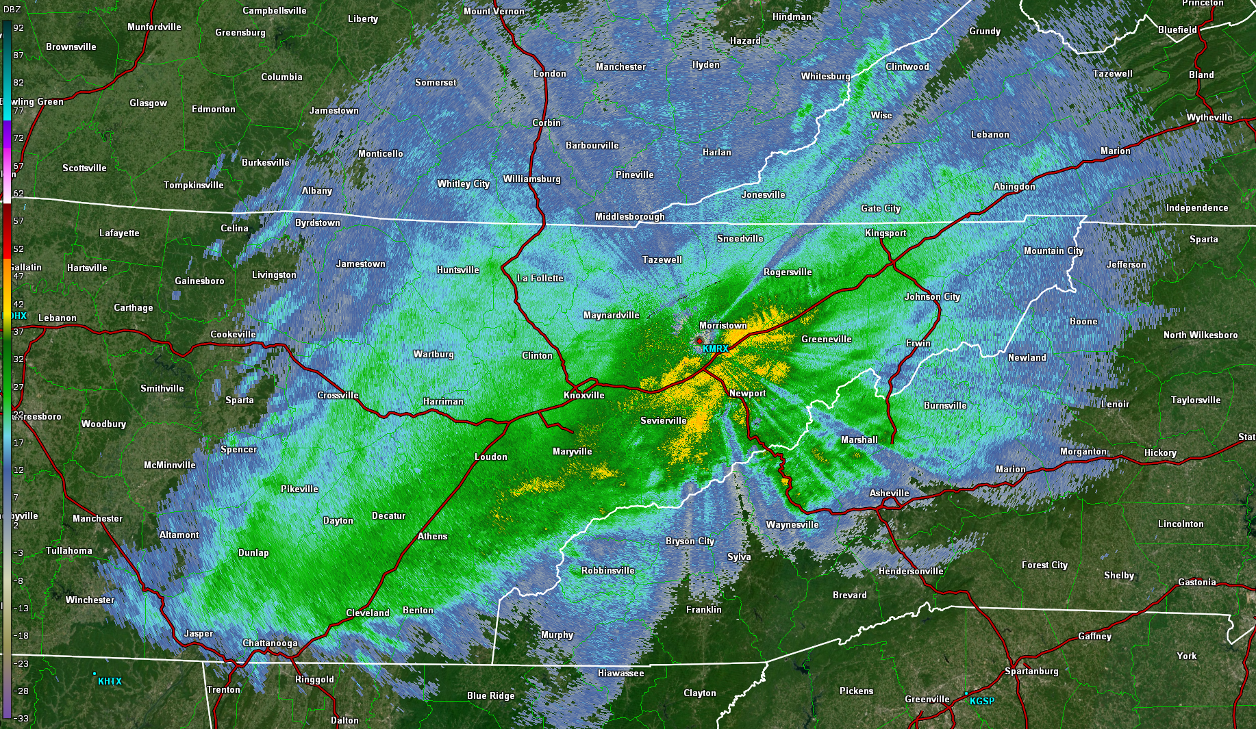
Radar imagery throughout the day on the 15th reveals both the intensity and mixed precipitation types that were seen in certain areas. Figure 1 depicts imagery from just after noon from the Morristown, TN radar site. The higher reflectivities to the south of the radar are indicative of mixed precipitation and melting 1,000 feet AGL and below. Figure 2 is a view from the Huntsville, AL radar and is an example of the convective nature of showers moving onto the Plateau, which led to very enhanced snowfall rates. Figure 3 depicts a broad view of reflectivity from the Morristown radar, which shows an area of very heavy snowfall. The continued southwest to northeast progression of intense snow led to the widespread, very significant 6" to 10" totals. Figure 4 shows a similarly broad view from the Huntsville radar and illustrates the convective nature of very intense snow bands.
 |
 |
 |
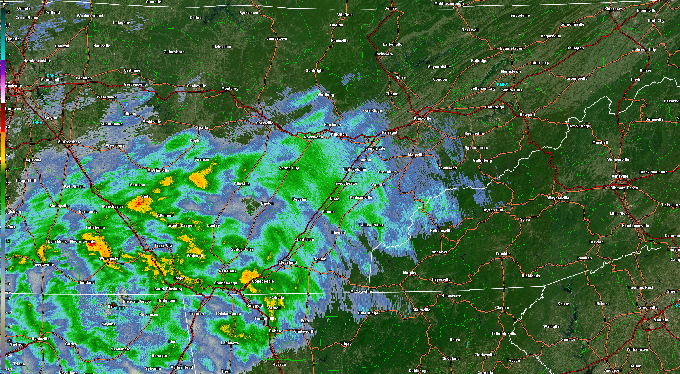 |
| Figure 1: Base Reflectivity Imagery from KMRX at 12:20 PM EST. | Figure 2: Base Reflectivity Imagery from KHTX at 4:07 PM EST | Figure 3: Base Reflectivity Imagery from KMRX at 4:01 PM EST | Figure 4: Base Reflectivity Imagery from KHTX at 6:02 PM EST |
Figure 5 shows visible satellite imagery on the afternoon of the 17th after snow and cloud cover moved out of the area. The image really illustrates the tight gradient in snow cover, especially further south and west of the Knoxville area.
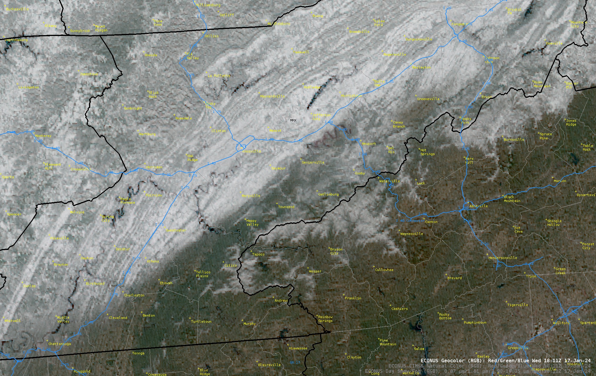 |
| Figure 5: GOES Visible Satellite Imagery at 1:11 PM on Wednesday the 17th |
Storm Reports
This event was very significant with respect to snow totals, not to mention the cold air that followed and allowed snow to stick around for many days afterwards. Most places from the southern Plateau through the southern and central Valley up towards northeast Tennessee received at least 6" of snow. Some places confirmed up to 10" of snow. Places in far southern portions of the area even saw multiple inches of snow, which is very significant when given the fact that many winters in those areas go with little to no snowfall. On the topic of the cold that followed, many places saw low temperatures on the 17th fall to near or below 0°. For several places, these temperatures were the lowest seen in 5 to 10 years. Below, there is a snowfall analysis map, an LSR summary of reports, and a map of observed low temperatures on the morning of January 17th.
..TIME... ...EVENT... ...CITY LOCATION... ...LAT.LON... ..DATE... ....MAG.... ..COUNTY LOCATION..ST.. ...SOURCE.... ..REMARKS.. 0330 PM Snow 3 S Maynardville 36.20N 83.80W 01/16/2024 M8.3 inch Union TN Trained Spotter Reported by Trained Spotter. Very fine crust on the snow this morning and when I measured. 0252 PM Snow 3 WSW Gray 36.40N 82.53W 01/16/2024 E3.0 inch Washington TN Public 0219 PM Snow 4 SSW Roan Mountain 36.12N 82.10W 01/16/2024 M4.5 inch Carter TN Trained Spotter Reported by Trained Spotter. 0159 PM Snow 1 WNW Wartburg 36.11N 84.61W 01/16/2024 E10.0 inch Morgan TN Public 0124 PM Snow 2 NE Sadie 36.45N 82.04W 01/16/2024 E7.8 inch Carter TN Public Location Buladeen TN. Still snowing heavily. 0117 PM Snow 2 WNW Bearden 35.94N 84.04W 01/16/2024 M8.8 inch Knox TN Trained Spotter Reported by Trained Spotter. 1229 PM Snow 4 ENE Mount Carmel 36.59N 82.59W 01/16/2024 M6.1 inch Sullivan TN Trained Spotter Reported by Trained Spotter. Current condition is light flurries. 1100 AM Snow 1 WSW Bearden 35.92N 84.02W 01/16/2024 M7.7 inch Knox TN Trained Spotter Reported by Trained Spotter. Total snow depth 9.0. 1100 AM Snow 2 SSW Surgoinsville 36.45N 82.88W 01/16/2024 M7.5 inch Hawkins TN Trained Spotter Reported by Trained Spotter. Storm total read at 1100. Measured by ruler. Some tree limb breakage due to snow weight. 1051 AM Snow 7 SSW Jonesville 36.59N 83.15W 01/16/2024 M5.8 inch Lee VA Trained Spotter Reported by Trained Spotter. Little/no drifts. 1600 ft elevation. 6 miles NE Sneedville, TN. 7 miles SSW Jonesville, VA. 1015 AM Snow Winfield 36.56N 84.45W 01/16/2024 E5.0 inch Scott TN Public Blowing and drifting snow is also occurring. Some snow drifts are approaching 6 inches, with some spots seeing snow drifts near 7 or 8 inches in some locations. 1010 AM Snow 1 ENE Colonial Heights 36.48N 82.50W 01/16/2024 E4.5 inch Sullivan TN Public Roads are slushy and slick with some secondary roads very slippery. 1009 AM Snow 1 NNE Sharps Chapel 36.35N 83.80W 01/16/2024 M6.4 inch Union TN Trained Spotter Reported by Trained Spotter. Total storm precipitation. finished with a wafer-thin layer of ice accretion. 1007 AM Snow 3 NNW Maloneyville 36.12N 83.86W 01/16/2024 M8.6 inch Knox TN Trained Spotter Reported by Trained Spotter. Snowfall Total 8.6 Up from 1.3 yesterday 1/15/2024 @ 6AM EST. 0952 AM Snow 2 S Eagleton Village 35.76N 83.94W 01/16/2024 M6.4 inch Blount TN Trained Spotter Reported by Trained Spotter. 0921 AM Snow 5 W Blountville 36.56N 82.40W 01/16/2024 M4.5 inch Sullivan TN Public 0916 AM Snow 1 NW Jonesville 36.71N 83.13W 01/16/2024 M5.5 inch Lee VA Public Reported by Trained Spotter. 0854 AM Snow 3 SW Andersonville 36.17N 84.07W 01/16/2024 M8.0 inch Anderson TN Public 0850 AM Snow 1 E Church Hill 36.53N 82.70W 01/16/2024 M7.8 inch Hawkins TN Public Reported by Trained Spotter. 0847 AM Snow 3 NE Gray 36.44N 82.46W 01/16/2024 M1.3 inch Sullivan TN Public Reported by Trained Spotter. 0843 AM Snow 3 E Jonesville 36.69N 83.06W 01/16/2024 M7.0 inch Lee VA Trained Spotter 0842 AM Snow 2 E Halls 36.10N 83.89W 01/16/2024 M8.3 inch Knox TN Public Reported by Trained Spotter. 0832 AM Snow 2 NW Clinton 36.11N 84.14W 01/16/2024 M10.0 inch Anderson TN Public 0804 AM Snow 3 NE Kodak 36.01N 83.60W 01/16/2024 M6.0 inch Sevier TN Public Reported by Trained Spotter. 0800 AM Snow 5 SW Clinton 36.06N 84.21W 01/16/2024 M8.8 inch Anderson TN Public 0800 AM Snow 2 NW Bristol Va 36.64N 82.19W 01/16/2024 M5.2 inch Washington VA Broadcast Media 0800 AM Snow Pennington Gap 36.76N 83.03W 01/16/2024 M5.1 inch Lee VA Public Reported by Trained Spotter. 0800 AM Snow 3 ESE Pigeon Forge 35.78N 83.52W 01/16/2024 E1.0 inch Sevier TN Public 0748 AM Snow 3 SW Harrison 35.10N 85.18W 01/16/2024 M2.1 inch Hamilton TN Cocorahs Cocorahs station TN-HL-31 Chattanooga 5.1 ENE. 0746 AM Snow 1 N Kingsport 36.55N 82.56W 01/16/2024 E5.2 inch Sullivan TN Public 0745 AM Snow 1 ENE Blountville 36.54N 82.32W 01/16/2024 E4.9 inch Sullivan TN Public 0700 AM Snow 1 SW Norris 36.20N 84.08W 01/16/2024 M6.5 inch Anderson TN Cocorahs Cocorahs station TN-AN-8 Norris 0.6 NW. 0700 AM Snow 3 SSW Jonesborough 36.26N 82.50W 01/16/2024 M2.0 inch Washington TN Cocorahs Cocorahs station TN-WS-22 Jonesborough 2.7 SSW. 0630 AM Snow 4 SW Abingdon 36.68N 82.02W 01/16/2024 M5.0 inch Washington VA Trained Spotter 0600 AM Snow 2 NNW Kimberlin Heights 35.96N 83.77W 01/16/2024 M8.0 inch Knox TN Cocorahs Cocorahs station TN-KX-58 Seymour 5.8 N. 0600 AM Snow Petros 36.09N 84.44W 01/16/2024 M6.0 inch Morgan TN Cocorahs Cocorahs station TN-MG-3 Petros. 0530 AM Snow 1 SSW Bulls Gap 36.25N 83.09W 01/16/2024 M4.5 inch Hawkins TN Cocorahs Cocorahs station TN-HK-8 Bulls Gap 0.9 SSW. 0400 AM Snow 1 SSE Fort Blackmore 36.75N 82.58W 01/16/2024 M6.0 inch Scott VA Trained Spotter 0323 AM Snow 4 SW Bearden 35.90N 84.06W 01/16/2024 M9.9 inch Knox TN Trained Spotter 0230 AM Snow 1 ESE Mount Carmel 36.55N 82.64W 01/16/2024 M6.5 inch Hawkins TN Trained Spotter Reported by Trained Spotter. 0208 AM Freezing Rain 4 S Tasso 35.15N 84.80W 01/16/2024 M0.10 inch Bradley TN Trained Spotter 0106 AM Snow 3 ESE Karns 35.96N 84.06W 01/16/2024 M9.0 inch Knox TN Public 1200 AM Snow 2 ESE Kingsport 36.52N 82.53W 01/16/2024 M3.5 inch Sullivan TN CO-OP Observer CO-OP Observer station KNGT1 Kingsport. 1159 PM Snow 2 E Honaker 37.02N 81.95W 01/15/2024 M6.0 inch Russell VA Trained Spotter 1139 PM Snow 2 NE Lenoir City 35.83N 84.25W 01/15/2024 M8.0 inch Loudon TN Trained Spotter Ice reported in vicinity. 1100 PM Snow 2 SW Mount Carmel 36.54N 82.68W 01/15/2024 M7.0 inch Hawkins TN Public 1100 PM Snow 4 NNW Kingsport 36.58N 82.58W 01/15/2024 M5.8 inch Sullivan TN Trained Spotter 1053 PM Snow 4 NE Limestone Cove 36.22N 82.21W 01/15/2024 M5.0 inch Carter TN Public 1000 PM Snow 3 N Kimberlin Heights 35.98N 83.76W 01/15/2024 E8.5 inch Knox TN Public 0930 PM Snow Talbott 36.15N 83.42W 01/15/2024 M7.5 inch Jefferson TN NWS Employee 0923 PM Snow 2 NW Lake Forest 35.94N 83.89W 01/15/2024 M8.9 inch Knox TN Public 0915 PM Snow Powell 36.03N 84.03W 01/15/2024 M8.0 inch Knox TN Trained Spotter 0900 PM Snow 1 NNW Maloneyville 36.10N 83.85W 01/15/2024 M9.0 inch Knox TN Public 0900 PM Snow 3 SE Halls 36.05N 83.90W 01/15/2024 M9.0 inch Knox TN Public 0900 PM Snow 3 W Knoxville 35.98N 84.00W 01/15/2024 M9.0 inch Knox TN Public 0900 PM Snow 2 N Heiskell 36.11N 84.06W 01/15/2024 M8.0 inch Anderson TN Public Roads are icy. 0900 PM Snow 1 SW Eagleton Village 35.79N 83.94W 01/15/2024 M5.5 inch Blount TN Public 0855 PM Snow 2 NW Bearden 35.96N 84.03W 01/15/2024 E9.0 inch Knox TN Public Facebook report. No picture provided. 0841 PM Snow 3 NW Oak Ridge 35.99N 84.33W 01/15/2024 E8.5 inch Roane TN Public Facebook report. Estimated from ruler. 0835 PM Snow 1 NNW Jonesville 36.71N 83.13W 01/15/2024 M5.0 inch Lee VA Trained Spotter Still snowing at time of observation. 0830 PM Snow 3 SSE Strawberry Plains 36.02N 83.67W 01/15/2024 M9.0 inch Sevier TN NWS Employee 0830 PM Snow 1 ENE Farragut 35.88N 84.16W 01/15/2024 M8.0 inch Knox TN Public X (Twitter) report. 0812 PM Snow 2 ENE Powell 36.04N 84.00W 01/15/2024 M7.5 inch Knox TN Trained Spotter 0809 PM Freezing Rain 3 NW Wartburg 36.13N 84.62W 01/15/2024 U0.00 inch Morgan TN Emergency Mngr Freezing rain reported in the Wartburg and Lancing area of Morgan County. 0800 PM Snow 1 SSE Bearden 35.92N 84.00W 01/15/2024 E9.5 inch Knox TN Public Facebook report. Estimated from ruler. 0800 PM Snow 4 W Oliver Springs 36.03N 84.42W 01/15/2024 E8.5 inch Morgan TN Public X (Twitter) report. Estimated from ruler. 0800 PM Snow 4 N Farragut 35.93N 84.19W 01/15/2024 E8.0 inch Knox TN Public X (Twitter) report. Around 8 inches. 0758 PM Snow 2 E Morristown 36.22N 83.25W 01/15/2024 M7.0 inch Hamblen TN NWS Employee 0755 PM Snow 1 NNW Clinton 36.10N 84.13W 01/15/2024 E7.5 inch Anderson TN Public X (Twitter) report. Estimated from ruler. 0754 PM Snow 1 S Mount Carmel 36.55N 82.66W 01/15/2024 M8.0 inch Hawkins TN Public 0754 PM Snow Doeville 36.39N 81.97W 01/15/2024 E7.0 inch Johnson TN Public Over 7 inches reported, but not a definitive amount. 0754 PM Snow 2 WNW Leesburg 36.30N 82.58W 01/15/2024 M6.0 inch Washington TN Public 0745 PM Snow Blountville 36.53N 82.33W 01/15/2024 E5.5 inch Sullivan TN Public 5 to 6 inches reported. 0744 PM Snow 2 NW Lenoir City 35.82N 84.30W 01/15/2024 M9.0 inch Loudon TN Trained Spotter Reported by Trained Spotter. 0744 PM Snow Rogersville 36.41N 83.01W 01/15/2024 M6.0 inch Hawkins TN Public 0741 PM Snow 3 SE Blaine 36.11N 83.66W 01/15/2024 M8.0 inch Jefferson TN Public 0739 PM Snow 1 ENE Church Hill 36.53N 82.70W 01/15/2024 M6.5 inch Hawkins TN Trained Spotter Heavy, wet snow still coming down at time of report. 0735 PM Freezing Rain 4 NNE Oak Ridge 36.01N 84.26W 01/15/2024 U0.00 inch Anderson TN Public Freezing rain and fine mist reported in Oak Ridge. 0715 PM Snow 1 W Talbott 36.15N 83.43W 01/15/2024 E8.0 inch Jefferson TN Public 0705 PM Snow 1 S Decatur 35.51N 84.79W 01/15/2024 E6.5 inch Meigs TN Public Facebook report. Estimated from ruler. 0700 PM Snow 3 NW Bearden 35.96N 84.04W 01/15/2024 E9.5 inch Knox TN Public Facebook report. 0700 PM Snow 1 SSE Pikeville 35.60N 85.19W 01/15/2024 M8.2 inch Bledsoe TN CO-OP Observer Station PKET1 0.6 S Pikeville. 0700 PM Snow 4 SSW Luttrell 36.15N 83.78W 01/15/2024 E7.5 inch Knox TN Public 0700 PM Snow Halls 36.08N 83.94W 01/15/2024 E7.0 inch Knox TN Public 0700 PM Snow 3 ENE Saint Clair 36.34N 83.03W 01/15/2024 M7.0 inch Hawkins TN Trained Spotter Reported by Trained Spotter. 0700 PM Snow Abingdon 36.71N 81.97W 01/15/2024 M5.3 inch Washington VA Public X (Twitter) report. 0652 PM Snow 2 W Farragut 35.87N 84.23W 01/15/2024 E8.8 inch Knox TN Public X (Twitter) report. 0650 PM Snow 3 NNE Heiskell 36.13N 84.04W 01/15/2024 M7.3 inch Anderson TN Trained Spotter 0640 PM Snow Washburn 36.29N 83.59W 01/15/2024 E8.5 inch Grainger TN Public 0640 PM Snow 2 SSW Bearden 35.90N 84.02W 01/15/2024 M8.0 inch Knox TN Public 0636 PM Snow 2 NW Ten Mile 35.69N 84.70W 01/15/2024 M9.0 inch Meigs TN Public 0635 PM Snow 3 WSW Alcoa 35.77N 84.02W 01/15/2024 M4.8 inch Blount TN Public Just recently switched over to heavy snow after a mixture most of the day. 0630 PM Snow 4 WNW Alcoa 35.82N 84.04W 01/15/2024 E9.0 inch Blount TN Public Facebook report. Estimated from ruler. 0615 PM Snow 3 NW Lowland 36.19N 83.24W 01/15/2024 E6.0 inch Hamblen TN Public 0613 PM Snow 1 ESE Mascot 36.06N 83.74W 01/15/2024 M9.0 inch Knox TN Public X (Twitter) report. 0613 PM Snow 1 W Eagleton Village 35.79N 83.95W 01/15/2024 M5.0 inch Blount TN Trained Spotter 0600 PM Snow 4 S Hampton 36.23N 82.19W 01/15/2024 M6.0 inch Carter TN Public 0554 PM Snow 2 WNW Lake Forest 35.94N 83.89W 01/15/2024 M8.2 inch Knox TN Public Snow still falling at time of report. 0545 PM Snow 3 NNE Eagle Furnace 35.81N 84.72W 01/15/2024 M7.0 inch Roane TN Public 0530 PM Snow 7 W Okolona 36.57N 82.90W 01/15/2024 M5.3 inch Hancock TN Public 0518 PM Snow 5 WNW Blountville 36.56N 82.40W 01/15/2024 E4.2 inch Sullivan TN Public 0517 PM Snow 1 ENE Kingsport 36.54N 82.54W 01/15/2024 M5.0 inch Sullivan TN Trained Spotter 32.5 degrees and snowing at observation time. 0515 PM Snow 5 WSW Karns 35.95N 84.19W 01/15/2024 M6.5 inch Knox TN Trained Spotter 0455 PM Snow 1 N Sharps Chapel 36.35N 83.80W 01/15/2024 M5.5 inch Union TN Trained Spotter 0431 PM Snow 3 S Karns 35.93N 84.13W 01/15/2024 M8.0 inch Knox TN Public 0424 PM Snow 3 N Church Hill 36.57N 82.71W 01/15/2024 M5.0 inch Hawkins TN Public Reported by Trained Spotter. 0420 PM Snow 3 E Karns 35.96N 84.06W 01/15/2024 M6.0 inch Knox TN Public 0414 PM Snow 6 E Dunlap 35.37N 85.28W 01/15/2024 M4.0 inch Sequatchie TN Public Reported by Trained Spotter. 0400 PM Snow 2 SE Cagle 35.45N 85.43W 01/15/2024 M6.0 inch Sequatchie TN Public 6.0 inches of snow on the ground with heavy aggregate snowfall at observation. Elevation is 1800 ft. 0337 PM Snow 4 NW Clear Water 35.56N 84.67W 01/15/2024 M5.0 inch McMinn TN Public 0330 PM Snow 3 NE Dearmond 36.00N 84.45W 01/15/2024 M4.5 inch Morgan TN Public 4.5 inches measured snowfall. 0330 PM Snow 4 W Alcoa 35.81N 84.05W 01/15/2024 M4.0 inch Blount TN Public Reported by Trained Spotter. 0300 PM Snow 5 NNE Brayton 35.54N 85.14W 01/15/2024 M3.2 inch Bledsoe TN Cocorahs Cocorahs station TN-BL-24 Pikeville 5.7 SSE. 0238 PM Snow 1 NE East Brainerd 35.03N 85.10W 01/15/2024 M0.5 inch Hamilton TN Public Reported by Trained Spotter. 0237 PM Snow 2 E Waterville 35.12N 84.83W 01/15/2024 M1.0 inch Bradley TN Public Reported by Trained Spotter. 0230 PM Snow 5 S Lenoir City 35.73N 84.26W 01/15/2024 M5.0 inch Loudon TN Public Average of three snowfall measurements was 5 inches. Taken near Tanasi Golf course in Tellico Village. 0230 PM Snow Wise 36.98N 82.58W 01/15/2024 M3.0 inch Wise VA Public 0209 PM Snow 2 SSW Oliver Springs 36.00N 84.35W 01/15/2024 M5.0 inch Roane TN Public 0208 PM Snow 1 S Athens 35.44N 84.60W 01/15/2024 M2.5 inch McMinn TN Public Reported by Trained Spotter. 0200 PM Snow 3 ENE Georgetown 35.30N 84.90W 01/15/2024 M4.0 inch Bradley TN Trained Spotter 0145 PM Snow 1 SW Tazewell 36.45N 83.59W 01/15/2024 M5.3 inch Claiborne TN Public 0123 PM Snow 2 WSW Gray 36.40N 82.52W 01/15/2024 M1.5 inch Washington TN Public Moderate snow falling right now. 1256 PM Snow 6 E Shady Grove 35.23N 85.03W 01/15/2024 M2.5 inch Hamilton TN Public 1250 PM Snow Athens 35.45N 84.60W 01/15/2024 M4.0 inch McMinn TN Trained Spotter 1240 PM Snow 3 NNE Englewood 35.47N 84.46W 01/15/2024 M1.3 inch McMinn TN Public Reported by Trained Spotter. 1212 PM Snow Charleston 35.29N 84.76W 01/15/2024 M3.0 inch Bradley TN Trained Spotter Still snowing. 1212 PM Snow 2 W Gray 36.40N 82.52W 01/15/2024 M1.3 inch Washington TN Public 1110 AM Snow Wartburg 36.10N 84.59W 01/15/2024 E3.0 inch Morgan TN Public Still snowing. 1058 AM Snow 3 WSW Lone Oak 35.17N 85.42W 01/15/2024 E3.0 inch Marion TN Public From social media. Roads are snow and ice covered in the area. Several cars in ditches. Location of report is Suck Creek Mountain at Prentice Cooper State Forest. Location on map estimated.
Environment
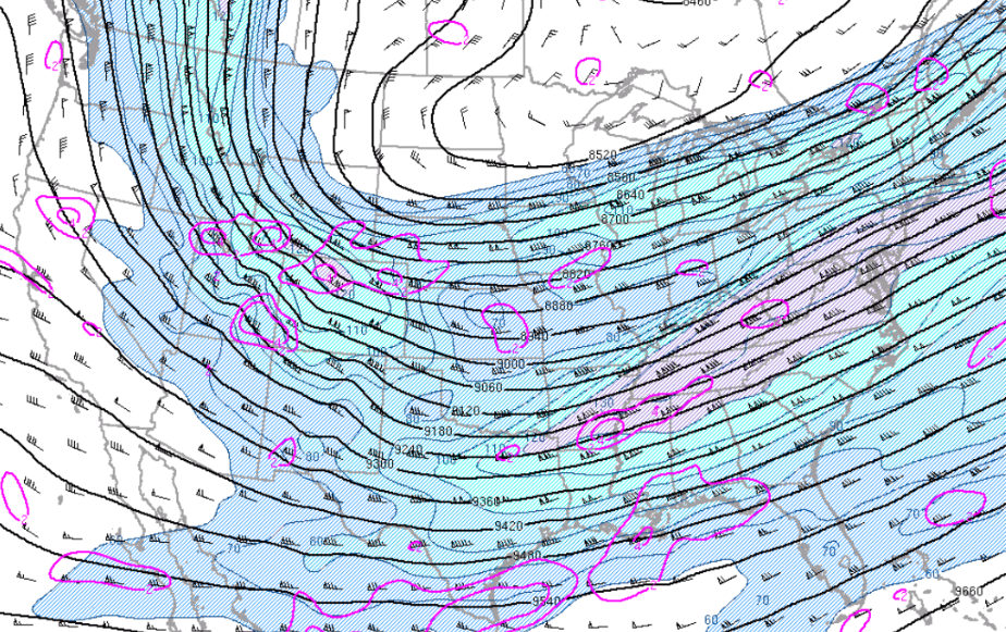
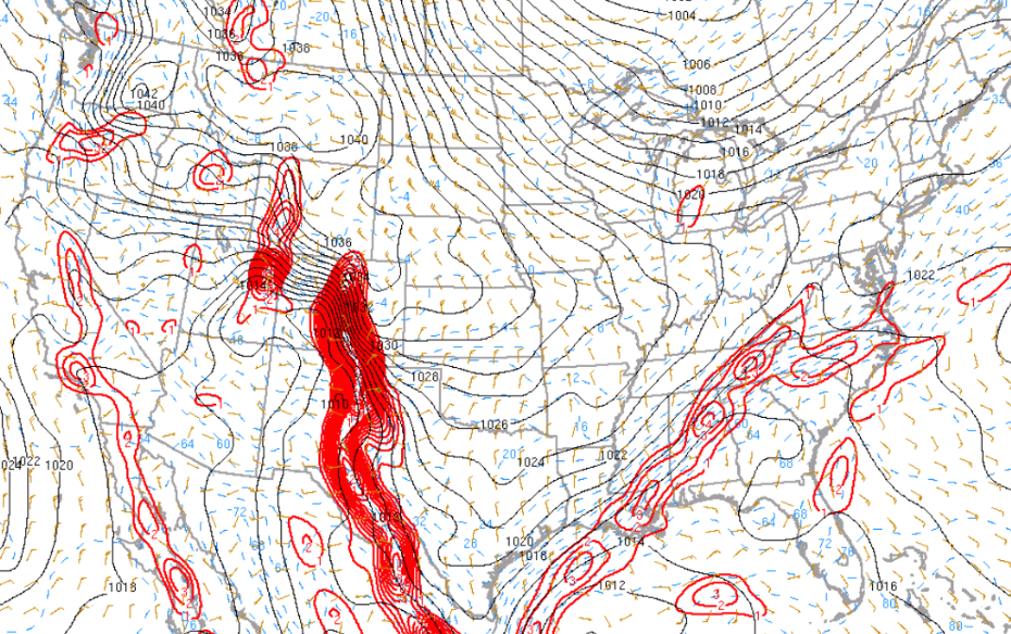
A strong upper level jet moved across the Tennessee and Ohio valleys with 300mb winds of 140 knots. This jet was located in deep southwest flow from Texas, middle Mississippi River Valley, Tennessee valley into the mid-Atlantic states.
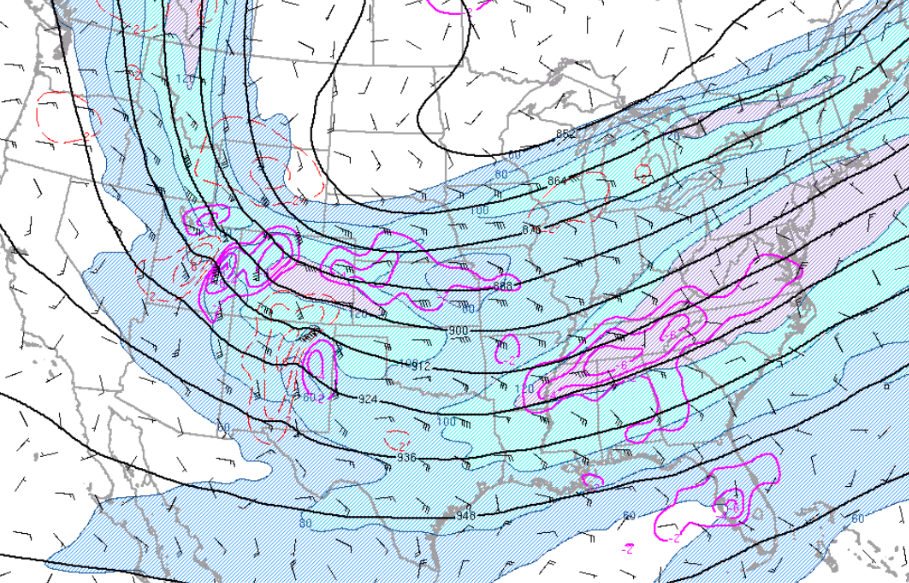
The deep and strong upper jet enhanced the fronto-genetic forcing across east Tennessee and southwest Virginia. The 850mb flow over the Tennessee valley and southern Appalachians was also strong out of the southwest between 30 and 35 knots that produced warm air advection and isentropic lift across the southern Appalachians. The forcing combined to produce widespread precipitation over the area.
 |
 |
 |
| Figure 1: 300mb Heights, Divergence, and Winds at 10 AM EST on January 15 | Figure 2: 300mb Isotachs, Heights, Ageostrophic Winds, and 700-500mb Layer-Avg Omega at 12 PM EST on January 15 | Figure 3: 850mb Heights, Temperatures, and Winds at 10 AM EST on January 15 |
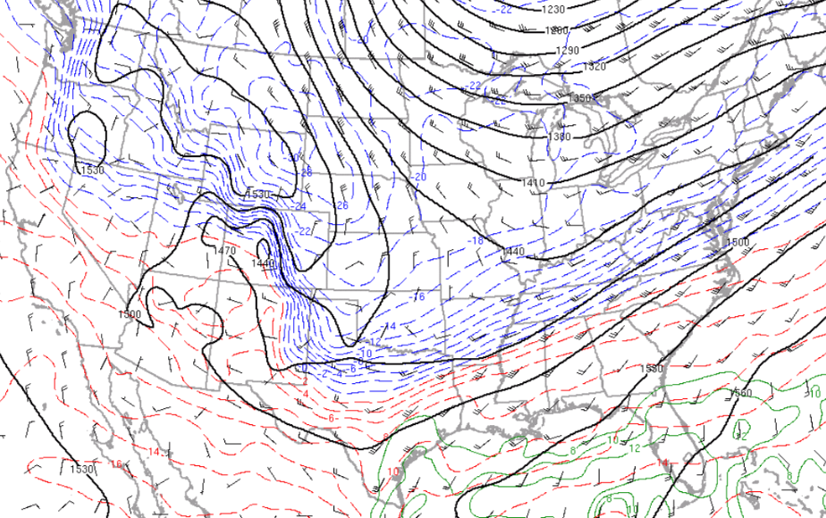
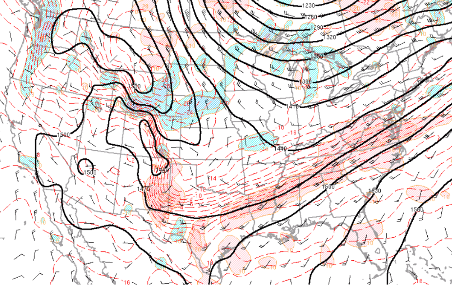
A sharp nearly stationary frontal boundary was located from northern Alabama into the southern Appalachians. Very cold Arctic air-mass was located just west and northwest of this frontal boundary with mild conditions over the southeast United States. The sharp temperature gradient set the stage for active weather, as well as, varying precipitation types across the Tennessee valley and southern Appalachians.
 |
 |
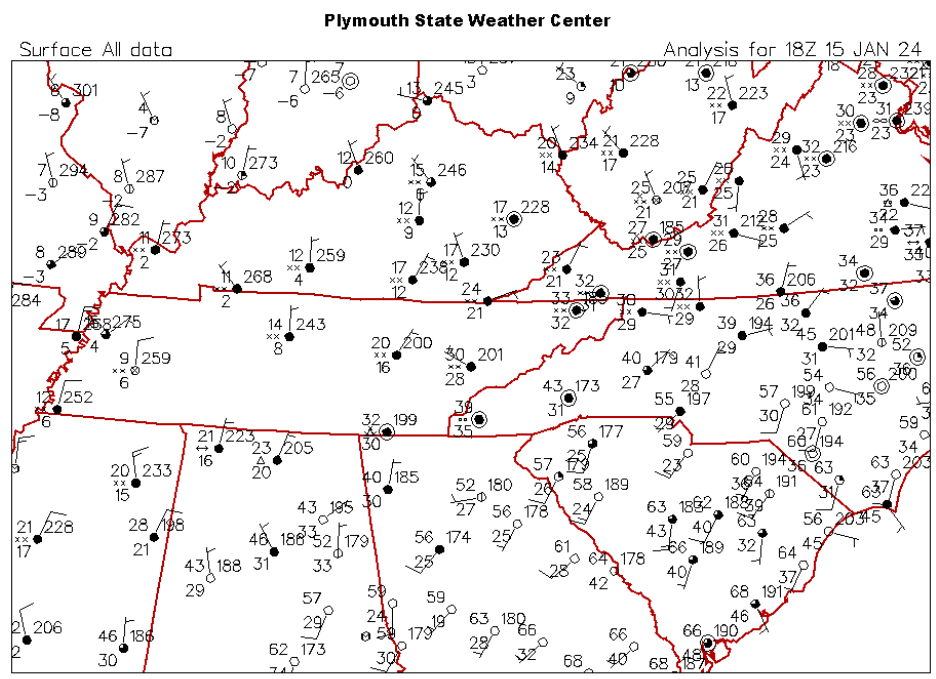 |
| Figure 4: 850mb Heights, Temperatures, Temperature Advections, and Winds at 10 AM EST on January 15 | Figure 5: Surface Frontogenesis at 12 PM EST on January 15 | Figure 6: Surface Station Plot at 1 PM EST on January 15 |
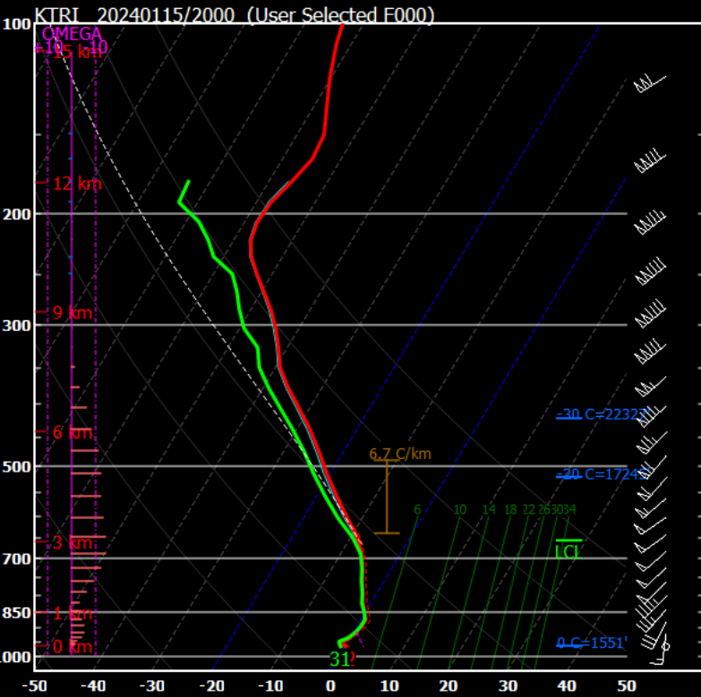
The initialized RAP model soundings depicted temperatures at or below normal across much of the vertical profile except at the Tri-Cities and Chattanooga, Tennessee and especially Watauga, North Carolina. For these locations, the temperature profile climbed just above freezing which allowed for more of a wintry mixture of snow, sleet, freezing rain, and rain.
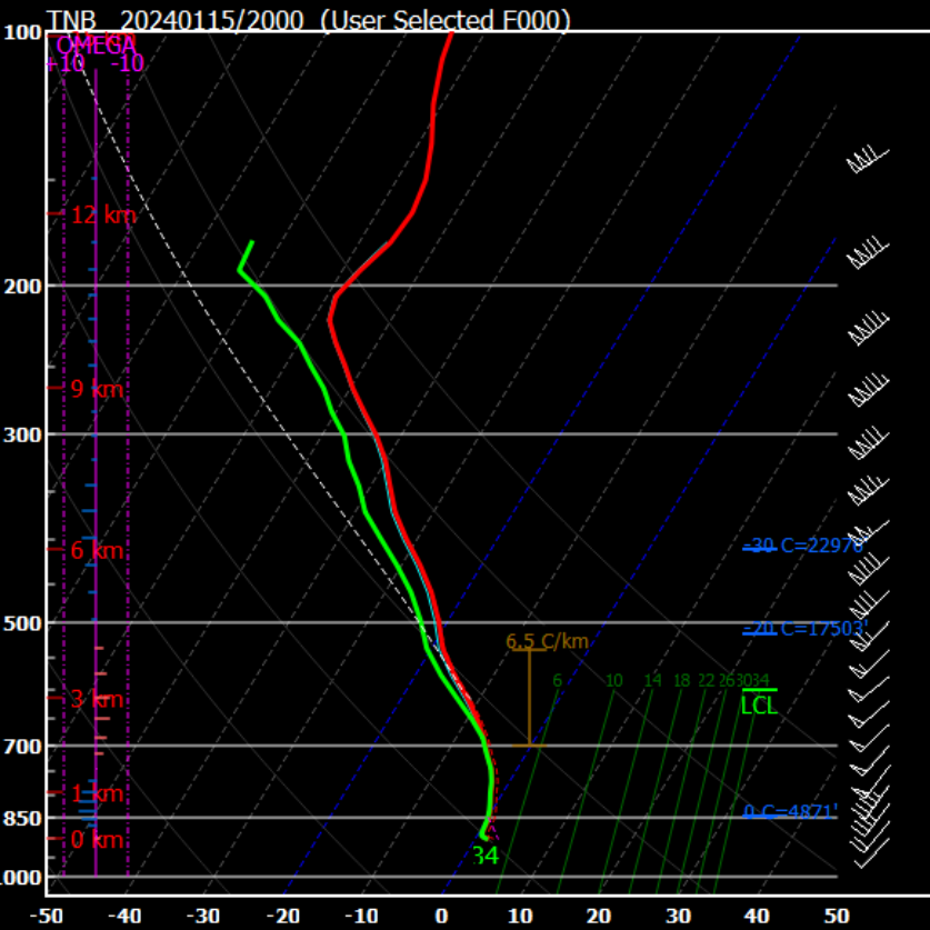
For Morristown and Knoxville, Tennessee, the temperature profile was mainly at or below freezing, which allowed most of the precipitation to be in the form of snow. These locations received the heaviest snowfall totals.
Also the vertical profile depicted a fairly saturated dendritic snow growth region between the -12°C and -18°C levels which allowed for good snow growth and snowfall intensity.
 |
 |
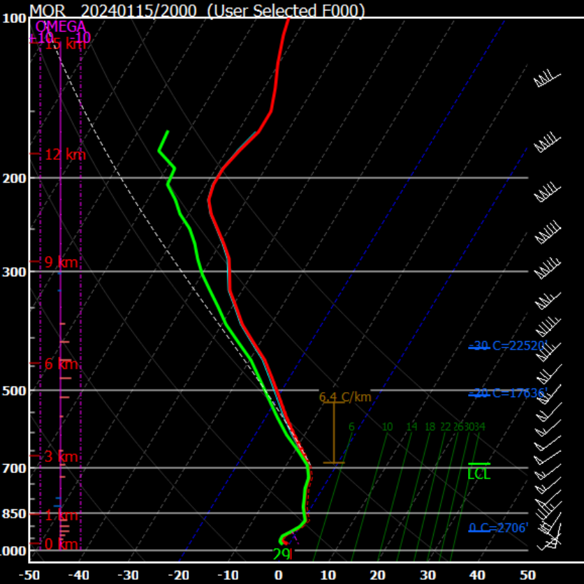 |
| Figure 7: Tri-Cities, TN Initialized RAP Sounding at 3 PM EST on January 15 | Figure 8: Watauga, NC Initialized RAP Sounding at 3 PM EST on January 15 | Figure 9: Morristown, TN Initialized RAP Sounding at 3 PM EST on January 15 |
 |
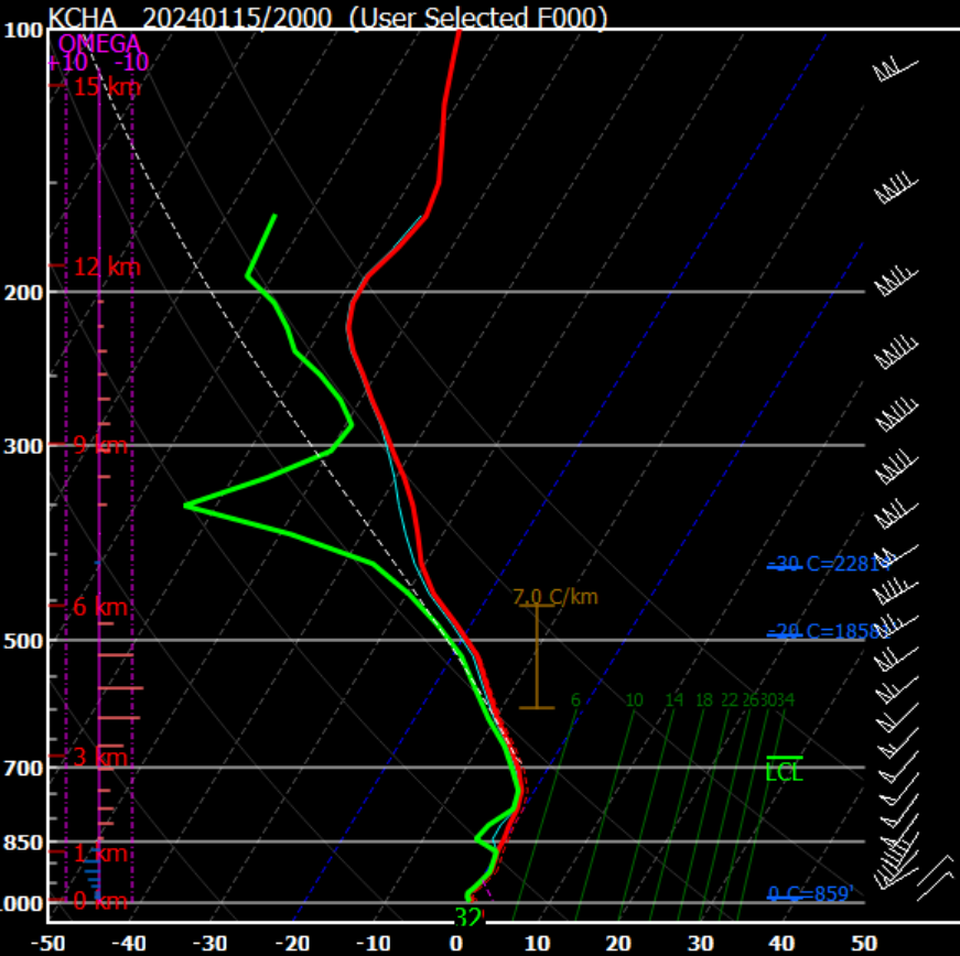 |
| Figure 10: Knoxville, TN Initialized RAP Sounding at 3 PM EST on January 15 | Figure 11: Chattanooga, TN Initialized RAP Sounding at 3 PM EST on January 15 |
 |
Media use of NWS Web News Stories is encouraged! Please acknowledge the NWS as the source of any news information accessed from this site. |
|


 Local Radar
 Huntsville Radar
 Regional Satellite
 Graphical Forecast
 Weather Map