National Weather Service United States Department of Commerce

Severe Thunderstorms and Flash Flooding for the Central U.S. through Tuesday; Dangerous East Coast Beach Conditions

Thunderstorms ahead of an approaching cold front will impact much of the Central U.S. through Tuesday. Severe thunderstorms and flash flooding are forecast for portions of the central/southern Plains and the Mississippi, Ohio, and Tennessee Valleys. Meanwhile, dangerous waves and rip currents will impact portions of the East Coast as tropical activity increases in the Atlantic. Read More >

Click a location below for detailed forecast.

Last Map Update: Mon, Sep 22, 2025 at 6:06:32 pm EDT


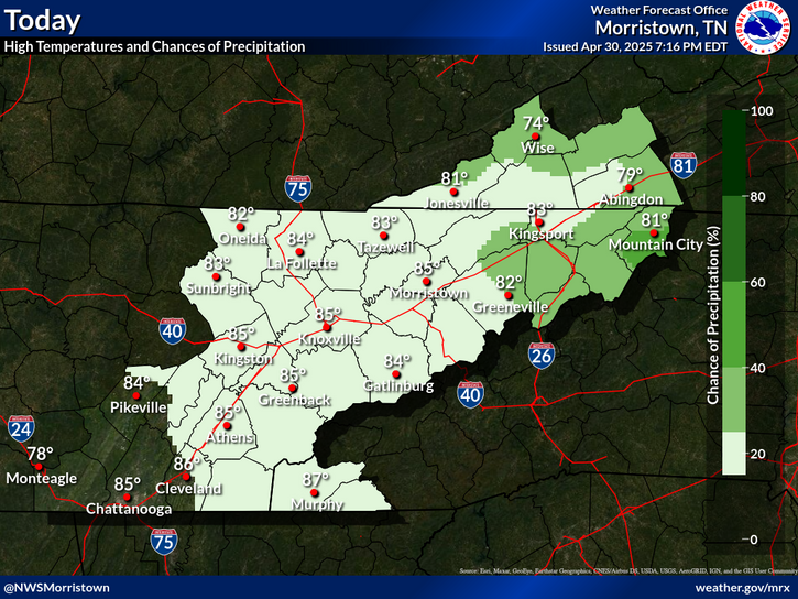
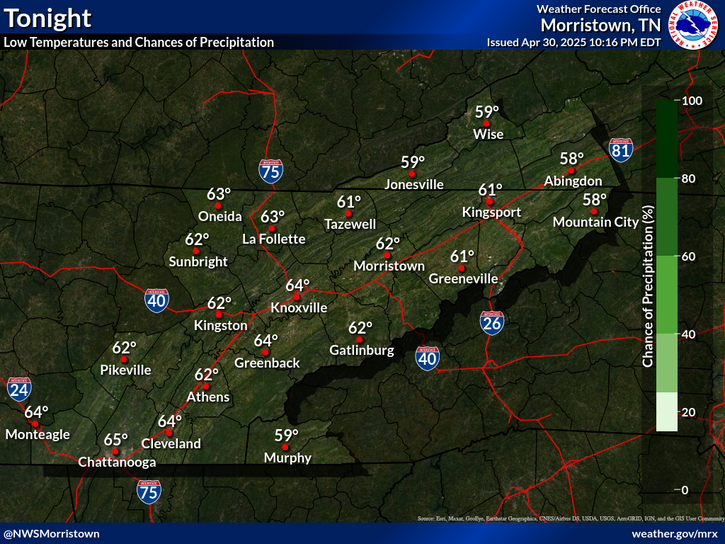
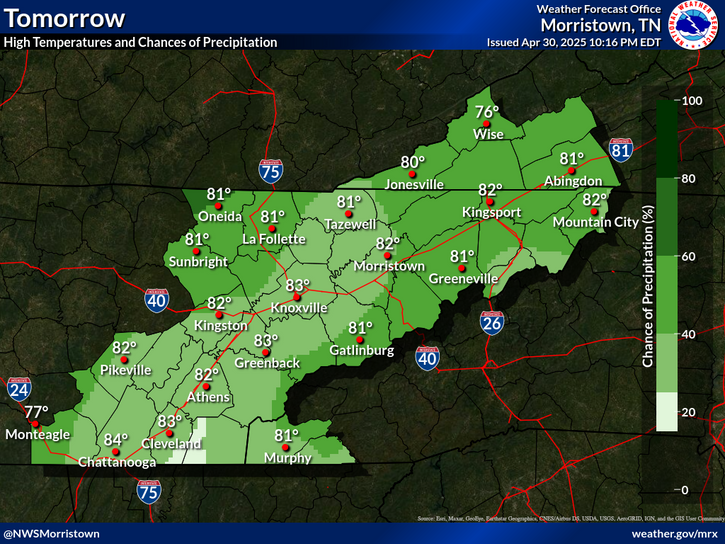
It'll be mostly dry today with isolated to scattered showers and thunderstorms this afternoon. Chances for much needed rain increase tomorrow and peak on Wednesday afternoon through Thursday when heavy rain chances become more likely. This may result in localized flooding Wednesday night into Thursday. If you live near flood prone areas like creeks and streams, have a flood safety plan. Monitor stream rises closely.
Isolated to scattered afteroon showers and thunderstorms are expected through Tuesday. Increasing chances of showers and thunderstorms are expected Wednesday and Thursday with cooler, near normal temperatures.
Each observation point is apart of our COOP program (Cooperative Observer Program). Each site has a 24 hour observation period that ends and begins at 8 am local time. Each site records temperature, precipitation, and snowfall data. More information about the COOP program can be found here www.nws.noaa.gov/om/coop/ Data began being collected at: Cades Cover on 01/01/1999 || Mount LeConte on 07/01/1987 || Newfound Gap on 01/01/1991 || Sugarlands Visitor Center on 12/01/1921

 Current Weather Observations...
Location Time
(EDT)
Weather Vsby.
(SM)
Temp.
(ºF)
Dewpt.
(ºF)
Hum.
(%)
Wind
(mph)
Wind Chill / Heat Index
(ºF)
Pres.
(in)
Abingdon VA17:55Clear10786054SSW 7-30.05
Andrews-Murphy NC17:49Mostly Cloudy10796052SW 3-30.07
Chattanooga TN17:53Mostly Cloudy10807071SE 3-29.99
Crossville TN17:53Mostly Clear10706790CALM-30.05
Dalton GA17:55Light Rain \ Lightning Observed9836656CALM-29.98
Knoxville TN (McGhee-Tyson)17:53Cumulonimbus Clouds, Lightning Observed10796562SSW 9-30.00
Middlesboro KY17:55Lightning Observed10796561SSW 5-30.02
Monroe Cnty TN17:35Mostly Clear10807174VRB 6-30.00
Morristown TN17:35Mostly Cloudy8787178WNW 7-30.01
Oak Ridge TN10:53Partly Cloudy10674952VRB 5-30.26
Tazewell Cnty VA17:55Lightning Observed10765853S 3-30.08
Tri-Cities TN17:53Cumulonimbus Clouds Observed10816456W 7-30.02
Wise VA17:55Lightning Observed10736064SSW 7-30.10
Greeneville, TN17:35Clear10806254VRB 3-30.02


Local Weather History For September 22nd...
In 2011, storms hit producing $20,000 wind damage. Tree fell on a home in Bradley Co.


Briefing Hydrology Past Weather Events Graphical Hazardous Weather Outlook for East Tennessee East Tennessee Observations
Decision Support Hydrology Past Weather Events GHWO Observations Gridded Forecast
Daily Climate for Middle Tennessee Local East Tennessee Climate Tornado Database Tropical Weather Information NOAA Weather Radio
IDSS Point Forecasts Daily Climate Local Climate Tornado Database Tropical Weather Radio
Daily Climate for Middle Tennessee Probabilistic Data for East Tennessee Virtual Tour of the NWS Morristown Office Skywarn Spotter Training for East Tennessee  
Being Prepared Estar Perparado Probabilistic Virtual Tour Spotter Training