Excessive Rains and High Impact Flooding Impacts
Portions of the Central Gulf Coast
April 6 2025
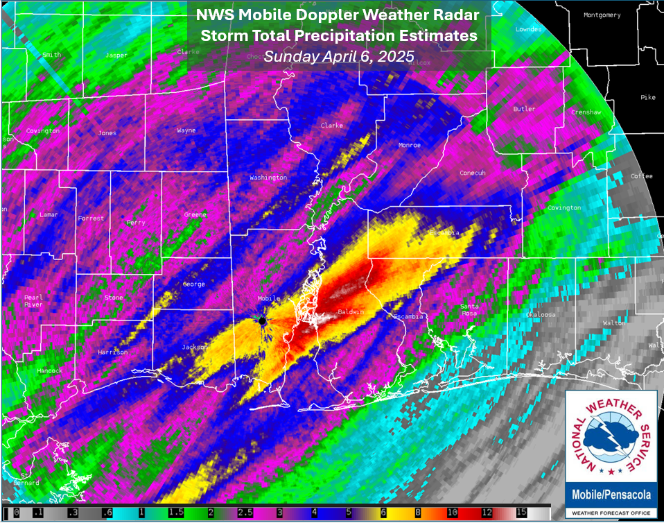
A slow moving early April weather system brought a period of excessive rainfall and flooding problems over portions of the central Gulf coast. On the afternoon of Sunday April 6th, 2025, a cold front was approaching the National Weather Service (NWS) Mobile forecast area, but only creeping eastward as it started to move in. Out ahead of the front, a warm, plume of rich moisture was streaming northward off the Gulf. This combined with the larger scale ascent from the slow eastward advance of the front resulted in an excessive, high impact rainfall across portions of the coast. The highest rainfall accumulation footprint of 6 to 12" was in a swath from central Mobile Co, into Baldwin Co. from Daphne, northeast to Stapleton, including Spanish Fort. From there, the heavy rain extended into southwest Escambia County in Alabama and northern Escambia County in Florida. Elsewhere, many areas saw 3 to 6" of rain over several areas. The rain gauge swelled to a record setting daily rainfall at Mobile Regional, measuring 6.51" which nearly doubled the last record on this date of 3.65" set way back in 1918. The heaviest rains appeared more focused in and near Spanish Fort where 10 to 12" of rainfall was measured. There was a rapid downstream response with the Styx and Fish Rivers in Baldwin County going into moderate to major flood stage. Several other rivers over the local area were dealing with minor flooding problems. Numerous reports were received of water covered, impassable roads with cars stalled out. The long duration and intensity of the rainfall resulted in multiple high water rescues from downtown Mobile, to in and near Spanish Fort.
The image below shows the NWS Mobile Doppler Weather Radar Storm Total Precipitation estimates from the event.
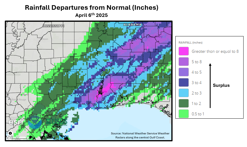
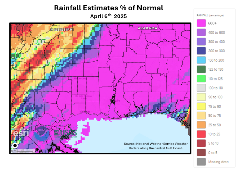
The following two images highlight April 6th's excessive rainfall in a climate frame of reference using radar rainfall estimates. Fig. 1 shows the rainfall for much of the heart of the local area was between 4 to 8 inches above normal and Fig. 2 indicates that much of the entirety of the area saw an astounding 600% or higher of daily normal rainfall.
|
|
Acknowledgements: Page created by Joe Maniscalco (Observation Program Leader). A huge thank you goes out to NWS COOP Observers, the many volunteer rainfall observers with the Community Collaborative Rain Hail and Snow Network (CoCoRaHS), our Mesonet partners, and citizens who share their data via personal weather stations.
LAST UPDATED: April 7, 2025

