Melbourne, FL
Weather Forecast Office
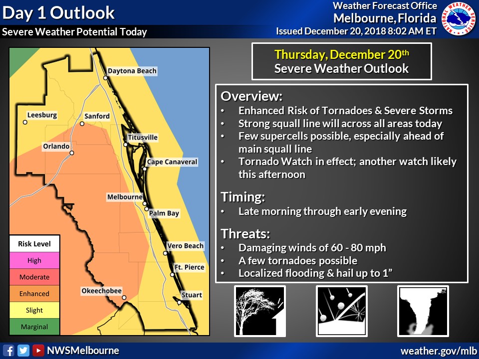
Severe Weather Risk across East Central Florida
on Thursday, December 20th, 2018
The Storm Prediction Center has upgraded much of east central Florida to an Enhanced Risk for Severe Weather on Thursday.
Fast moving severe storms may contain:
​Residents and visitors should monitor the latest forecasts and statements concerning this storm system, as well as the potential for severe weather.
Now is a good time review your severe weather action plan, and to make sure you have at least one or two methods of receiving timely severe weather information, in case any watches or warnings are issued for your area on Thursday.
For additional Hazardous Weather information please see our graphical Hazardous Weather Outlook and Impact Weather Update.

CURRENT HAZARDS
Cold Weather Support
Florida Hazards (CAP Text)
Hazardous Weather Outlook (Graphical)
Hazardous Weather Outlook (Text)
Outlooks
Storm Reports (Graphical)
Storm Reports (Text)
FORECASTS
Area Forecast Discussion
Aviation Weather
Fire Weather
Graphical
Marine Weather
Probabilistic
Text Products
Tropical Weather
Winter
CURRENT WEATHER
Local Analysis
Observations
Precip Analysis
Satellite Images
Rivers/Lakes
RADAR IMAGERY
Melbourne Standard
Melbourne Enhanced
Regional - Southeast
Area Radars
US Dept of Commerce
National Oceanic and Atmospheric Administration
National Weather Service
Melbourne, FL
421 Croton Road
Melbourne, FL 32935
321-255-0212
Comments? Questions? Please Contact Us.

