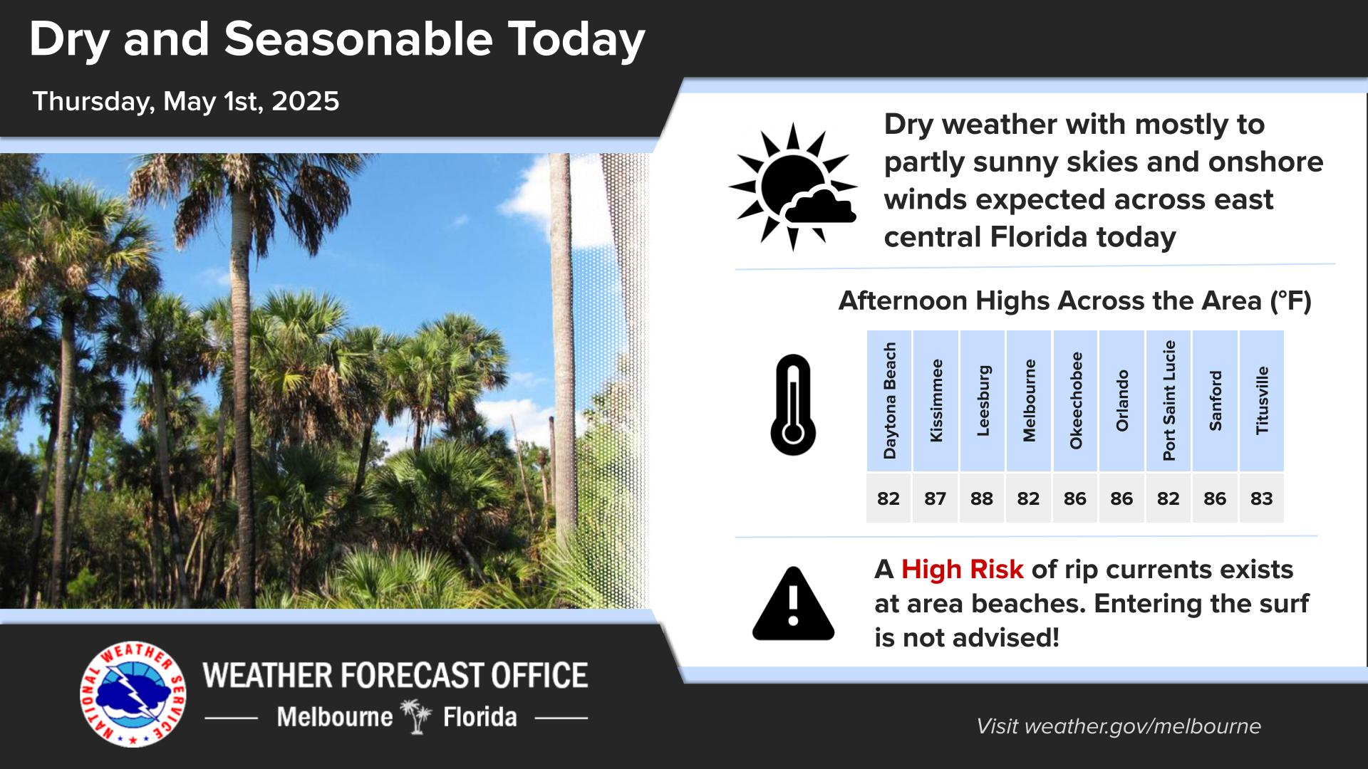
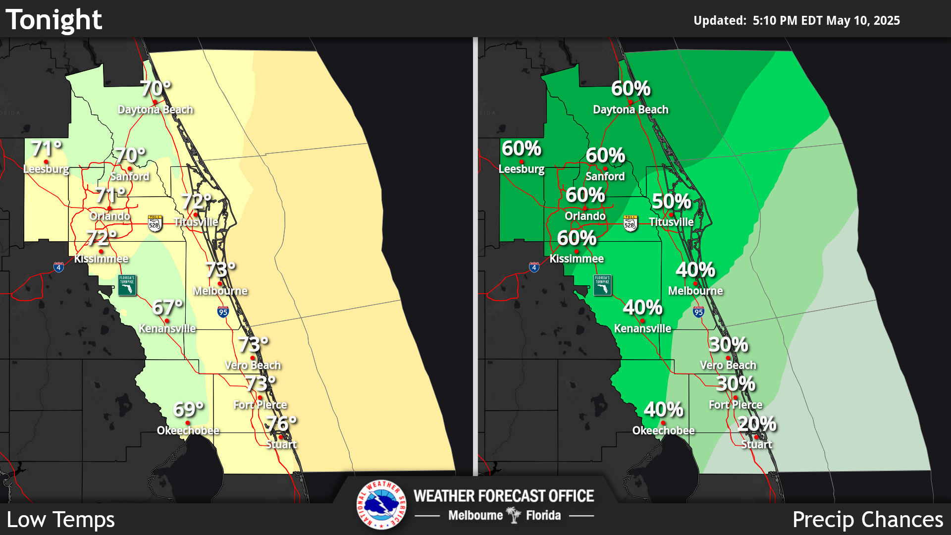
Click/tap image to enlarge | Warm and humid today under partly cloudy skies. Isolated to scattered showers will be possible through the day, mainly south of Orlando. Isolated lightning storms will also be possible, especially across the Treasure Coast.
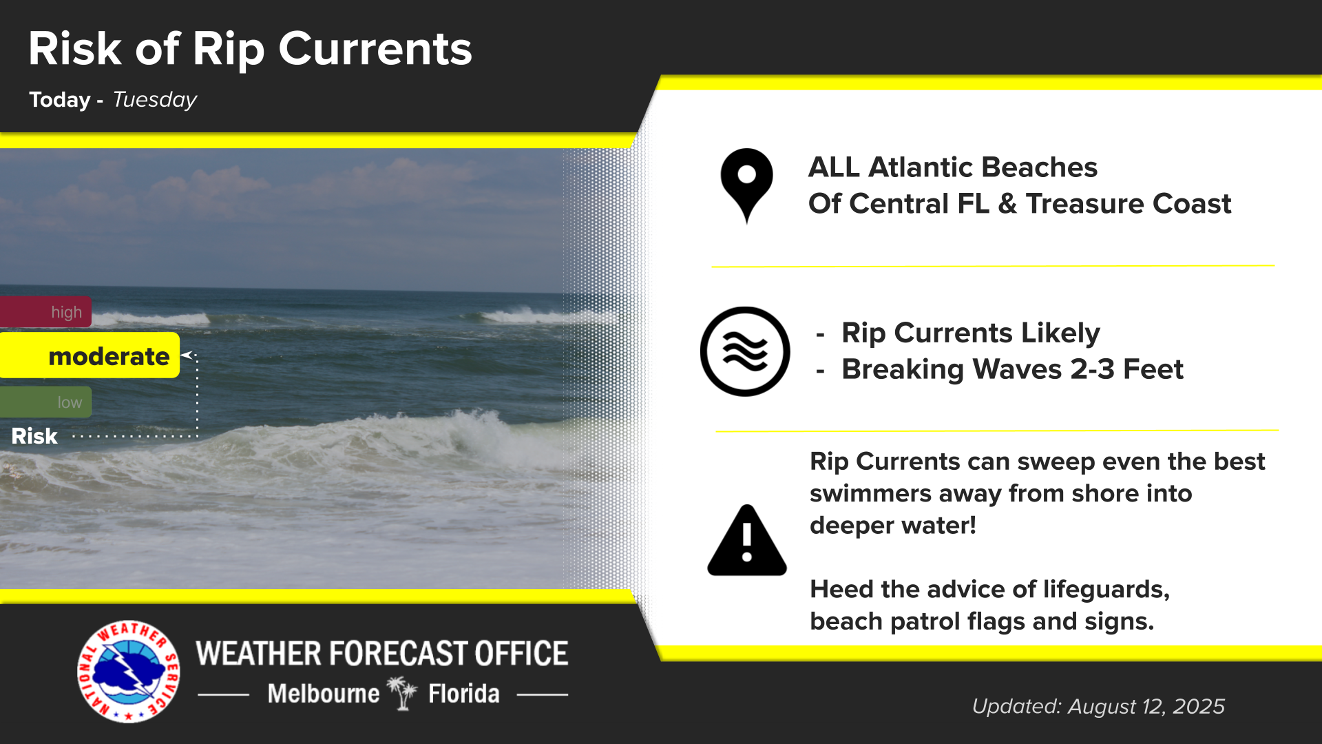
Click/tap image to enlarge | There is a moderate risk of rip currents at all central Florida Atlantic beaches today. Heed the advice of lifeguards, beach patrol flags and signs.
Click/tap image to enlarge | Warm and humid conditions through late week with rain chances gradually increasing through late week and into early weekend. A cold front is forecast to cross the area early Saturday, which will bring windy to very windy conditions this weekend and into early next week. Locally heavy rainfall will be possible across the south through at least this weekend. Rain and storm chances will gradually decrease into early next week.
Click/tap image to enlarge | Join us for one of five FREE SKYWARN Storm Spotter Training classes through November 3 and learn how you can help keep your community safe.











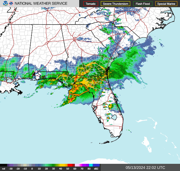 Interactive Radar
 Regional Satellite
 Tropical Weather
 Follow us on X
 Follow us on Facebook
 MLB RSS Feed