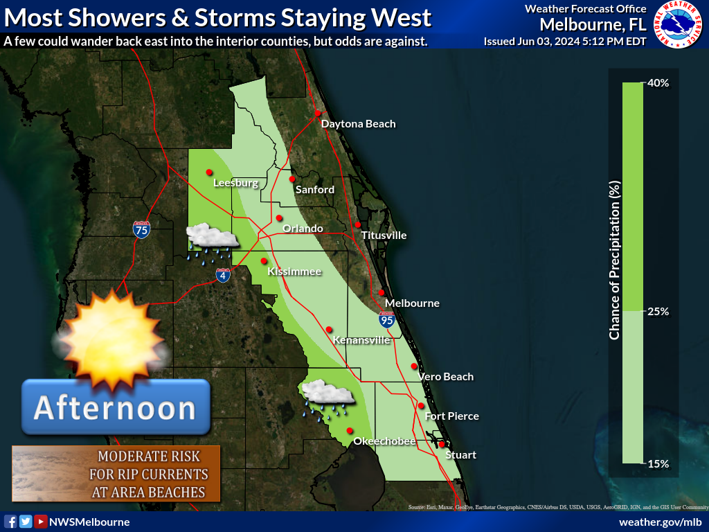
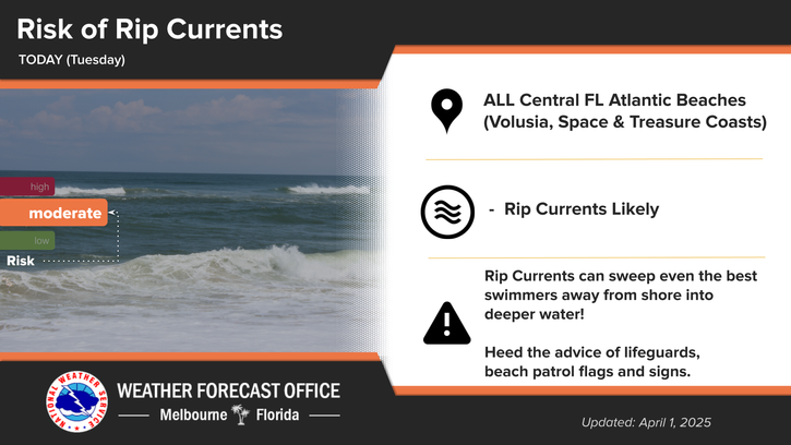
It will be hot and humid today, with higher shower and storm coverage expected, mainly during the mid afternoon through evening hours. Storms and heavier showers will have the potential to produce heavy rainfall of 1-3 inches, with localized totals of 4-5 inches possible. These amounts may lead to flooding issues of urban, poor drainage and low-lying areas. Additional storm threats will include lightning strikes and gusty winds up to 40 to 45 mph. Highs will reach the low 90s, with peak heat index values of 102-107F. Increasing showers and storms into the mid to late afternoon will provide some relief from the heat. A Moderate Risk for rip currents will exist at area beaches.


 Interactive Radar
 Regional Satellite
 Tropical Weather