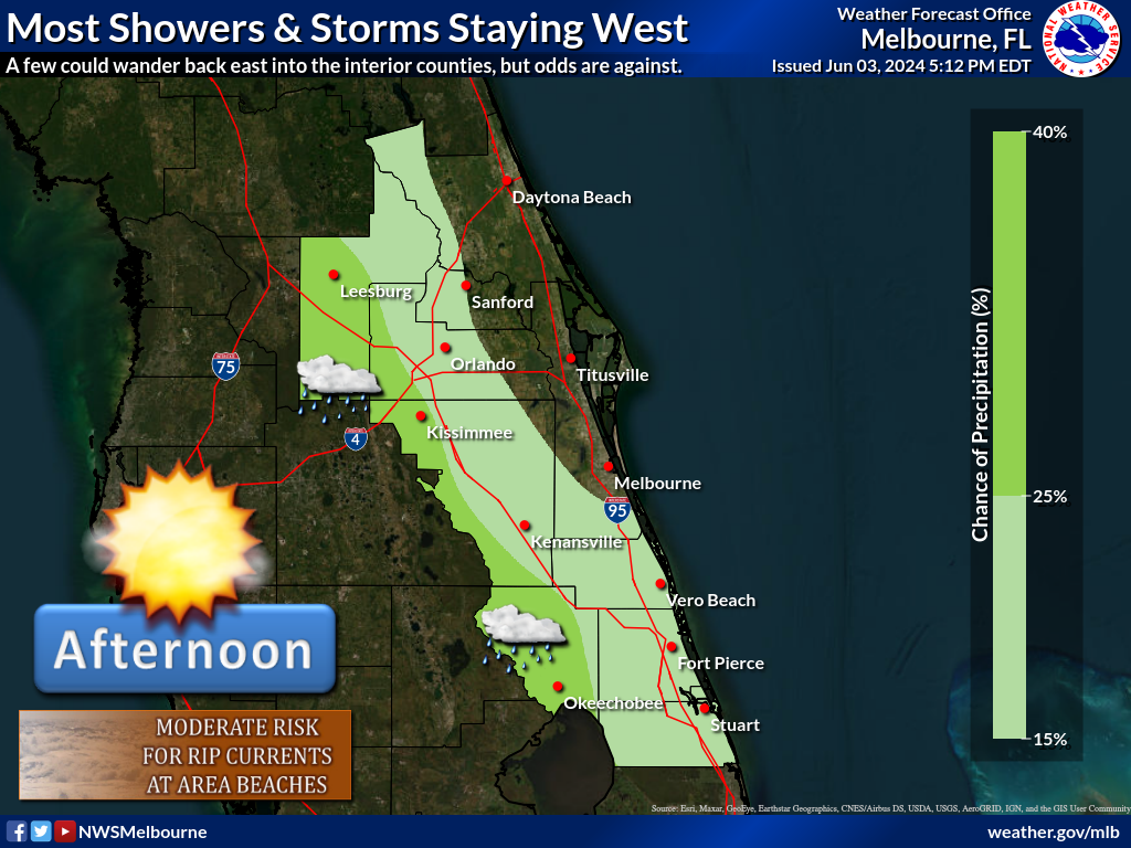
It'll be a little breezy and gusty again this afternoon, especially along the coast as winds increase up to 15 mph with gusts as high as 30 mph. Fresh onshore flow will continue to push showers from the Atlantic waters to the coast and inland, mainly from the Cape south. This activity should decrease through the day as drier air in the wake of Milton filters across the area. Afternoon highs in the low to mid 80s.
Numerous hazards from Milton continue across east central Florida, especially at the beaches. A HIGH risk for rip currents continues at all Atlantic beaches, accompanied by large breaking waves of 6-12 feet and coastal flooding, which will also contribute to beach erosion. Do not enter this life-threatening surf! Flooding along the St Johns and Little Wekiva rivers also continues.
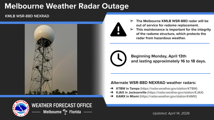


 Interactive Radar
 Regional Satellite
 Tropical Weather