Very humid conditions are forecast in the wake of Helene, with heat indices approaching 108 across Brevard, Okeechobee, Indian River, St. Lucie, and Martin counties. Heat indices up to 100 - 104 are expected elsewhere.
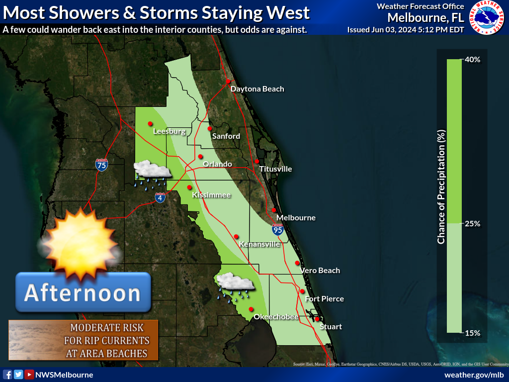
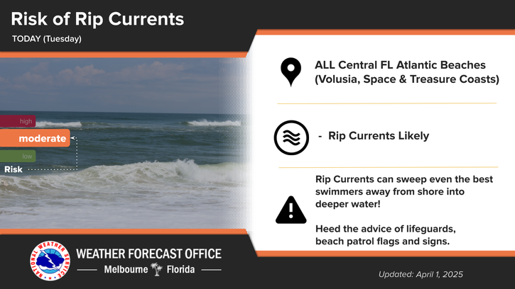
Tropical Storm Warnings have ended across the area, but a Wind Advisory continues across east central Florida through 11 AM, as southwest winds up to 20-25 mph and gusts up to 35 mph will still be possible. It will be hot and humid into the afternoon, with near record heat at the coast. A Heat Advisory is in place for Brevard and Okeechobee counties, as well as the Treasure Coast for peak heat index values of 108-110F. Scattered showers and isolated storms will continue across the area this morning, and then into the afternoon the greatest potential for showers and storms will be south of Orlando. Hazardous boating and surf conditions continue. Entering the surf is not advised today!


 Interactive Radar
 Regional Satellite
 Tropical Weather