There are no watches, warnings, or advisories at this time.
Today's Outlook
Rip Currents
Maximum Heat Index Forecast
Looking Ahead
Tropical Weather Outlook
Forecast
Climate
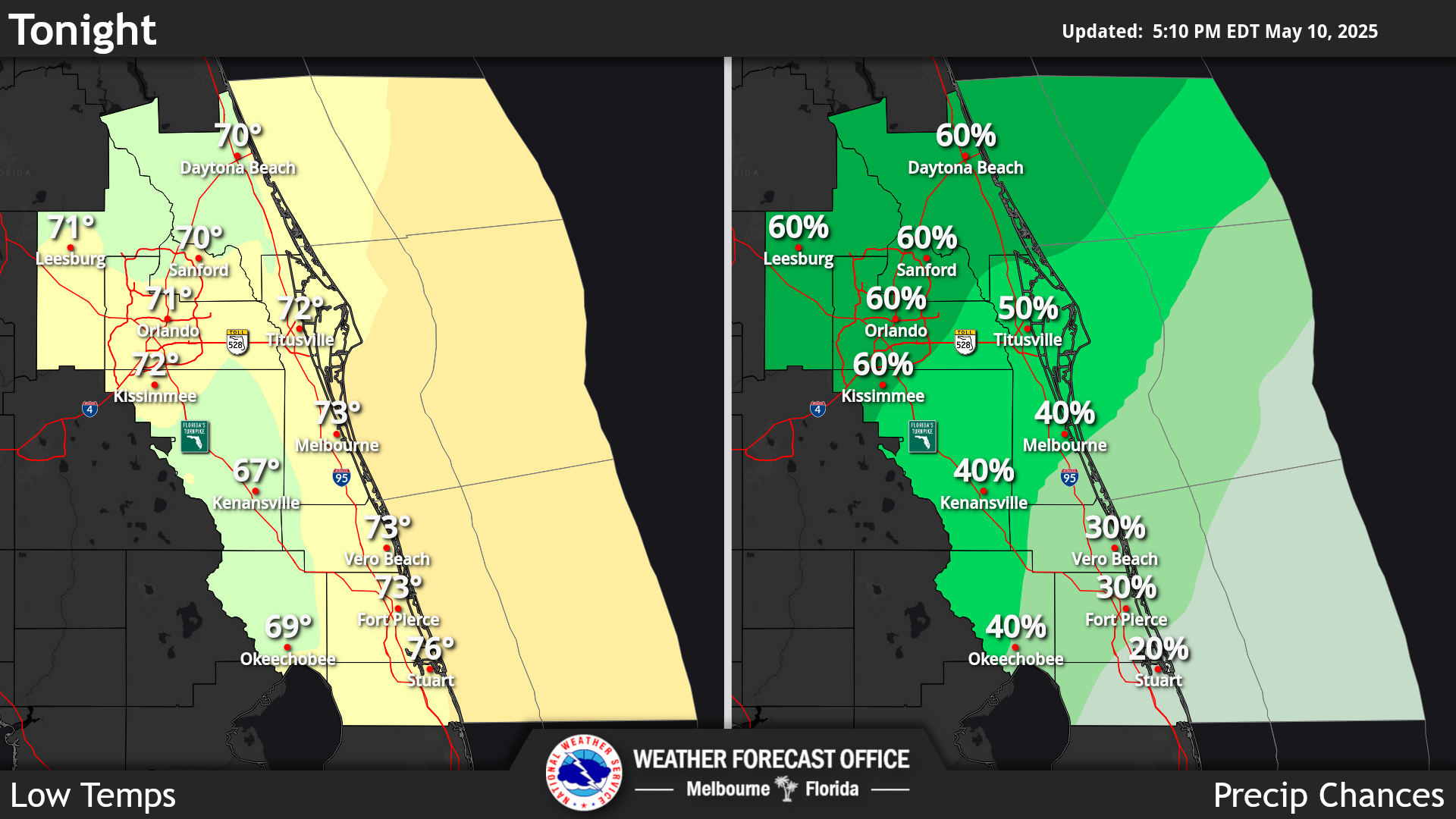
Click/tap image to enlarge | Increasing onshore flow shifts the sea breeze collision and highest afternoon lighting storm chances to the far interior and western side of the peninsula. Isolated to scattered showers and storms are expected to develop along and ahead the east coast sea breeze in the afternoon to early evening while quickly moving inland. Mostly dry conditions behind the sea breeze. Showers and storms developing over the Atlantic waters may be able to push onshore, even after the sea breeze moves inland. Stronger storms capable of wind gusts to around 55 mph, frequent cloud to ground lightning, and locally heavy rainfall leading to minor flooding are possible. Seasonably hot high temperatures in the upper 80s to mid 90s, resulting in peak afternoon heat indices up to 105, and mainly Minor to Moderate HeatRisk impacts, with some areas of Major in and around the Orlando Metro area.
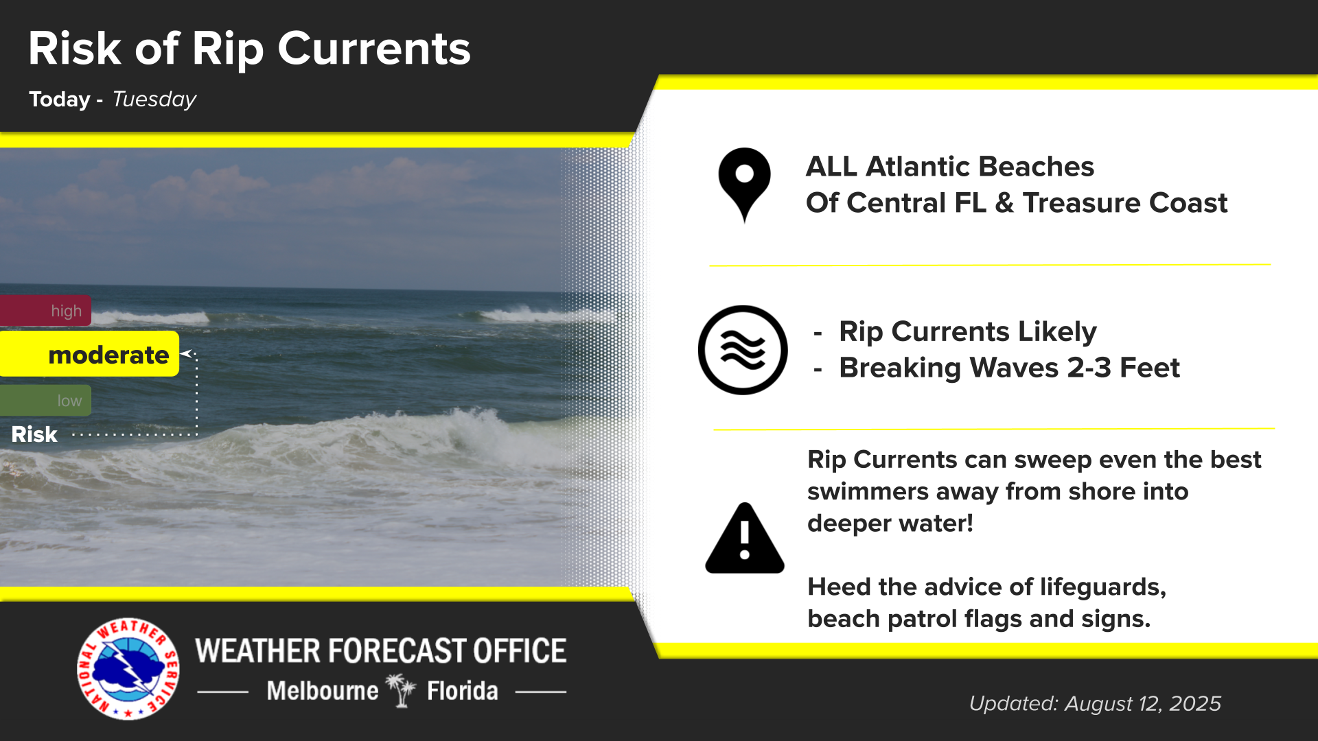
Click/tap image to enlarge | A Moderate risk of rip currents exists at all east central Florida beaches today. Always swim near a lifeguard, and never swim alone.
Click/tap image to enlarge | A Minor to Moderate HeatRisk, with pockets of Major impacts in/around the Orlando Metro and the southern coastal counties, will continue through the weekend and into next week. Seasonably hot high temperatures in the upper 80s to mid 90s are forecast through the period, which combined with humidity, result in widespread peak afternoon heat index values of 100°F to 105°F, up to 107°F in a few spots. Remember to practice heat safety if spending considerable time outdoors, especially during peak daytime heating.
Click/tap image to enlarge | Onshore flow shifts the highest chances for afternoon storms well inland to the western side of the peninsula, but additional moisture is forecast to increase coverage of westerly moving shower and storms from isolated to scattered today, to scattered to numerous next week. While most showers and storms will be in the afternoon and early evening, activity that develops over the Atlantic waters could move onshore throughout the day and night. Temperatures remain seasonably hot in the in the U80s-L90s through early next week, then heat impacts may return midweek.
Click/tap image to enlarge | Two disturbances in the Atlantic and Gulf have low (10%) chances of develop over the next 7 days. The remnants of Tropical Storm Dolly, now a wave east of the Leeward Islands, is unlikely to redevelop while moving west-northwestward at 25 mph. In the Gulf, development, if any, of an area of weak low pressure will be slow over the next several days as the feature remains nearly stationary.