Event Overview
The November 2009 Mid-Atlantic nor'easter (also referred to as "Nor'Ida") was a powerful autumn nor'easter that caused widespread damage along the east coast of the United States (Figure 1). This extratropical cyclone formed from the remnants of Hurricane Ida's mid-level circulation across southeastern Georgia and moved east-northeast offshore North Carolina (Figure 2) before slowly dropping south and southeast over the succeeding several days. The interaction between this extratropical low and a strong high pressure system over eastern Canada brought strong winds, coastal flooding, and heavy rains to the mid-Atlantic region.Nor’ida produced large wave heights, strong wave action at the shore, and moderate to severe flooding, with the highest water levels reaching 7 to 8 feet along the coast of New Jersey. Flooding on some barrier islands was worse on the bay side than on the ocean side because of the build-up of water between tide cycles during this lengthy event. The high water mark at Sewells Point in Norfolk, VA, was 7.75 feet - just 3.24 inches under the all-time record high level.

Figure 1. Satellite image of “Nor’ida” off the Mid-Atlantic coast on November 13, 2009.

Figure 2. Surface Low (“Nor’ida”) off the North Carolina coast at 7 am November 12, 2009.
Evolution and Impacts
As the remnants of Ida moved offshore and the developing nor'easter began to intensify on November 11, 2009, flood warnings were in effect from Alabama to Georgia and watches extended northward into the Mid-Atlantic states. Coastal flood watches and high wind warnings were also in effect from North Carolina to Delaware. Flood warnings were later expanded into South Carolina and coastal advisories were extended to New Jersey and Long Island. Gale warnings continued to grow in coverage, encompassing areas from North Carolina to New Jersey by the afternoon of November 12.
Flash flooding and storm surge were the main impacts on eastern North Carolina. Rainfall amounts (Figure 3) of up to 9 inches were reporting in Swansboro, in Onslow County. Strong winds downed several trees loosened in saturated soil. In the Outer Banks, with water levels as much as 6 to 7 feet above normal (Figure 4), four homes were destroyed and over 500 others were damaged by the system, leaving at least $5.8 million in losses. One death was reported in Rockingham County, North Carolina due to a large tree branch falling on a car.

Figure 3. Rainfall Totals from “Nor-Ida”, November 10-14, 2009.
.gif)
Figure 4. Observed Water Level (red) versus Prediction Water Level (green) at Duck NC for November 11-15, 2009.
Sources
National Hurricane Center
Wikipedia
Associated Press
Damage Pictures from Outer Banks
Photos courtesy of: Associated Press, Michael Halminski
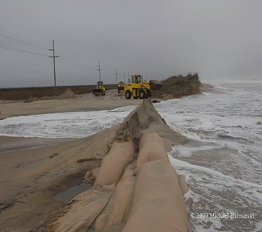
Damage along Highway 12 near Mirlo, NC during the “Nor-ida” storm.
Case Study Team:
Chris Collins


 Map View
 Weather Hazard Briefing (when applicable)
 Forecaster Discussion
 Marine
 Text Products
.png) Skywarn
Skywarn Submit Storm Reports
 Coastal Flood
.png) Surf Forecast/Rip Currents
Surf Forecast/Rip Currents