Overview
Tropical Storm Beryl was the strongest off-season Atlantic tropical cyclone to make landfall in the United States on record. Beryl developed on May 26 from a low-pressure system near the East Coast of the United States and was classified as a Subtropical Storm on May 27. Later in the day on May 27, Beryl transitioned into a tropical cyclone while less than 120 miles from North Florida. Early on May 28, the storm moved ashore near Jacksonville Beach, Florida, with peak winds of 70 mph It quickly weakened into a tropical depression, and dropped heavy rainfall while moving slowly across the southeastern United States. A cold front turned the storm to the northeast, and Beryl affected Eastern North Carolina during the morning and afternoon hours of May 30 (Figures 1 and 2).
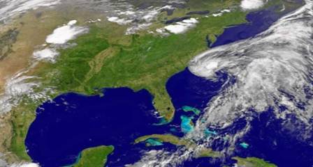
Figure 1. Satellite image of Tropical Depression Beryl just off the North Carolina coast, May 30, 2012.
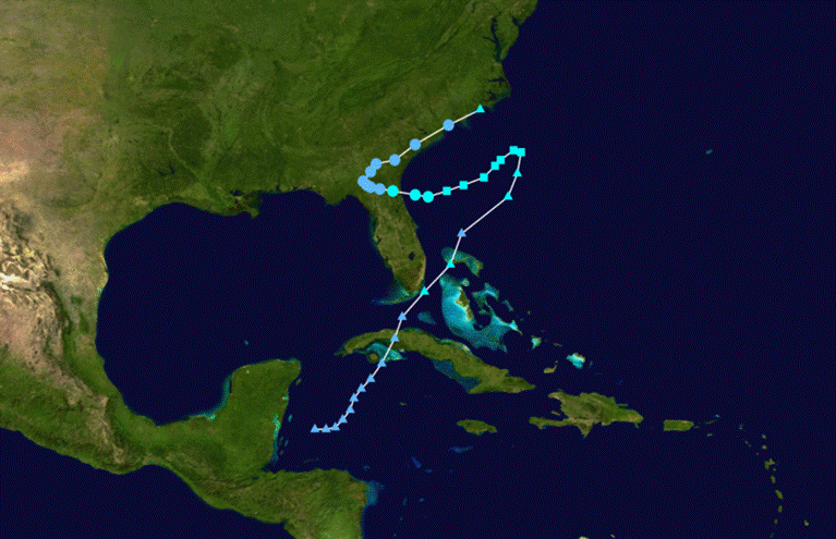
Figure 2. Track of Tropical Storm Beryl, May 26-30, 2012.
Impacts
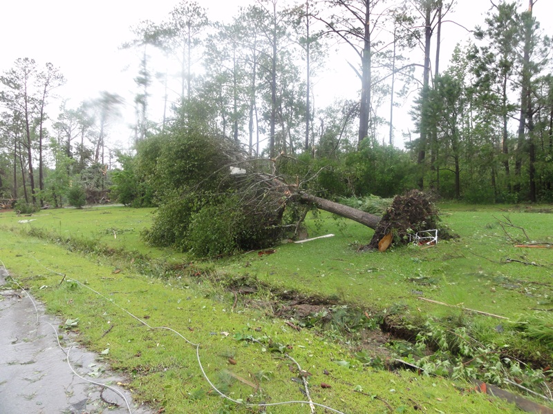
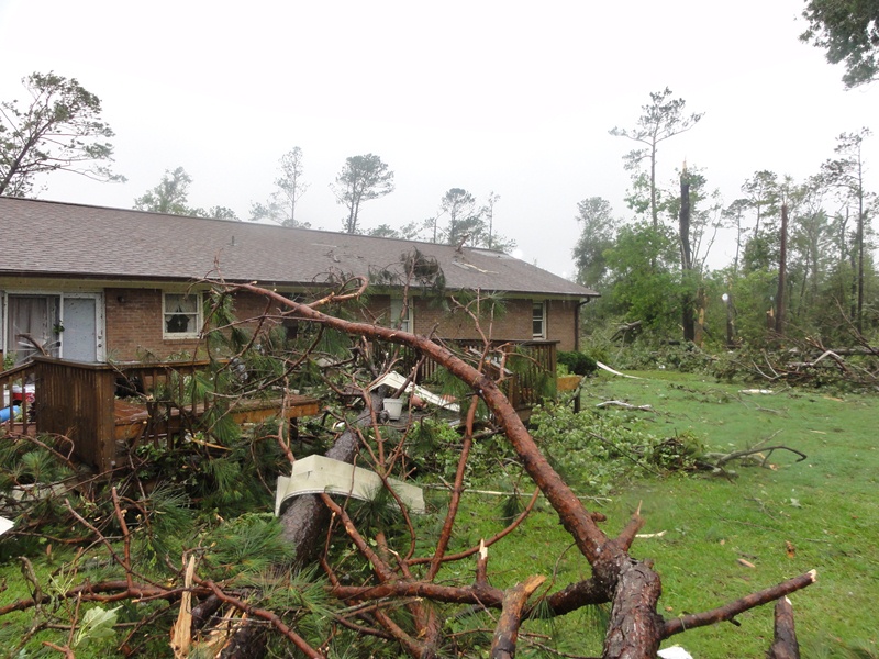
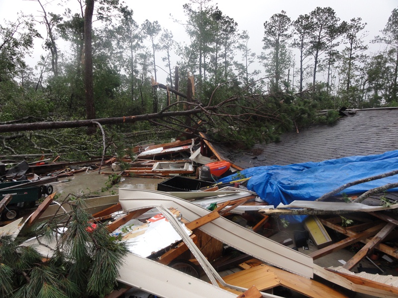
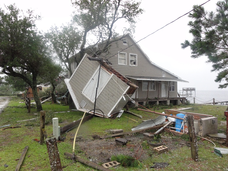
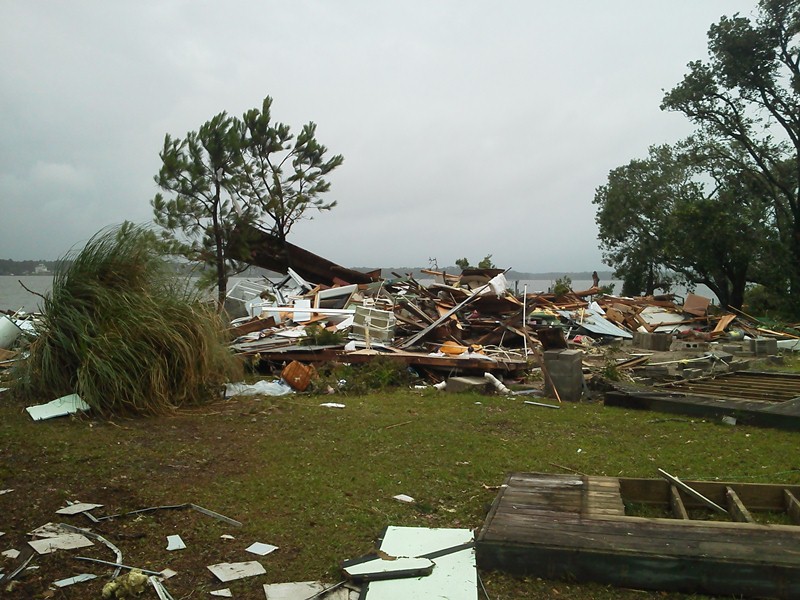
Beryl produced widespread 2 to 4 inch rainfall amounts across Eastern North Carolina, with amounts of up to 6 inches reported in Hyde County. Beryl produced a brief EF-1 tornado in Peletier in Carteret County around 10:34 AM. The tornado touched down near the intersection of Little Kinston Road and Buster Road and then progressed west-northwest along Little Kinston Road and Carter Shores Road and lifted as it moved into the White Oak River. Approximately 67 homes were damaged and 3 modular or mobile homes as well as one garage and several small outbuildings were destroyed. Seventy Five to one hundred and fifty pine trees were snapped in half with many other trees uprooted. No injuries were reported.
Damage Pictures from Carteret County
Photos Courtesy of: National Weather Service Newport/Morehead City Storm Damage Survey Team
Case Study Team:
Chris Collins
Scott Kennedy
Donnie King


 Map View
 Weather Hazard Briefing (when applicable)
 Forecaster Discussion
 Marine
 Text Products
.png) Skywarn
Skywarn Submit Storm Reports
 Coastal Flood
.png) Surf Forecast/Rip Currents
Surf Forecast/Rip Currents