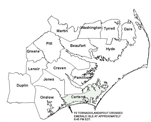
June 25, 2005 Emerald Isle Waterspout/Tornado
Event Overview
An unusual waterspout/tornado affected Emerald Isle on the evening of Saturday June 25, 2005. The F0 waterspout/tornado that occurred was spawned by a heavy shower that had no cloud-to-ground lightning. By definition, the convective cell in question wasn't even a thunderstorm!
Severe Weather Reports - Minor damage consisting of downed tree limbs and shingles was reported in Emerald Isle between 6:38 - 6:45 pm EDT.
Synoptic Overview
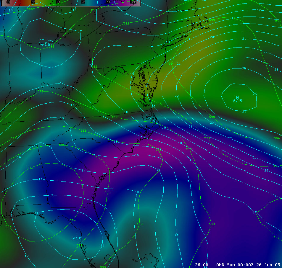
A closed 500 mb low was present over southern GA/AL and northern FL. A 1010 mb surface low was located over central/northern FL with a trough extending north along and off the SC/NC coast. A 1025 mb Bermuda high was located several hundred miles east of Cape Hatteras, NC.
Mesoscale Overview
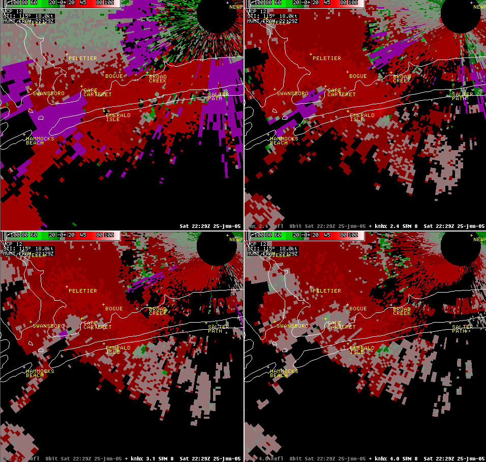
On the afternoon of June 25, 2005, numerous showers moving west and west-northwest off the Atlantic Ocean affected coastal North Carolina. Most of the showers produced nothing more than a short burst of moderate to heavy rain. However, at approximately 6:29 pm EDT (2229Z) a shower approaching Emerald Isle began to show signs of weak rotation. At 6:34 pm EDT (2234Z) the area of weak rotation associated with the shower was approaching the south (Atlantic-facing) side of Emerald Isle near Lee Avenue. At 6:38 pm EDT (2238Z), radar showed the weak area of rotation over Emerald Isle. At this time, two phone calls reporting a possible tornado in Emerald Isle were received. The first caller indicated that a waterspout had approached Emerald Isle around 6:35 pm EDT (2235Z) and was now on land. The second caller confirmed seeing a tornado on the ground in Emerald Isle at approximately 6:40 pm EDT (2240Z). A tornado warning was issued at 6:42 pm EDT (2242Z) for western Carteret County. The warning mentioned a tornado spotted on the ground in Emerald Isle, and included Cedar Point and Peletier in the pathcast. At 6:42 pm EDT (2242Z), radar continued to show an area of very weak rotation over Emerald Isle. Spotters subsequently reported that the tornado crossed Emerald Isle into Bogue Sound and then dissipated before reaching mainland Carteret County and the town of Cedar Point. The shower that had spawned the waterspout/tornado dissipated and dissapeared from radar in the next two volume scans, as well. Emerald Isle police reported only minor damage in the area. Damage was limited to a few severed tree limbs and shingles.
Radar Imagery - 6:29 pm EDT (2229Z) 4-Panel Reflectivity Display (0.5, 1.3, 2.4 and 3.1 degree elevation slices) showing shower approaching Emerald Isle.
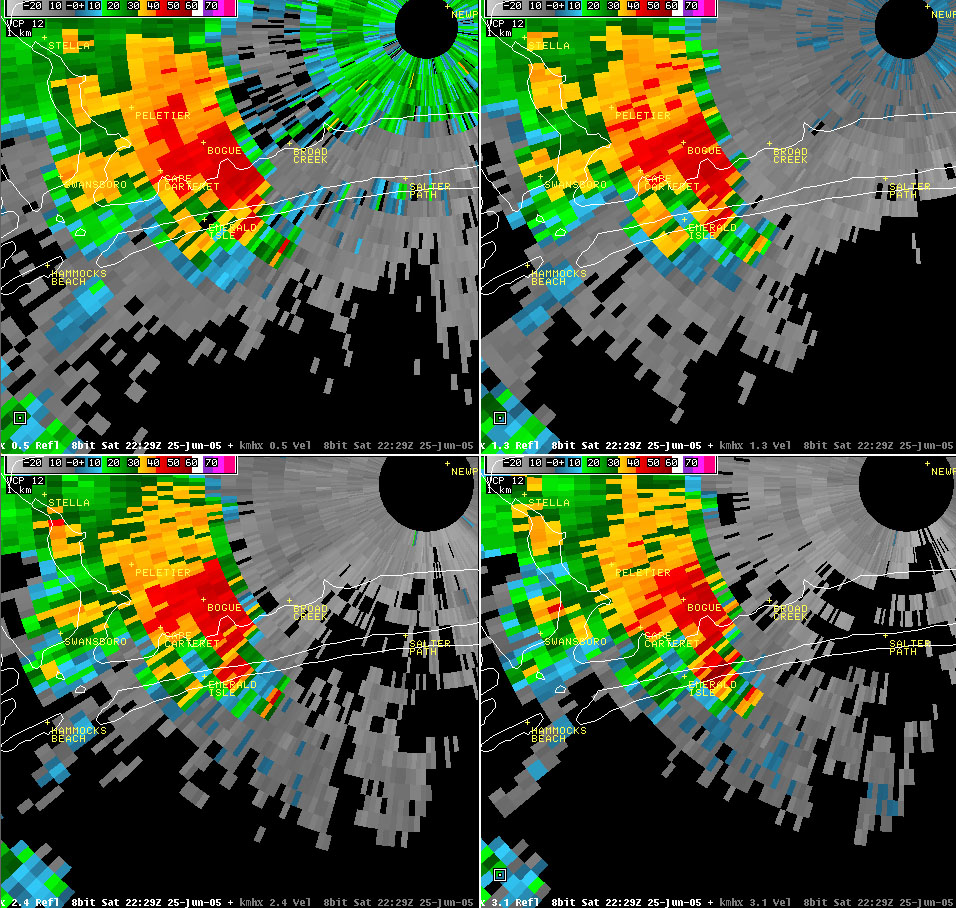
Radar Imagery - 6:29 pm EDT (2229Z) 4-Panel Storm-Relative Velocity Display (0.5, 1.3, 2.4 and 3.1 degree elevation slices) showing shower with weak rotation approaching Emerald Isle.
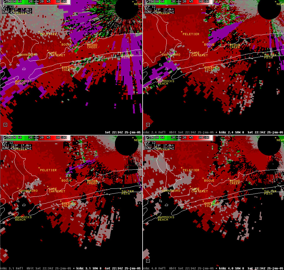
Radar Imagery - 6:34 pm EDT (2234Z) 4-Panel Storm-Relative Velocity Display (0.5, 1.3, 2.4 and 3.1 degree elevation slices) showing shower with weak rotation approaching Emerald Isle.
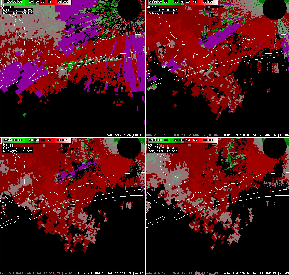
Radar Imagery - 6:38 pm EDT (2238Z) 4-Panel Storm-Relative Velocity Display (0.5, 1.3, 2.4 and 3.1 degree elevation slices) showing shower with weak rotation crossing Emerald Isle.
Case Study Team:
Brandon Vincent


 Map View
 Weather Hazard Briefing (when applicable)
 Forecaster Discussion
 Marine
 Text Products
.png) Skywarn
Skywarn Submit Storm Reports
 Coastal Flood
.png) Surf Forecast/Rip Currents
Surf Forecast/Rip Currents