Event Overview
On June 4, 2004, an east to west oriented warm front lifted north across the Newport/Morehead City County Warning Area (CWA), which was associated with a surface low lifting northeast along the I-95 corridor. The atmosphere was quite unstable in the warm sector south of the warm front. Low level veering wind fields, especially in the vicinity of the warm front would result in rotation and a good likelihood of tornadoes. A Tornado Watch was issued for our area from 1 PM EDT to 5 PM EDT. The Newport/Morehead City NWS Office issued 5 Tornado Warnings, 5 Severe Thunderstorm Warnings, and 1 Flash Flood Warning for our CWA.
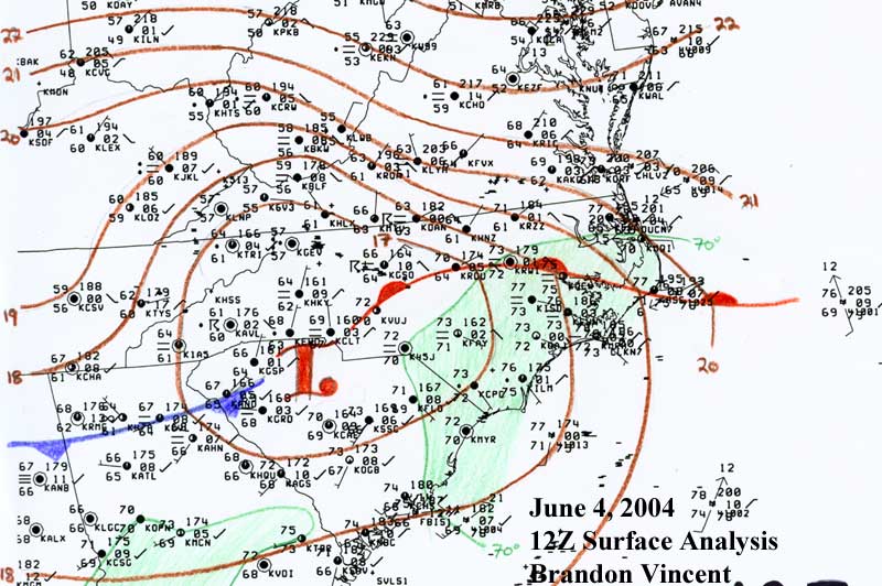
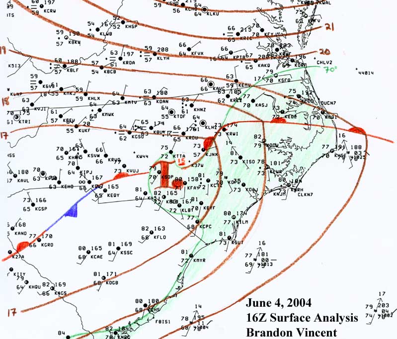
| Surface Analysis | |
|
12Z (8 AM EDT) Analysis |
16Z (12 PM EDT) Analysis |
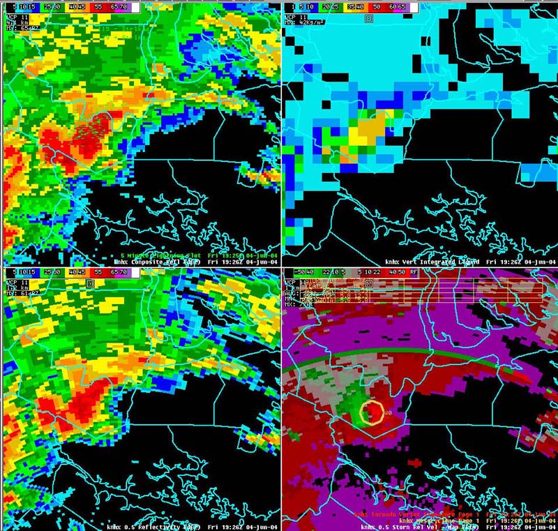
| Radar Imagery | |
|
|
|
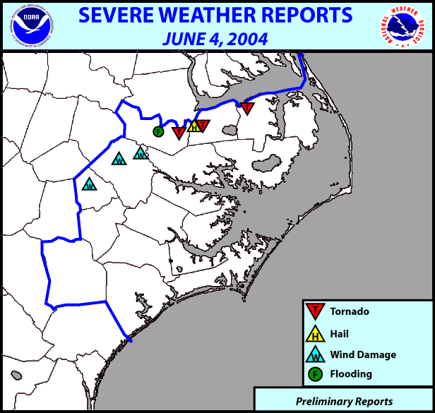
Preliminary Local Storm Reports:
..TIME... ...EVENT... ...CITY LOCATION... ...LAT.LON...
..DATE... ....MAG.... ..COUNTY LOCATION...ST.. ...SOURCE....
..REMARKS..
0209 PM TSTM WND DMG 7 NW GREENVILLE 35.67N 77.46W
06/04/2004 PITT NC EMERGENCY MNGR
PITT COUNTY EMERGENCY MANAGEMENT REPORTED POWER LINES
BLOWN DOWN NEAR BELVOIR CROSSROADS.
0215 PM TSTM WND DMG STOKES 35.71N 77.26W
06/04/2004 PITT NC EMERGENCY MNGR
PITT EM REPORTS POWER LINES BLOWN DOWN NEAR STOKES
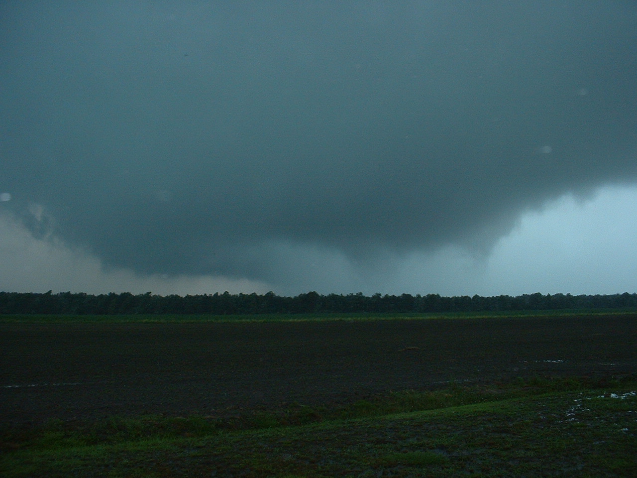
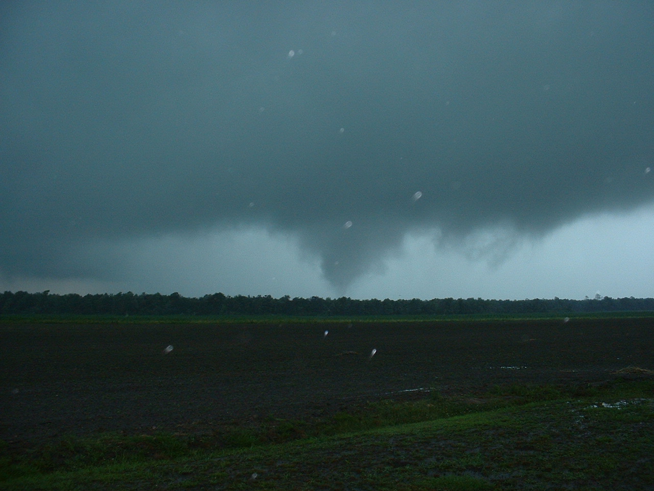
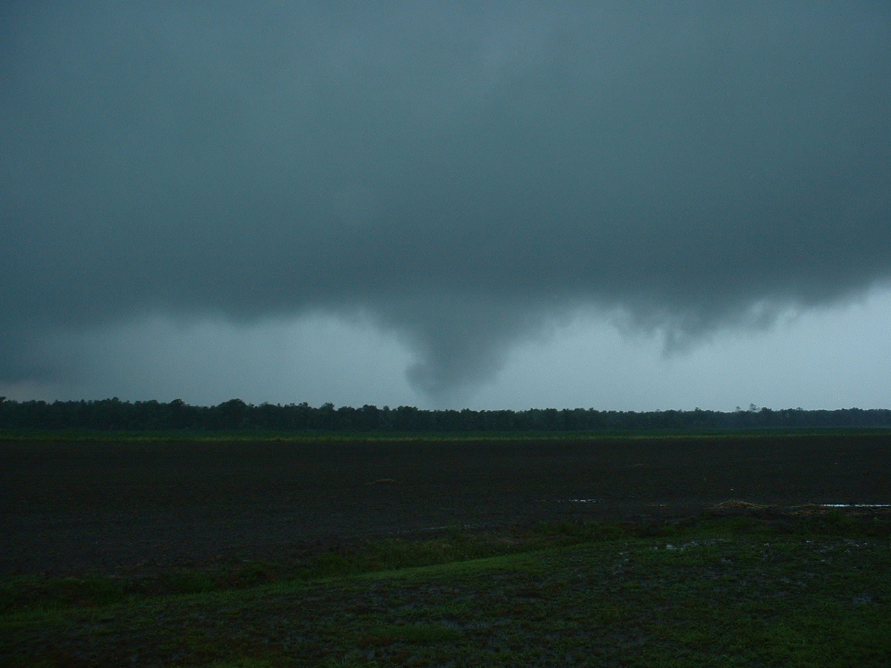
0335 PM TORNADO 8 SW JAMESVILLE 35.73N 77.00W
06/04/2004 MARTIN NC PUBLIC
TORNADO TOUCHDOWN REPORTED NEAR INTERSECTION OF HIGHWAY
171 AND PINEY GROVE CHURCH ROAD.
0415 PM HAIL PLYMOUTH 35.86N 76.75W
06/04/2004 0.75 INCH WASHINGTON NC COUNTY OFFICIAL
0425 PM TORNADO PLYMOUTH 35.86N 76.75W
06/04/2004 WASHINGTON NC COUNTY OFFICIAL
PUBLIC REPORTED BRIEF TORNADO TOUCHDOWN ON HIGHWAY 32
NEAR PLYMOUTH.
0425 PM FLASH FLOOD WILLIAMSTON 35.85N 77.06W
06/04/2004 MARTIN NC EMERGENCY MNGR
MARTIN EM REPORTS WATER ON BEAR GRASS ROAD, HIGHWAY 17
AND PRISON CAMP ROAD IN MARTIN COUNTY.
0520 PM TSTM WND DMG 5 NW SNOW HILL 35.50N 77.74W
06/04/2004 GREENE NC EMERGENCY MNGR
ROOF TORN OFF HOG HOUSE.
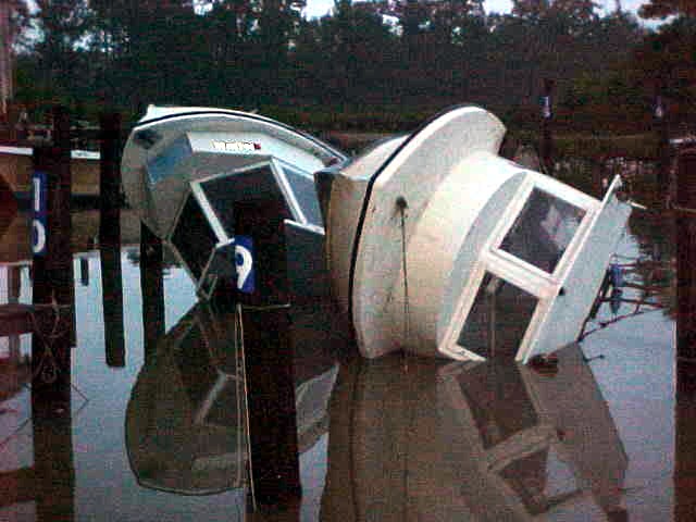
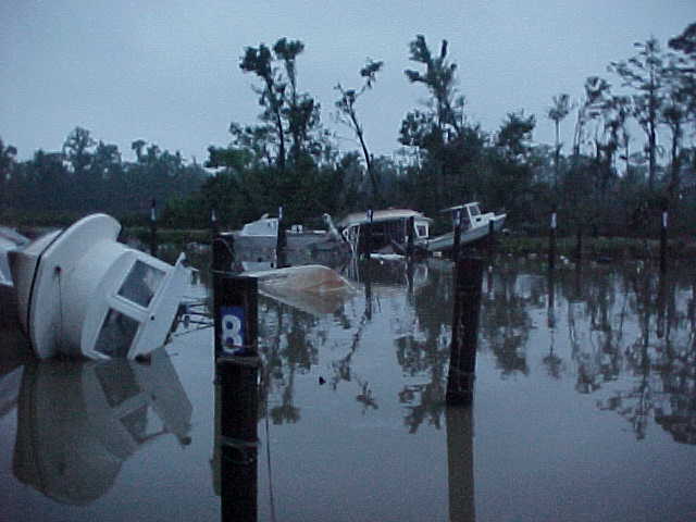
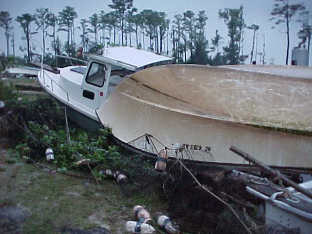
0615 PM TORNADO COLUMBIA 35.92N 76.25W
06/04/2004 TYRRELL NC EMERGENCY MNGR
*** 1 INJ *** MARINA ON DEWEY PIER ROAD HAD 12 VESSELS
DESTROYED.
| Tornado Damage to Marina Near Columbia | ||
|
|
|
|
| Tornado Near Jamesville | ||
|
|
|
|


 Map View
 Weather Hazard Briefing (when applicable)
 Forecaster Discussion
 Marine
 Text Products
.png) Skywarn
Skywarn Submit Storm Reports
 Coastal Flood
.png) Surf Forecast/Rip Currents
Surf Forecast/Rip Currents