January 21, 2014 Light Snow Event
Quick Overview
A developing area of low pressure, coupled with a strong Arctic cold front, combined to produce a light snow event across mainly northern portions of eastern North Carolina during the evening hours of Tuesday January 21, 2014. Ahead of the front, temperatures were unseasonably warm with New Bern reaching 68 degrees on Tuesday afternoon. Strong thunderstorms actually formed along the coast during the late afternoon and early evening hours. As a strong mid-level disturbance (Figure 1) dove east across the state, a surface low started to form over central and western North Carolina, then strengthened off the North Carolina coast in the early evening (Figure 2). As the low raced northeastward and the strong Arctic front advanced south into the eastern North Carolina, light rain quickly changed to light snow by around 6 PM. The snow began to develop into bands (Figure 3) with one the the heavier bands setting up over Rocky Mount, NC, which recorded 2.5 inches of snow. This band then dropped between 1 and 2 inches over portions of Pitt, Martin, Washington and Tyrrell Counties. As the precipitation continued east, up to 1 to 1.5 inches of snow was observed over the northern Outer Banks. While light snow was observed further south, accumulations ranged from zero to just a light dusting (Figure 4).
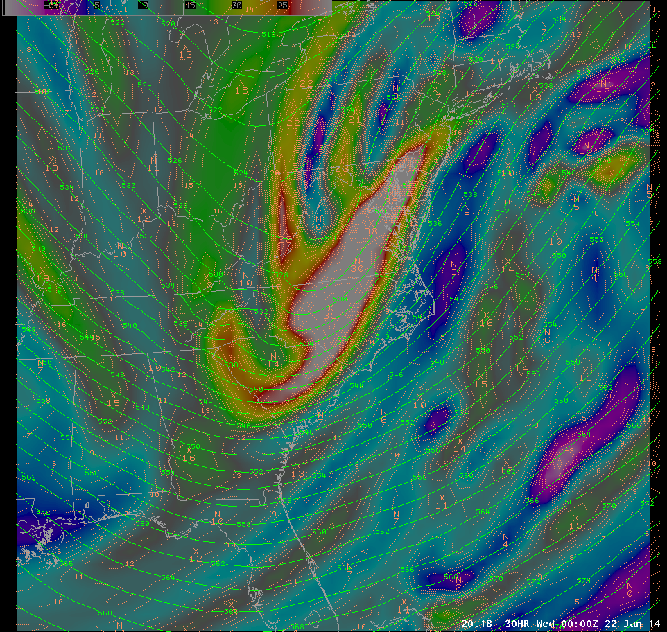
Figure 1. Strong mid-level (500 MB) disturbance approaching eastern North Carolina late on January 21, 2014. Vorticity which is a measure of the rotation of air in a horizontal plane is in orange.
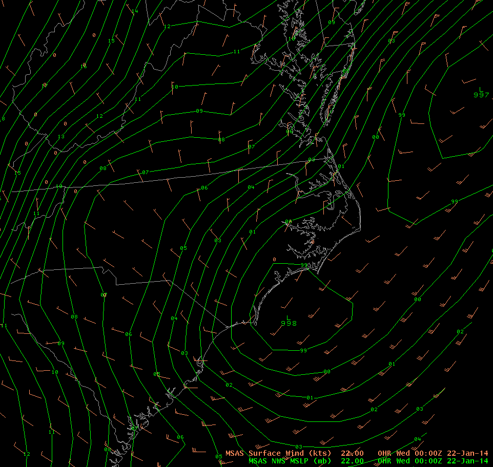
Figure 2. Surface low pressure forms off the southeast North Carolina at 7 PM EST, January 21, 2014.
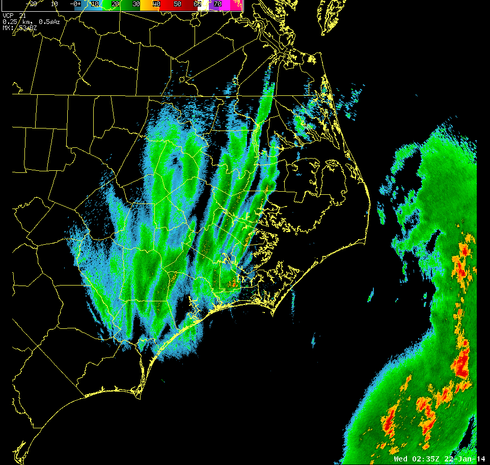
Figure 3. Bands of heavier snow setting up across eastern North Carolina during the evening on January 21, 2014. Stronger thunderstorms were well offshore.
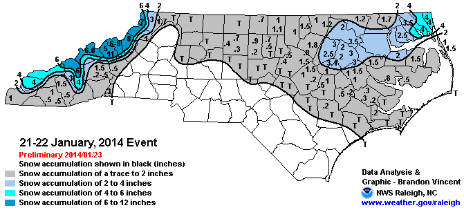
Figure 4. Snowfall Accumulation Map for January 21, 2014. (Courtesy National Weather Service, Raleigh, NC)
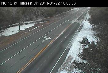
Light Snow along Highway 12 near Duck, NC