Hurricane Ione, September 11-21, 1955
OVERVIEW
Hurricane Ione developed in an easterly wave which passed through the Cape Verde Islands on September 6, 1955. Ione gradually intensified as it moved almost due west as it crossed the Atlantic and reached hurricane intensity during the night of September 14. Ione then turned northwest near the Virgin Islands and continued a northwest course toward the North Carolina coast (Figure 1). Ione reached its greatest intensity on September 17 with a central pressure of 938 millbars (27.70 inches/mercury) and peak winds of 125 mph, a category three on the Saffir-Simpson Wind Scale. Thankfully, drier and cooler air started to be entrained into the storms circulation, and Ione weakened to a minimal hurricane as it approached the North Carolina coast (Figure 2). Ione was the third hurricane to make landfall in eastern North Carolina within six weeks and the fourth within eleven months. After making landfall, Ione recurved to the northeast and moved back out to sea south of the Norfolk, Virginia area.
One interesting aspect of Hurricane Ione was that it was the first hurricane to be observed by the newly-installed Cape Hatteras radar. For some 35 hours, on September 18 through early morning on September 20, the eye was under radar surveillance. During this time, the storm made several small-scale oscillations within its track (Figure 3).
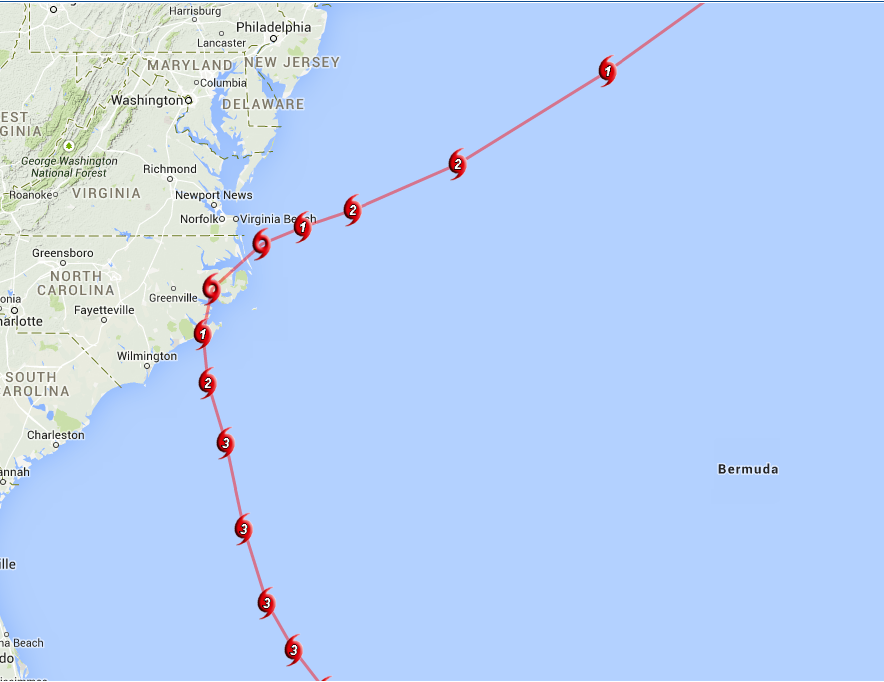
Figure 1. Track of Hurricane Ione, September 1955.
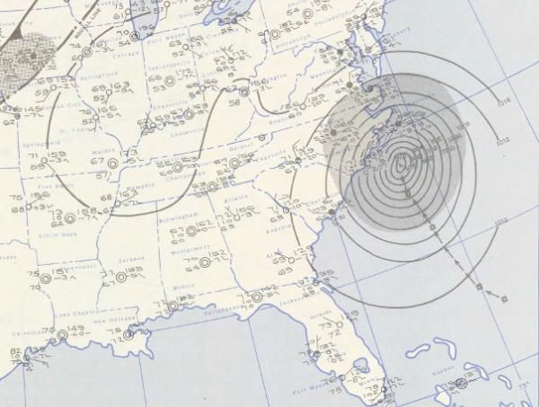
Figure 2. Hurricane Ione reaching the North Carolina coast, September 19, 1955 (Courtesy NOAA Daily Weather Maps).
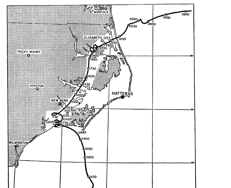
Figure 3. Small loops or oscillations from Hurricane Ione, September 1955. (Courtesy Monthly Weather Review)
IMPACTS
Adding to the previous devastation from Hurricanes Connie and Diane, especially from flooding 6 weeks earlier, Ione caused over 600 million dollars in damage to eastern North Carolina, much of it agricultural losses. Strong and prolonged easterly winds caused some of the largest tidal inundations in eastern North Carolina history. Morehead City recorded a surge of 3.6 feet, while further south at Wrightsville Beach, a storm tide of 5.3 feet was observed. With the additional rainfall from Ione (Figure 4), many rivers reached stages not seen again until Hurricane Floyd in 1999.
Strong winds accompanied Hurricane Ione with Cherry Point recording sustained winds of 75 mph with gusts to 107 mph. Despite the wind and massive flooding, only 7 fatalities occurred in North Carolina from Hurricane Ione. These low numbers are a tribute to the effectiveness of the warnings and precautionary measures taken by the government and private agencies such as the Red Cross.
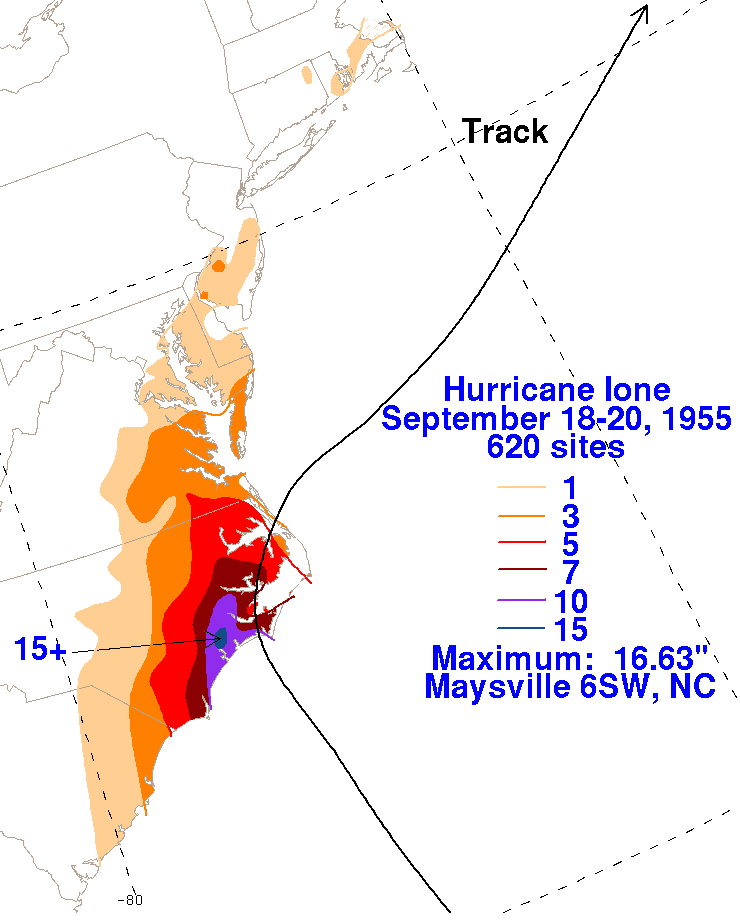
Figure 4. Rainfall Graphic from Hurricane Ione, September 18-20, 1955 (Courtesy David Roth, Weather Prediction Center)
https://www.youtube.com/watch?v=EXdMLZUNEBY
British News Video from Hurricane Ione
SOURCES
National Hurricane Center
Weather Prediction Center
Monthly Weather Review, September 1955.
NOAA Daily Weather Maps.


.png) Surf Forecast/Rip Currents
Surf Forecast/Rip Currents Tropical Weather
 Map View
 Weather Hazard Briefing (when applicable)
 Forecaster Discussion
 Marine
 Text Products
.png) Skywarn
Skywarn Submit Storm Reports