
Hurricane Charley - August 17, 1986
Overview
Hurricane Charley spawned from a trough of low pressure that persisted over south Florida and the southeast Gulf of America. Showers and thunderstorms associated with this system first appeared over the Florida peninsula on August 11th, 1986. The activity spread into the eastern Gulf of America the next day, when surface observations indicated a very broad area of low pressure formed. The poorly defined, diffuse system drifted north on the 12th and 13th and became better organized over the Florida panhandle and Georgia as it merged into a decaying frontal trough. Continuing to improve in organization, the low emerged off the Georgia/South Carolina coast during the morning of the 15th, when it became a tropical depression. By mid-afternoon, the depression strengthened into a tropical storm. A weak ridge north of the storm led to a slow east to northeast drift. A trough amplified west of the storm over the eastern United States, resulting in a more northerly motion on the 17th and 18th. Charley recurved more to the eastward by the 19th and weakened as it merged with a frontal zone. By the 21st, as an extratropical low, Charley significantly deepened and became a large, strong storm which migrated to Europe, and eventually dissipated in the North Sea.

Track of Hurricane Charley, August 12-18, 1986 (Courtesy National Hurricane Center)
Impacts
Charley crossed the coast of North Carolina as a minimal hurricane, producing locally strong wind gusts, peaking at 80 mph in Frisco. Charley produced heavy amounts of rain falling along the coast, with up to 7 inches near Manteo. As Charley moved ashore, the storm produced high tides, reaching 5.78 feet at the Duck Coe Fishing Pier. A woman drowned near Cape Hatteras while attempting to drive through a flooded roadway. Roads and bridges across the Outer Banks were flooded with up to 3 feet of water, including a portion of North Carolina Highway 12 near Hatteras Island. The storm left about 8,000 people without power, but overall damage was minimal and limited to shingles and roofs. Statewide, the impact was primarily caused by tidal flooding and downed trees, and a preliminary damage estimate placed total monetary losses at $400,000 in 1986 dollars.
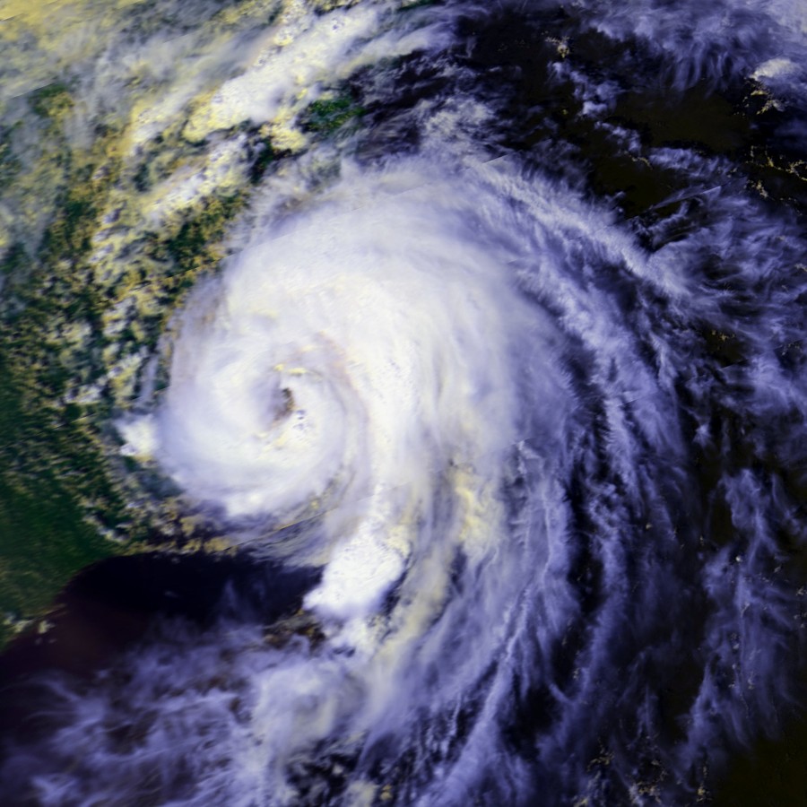
Satellite photograph of Hurricane Charley near peak intensity off of the North Carolina coast, August 17, 1986.
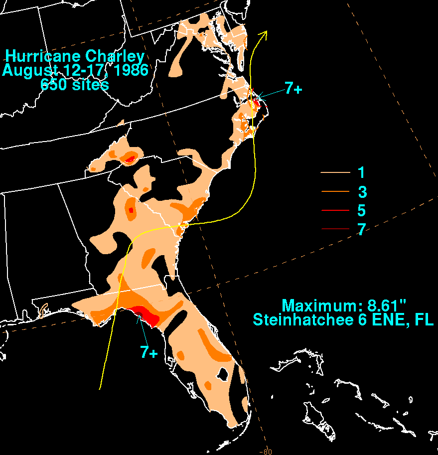
Rainfall Totals from Hurricane Charley August 12-17, 1986 (Courtesy David Roth, Weather Prediction Center)
Interestingly, Charley continued across the Atlantic as an extratropical cyclone and became one of the strongest storms to ever effect Ireland. The counties of Dublin and Wicklow were badly hit and there was extensive damage to homes and businesses with the River Dargle and the River Dodder both overflowing their banks.
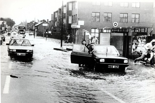
Flooding in Ireland from Hurricane Charley, August 1986.
SOURCES
National Hurricane Ceneer
CASE STUDY TEAM:
Chris Collins


.png) Surf Forecast/Rip Currents
Surf Forecast/Rip Currents Tropical Weather
 Map View
 Weather Hazard Briefing (when applicable)
 Forecaster Discussion
 Marine
 Text Products
.png) Skywarn
Skywarn Submit Storm Reports