Event Overview
Multiple long track tornadoes developed over eastern North Carolina during the late afternoon and evening of Saturday April 16th. Twelve tornadoes have been confirmed over the area, several of which caused major damage. Hundreds of homes were damaged or completely destroyed across the region. Many business and several schools received structural damage with some buildings totally destroyed. Thousands of residents were either temporarily or permanently displaced from their homes. Scores of injuries also occurred with several injuries being categorized as critical.

Tornado on the ground over Greene County NC (Courtesy WNCT)
Synoptic Overview
The atmospheric set up was conducive for supercellular thunderstorms to form on this day. A dual jet stream structure (Figure 1) enhanced lift over the area while a vigorous negative tilt mid level trough (Figure 2) provided strong positive vorticity advection. Strong vertical wind shear as seen on the MHX 00Z sounding (Figure 3) provided the ability for storms to violently rotate while surface heating during the afternoon increased surface based instability.
At the surface, a cold front was poised to the west over the North Carolina mountains at 7 am Saturday morning as a warm front moved north to the near the North Carolina/Virginia border (Figure 4). Thunderstorms would break out ahead of the cold front, first over central North Carolina during the early afternoon hours and move into Eastern North Carolina by late afternoon and early evening. Strong surface based instability and low-level wind shear led to the thunderstorms very quickly becoming tornadic.
All these factors were contributors to the intensity of the thunderstorm that developed which formed into discrete supercell structures. These discrete supercell thunderstorms produced violent tornadoes that caused damage of up to EF3 intensity on the Enhanced Fujita Scale (Figure 5) for rating tornadoes.
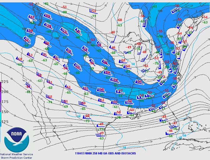
Figure 1. 250 mb Analysis at 00Z April 17, 2011 showing dual jet structure over the Eastern United States.
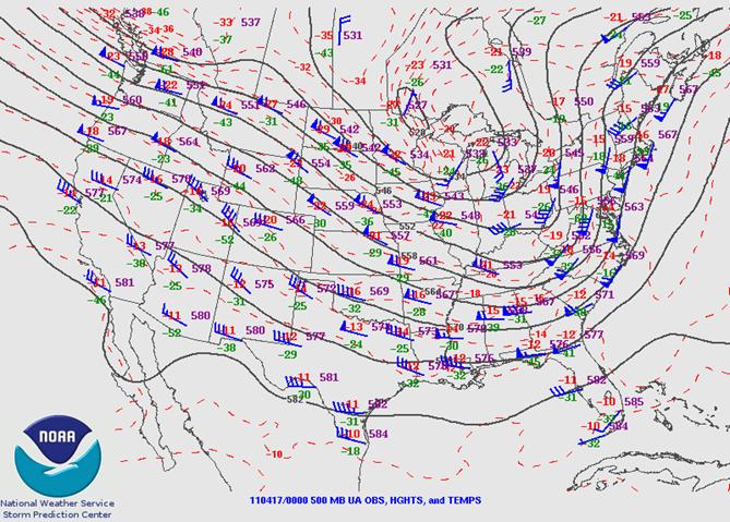
Figure 2. 500 mb Analysis at 00Z April 17, 2011 showing mid-level trough becoming negatively tilted.
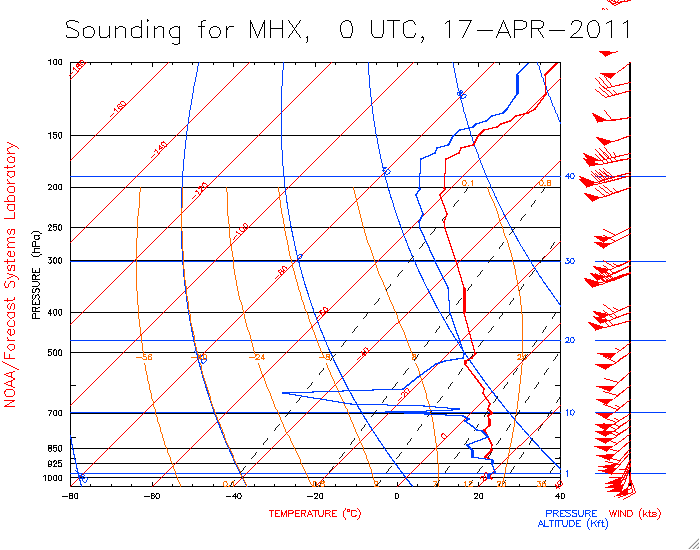
Figure 3. The 00Z April 17, 2011 Newport/Morehead City (MHX) sounding showing strong low-level wind shear.
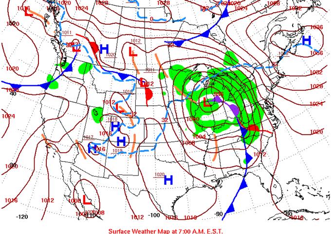
Figure 4. Surface map at 7 am April 16, 2011 showing a cold front approaching Western North Carolina as a warm front moves north of the area.
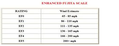
Figure 5. The Enhanced Fujita Scale
Radar Imagery
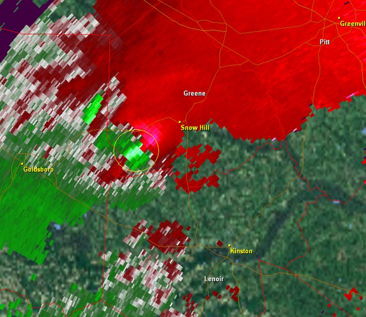
Velocity image showing strong rotational couplet (yellow circle) near Snow Hill around 545 pm April 16, 2011. An EF-3 tornado was on the ground at this time.
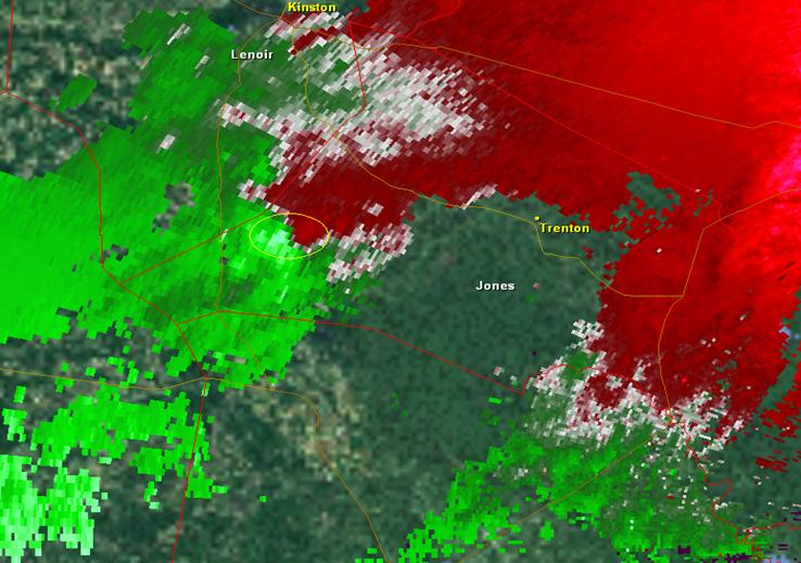
Another rotational couplet observed near Hargett’s Crossroads in Jones County around 710 pm April 16, 2011. The result was an EF-2 tornado.
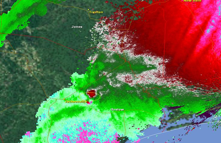
Another rotational couplet on the east side of Jacksonville around 815 pm April 16, 2011 which led to a EF-3 tornado which produced extensive damage in the Piney Green area and again near Riverdale in Craven County.
Sources
· Storm Prediction Center
· WNCT-TV
· GR2 Analyst Software
· NOAA Daily Weather Maps
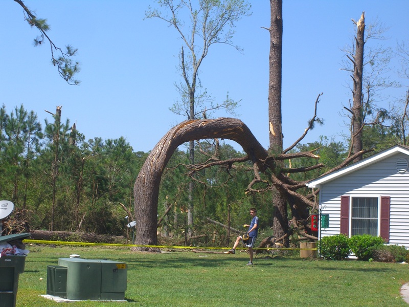
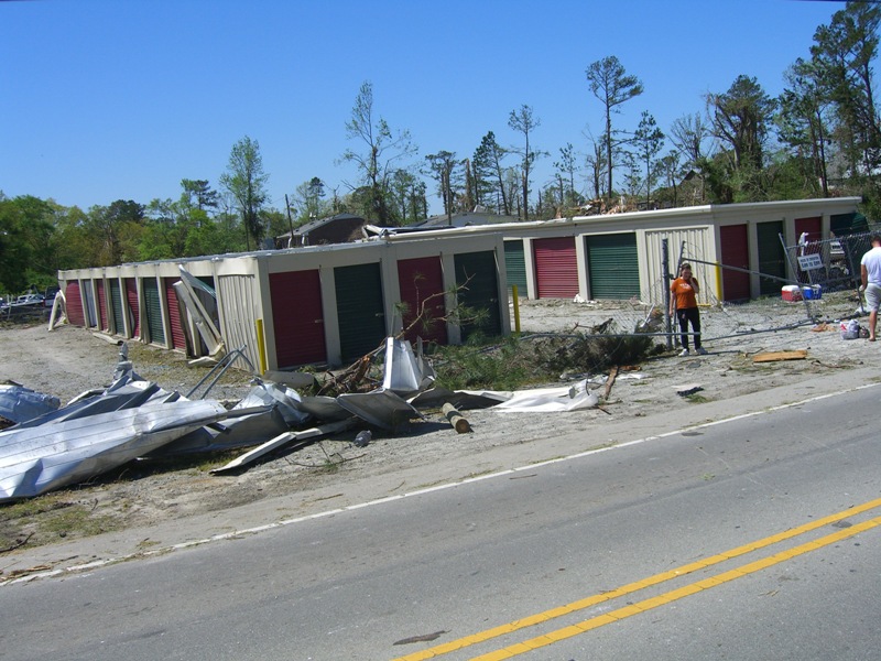
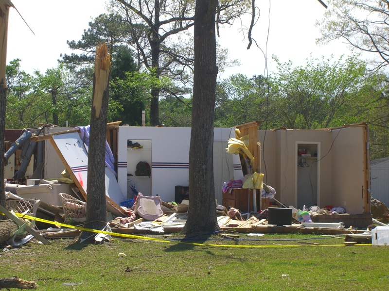
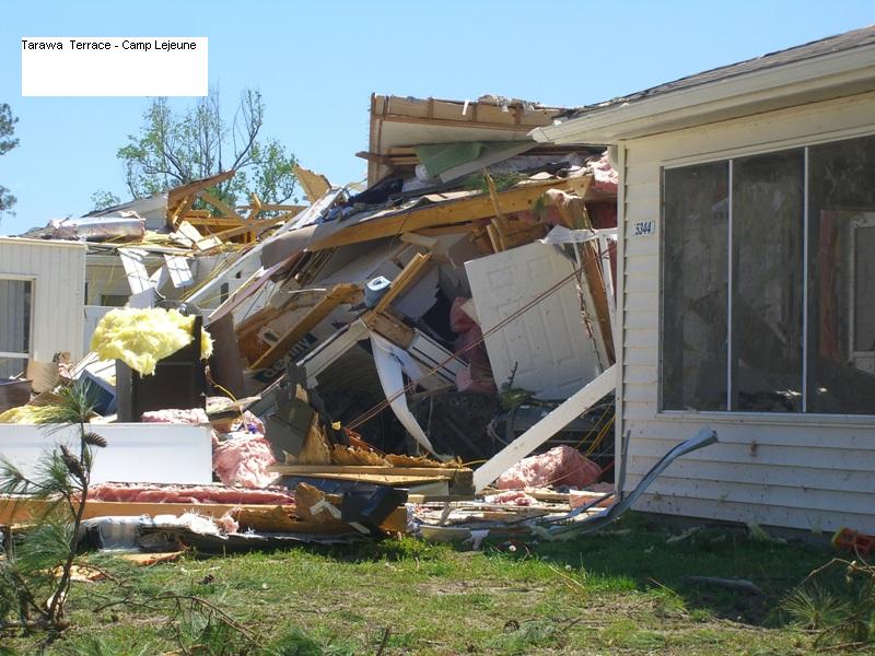
Damage Pictures from Jacksonville and Camp LeJeune
Photos courtesy of: NWS Newport/Morehead City, NC


Case Study Team:
NWS MHX


 Map View
 Weather Hazard Briefing (when applicable)
 Forecaster Discussion
 Marine
 Text Products
.png) Skywarn
Skywarn Submit Storm Reports
 Coastal Flood
.png) Surf Forecast/Rip Currents
Surf Forecast/Rip Currents