April 15, 2005 Coastal Flooding/High Winds
Event Overview
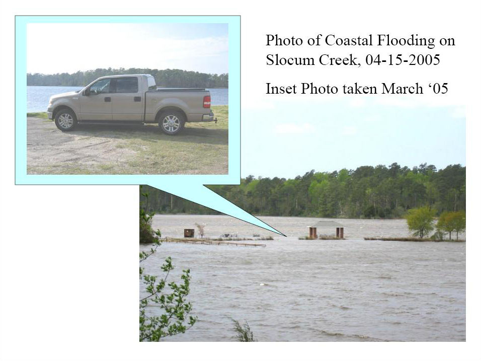
On Friday, April 15, 2005 a strong pressure gradient between two synoptic high/low pressure systems created very strong northeast (NE) flow in coastal North Carolina with sustained winds at or near tropical storm force in many locations and peak wind gusts up to 65 mph. The strong NE winds persisted Friday night into Saturday as the low pressure system meandered off the NC coast. Because of the strength and duration of these winds, in addition to the large fetch of ocean that they blew across, very large long-period swell with wave heights of 20+ feet developed and affected E and NE facing beaches along the northern Outer Banks. The strong, persistent NE winds also pushed water from the NE side of the Pamlico Sound to the SE side, causing coastal flooding in locations along the SE part of the Pamlico sound and eventually in locations along the Neuse river, such as New Bern. Water heights rose 3-5 feet above normal levels in many areas causing road closures and property damage in low-lying areas. Numerous products were issued for this event by the National Weather Service in Newport/Morehead City, NC, including Coastal Flood Warnings, Gale Warnings, Storm Warnings, High Wind Warnings and Wind Advisories.
High Wind Reports - Reports of High Winds from April 15, 2005.
PUBLIC INFORMATION STATEMENT
NATIONAL WEATHER SERVICE NEWPORT/MOREHEAD CITY NC
230 PM EDT FRI APR 15 2005
THE FOLLOWING ARE PEAK WIND GUSTS OBSERVED SINCE MIDNIGHT ACROSS
EASTERN NORTH CAROLINA. THIS INFORMATION IS FROM AUTOMATED WEATHER
STATIONS AND PUBLIC WIND EQUIPMENT AND IS UNOFFICIAL.
*********************************************************************
Hatteras Village (Dare County) 63 MPH
Alligator River Bridge (Dare County) 60 MPH
CI Ferry Terminal (Carteret County) 55 MPH
Kill Devil Hills (Dare County) 54 MPH
Harkers Island (Carteret County) 53 MPH
Cedar Island (Carteret County) 52 MPH
Manteo (Dare County) 51 MPH
Rodanthe (Dare County) 51 MPH
Buxton (Dare County) 50 MPH
Beaufort (Carteret County) 48 MPH
Cherry Point (Craven County) 47 MPH
Davis (Carteret County) 47 MPH
Frisco (Dare County) 46 MPH
Southern Shores (Dare County) 46 MPH
Stumpy Point (Dare County) 45 MPH
North Topsail (Onslow County) 44 MPH
Hatteras (Dare County) 43 MPH
Sea Level (Carteret County) 41 MPH
New Bern (Craven County) 41 MPH
Greenville (Pitt County) 39 MPH
********************************************************************
Synoptic Overview
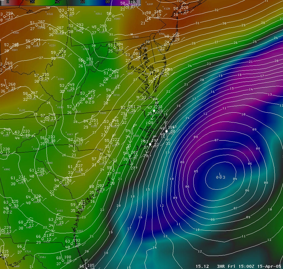
On Friday, April 15, 2005 a surface low moved off the coast of North Carolina and stalled out as an upper low captured it and the system became vertically stacked. As the surface low reached it's peak strength at 1003 mb just off the coast of North Carolina, a 1030 mb high-pressure ridge slid southward out of New England into the Mid-Atlantic. Although precipitation stayed offshore, the pressure gradient alone was strong enough to create sustained winds at/near tropical storm force with peak gusts up to 65 MPH along and off the North Carolina coast on Friday and Saturday. The surface low meandered off the coast, retrograding slightly on Saturday before moving east towards Bermuda on Sunday.
Model Imagery / Surface Data - 15Z 04/15/05 Eta MSLP and 15Z surface observations across the Mid-Atlantic.
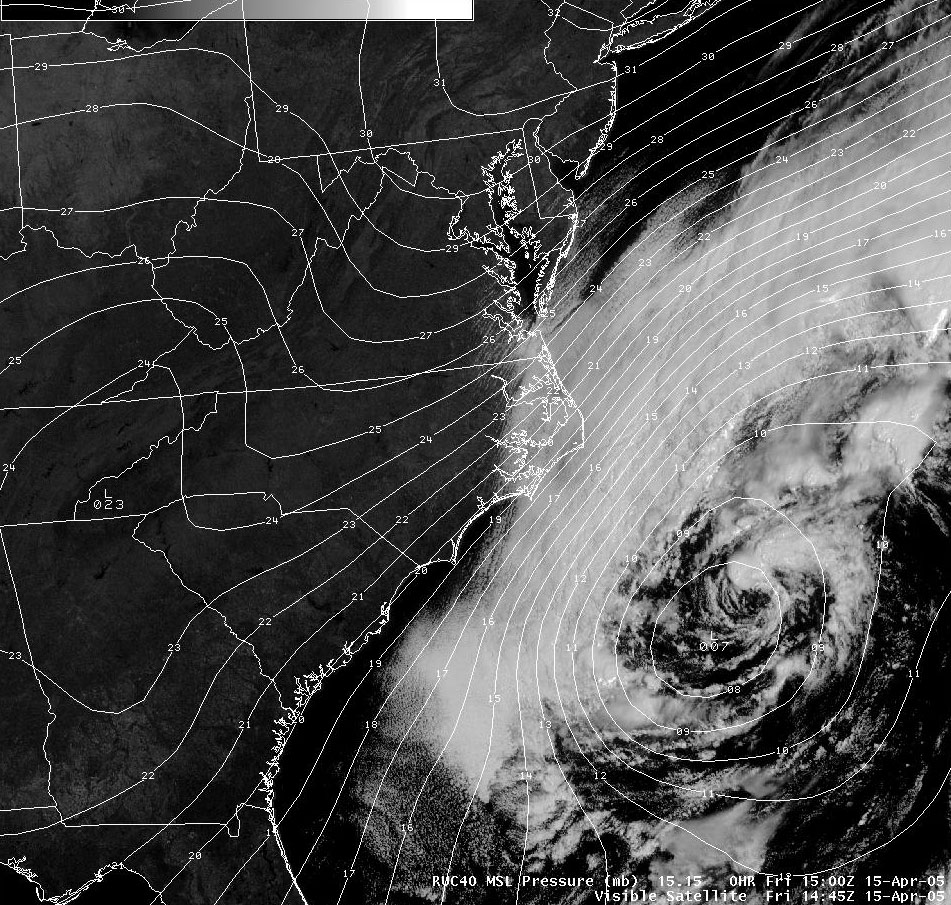
Visible Satellite / Model MSLP - 15Z 04/15/05 RUC MSLP and 1445Z visible satellite image of the Mid-Atlantic.
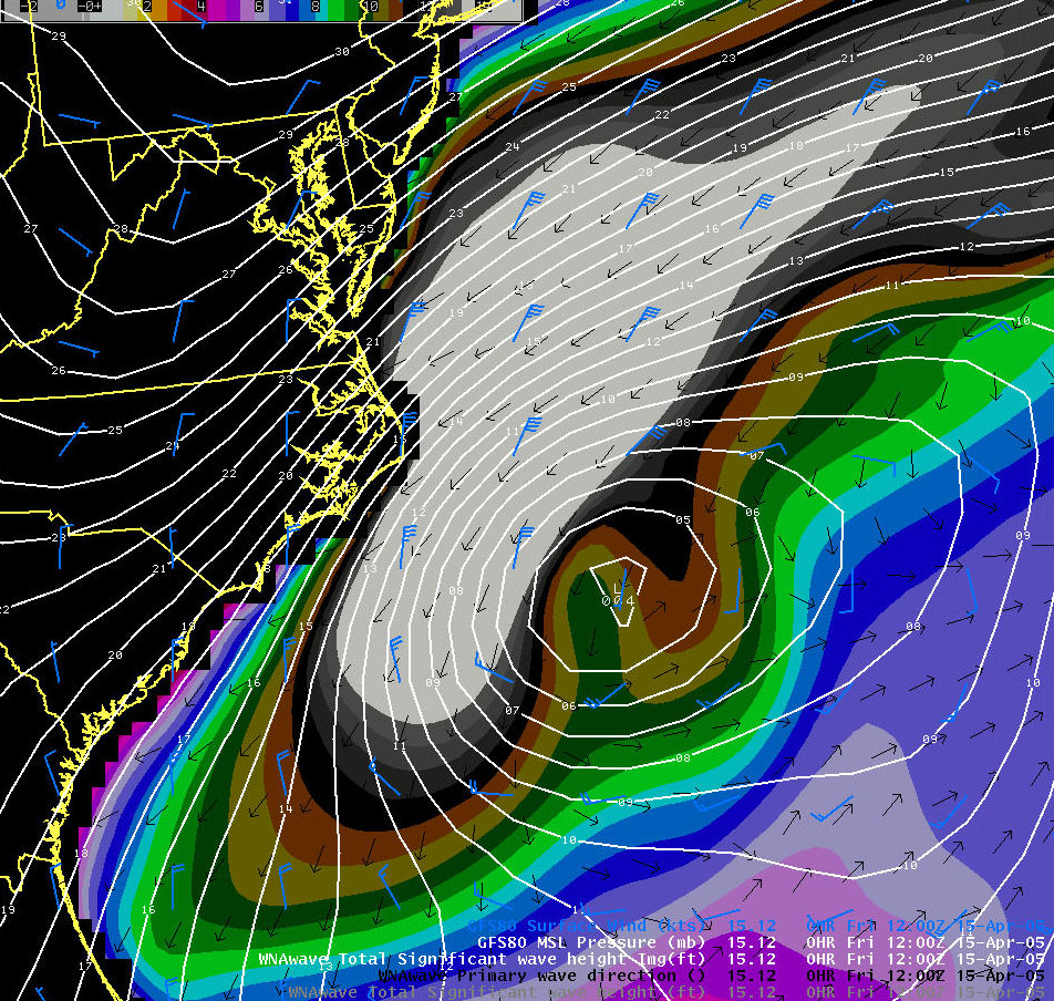
Wave Heights - 12Z 04/15/05 Wave Watch 3 (WW3) model data showing a large area of 14+ feet swell affecting primarily the northern Outer Banks of North Carolina. South-facing beaches were protected from the large swell.
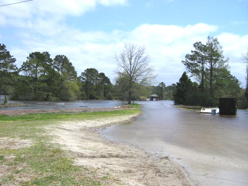
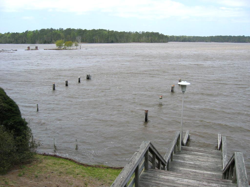
Damage Pictures from Craven County (near Cherry Point)
Photos courtesy of Bill Sanford, NWS Newport District SKYWARN EC.

Case Study Team:
Brandon Vincent


 Map View
 Weather Hazard Briefing (when applicable)
 Forecaster Discussion
 Marine
 Text Products
.png) Skywarn
Skywarn Submit Storm Reports
 Coastal Flood
.png) Surf Forecast/Rip Currents
Surf Forecast/Rip Currents