
A late-season winter storm continues to bring heavy snow, significant sleet, and disruptive icing to the Upper Midwest and western Great Lakes into the morning; and will be followed by another storm. Severe thunderstorms continue across the Midwest to the lower Great Lakes through tonight, before bringing a round of freezing rain and sleet Friday morning across northern New England. Read More >
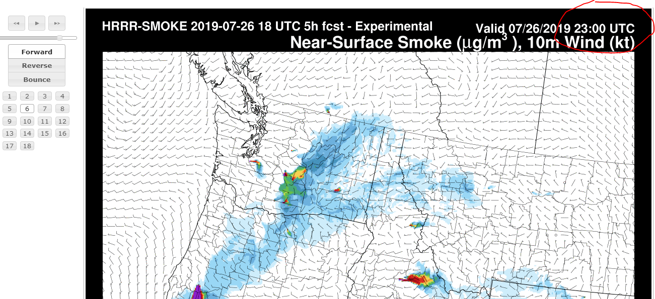
The animated movie on the weather.gov/medford/wildfire web page is based on the HRRR. Typically those movies only go out 18 hours. If you want to view imagery that goes out 48 hours, this tuturial will help you get there. The HRRR smoke model has really improved over the past several years and can provide a good idea on where the greatest/least concentration of smoke will be, out to 48 hours. Please understand when viewing this imagery that no model is perfect, and it's usually best to use to view trends where smoke is getting worse or better. Take a look at the AQI in your area, and then you can use the model to see if it looks like your area will improve or worsen through the day/night.
Here's the link to the smoke model page: https://rapidrefresh.
Note that this imagery only shows county boundaries. Below is an image with some approximate city locations as a reference in case you're not familiar with all county boundaries.

When you go to the page, choose NW-Large on the domain for Northwest. Choose the most recent
00Z, 06Z, 12Z, or 18Z model run to get the full, 48 hour outlook. Other model runs go out
18 hours.


 Precipitation Tracker
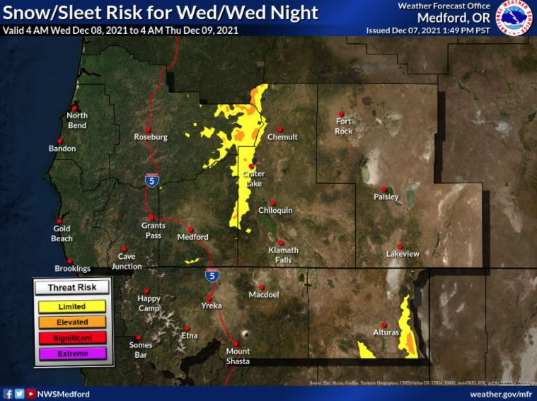 Graphical Hazards Outlook
 RADAR and Satellite
 Forecast Discussion
 Snowfall and Depth With Crater Lake Details
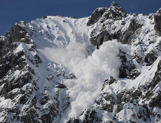 Avalanche Guidance
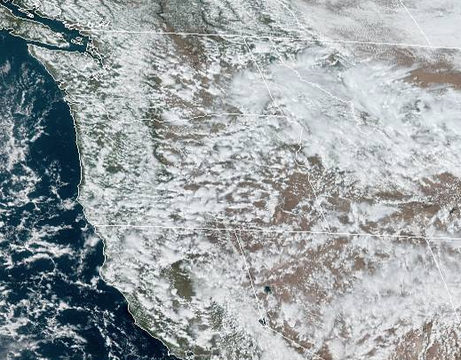 NESDIS Geocolor
 Weather Map
 Marine
 Fire Weather
 Crater Chronicle
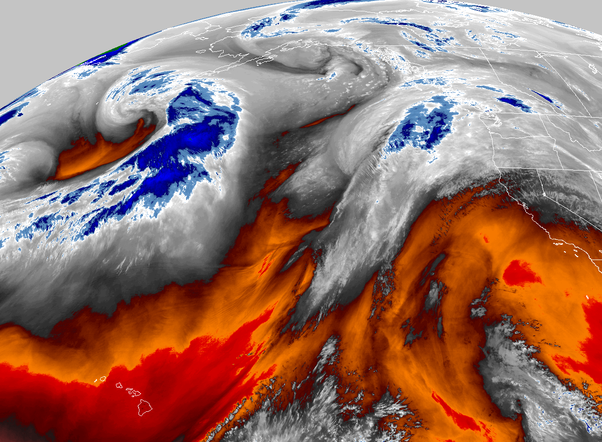 GOES 18 Water Vapor Imagery
 Mountain Pass Forecasts
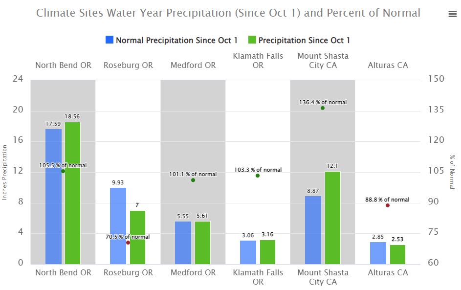
 Local Climate Data
 Alternate Point Forecast
 Weather Stats
 Year Charts