
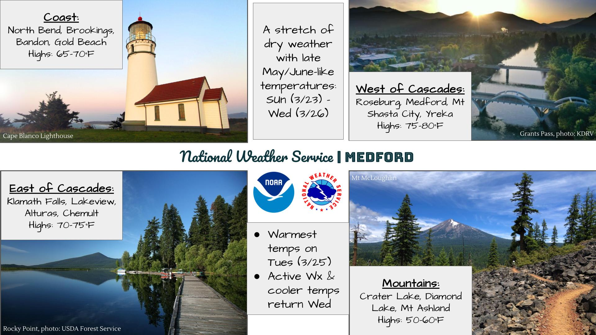
A late season winter storm will produce a combination of heavy snow and disruptive ice starting this evening in the Northern Plains and moving into the Upper Midwest and Great Lakes by tonight continuing through Thursday. Severe thunderstorms will likely produce severe wind gusts, large hail, a few tornadoes, and heavy rainfall across the southern and central Plains into the morning. Read More >
Last Map Update: Wed, Apr 1, 2026 at 6:20:19 pm PDT


|
Text Product Selector (Selected product opens in current window)
|
|


 Precipitation Tracker
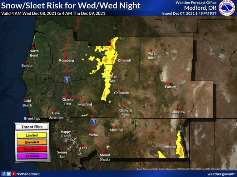 Graphical Hazards Outlook
 RADAR and Satellite
 Forecast Discussion
 Snowfall and Depth With Crater Lake Details
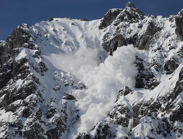 Avalanche Guidance
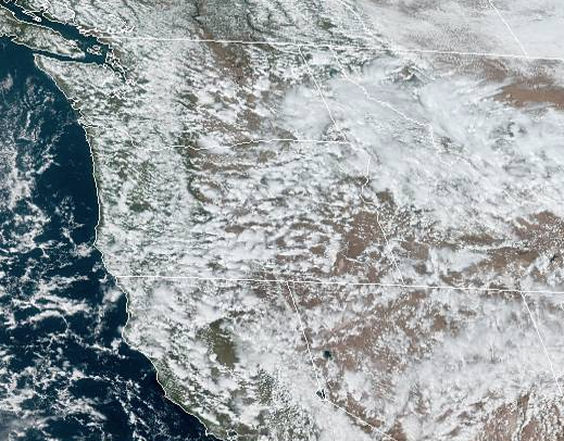 NESDIS Geocolor
 Weather Map
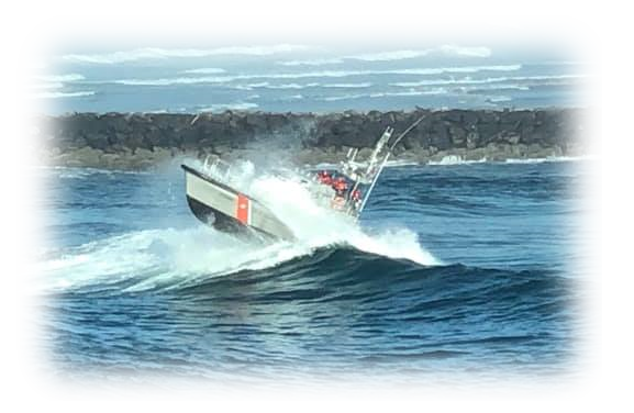 Marine
 Fire Weather
 Crater Chronicle
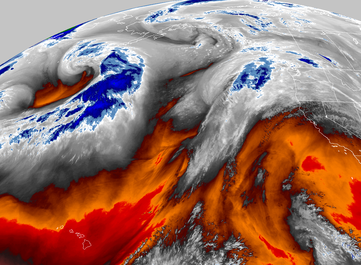 GOES 18 Water Vapor Imagery
 Mountain Pass Forecasts
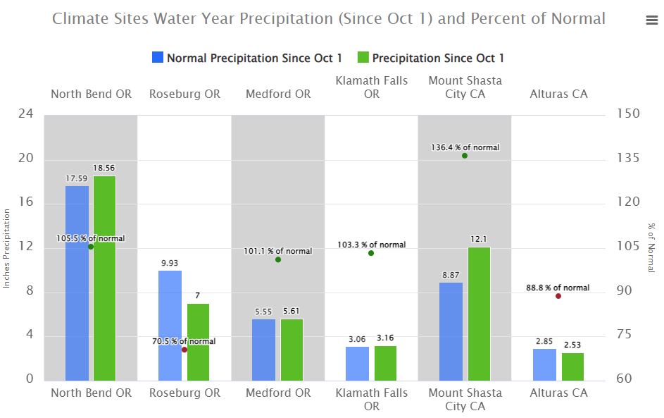
 Local Climate Data
 Alternate Point Forecast
 Weather Stats
 Year Charts