National Weather Service United States Department of Commerce
Click a location below for detailed forecast.

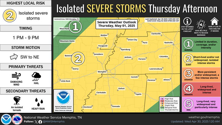
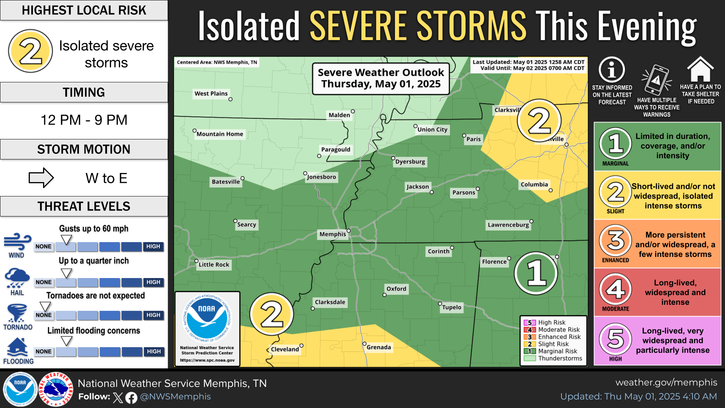
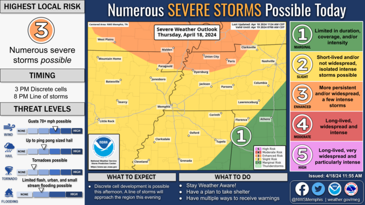
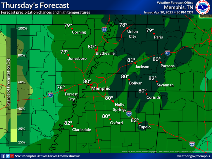
Last Map Update: Thu, Sep 26, 2024 at 9:48:58 pm CDT


Heavy rainfall is the primary threat for the Mid-South associated with Hurricane Helene.
A Flood Watch will go into effect at 7 PM tonight as rainfall from Hurricane Helene moves in. The watch will remain in effect until 7 AM Saturday with the bulk of the rainfall occurring on Friday.
A Wind Advisory remains in effect until 7 AM Saturday for Hurricane Helene. Sustained wind speeds of 20-25 mph with gusts to 40 mph are anticipated.
Bulk of the rainfall from Helene will occur on Friday. Highs will be in the upper 60s and lower 70s.

graphical hazard
Graphical Hazards
probabilistic
Probabilistic
current weather
Current Weather
be prepard
Being Prepared
estar preparado
Estar Preparado
safety
Weather Safety

Text Product Selector (Selected product opens in current window)

 Current Weather Observations...
Location Time
(CDT)
Weather Vsby.
(SM)
Temp.
(ºF)
Dewpt.
(ºF)
Hum.
(%)
Wind
(mph)
Wind Chill / Heat Index
(ºF)
Pres.
(in)
Memphis TN20:54Clear10715658N 10-29.76
Jackson TN20:53Mostly Cloudy10725861NNW 8-29.74
Jonesboro AR20:53Clear10705661NNW 7-29.80
Tupelo MS20:53Clear10725861NNW 9-29.69
West Memphis, AR20:53Clear10695662NNW 7-29.76
Blytheville, AR20:53Clear10705763N 12-29.77
Dyersburg, TN20:56Clear10715863N 8-29.77
Olive Branch, MS21:35Clear10685564NNW 9-29.74
Oxford, MS21:35Clear10665568NNW 6-29.74