
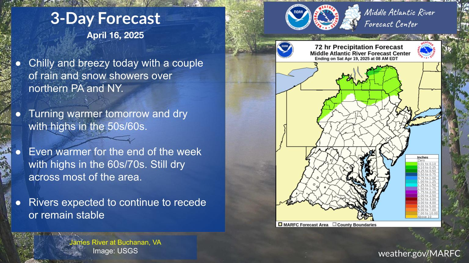
A Pacific storm system will continue to bring low elevation rain and mountain snow to much of the West through Wednesday, with heavy mountain snow expected in the higher elevations of the Sierra Nevada. This system will also bring strong winds to the Intermountain West, Rockies, and Plains, which will create Critical fire weather conditions for the High Plains. Read More >
Middle Atlantic RFC
River Forecast Center

Past Precipitation |
Water Story |
Future Precipitation |
 |
 |
 |
US Dept of Commerce
National Oceanic and Atmospheric Administration
National Weather Service
Middle Atlantic RFC
328 Innovation Boulevard
Suite 330
State College, PA 16803
814-954-6408
Comments? Questions? Please Contact Us.

