|
Rounds of scattered severe thunderstorms and localized torrential rain 22-23 April 2025 |
|
 |
|
|
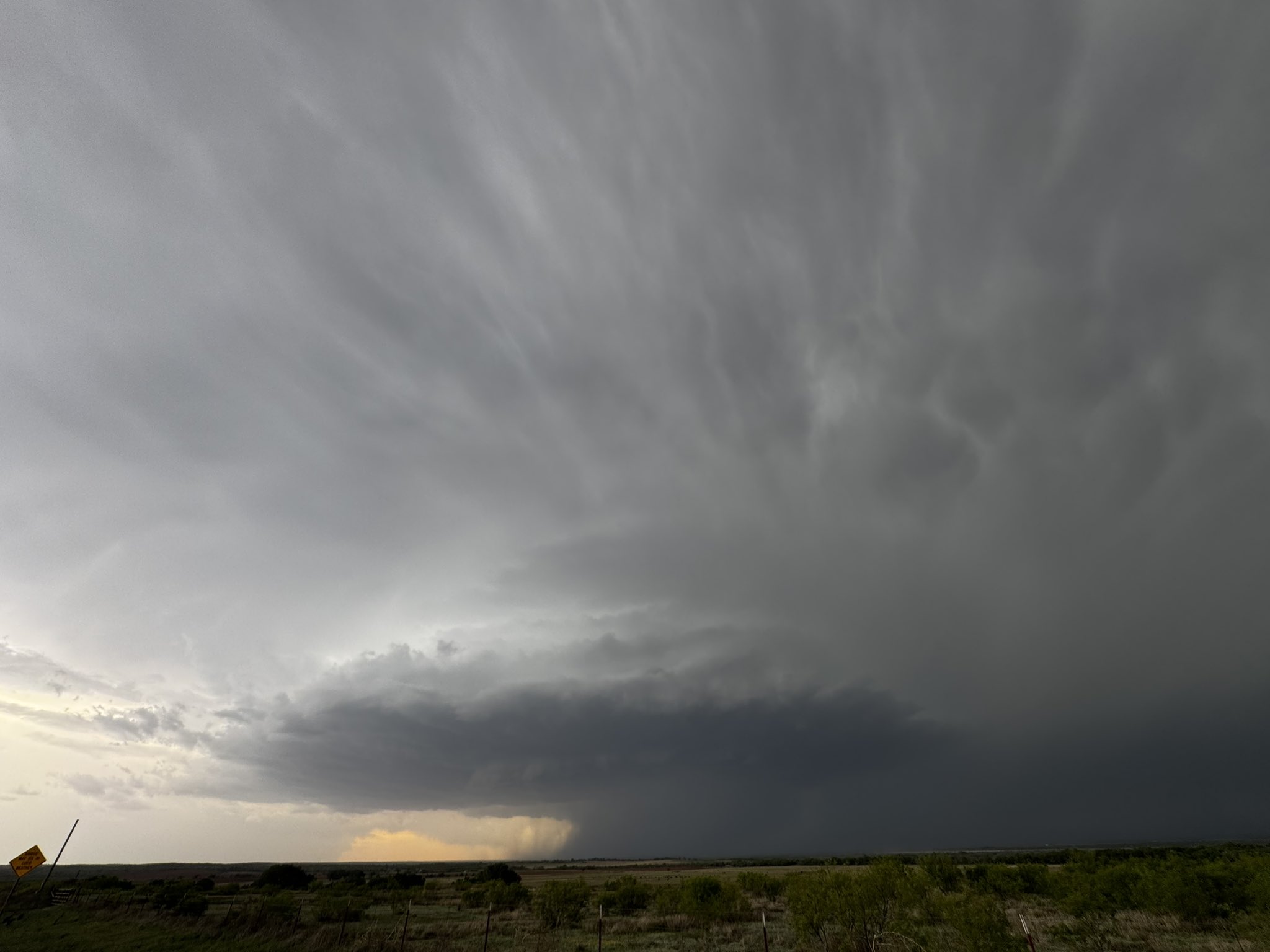
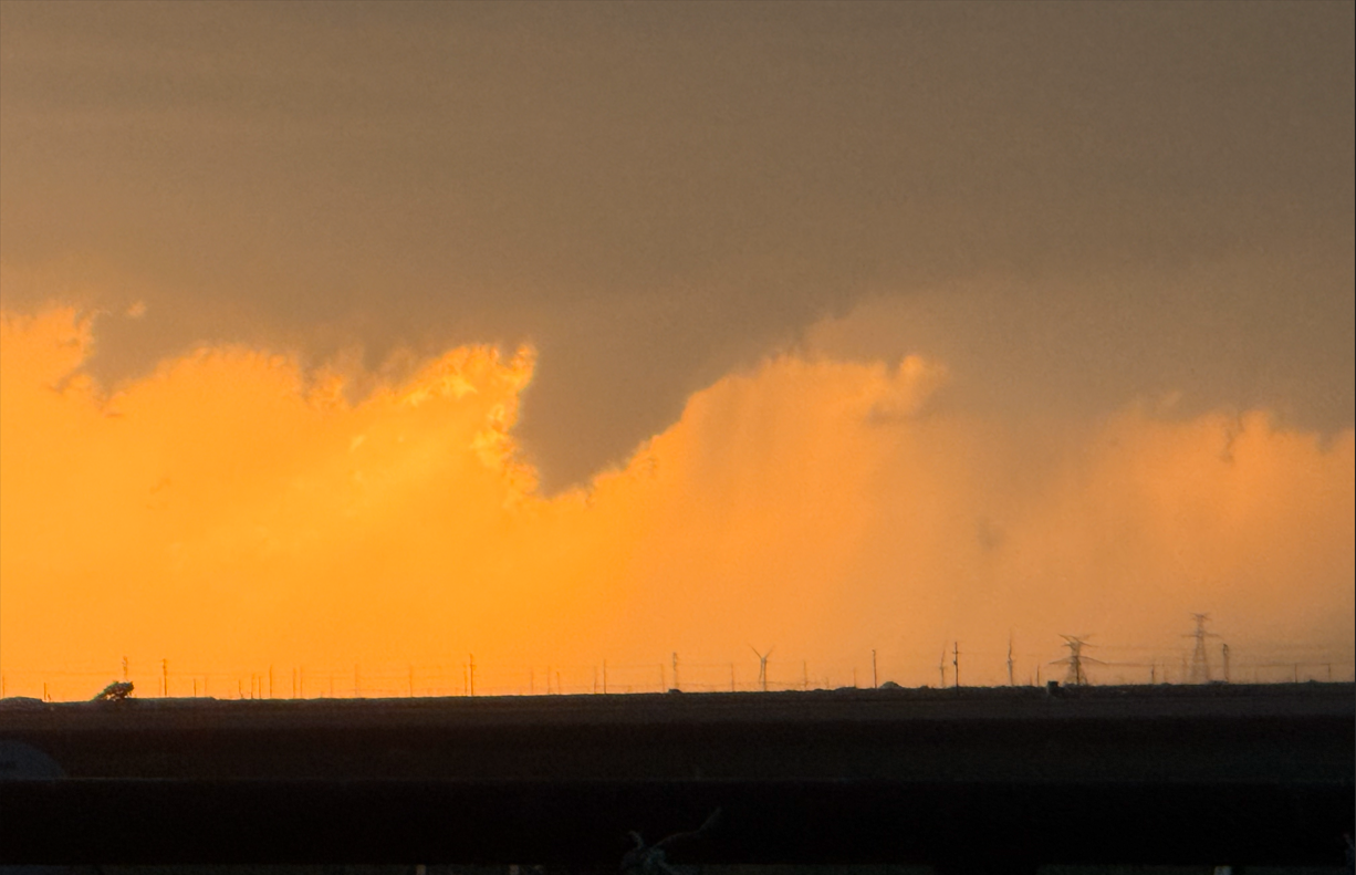
Supercell thunderstorm east of Turkey on Tuesday evening (22 April 2025). The picture is courtesy of @ThunderChasers on X. |
|
|
Springtime severe weather season ramped up a bit ahead of schedule in 2025, fully kicking off in late April. More specifically, Tuesday, April 22nd, served as the first act of an unsettled stretch of weather for West Texas. Despite relatively meager upper level support, intense heating, sufficient moisture and the dryline conspired to trigger scattered severe thunderstorms Tuesday afternoon and evening. In addition, there was just enough wind aloft to cause a number of the thunderstorm to organize and rotate. |
|
 |
|
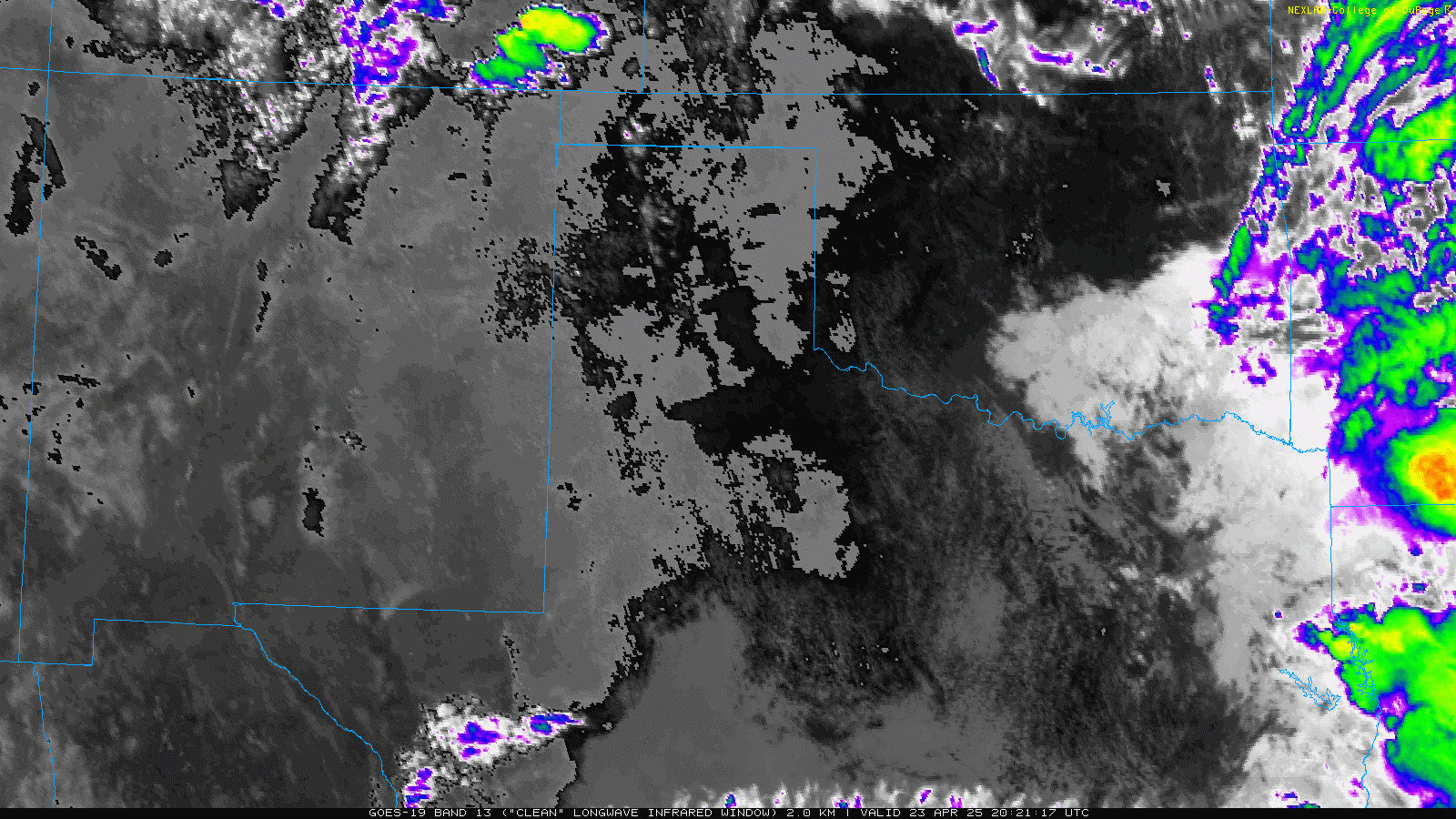
| "RGB-True Color" satellite loop valid from 6:39 pm to 6:57 pm on Tuesday (22 April 2025). An infrared satellite loop, valid from 4:21 pm to 10:21 pm on Tuesday, can be VIEWED HERE. | |
| The initial activity developed over the south-central Texas Panhandle, with additional development farther southwestward into the western South Plains. Large hail and gusty outflow winds were common with the strongest storms, as well as localized torrential rainfall. Several locations, including in or near Lakeview, Plains, Spade and Littlefield saw hail near or larger than golf ball size. The largest hailstone of the day was estimated to be 2.50 inches in diameter (tennis ball size), and was reported by the public 3 miles north of Littlefield. | |
 |
|
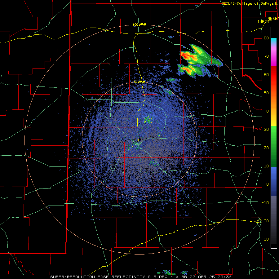
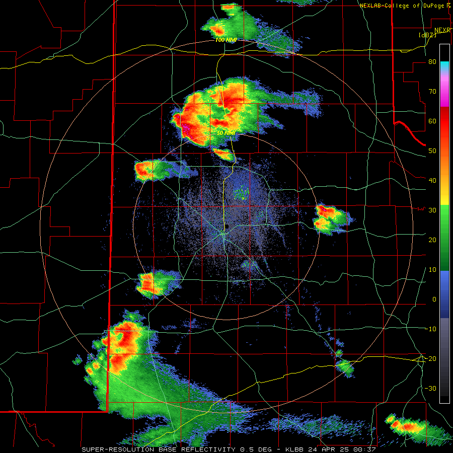
| LBB WSR-88D radar animation valid from 3:39 pm to 9:34 pm on Tuesday (22 April 2025). A additional radar animation, valid from 4:24 pm to 10:52 pm, can be VIEWED HERE. | |
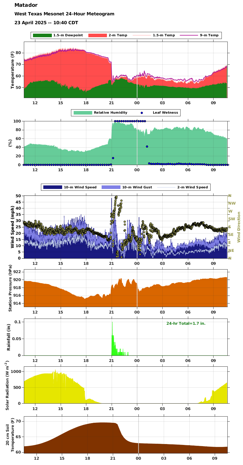
| In addition, one particularly intense storm approached the Matador area Tuesday evening. This storm was rotating rapidly aloft, but thankfully never produced a tornado. As the below graphs show, the temperature plummeted, dewpoint rose, winds gusted to near 50 mph and the wind direction shifted from southeasterly to northwesterly, then back to easterly as the storm moved by the West Texas Mesonet (WTM) site located just west of Matador. | |
 |
|
| Meteogram for the Matador Ranch West Texas Mesonet (WTM), located 4 miles WSW of Matador, valid from late morning on Tuesday to late morning on Wednesday (22-23 April 2025). Click on the image to see a larger version with more variables. | |
| The next day (Wednesday, 23 April) brought more of the same, but low level moisture and instability crept up a notch, which supported even more intense updrafts than the previous day. The dryline again provided the focus for thunderstorm development, this time across the southwest Texas Panhandle and western South Plains late Wednesday afternoon. | |
 |
|
| Funnel cloud captured north of Hart around 8:20 pm Wednesday evening (23 April 2025). The image is courtesy of Rabbit_Is_Good_Rabbit_Is_Wise (@rabbitt_stew_) on X. | |
| Similar to Tuesday, several of the thunderstorms on Wednesday quickly organized and began to rotate. These storms went on to produce large hail, damaging wind gusts and torrential rain as most of them drifted slowly eastward. | |
 |
|
| "RGB-True Color" satellite loop valid from 3:01 pm to 7:21 pm on Wednesday (23 April 2025). An infrared satellite loop, valid from 3:41 pm to 10:01 pm on Wednesday, can be VIEWED HERE. | |
|
The most intense storms were prolific hailers, with hail accumulating on the ground, including roadways, making travelling hazardous. |
|
 |
|
| Graphic showing accumulating hail covering the road 2 miles north of Happy on Wednesday evening (24 April 2025). The image is courtesy of Amarillo Cloud Chasing (@amaweather) on X. | |
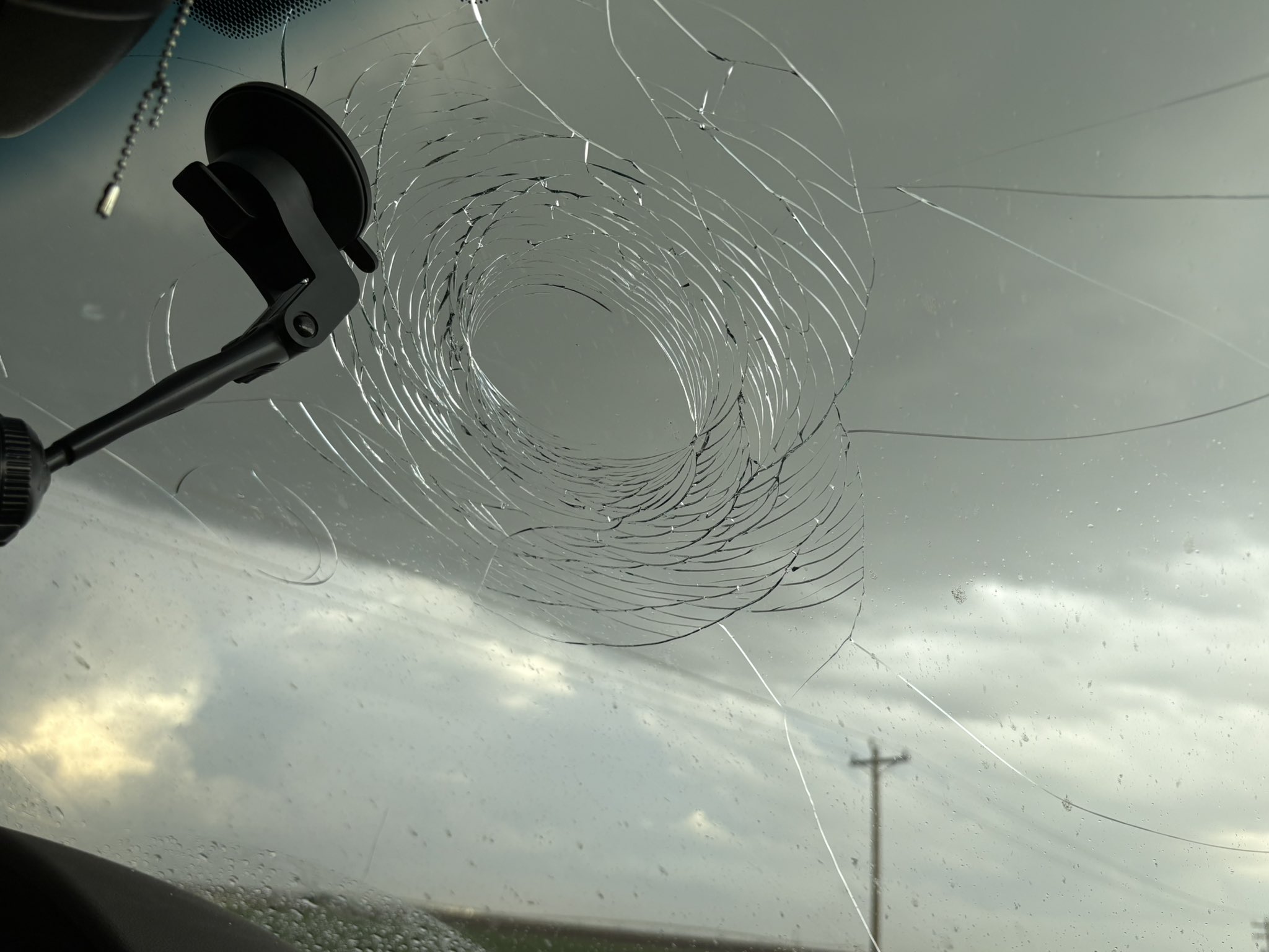
| Not only was the hail copious, in spots, it also became quite large in places too. In fact, hail rivalling the size of baseballs impacted the ground south of Dimmitt Wednesday evening. Wind gusts of 60 to 70+ mph also accompanied the storms, with a peak gust of 79 mph measured at the WTM site east of Silverton. | |
 |
|
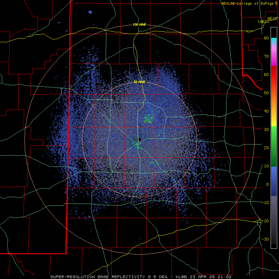
| LBB WSR-88D radar animation valid from 4:02 pm to 10:11 pm on Wednesday (23 April 2025). A additional radar animation, valid from 7:37 pm on Wednesday to 6:28 am on Thursday (23-24 April 2025), can be VIEWED HERE. | |
|
The relatively slow storm motion and intense rain rates also resulted in pockets of very heavy rainfall that induced flash flooding. One report of street flooding was received from Happy, though other locations likely experienced excessive rainfall too. |
|
 |
 |
| Large hail that fell south of Dimmitt on Wednesday evening (23 April 2025). The left picture is courtesy of Mitchell Lazarow and the right picture is courtesy of Rabbit_Is_Good_Rabbit_Is_Wise (@rabbitt_stew_) on X. | |
|
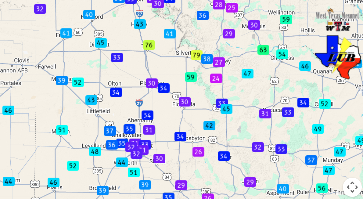
The below graphic shows the peak wind gusts recorded by the WTM on Wednesday (23 April). The strongest winds, in excess of 70 mph, accompanied the cluster of storms that moved across the south-central Texas Panhandle, while many other locations over the southern Panhandle and western South Plains experienced wind gusts near or above 50 mph. |
|
 |
|
| Peak wind gusts measured by the West Texas Mesonet on Wednesday (23 April 2025). | |
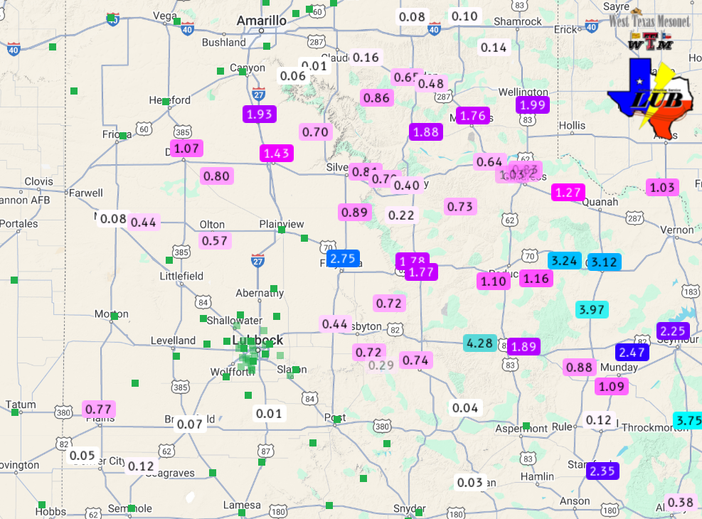
| The 2-day rainfall, although scattered, was very heavy in spots. Several pockets across the southern Texas Panhandle, Rolling Plains and southwest South Plains received 1 to 3+ inches of rainfall, oftentimes over the course of an hour or two. | |
 |
|
| 2-day radar-estimated and biased-corrected precipitation ending at 7 am on Thursday (24 April 2025). Rainfall over this same period, measured by the WTM, can be VIEWED HERE. | |
| The excessive rainfall was more than the ground could absorb in places, and resulted in flooded roadways and swollen playa lakes. | |
 |
|
| Flooded roadway south of East Afton Thursday morning (24 April 2025). The image is courtesy of Matthew McEwen. | |
| Additional pictures captured from the active couple of days of weather can be viewed below. | |
 |
 |
| (Left) Funnel cloud near Kress; (Right) Window damage from giant hail near Hart on Wednesday evening (23 April 2025). The images are courtesy of Darin Martin and Tristan White, respectively. | |
 |
 |
| (Left) Mammatus cloud at sunset form Lubbock and (Right) a supercell near Earth on Wednesday evening (23 April 2025). The images are courtesy of Cole Marvin and Daniel Shaw, respectively. | |
| A list of the preliminary storm reports collected on April 22nd and 23rd can be found below. | |
Preliminary Local Storm Report...Summary
National Weather Service Lubbock TX
141 AM CDT Wed Apr 23 2025

..TIME...   ...EVENT...      ...CITY LOCATION...     ...LAT.LON...
..DATE...   ....MAG....      ..COUNTY LOCATION..ST.. ...SOURCE....
            ..REMARKS..

0525 PM     Hail             8 N Littlefield         34.04N 102.33W
04/22/2025  M1.00 Inch       Lamb               TX   Trained Spotter

            Hockley County spotter.

0602 PM     Hail             12 WNW Lakeview         34.74N 100.89W
04/22/2025  M2.00 Inch       Hall               TX   Storm Chaser

            Estimated from chaser video at Brice.

0604 PM     Tstm Wnd Gst     10 W Lakeview           34.67N 100.87W
04/22/2025  M63 MPH          Hall               TX   Mesonet

            West Texas Mesonet report (Lesley).

0613 PM     Hail             6 NNE Littlefield       34.01N 102.33W
04/22/2025  M1.00 Inch       Lamb               TX   Trained Spotter

            Corrects previous hail report from 6 N
            Littlefield. Reported location was US385 and
            FM37 (Cofferville) Hockley county storm
            team.

0646 PM     Hail             4 N Whitharral          33.80N 102.33W
04/22/2025  E1.00 Inch       Hockley            TX   Public

            Public report via Facebook. Time estimated
            via radar.

0713 PM     Hail             Plains                  33.19N 102.83W
04/22/2025  M1.75 Inch       Yoakum             TX   Public

            Public report relayed through local media.

0735 PM     Hail             2 S Fieldton            34.01N 102.22W
04/22/2025  E1.50 Inch       Lamb               TX   Public

            Report via X/twitter.

0738 PM     Hail             Plains                  33.19N 102.83W
04/22/2025  M1.50 Inch       Yoakum             TX   Public

            Relayed via local media.

0819 PM     Hail             Floydada                33.98N 101.34W
04/22/2025  M0.88 Inch       Floyd              TX   Public

            Accumulating small hail.

0835 PM     Hail             9 SSE Plains            33.07N 102.77W
04/22/2025  M2.00 Inch       Yoakum             TX   Storm Chaser

            Report Via Spotter Network.

0840 PM     Hail             3 N Littlefield         33.96N 102.33W
04/22/2025  E2.50 Inch       Lamb               TX   Public


0850 PM     Hail             1 W Spade               33.93N 102.17W
04/22/2025  E1.75 Inch       Lamb               TX   Trained Spotter

            Hockley County Storm Spotter reported
            accumulating golf ball size hail covering
            the highway.

0850 PM     Hail             Floydada                33.98N 101.34W
04/22/2025  E1.25 Inch       Floyd              TX   Law Enforcement

            Reported by Floyd SO.

1015 PM     Hail             1 SW Crosbyton          33.65N 101.24W
04/22/2025  M1.75 Inch       Crosby             TX   CO-OP Observer

            Time estimated from radar.

1020 PM     Hail             1 N Crosbyton           33.66N 101.24W
04/22/2025  E1.25 Inch       Crosby             TX   Broadcast Media

            Slack message and picture confirmed.

