|
Thunderstorms, widespread rain and heavy snow (3-5 April 2025) 3-5 April 2025 |
|
 |
|
|
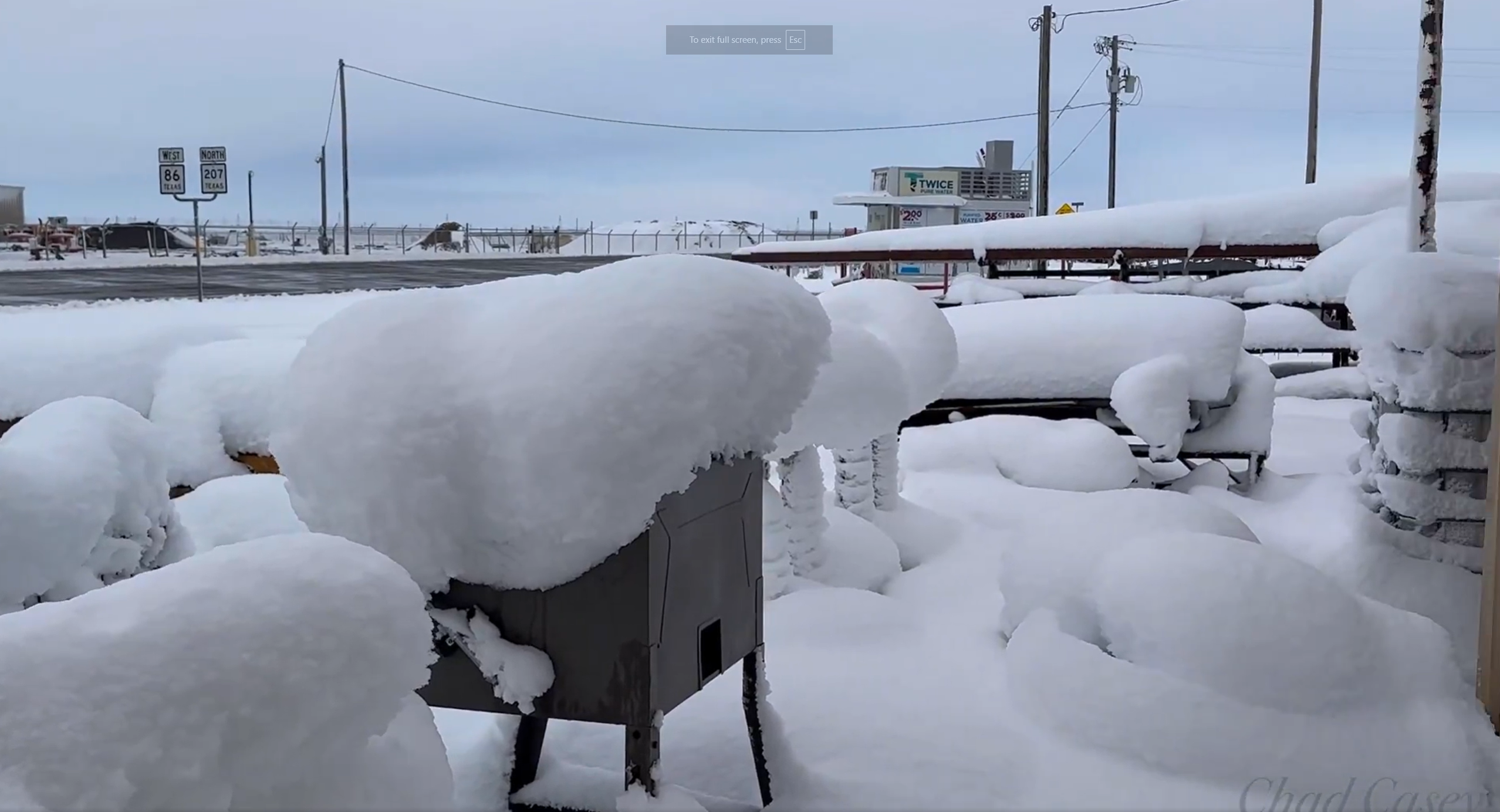
Heavy, wet snow blanketing a homestead in Claytonville on Sunday morning (6 April 2025). The picture is courtesy of Chad Casey. |
|
|
Although fully into the spring season, early April brought a mixture of the seasons. The culprits for the unsettled and changeable weather included two cold fronts, as well a few passing upper level disturbances. The initial cold front passage was fairly uneventful, thanks to very dry air in its immediate wake. However, much richer moisture downstate was gradually was drawn northwestward, ultimately resulting in precipitation across West Texas. |
|
 |
|
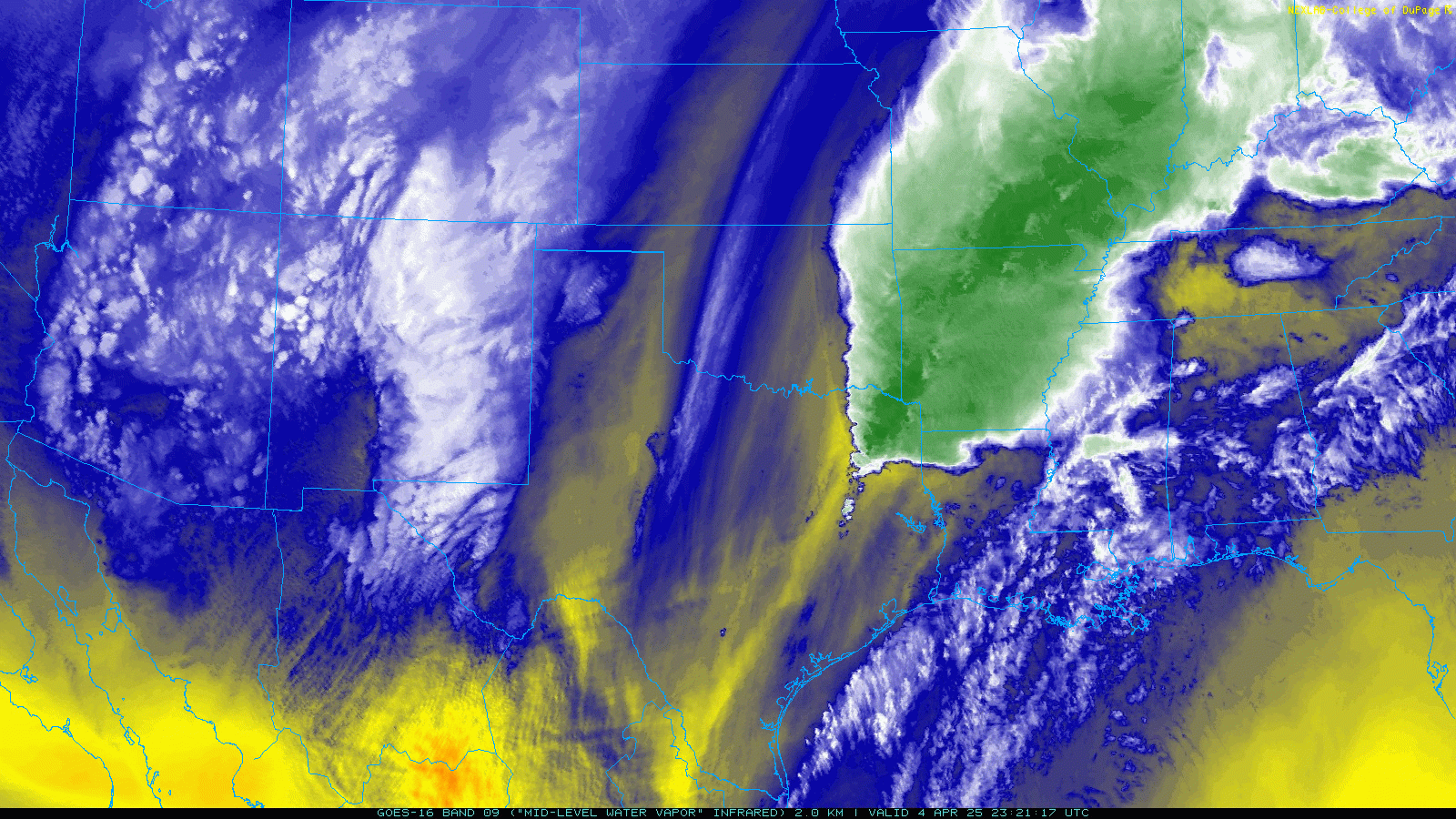
| Water vapor satellite loop valid from 6:21 pm to 11:01 pm on Friday (4 April 2025). | |
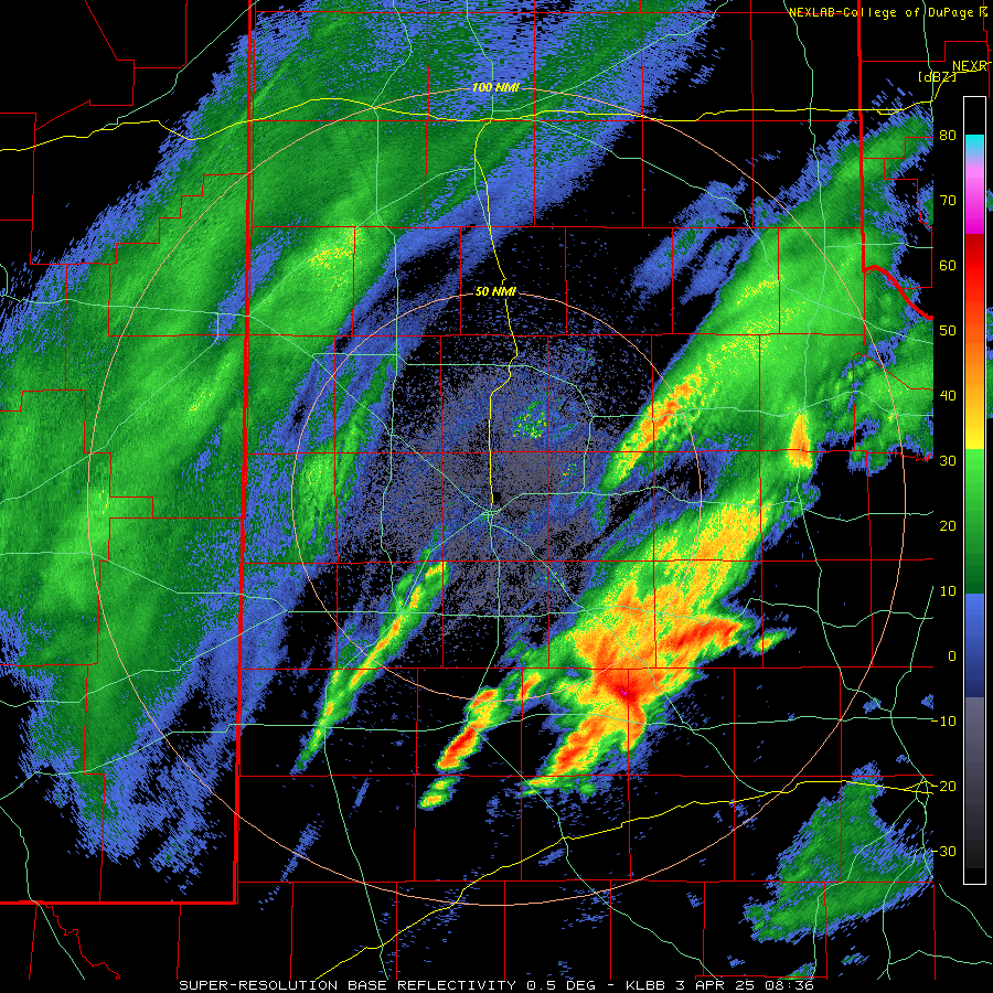
| Strong and persistent lift associated with an intense upper level jet was sufficient to gradually moisten the atmosphere from the top down. In response, a band of light to moderate rain developed from southeast New Mexico through the northwestern South Plains and into the Texas Panhandle Wednesday evening (2 April). Farther southeast, scattered thunderstorms erupted over the Rolling Plains as better moisture and instability moved in aloft early Thursday morning (3 April). A few of these early-day storms became strong to severe as they raced off to the east. | |
 |
|
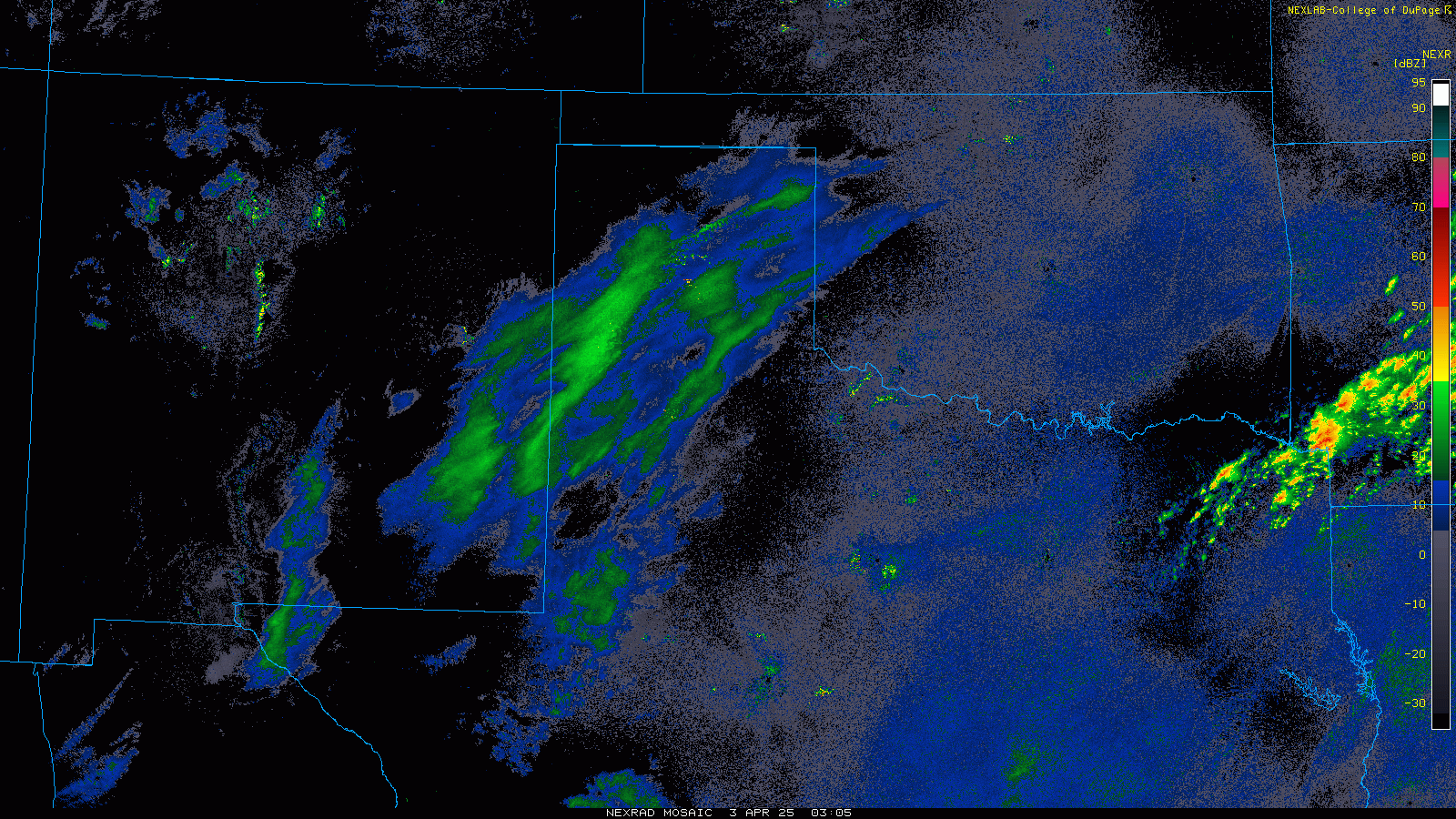
| Regional radar animation valid from 10:05 pm on Wednesday to 8:05 pm on Thursday (2-3 April 2025). A close-up radar animation from the LBB WSR-88D, valid from 3:36 am to 8:14 pm on Thursday (3 April 2025), can be VIEWED HERE. | |
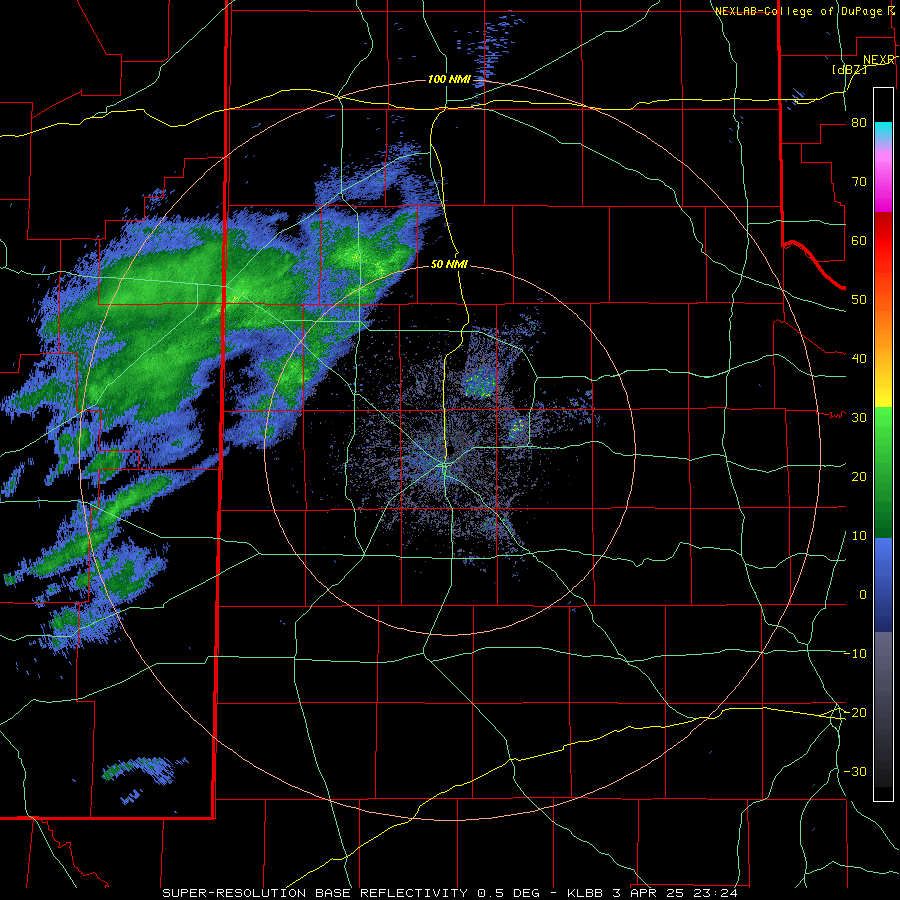
| Most locations experienced a lull in activity Thursday afternoon and evening, followed by another round of rain and thunderstorms early Friday morning (4 April) as the next disturbance emerged above the southern High Plains. Similar to the first round of activity, a couple of the storms over the southern Rolling Plains (and points south and east) were fairly intense. | |
 |
|
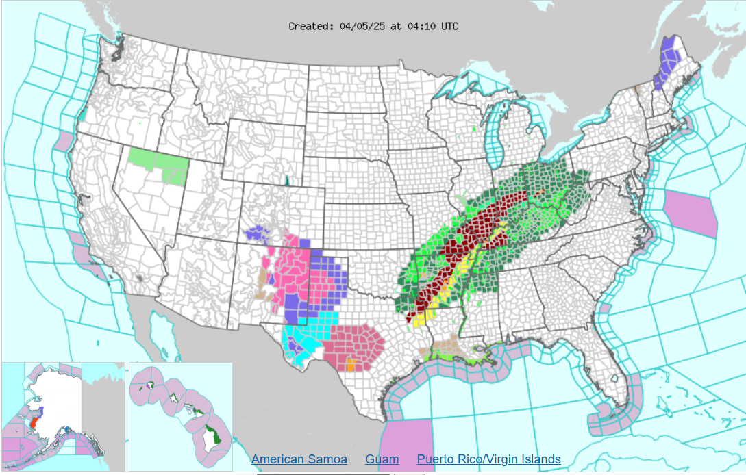
| Watches, Warnings and Advisories (WWA) map at 11:10 pm on Friday (4 April 2025). | |
| Eventually, the primary storm system moved out of the Four Corners, and provided the final round of lift and widespread precipitation for northwest Texas. The system was accompanied by another cold front, which brought gusty north winds and temperatures tumbling into the 30s. The cool rain quickly changed to snow across much of the Caprock Saturday morning (5 April), with snow noted at many locations off the Caprock during the afternoon. | |
 |
|
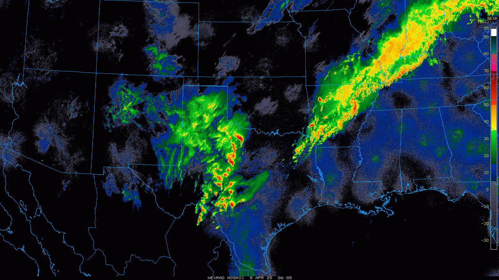
| Regional radar animation valid from 1:05 am to 9:05 am on Saturday (5 April 2025). Close-up radar animations from the LBB WSR-88D can be found at: 6:24 pm on Thursday to 8:41 am on Friday (3-4 April 2025); and 8:34 pm on Friday to 3:07 pm on Saturday (4-5 April 2025). | |
| Where the temperatures were coldest (in the upper 20s and lower 30s) and the snow heaviest, several inches or more of snow accumulated over parts of the northern South Plains into the south-central Texas Panhandle. | |
 |
|
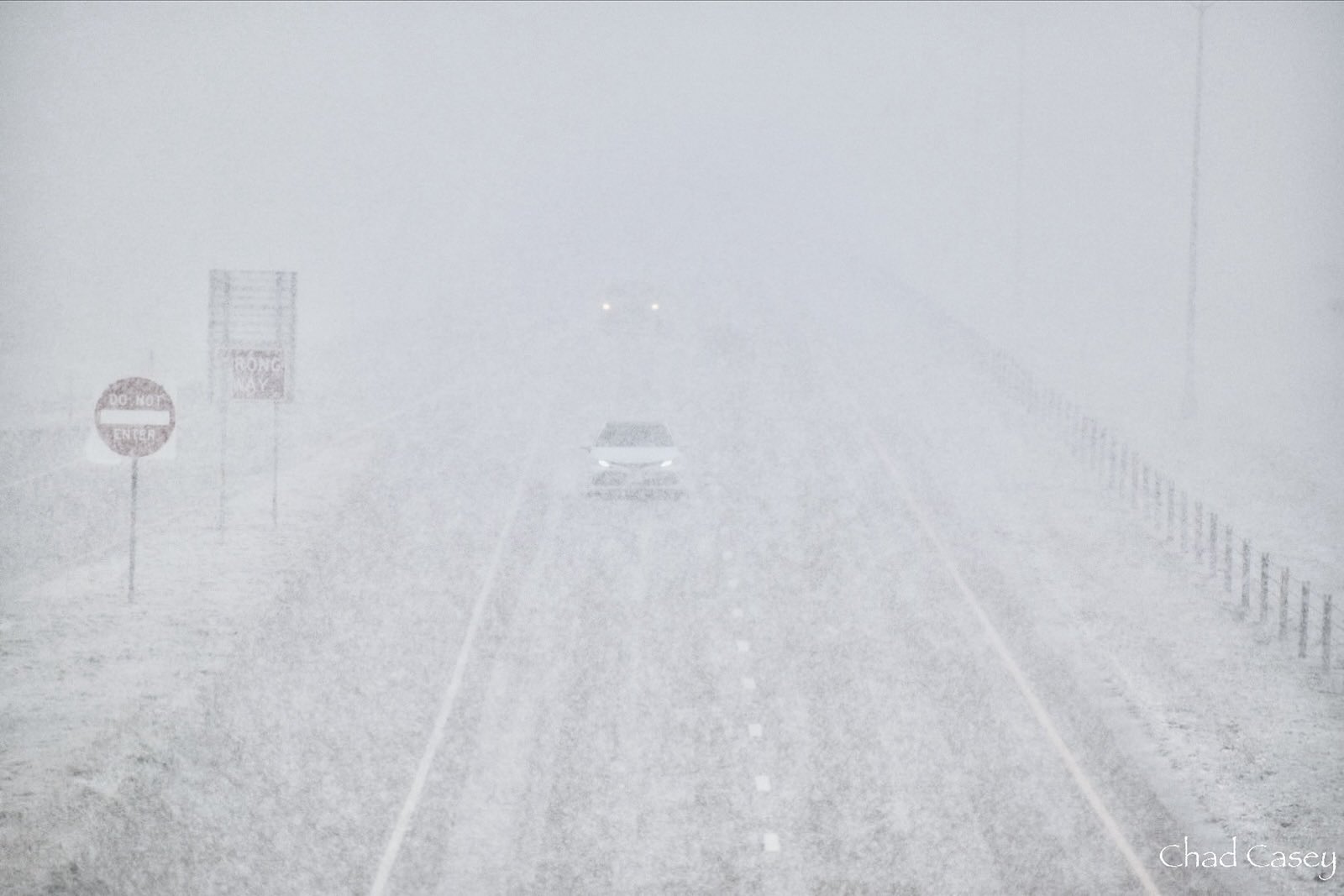
| Near whiteout conditions from heavy snow along I-27, between Abernathy and Plainview, on Saturday (5 April 2025). The picture is courtesy of Chad Casey. | |
|
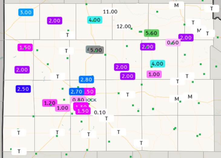
Locations from around Plainview north and northeastward through Tulia, Silverton and Turkey were especially hard hit. Much of this area saw around a half foot of snow or more, including an incredible 12 inches at Silverton! The heavy snow did create travel problems, though thankfully the relatively mild temperatures allowed the roads to recover quickly when the snow intensity waned. |
|
 |
|
| Graphic showing the observed snowfall for the South Plains region on Saturday, 5 April 2025. | |
| Farther south, Lubbock officially measured 1.5 inches of snow on April 5th. This set a new daily snowfall record, easily surpassing the previous record of 0.2 inches, set in 1983. Although not unprecedented, the April snow is rare, with the last measurable April snow recorded on April 10, 2013. This was also only the third time measurable snow was recorded in April at Lubbock since 2000. A more complete list of early and late season snowfall for Lubbock can be FOUND HERE. | |
 |
|
| Graphic showing the record snowfall in Lubbock on Saturday, 5 April 2025. | |
|
The rare late-season snowfall did make for interesting sights, with the wet snow often being plastered to the north side of exposed surfaces, driven by sustained winds of 20 to 30+ mph. |
|
 |
 |
| Pictures captured late Saturday afternoon (5 April 2025) along I-27 near Hale Center (left) and Plainview (right). The pictures are courtesy of TXDOT. | |
|
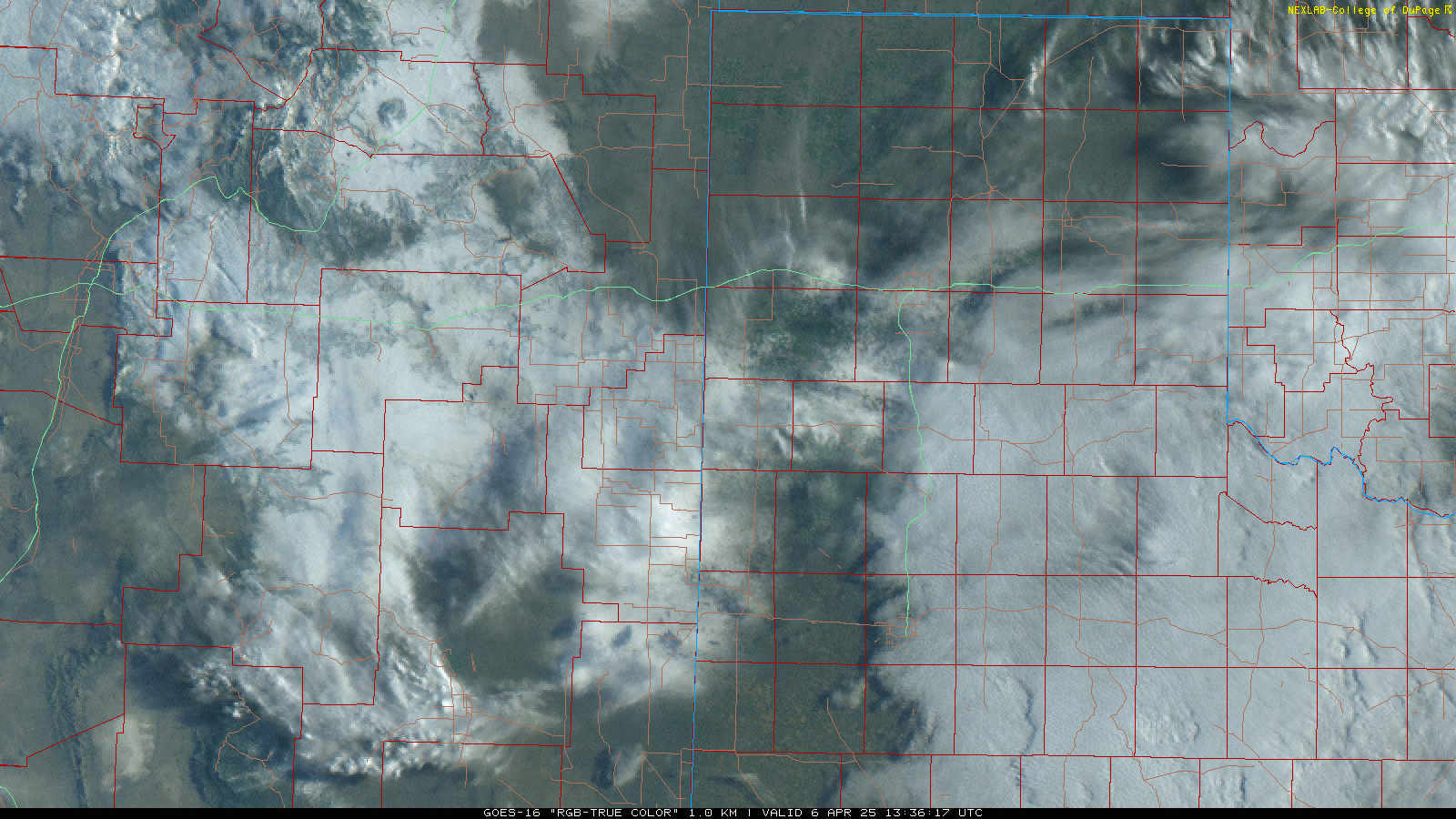
The following day, as clouds cleared, the extent of the snowfall was evident on satellite imagery. Plenty of sunshine and temperatures warming into the 50s caused the snow to melt quickly. However, where the deepest snow existed across the eastern portions of Swisher County and western Briscoe County, the snowpack persisted into Monday (7 April). |
|
 |
|
| "RGB-True Color" satellite loop captured the day after the snow, on Sunday (6 April 2025). | |
| The cool temperatures and gusty north winds did create quite a chill on Saturday, at least by early April standards. Fortunately, at least for those that don't like the cold, the snow quickly melted off as temperatures rebounded in the 50s on Sunday and 60s and lower 70s on Monday. | |
 |
 |
| Temperatures (left) and wind speeds and wind barbs (right) at 3 pm on Saturday (5 April 2025). The data are courtesy of the West Texas Mesonet (WTM). | |
| In addition to the pretty scenes, the heavy snow provided great moisture for the region, which was able to soak slowly into the ground as it melted. | |
 |
|
| Heavy, wet snow blanketing Silverton on Sunday morning (6 April 2025). The picture is courtesy of Chad Casey. | |
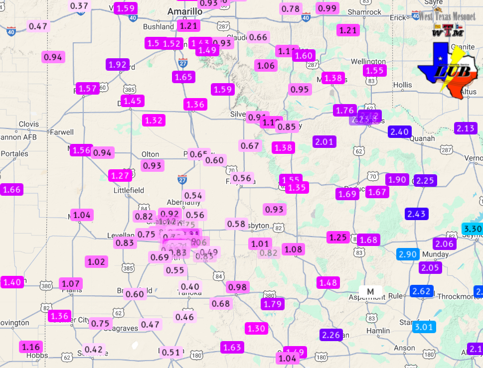
| By the conclusion of this unsettled early April, the rounds of thunderstorms, rain and snow tallied to respectable amounts. One to 2+ inches of liquid (rain and melted snow) was common over the western South Plains and southern Texas Panhandle as well as the Rolling Plains. Amounts were lower, but still generally ranged from a half inch to an inch over the central and eastern South Plains. Officially, the Lubbock Airport measured 0.79 inches of moisture over this active stretch, while Childress had 1.40 inches. | |
 |
|
| 4-day radar-estimated and biased-corrected precipitation ending at 7 am on Monday (7 April 2025). An expanded view of much of the center of the nation can be SEEN HERE. The precipitation totals (rain and melted snow) measured by the WTM can be VIEWED HERE. A close-up of the Lubbock area can be FOUND HERE. | |
| A list of the preliminary snow reports collected on this rare late-season winter event can be found below. | |
Preliminary Local Storm Report...Summary
National Weather Service Lubbock TX
930 AM CDT Sun Apr 6 2025

..TIME...   ...EVENT...      ...CITY LOCATION...     ...LAT.LON...
..DATE...   ....MAG....      ..COUNTY LOCATION..ST.. ...SOURCE....
            ..REMARKS..

0800 AM     Snow             8 NNW Mackenzie Reservo 34.65N 101.50W
04/06/2025  M4.0 Inch        Swisher            TX   CO-OP Observer

            CO-OP Observer station VIGT2 Vigo Park.

0700 AM     Snow             1 NE Tulia              34.55N 101.76W
04/06/2025  M4.0 Inch        Swisher            TX   CO-OP Observer

            CO-OP Observer station TULT2 0.9 NE Tulia.

0730 AM     Snow             3 ENE Tulia             34.56N 101.72W
04/06/2025  M4.0 Inch        Swisher            TX   CO-OP Observer


0700 AM     Snow             3 S Tell                34.34N 100.40W
04/06/2025  M2.0 Inch        Childress          TX   CO-OP Observer

            CO-OP Observer station TEST2 2.8 S Tell.

0730 AM     Snow             3 S Tell                34.34N 100.40W
04/06/2025  M2.0 Inch        Childress          TX   CO-OP Observer


0700 AM     Snow             Shallowater             33.69N 101.99W
04/06/2025  M2.7 Inch        Lubbock            TX   CO-OP Observer

            CO-OP Observer station SHWT2 Shallowater.

0700 AM     Snow             6 NNW Ropesville        33.49N 102.19W
04/06/2025  M1.0 Inch        Hockley            TX   CO-OP Observer

            CO-OP Observer station ROPT2 Ropesville 6
            NNW.

0730 AM     Snow             Roaring Springs         33.90N 100.86W
04/06/2025  M1.0 Inch        Motley             TX   CO-OP Observer

            CO-OP Observer station RORT2 Roaring Springs
            0 S.

0340 PM     Snow             Plainview               34.19N 101.72W
04/05/2025  M3.0 Inch        Hale               TX   Public

            Relayed by KLBK-TV.

0445 PM     Snow             1 WNW Plainview         34.20N 101.74W
04/05/2025  M4.5 Inch        Hale               TX   Public


0730 AM     Snow             2 N Plainview           34.21N 101.72W
04/06/2025  M4.9 Inch        Hale               TX   CO-OP Observer

            CO-OP Observer station PKVT2 1.6 N
            Plainview.

0730 AM     Snow             1 E Plainview           34.19N 101.70W
04/06/2025  M4.9 Inch        Hale               TX   CO-OP Observer


0730 AM     Snow             Morton                  33.72N 102.76W
04/06/2025  M2.5 Inch        Cochran            TX   CO-OP Observer


0800 AM     Snow             Morton                  33.72N 102.76W
04/06/2025  M2.5 Inch        Cochran            TX   CO-OP Observer

            CO-OP Observer station MOOT2 Morton.

0800 AM     Snow             1 NE Matador            34.02N 100.81W
04/06/2025  M4.0 Inch        Motley             TX   CO-OP Observer

            CO-OP Observer station MTDT2 Matador 1 NE.

1200 AM     Snow             4 SSW Lubbock           33.53N 101.88W
04/06/2025  M2.0 Inch        Lubbock            TX   CO-OP Observer

            CO-OP Observer station LUST2 2.7 E Lubbock
            South Plains.

0800 AM     Snow             5 E Wolfforth           33.51N 101.93W
04/06/2025  M1.5 Inch        Lubbock            TX   Cocorahs

            Cocorahs station TX-LK-14 Lubbock 5.3 SSW.

0600 AM     Snow             6 E Wolfforth           33.52N 101.91W
04/06/2025  M1.3 Inch        Lubbock            TX   Cocorahs

            Cocorahs station TX-LK-100 Lubbock 4.7 SSW.

0700 AM     Snow             4 SSW Lubbock           33.53N 101.88W
04/06/2025  M1.8 Inch        Lubbock            TX   Cocorahs

            Cocorahs station TX-LK-21 Lubbock 3.1 S.

0700 AM     Snow             3 NW New Deal           33.77N 101.88W
04/06/2025  M1.5 Inch        Lubbock            TX   Cocorahs

            Cocorahs station TX-LK-48 Lubbock 13.2 N.

0346 PM     Snow             5 SSW Lubbock           33.52N 101.88W
04/05/2025  M1.0 Inch        Lubbock            TX   Official NWS Obs

            Snowboard measurement as of 3 pm.

0553 PM     Snow             5 SSW Lubbock           33.52N 101.88W
04/05/2025  M1.5 Inch        Lubbock            TX   Official NWS Obs

            Snowboard measurement as of 5:45 pm.

0700 AM     Snow             2 SSW Levelland         33.55N 102.38W
04/06/2025  M1.2 Inch        Hockley            TX   CO-OP Observer

            CO-OP Observer station LLLT2 Levelland 2 S.

0730 AM     Snow             1 WNW Levelland         33.59N 102.38W
04/06/2025  M1.2 Inch        Hockley            TX   CO-OP Observer


0822 PM     Snow             Kress                   34.37N 101.75W
04/05/2025  M7.0 Inch        Swisher            TX   Public


0511 PM     Snow             Hale Center             34.06N 101.84W
04/05/2025  M5.0 Inch        Hale               TX   Public


0635 PM     Snow             Hale Center             34.06N 101.84W
04/05/2025  M6.5 Inch        Hale               TX   Public


0700 AM     Snow             1 ENE Friona            34.64N 102.71W
04/06/2025  M3.3 Inch        Parmer             TX   CO-OP Observer

            CO-OP Observer station FRIT2 0.7 E Friona.

0730 AM     Snow             Friona                  34.64N 102.72W
04/06/2025  M3.0 Inch        Parmer             TX   CO-OP Observer


0700 AM     Snow             9 SE Floydada           33.88N 101.25W
04/06/2025  M2.0 Inch        Floyd              TX   CO-OP Observer

            CO-OP Observer station FLDT2 Floydada 9 SE.

0700 AM     Snow             Floydada                33.98N 101.33W
04/06/2025  M2.0 Inch        Floyd              TX   CO-OP Observer

            CO-OP Observer station FYDT2 Floydada.

0730 AM     Snow             Floydada                33.99N 101.33W
04/06/2025  M2.0 Inch        Floyd              TX   CO-OP Observer


0730 AM     Snow             2 ENE Flomot            34.23N 100.96W
04/06/2025  M2.0 Inch        Motley             TX   CO-OP Observer


0800 AM     Snow             2 E Flomot              34.23N 100.96W
04/06/2025  M2.0 Inch        Motley             TX   CO-OP Observer

            CO-OP Observer station FMTT2 1.9 E Flomot.

0730 AM     Snow             1 E Dimmitt             34.55N 102.30W
04/06/2025  M2.0 Inch        Castro             TX   CO-OP Observer


0800 AM     Snow             3 N Dimmitt             34.59N 102.31W
04/06/2025  M2.1 Inch        Castro             TX   CO-OP Observer

            CO-OP Observer station DMMT2 2.6 N Dimmitt.

0721 PM     Snow             Caprock Canyons State P 34.45N 101.07W
04/05/2025  E6.0 Inch        Briscoe            TX   Park/Forest Srvc


0550 PM     Snow             Abernathy               33.84N 101.85W
04/05/2025  M3.5 Inch        Hale               TX   Public


0824 AM     Snow             Abernathy               33.84N 101.85W
04/06/2025  M2.8 Inch        Hale               TX   CO-OP Observer

            CO-OP Observer station ABET2 Abernathy.

0900 AM     Snow             Silverton               34.47N 101.31W
04/06/2025  M12.0 Inch       Briscoe            TX   CO-OP Observer

            Delayed report. Up to 12 inches fell
            Saturday with a 10 inch snow depth as of
            Sunday morning. Snow depth Monday morning is
            3 inches.

1000 AM     Snow             1 WNW Muleshoe          34.23N 102.75W
04/06/2025  M1.5 Inch        Bailey             TX   CO-OP Observer

            1.5 inch total snowfall with 1 inch
            remaining.

1000 AM     Snow             2 NNE Kress             34.40N 101.73W
04/06/2025  E5.0 Inch        Swisher            TX   CO-OP Observer

            Estimated 4 to 5 inches fell yesterday.

