|
Heavy snow targets the southern Texas Panhandle & northern Rolling Plains |
|
 |
|
|
Heavy wet snow blanketing the trees and roadways near Turkey Saturday evening (8 March 2025). The picture is courtesy of Blake Brown. |
|
|
A slow-moving upper level low emerged from New Mexico and passed slowly across the South Plains region on Saturday (8 March 2025). In tandem, a cold front moved through the region late Friday night, dropping temperatures into the 30s and lower 40s. Lift along and immediately behind the front triggered showers and a few thunderstorms over the southern Rolling Plains early Saturday morning. |
|
 |
|
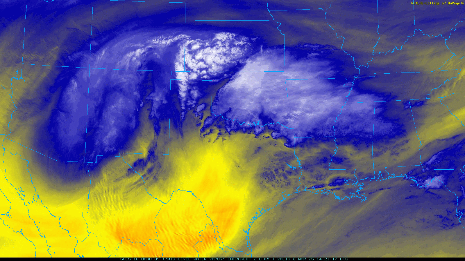
| Water vapor satellite loop valid from 8:21 am to 8:11 pm on Saturday (8 March 2025). | |
| Initially, the air moving in behind the pre-dawn cold front was lacking in low-level moisture. This tended to limit both the coverage and intensity of the precipitation through Saturday morning. However, moisture gradually increased throughout the day as lift persisted ahead of and north of the slow-moving low. This led to precipitation expanding in coverage and intensity, primarily over the southern Texas Panhandle and northern Rolling Plains, Saturday afternoon and evening. | |
 |
|
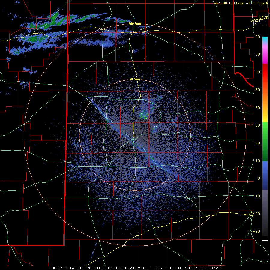
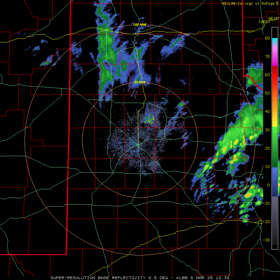
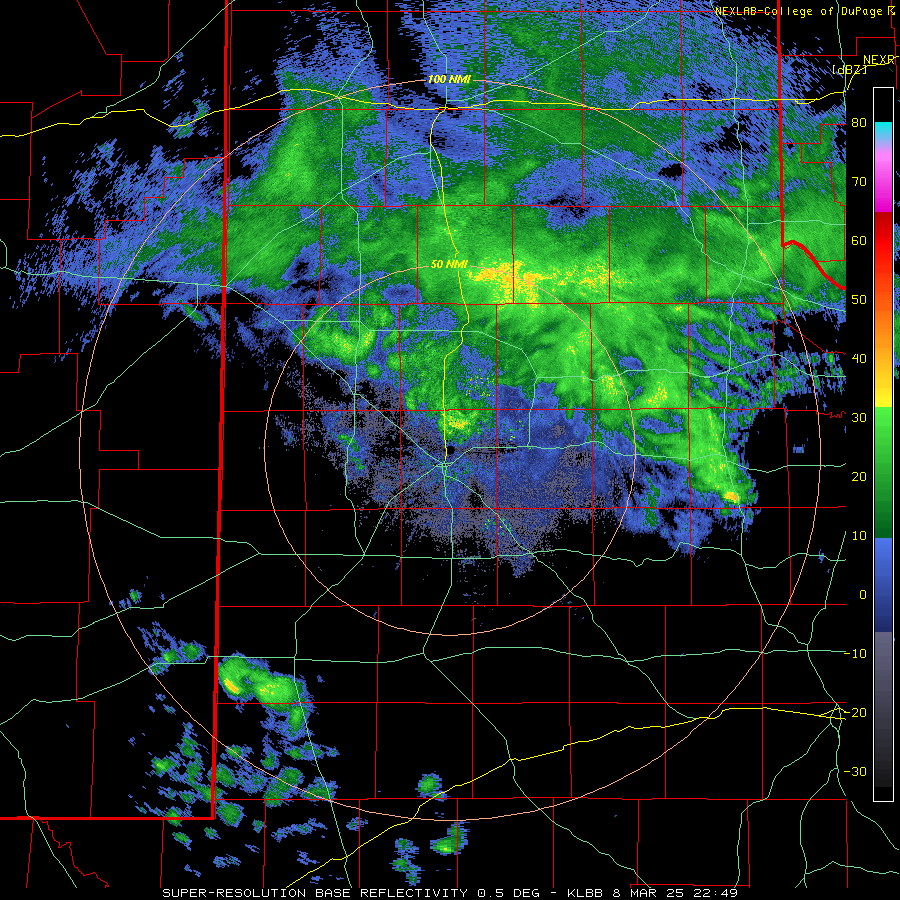
| Lubbock WSR-88D radar animation valid from 3:05 pm to 5:29 pm on Saturday (8 March 2025). Additional radar animations can be found at: 10:36 pm on March 7th to 6:43 am on March 8th; 6:38 am to 2:38 pm on March 8th; and 4:49 pm on March 8th to 8:57 am on March 9th. | |
| Although temperatures started out mild enough to support a cold rain over the southeast Texas Panhandle and northern Rolling Plains, the persistent and increasingly intense precipitation was sufficient to gradually cooled the low-levels just enough to result in a switchover to snow in may spots. | |
 |
|
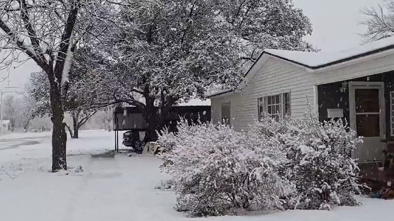
| Snow blanketing the homestead in Childress Saturday evening (8 March 2025). The picture is courtesy of Kyle Davies. | |
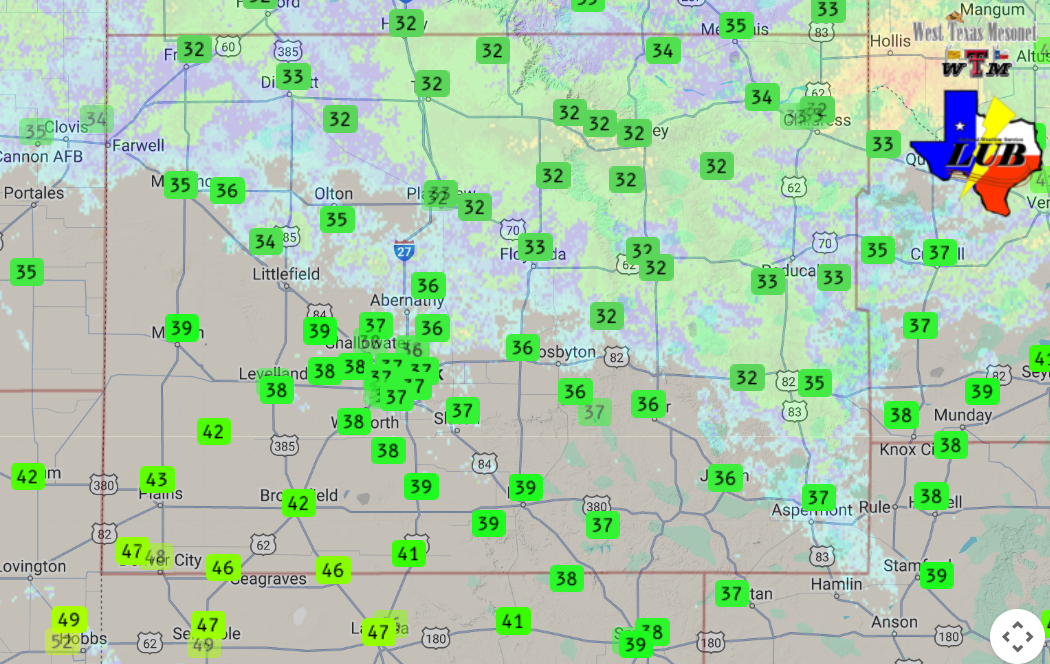
| As the below map shows, temperatures generally resided at or just above the freezing mark Saturday evening, even as snow fell. These "marginal" temperatures resulted in a lot of melting once the snow made it to the ground. As a result, most roadways remained wet, but during periods of moderate to heavy snow, the snow and slush did accumulate, even on the roads. | |
 |
|
| Temperatures and radar imagery valid at 5:30 pm on Saturday (8 March 2025). The data are courtesy of the West Texas Mesonet. | |
| The below images show the accumulation of snow and slush on the roadways around Childress during a period of moderate to heavy snow Saturday evening. The slushy and in places snow-covered roads did create hazardous travel in spots. | |
 |
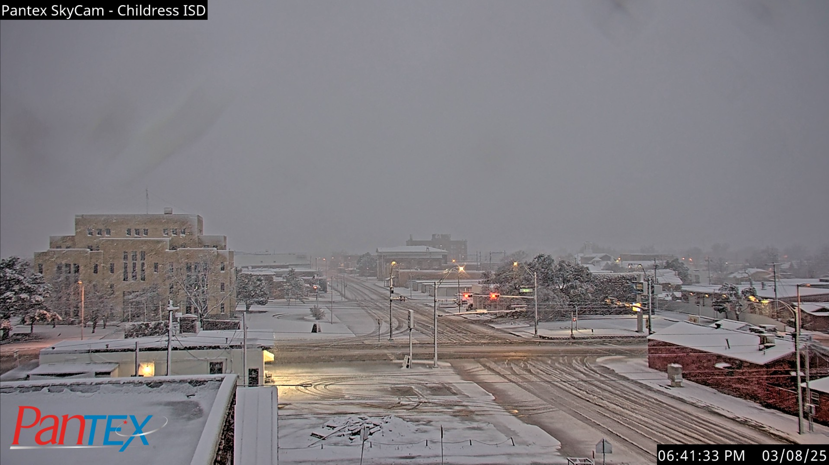 |
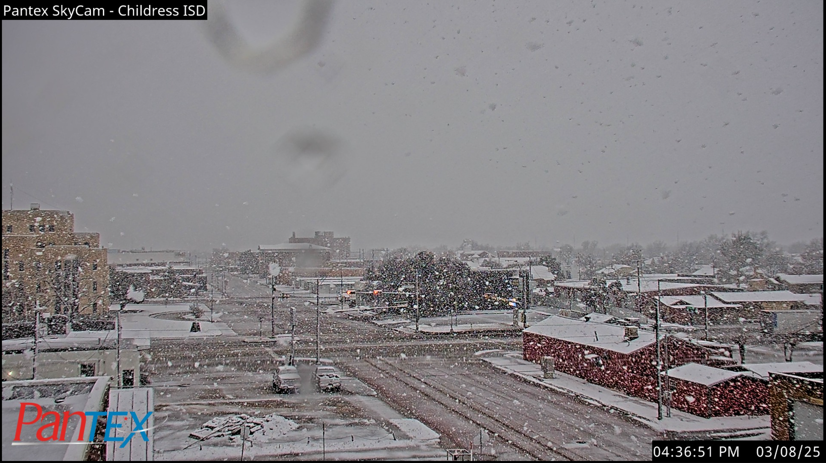
| Snow falling in Childress at 4:37 pm (left) and 6:42 pm (right) on Saturday (8 March 2025). The images are courtesy of Pantex. | |
|
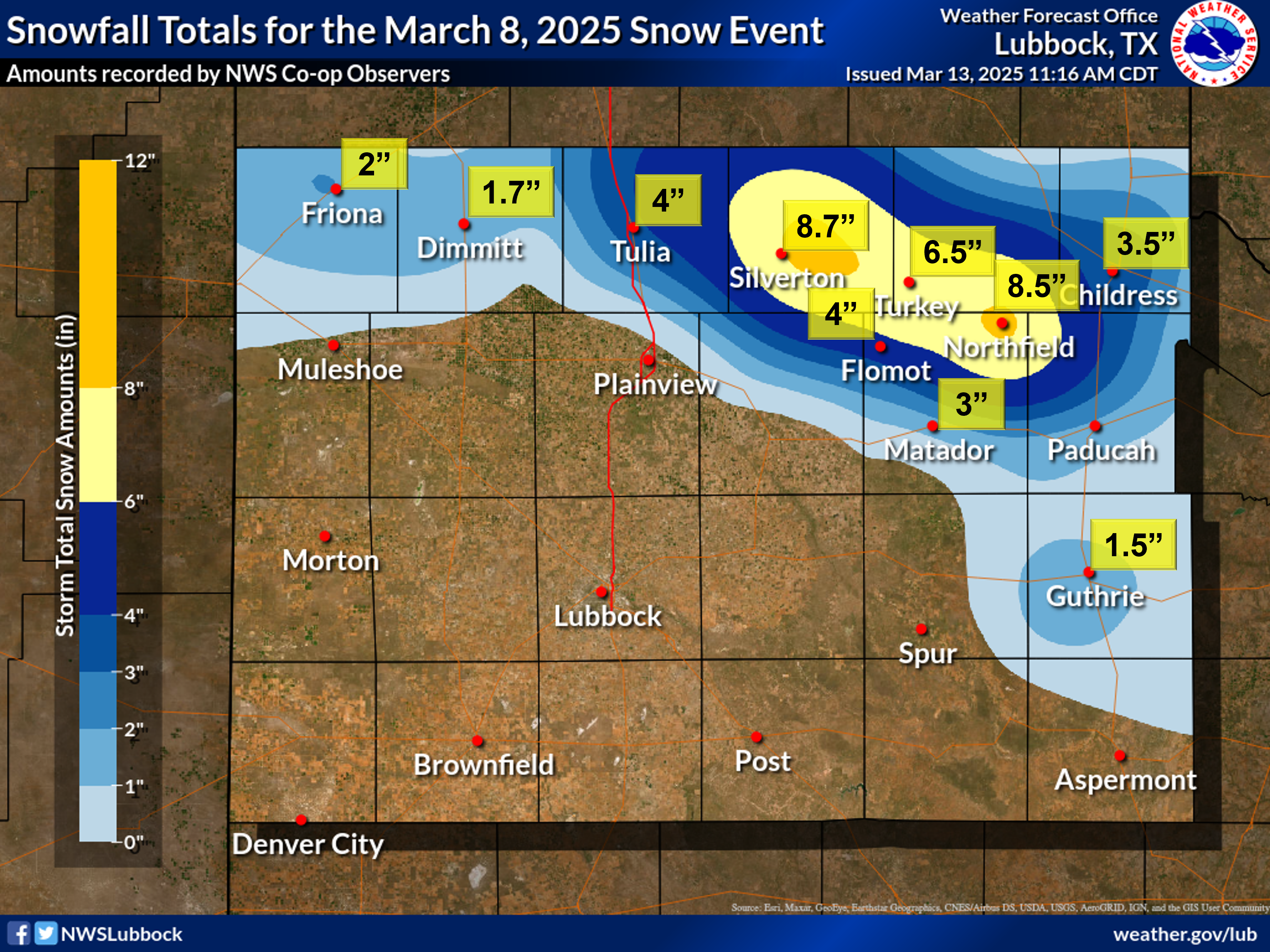
Where the heaviest band of snow setup and persisted the longest, a swath of 2 to 4+ inches of snow accumulated from the south-central Texas Panhandle into the northern Rolling Plains. Locations in and around Silverton, Turkey and Northfield were hardest hit, picking up an impressive 6 to 8+ inches before the precipitation came to an end late Saturday night. |
|
 |
|
| Map showing the snowfall reports received on March 8th and 9th, 2025. | |
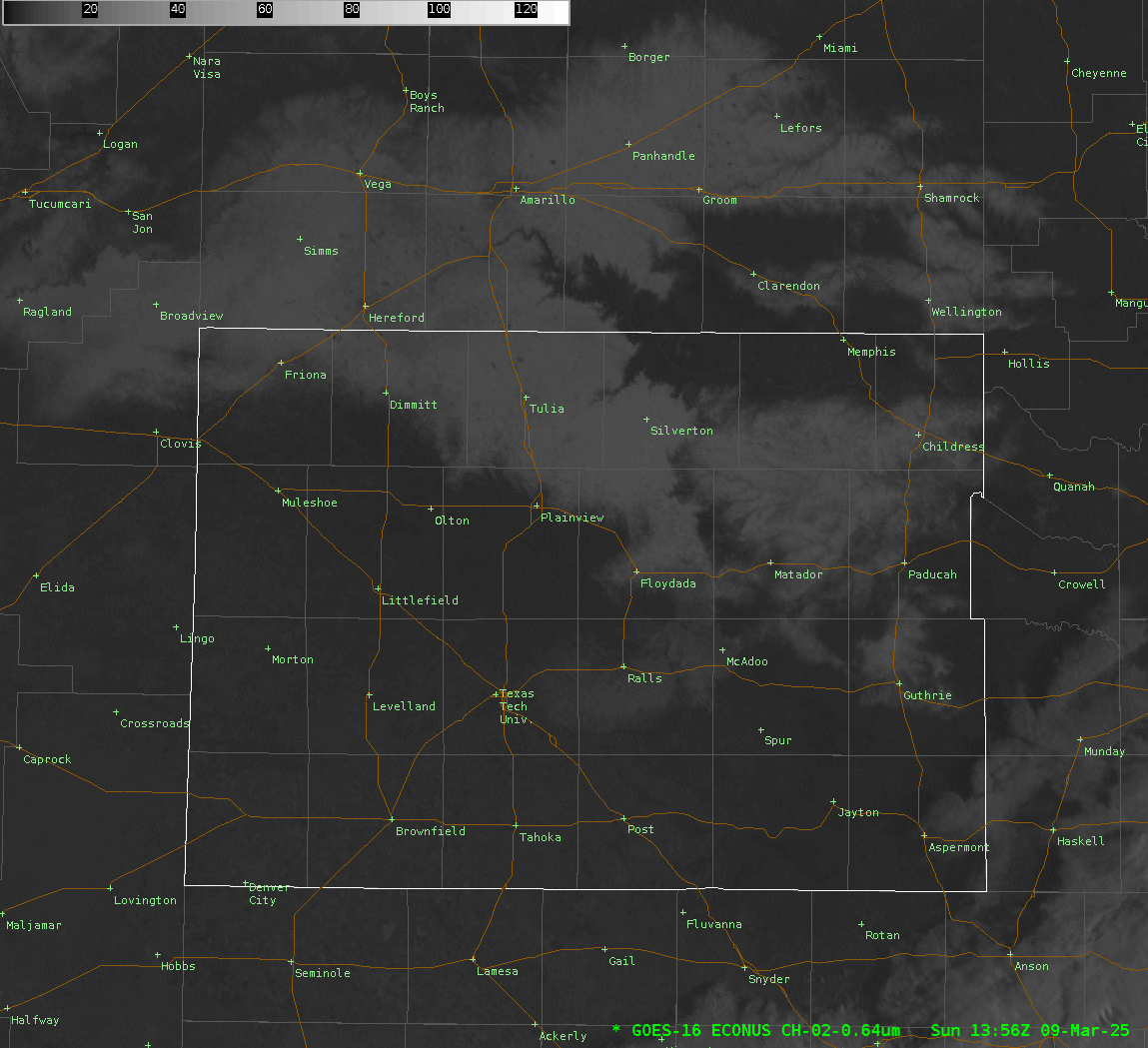
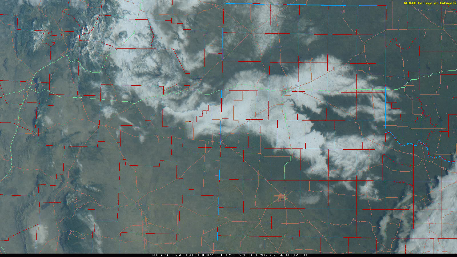
| The visible satellite imagery the next morning clearly showed where the heavy snow had fallen and accumulated. Mild temperatures and full sunshine quickly melted off the snow during the day Sunday, though where the heaviest snow fell, the final shreds didn't completely melt away until Monday morning. | |
 |
|
| Visible satellite loop valid from 8:56 am to 1:16 pm on Sunday (9 March 2025). A regional satellite loop on Sunday can be VIEWED HERE. | |
|
Almost as impressive, the satellite imagery shows where lesser amounts of snow accumulated, particularly from the lower elevations of Palo Duro Canyon through the Red River Valley of northern Hall and Childress Counties. Here, the slightly lower elevations and minimally "warmer" temperatures were enough to greatly limit snow accumulations, despite impressive precipitation totals. |
|
 |
|
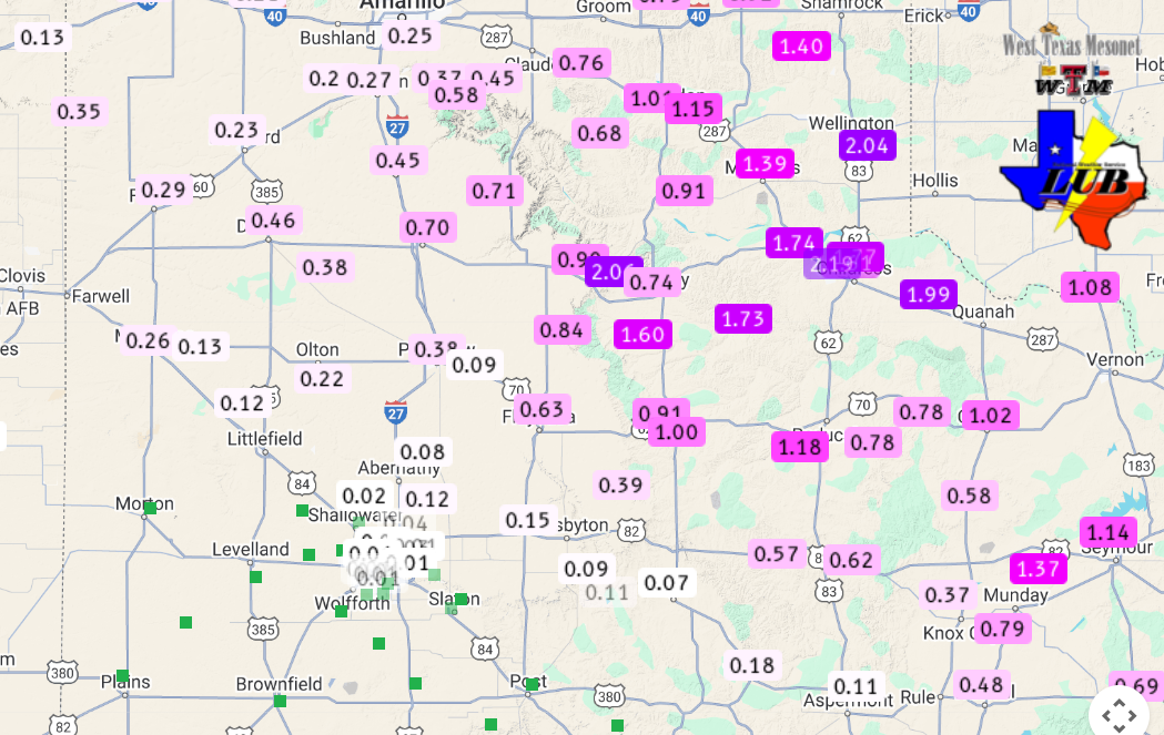
| Total precipitation (rain and melted snow) measured by the West Texas Mesonet over the early March event. | |
|
Altogether, between the cold rain and heavy wet snow, the southern Texas Panhandle, northeast South Plains and northern and central Rolling Plains picked up some welcome and beneficial moisture. This included an incredible 1 to 2+ inches of liquid in and around Silverton, Northfield and Childress. |
|
 |
|
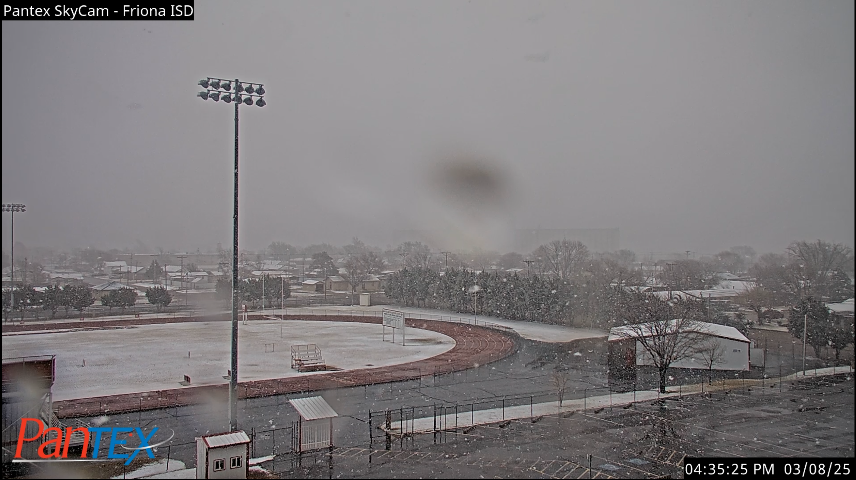
| Snow falling in Friona at 4:35 pm on Saturday (8 March 2025). The image is courtesy of Pantex. | |
|
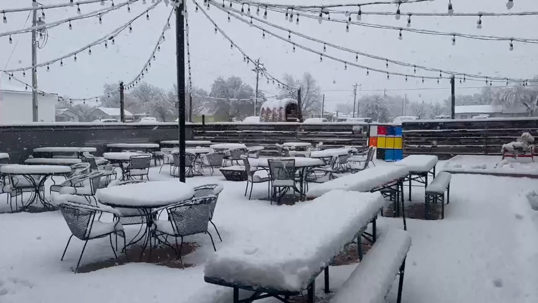
Above and below are a couple of additional pictures of the snow captured during the snow Saturday evening. |
|
 |
|
| Heavy wet snow covering Turkey, Texas, Saturday evening (8 March 2025). The picture is courtesy of Blake Brown. | |
| The preliminary snow reports collected during the early March event can be found below: | |
Preliminary Local Storm Report...Summary
National Weather Service Lubbock TX
354 PM CDT Sun Mar 9 2025

..TIME...   ...EVENT...      ...CITY LOCATION...     ...LAT.LON...
..DATE...   ....MAG....      ..COUNTY LOCATION..ST.. ...SOURCE....
            ..REMARKS..

0454 PM     Snow             3 ENE Tulia             34.56N 101.72W
03/08/2025  E1.0 Inch        Swisher            TX   CO-OP Observer

            Snowfall so far as of late afternoon
            Saturday. Moderate to heavy snow still
            falling at time of report, visibility about
            1/2 mile.

0459 PM     Snow             1 ENE Dimmitt           34.55N 102.30W
03/08/2025  E2.0 Inch        Castro             TX   Law Enforcement

            Castro County Sheriff reports about 2 inches
            of snowfall so far as of late afternoon
            Saturday. Moderate snow still falling at
            time of report.

0507 PM     Snow             Friona                  34.64N 102.72W
03/08/2025  E2.0 Inch        Parmer             TX   Law Enforcement

            Corrects previous snow report from Friona.
            Up to two inches of snow accumulation
            reported in Friona as of late afternoon
            Saturday. Light to moderate snow still
            falling at time of report, but PD reports
            roads are still just wet.

0530 PM     Snow             4 NNE Tell              34.44N 100.37W
03/08/2025  E3.0 Inch        Childress          TX   Public

            Several inches of snow reported just west of
            Childress as of late afternoon Saturday.
            Heavy snow still falling at time of report.

0532 PM     Snow             Childress               34.43N 100.20W
03/08/2025  E2.0 Inch        Childress          TX   Public

            Webcam shows at least a couple of inches of
            snowfall so far in downtown Childress as of
            late afternoon Saturday. Moderate snow still
            falling at time of report with some light
            snow accumulation observed on roadways.

0540 PM     Snow             Caprock Canyons State P 34.44N 101.07W
03/08/2025  E2.0 Inch        Briscoe            TX   Park/Forest Srvc

            Snowfall so far as of early evening
            Saturday. Heavy snow still falling at time
            of report with dirt roads reported to be
            snow-covered.

0604 PM     Snow             Childress               34.43N 100.21W
03/08/2025  M3.5 Inch        Childress          TX   Broadcast Media

            Snowfall so far as of early evening
            Saturday. Measured on top of a vehicle.
            Light snow still falling at time of report.

0641 PM     Snow             Turkey                  34.39N 100.89W
03/08/2025  E3.5 Inch        Hall               TX   Broadcast Media

            Photo shows between 3 and 4 inches of snow
            accumulation on outdoor furniture in Turkey.

0900 AM     Snow             7 NW Childress          34.52N 100.29W
03/09/2025  M3.0 Inch        Childress          TX   CO-OP Observer

            Storm total snowfall. Lots of melting and
            compaction reduced accumulation efficiency.

0900 AM     Snow             1 ESE Dimmitt           34.55N 102.30W
03/09/2025  M1.7 Inch        Castro             TX   CO-OP Observer

            Storm total snowfall. Paved surfaces remain
            clear.

0900 AM     Snow             2 E Flomot              34.23N 100.96W
03/09/2025  M4.0 Inch        Motley             TX   CO-OP Observer

            Storm total snowfall.

0900 AM     Snow             Friona                  34.64N 102.72W
03/09/2025  M2.0 Inch        Parmer             TX   CO-OP Observer

            Storm total snowfall.

0900 AM     Snow             15 S Paducah            33.82N 100.31W
03/09/2025  M3.0 Inch        King               TX   CO-OP Observer

            Storm total snowfall.

0900 AM     Snow             Guthrie                 33.63N 100.34W
03/09/2025  M1.5 Inch        King               TX   CO-OP Observer

            Storm total snowfall. Paved surfaces remain
            clear.

0900 AM     Snow             1 W Kirkland            34.39N 100.09W
03/09/2025  M3.5 Inch        Childress          TX   CO-OP Observer

            Storm total snowfall.

0900 AM     Snow             1 NE Matador            34.03N 100.81W
03/09/2025  M3.0 Inch        Motley             TX   CO-OP Observer

            Corrects previous snow report from 1 NE
            Matador. Storm total snowfall.

0900 AM     Snow             10 S Paducah            33.88N 100.38W
03/09/2025  M2.0 Inch        Cottle             TX   CO-OP Observer

            Storm total snowfall.

0900 AM     Snow             5 E Silverton           34.46N 101.22W
03/09/2025  E4.0 Inch        Briscoe            TX   Cocorahs

            Storm total snowfall.

0900 AM     Snow             3 S Tell                34.34N 100.40W
03/09/2025  M3.0 Inch        Childress          TX   CO-OP Observer

            Storm total snowfall.

0900 AM     Snow             Tulia                   34.54N 101.77W
03/09/2025  E4.0 Inch        Swisher            TX   Broadcast Media

            Storm total snowfall.

0900 AM     Snow             3 ENE Tulia             34.56N 101.72W
03/09/2025  M3.0 Inch        Swisher            TX   CO-OP Observer

            Storm total snowfall.

0900 AM     Snow             Vigo Park               34.65N 101.51W
03/09/2025  M3.0 Inch        Swisher            TX   CO-OP Observer

            Storm total snowfall.

