|
Intense wind, critical fire weather, blowing dust & rain/snow blast West Texas |
|
 |
|
|
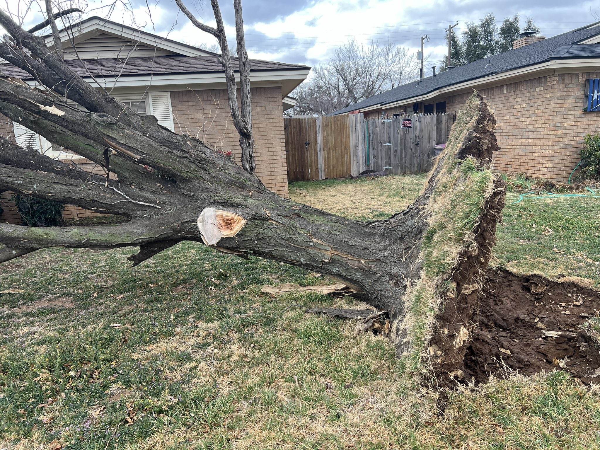
Uprooted tree in Lubbock Tuesday morning (4 March 2025). The picture is courtesy of EricWTxWX on X. |
|
|
Mother Nature sure received the memo that the calendar had turned to March, as it roared in like a lion. To be fair, the first day of March was quite pleasant, with light winds and temperatures in the middle to upper 70s. However, that changed by the second day of the month, as a small but potent storm system emerged from Desert Southwest and tracked across the southern Texas Panhandle. |
|
 |
|
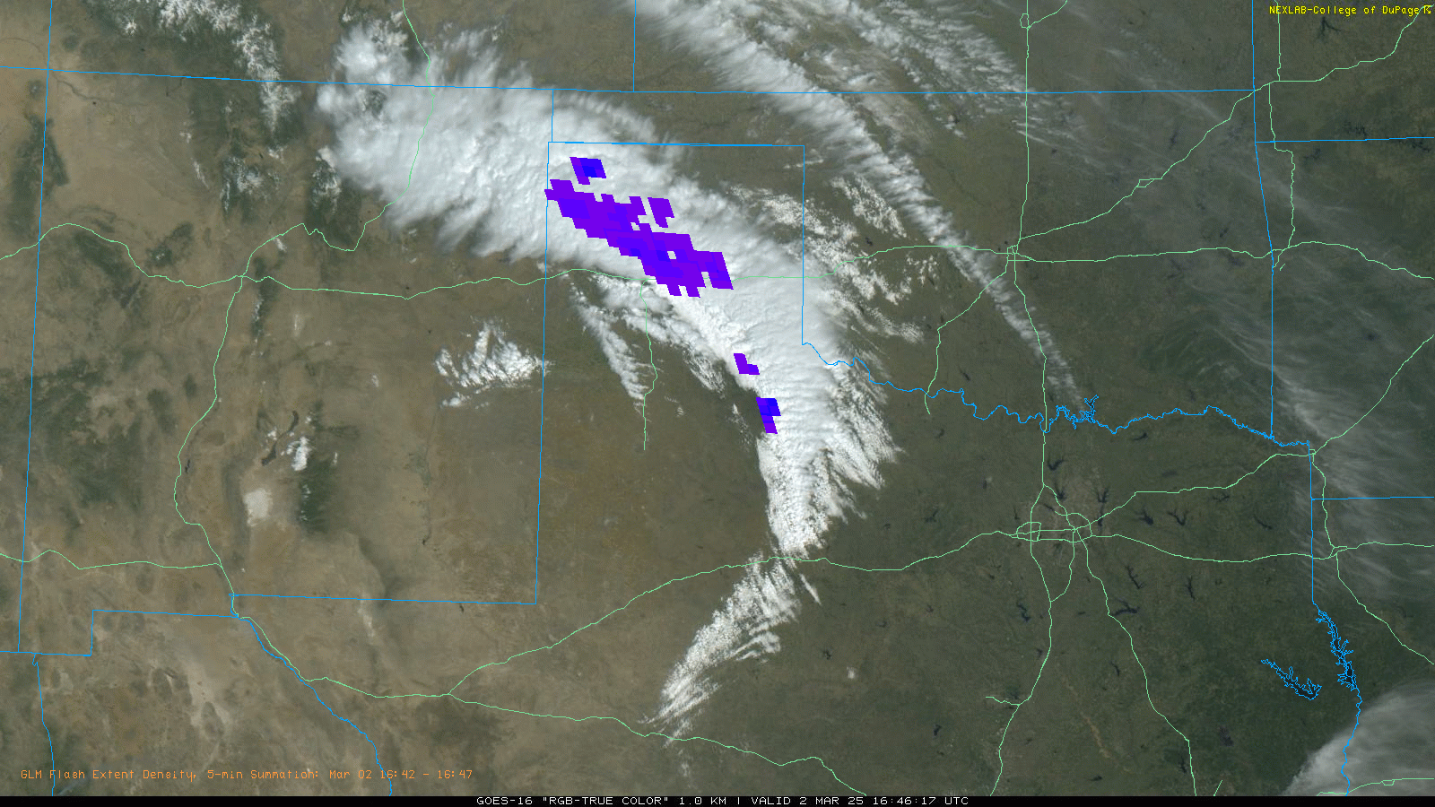
| "RGB-True Color" satellite loop valid from 10:56 am to 4:46 pm on Sunday (2 March 2025). Lightning data (GLM), as sensed from satellite, is also plotted on top of the clouds. | |
| Gulf moisture was not abundant, but when coupled with the strong lift immediately ahead of the system, it was able to generate a broken line of showers and thunderstorms across the northeast South Plains Sunday morning (2 March). This line advanced quickly eastward, and was followed by scattered thunderstorms over this same general area Sunday afternoon. In fact, there was enough instability to allow a few of the storms to become strong to severe. One of the more intense storms dropped around a half inch of rain, while covering the ground with hail, mostly pea to marble size, in and around Kirkland. | |
 |
|
| Lubbock WSR-88D radar animation valid from 7:45 am to 1:42 pm on Sunday (2 March 2025). 24-hour rainfall, ending at 7:30 pm on the 2nd, can be VIEWED HERE and HERE. | |
| South of the track of the upper low, the main impact was the wind, which really ramped up over the central and southern South Plains into the Rolling Plains. Wind gusts of 40 to 50+ mph were common Sunday afternoon, which even kicked up a little dust | |
 |
|
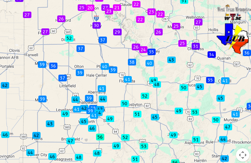
| Peak wind gusts measured on Sunday (2 March 2025). The data are courtesy of the West Texas Mesonet (WTM). | |
| This first round of wind served as foreshadowing to a more significant storm system following quickly on the heels of Sunday's. After a brief reprieve Sunday night into Monday morning, the much larger and more intense mid-upper level system began to emerge from the Intermountain West. | |
 |
|
| Water vapor satellite loop valid from 1:06 pm to 6:56 pm on Monday (3 March 2025). | |
| Despite considerable cloud cover, winds gradually increased through Monday afternoon, particularly across the western Texas Panhandle and western South Plains, where wind gusts of 55 to 65+ mph were common. | |
 |
|
| "RGB-True Color" satellite loop valid from 12:01 pm to 5:56 pm on Monday (3 March 2025). | |
|
The intense wind lofted copious amounts of blowing dust, primarily originating from northern Mexico, Far West Texas and southeastern New Mexico. This dust was carried over the TX/NM line, dropping the visibility to a few miles or lower late Monday afternoon into Monday evening. |
|
 |
|
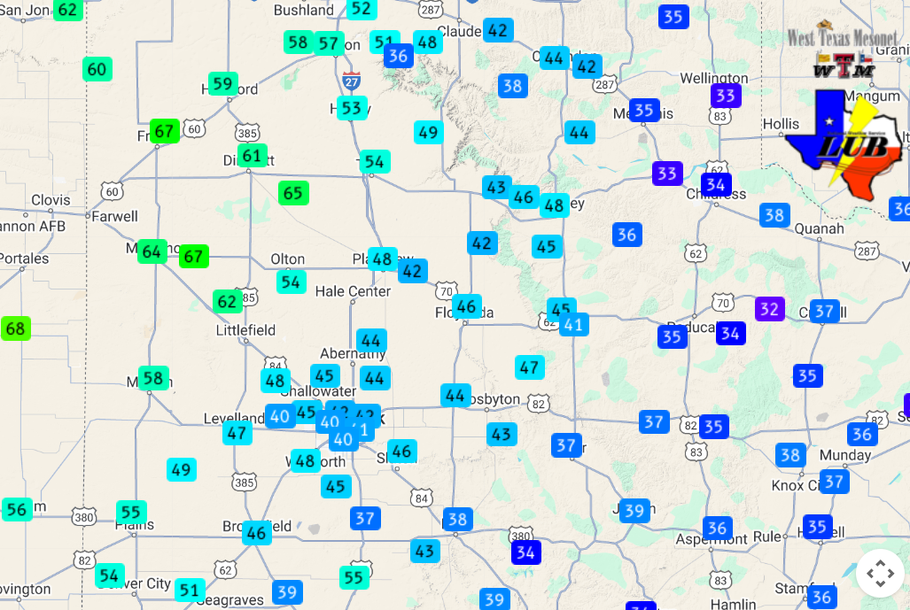
| Peak wind gusts measured on Monday (3 March 2025). The data are courtesy of the West Texas Mesonet (WTM). | |
| Conditions improved somewhat overnight, though the winds remained solidly breezy to low-end windy through the night. Conditions took a turn for the worse toward daybreak Tuesday (4 March) as the dynamic storm system emerged over the High Plains. Winds increased quickly, jumping to 45 to 55+ mph around daybreak, then ventured even higher through the morning and into the early-midafternoon hours. | |
 |
|
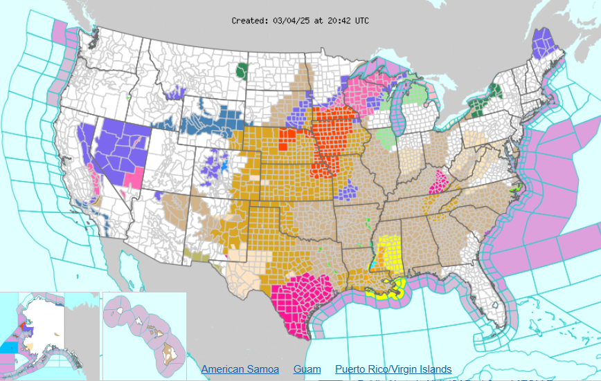
| National Watch, Warning and Advisory map valid Tuesday afternoon (4 March 2025). | |
|
Impacts from this weather system were not only felt locally, but encompassed most of the center of the nation, as the above graphic depicts. Intense winds were experienced from much of the High Plains all the way into the Carolinas. The system even sparked severe thunderstorms from eastern Oklahoma and East Texas into the southern Mississippi River Valley, including several tornadoes. Farther north, where temperatures were colder, a blizzard unfolded over portions of the Upper Midwest into the western Great Lakes. |
|
 |
|
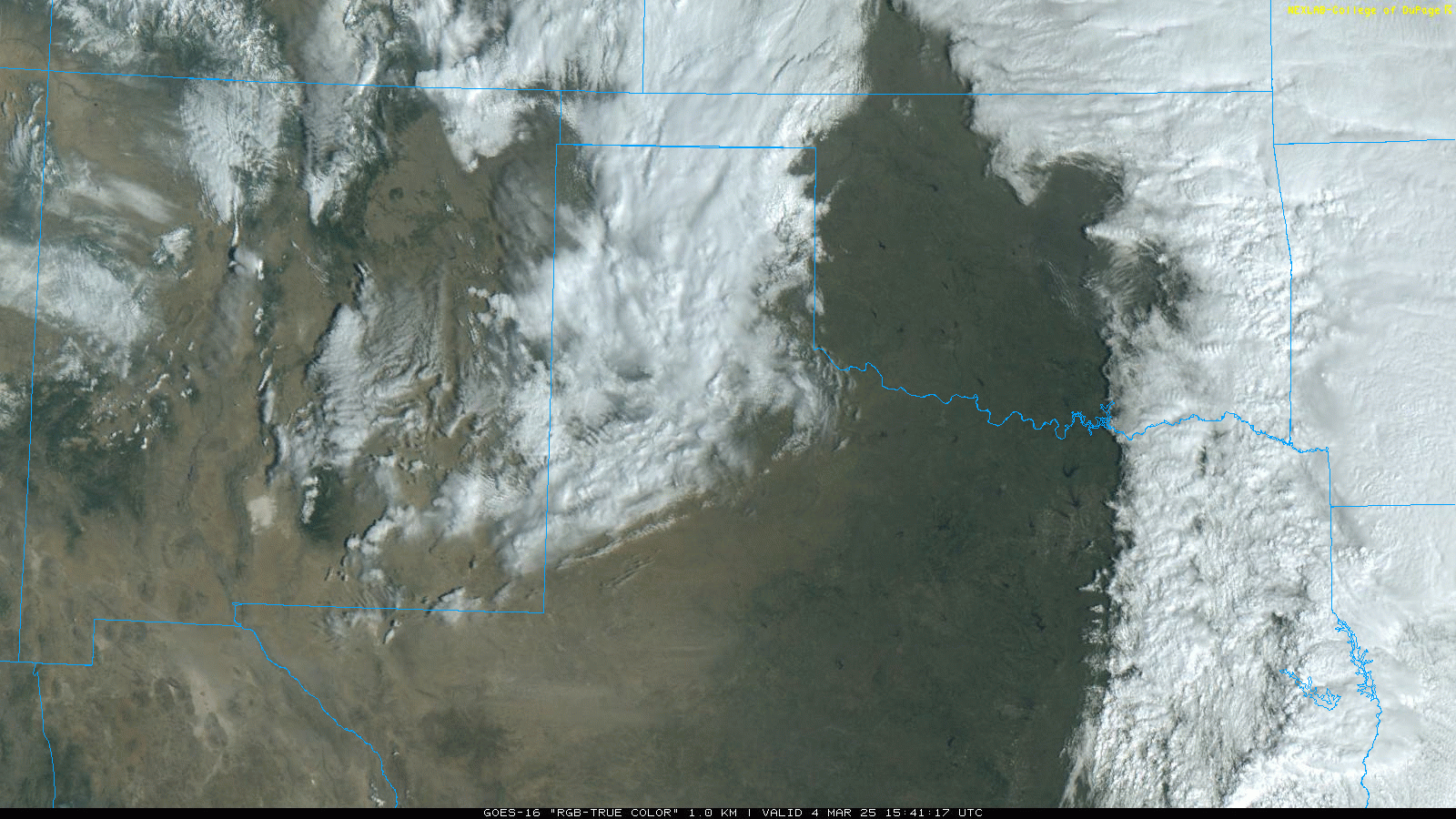
| "RGB-True Color" satellite loop valid from 9:41 am to 1:21 pm on Tuesday (4 March 2025). | |
|
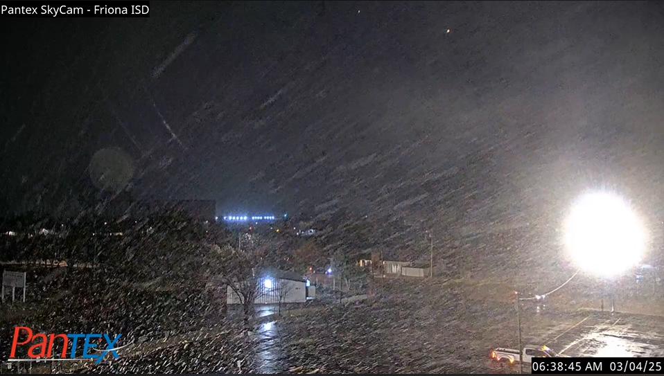
The initial round of intense winds, as high as 55 to 65 mph, were along and immediately in advance of a band of precipitation racing southeastward from the western Texas Panhandle into the northern and central South Plains. Where temperatures were coolest, a burst of snow impacted locations in and around Friona, Dimmitt and Hart. Even though temperatures remained just above freezing, a coating of snow quickly covered grassy spots, though it didn't hang around long. |
|
 |
|
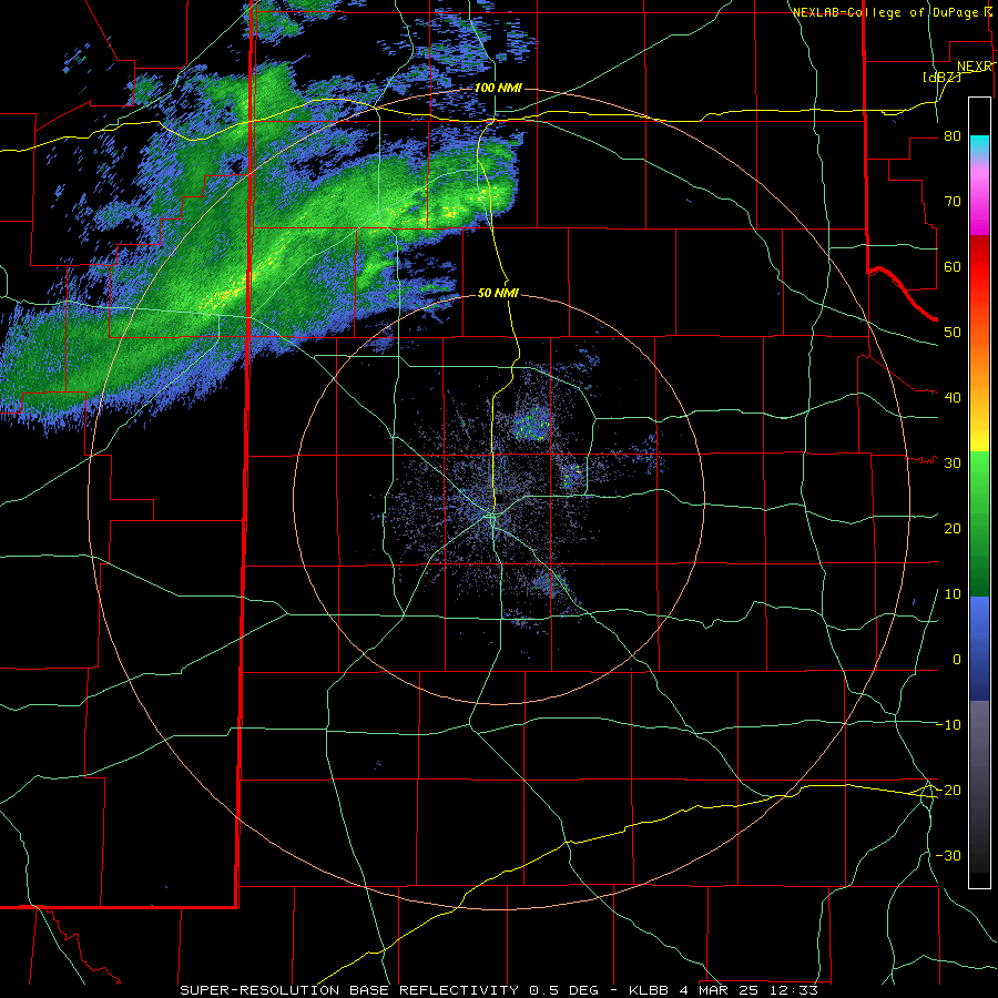
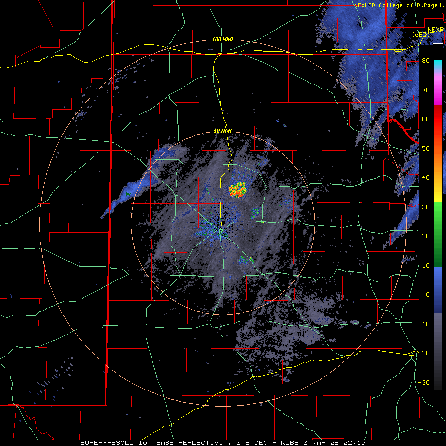
| Lubbock WSR-88D radar animation valid from 6:36 am to 9:19 am on Tuesday (4 March 2025). An additional radar animation, valid from 4:19 pm on the 3rd to 7:07 am on the 4th, can be VIEWED HERE. | |
|
Farther south and east, temperatures remained mild enough for mostly a cold rain. In addition to the welcome, albeit limited, moisture, the precipitation did manage to clear much of the dust from the sky, despite the strong winds. |
|
 |
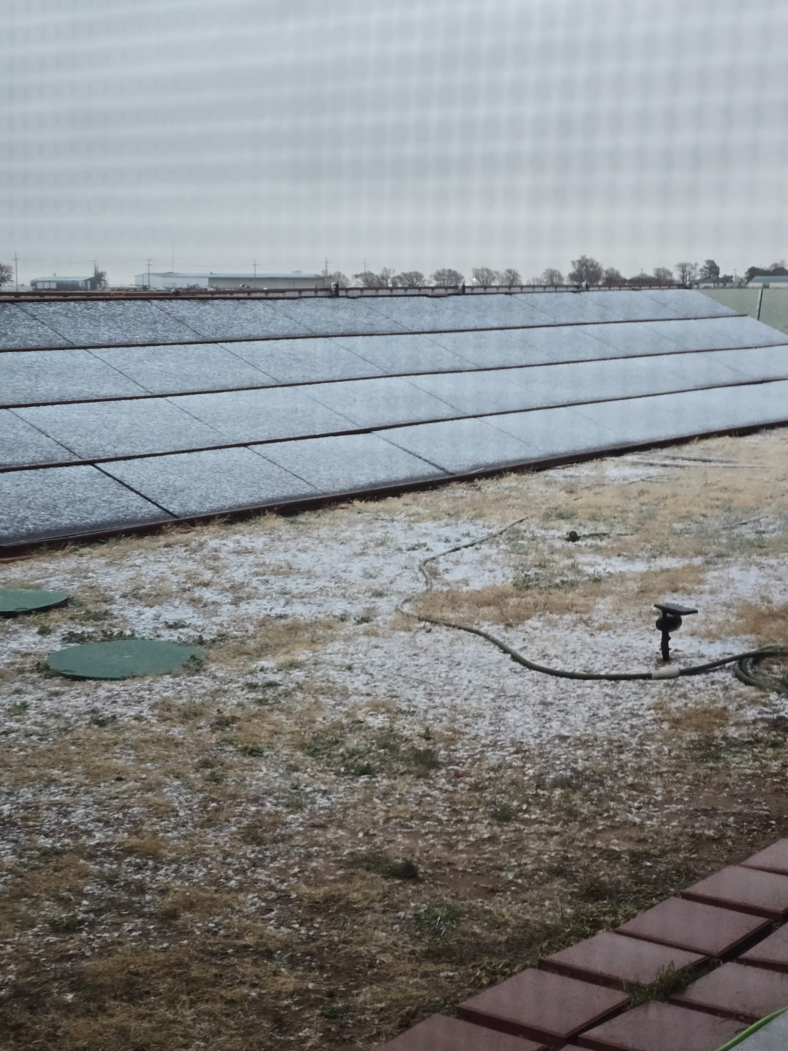 |
| (left) Snow falling in Friona early Tuesday morning (4 March 2025). The picture is courtesy of Pantex. (right) Snow coating the ground and solar panels in Dimmitt Tuesday morning (4 March 2025). The image is courtesy of Russell Stringfield. | |
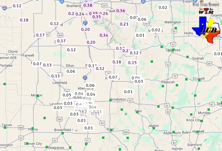
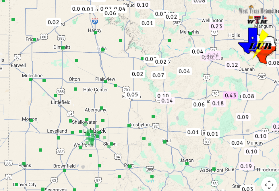
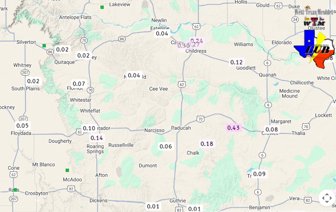
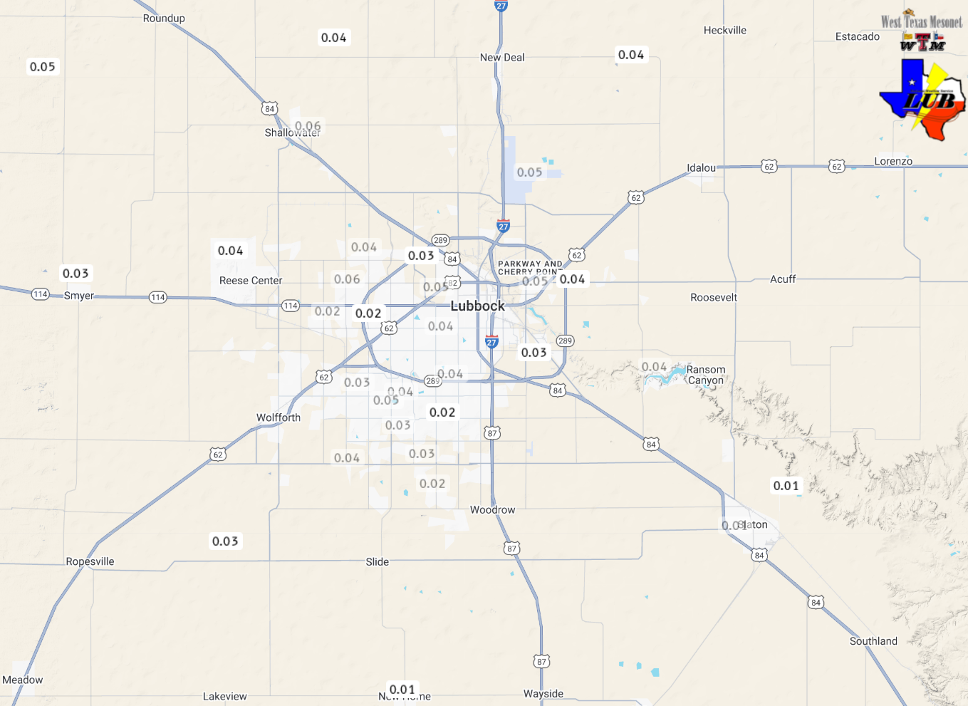
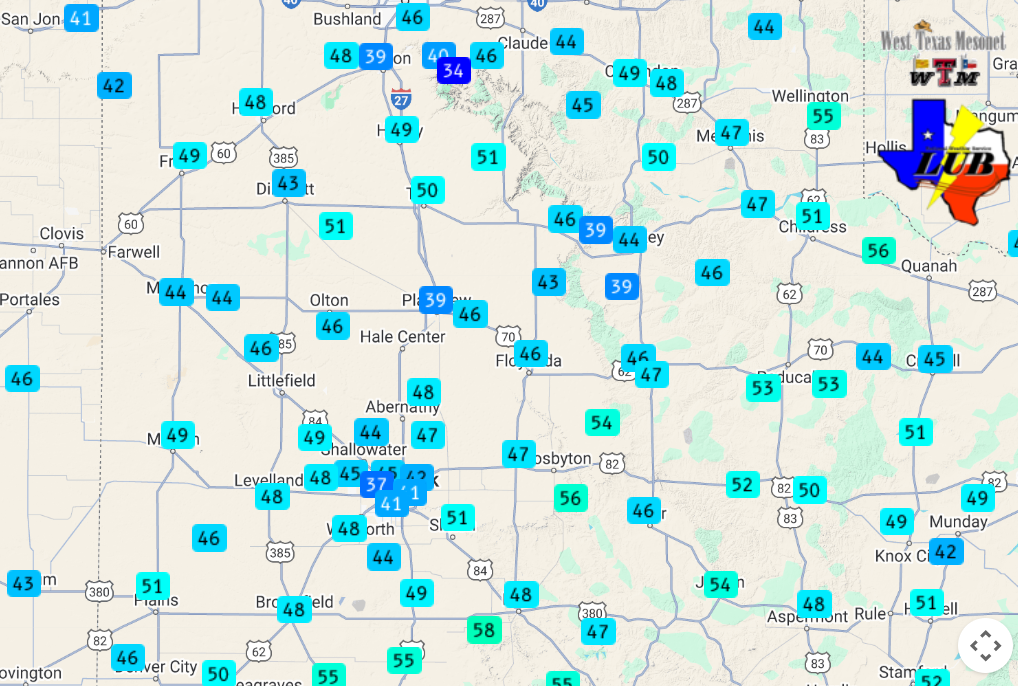
| Rain (and melted snow) totals were on the light side, ranging from a few hundredths of an inch over the central South Plains to around a third of an inch across the south-central Texas Panhandle. | |
 |
|
| 24-hour precipitation, ending at 7 am on Wednesday, 5 March 2025. The data are courtesy of the West Texas Mesonet (WTM). A close up view of the Lubbock area can be FOUND HERE. | |
| Unfortunately, as the winds persisted and then increased again, dust returned to much of the region Tuesday afternoon as the precipitation dwindled. Wind gusts of 60 to 70 mph were common over the entire area, with several gusts in excess of 70 mph measured in the Rolling Plains and eastern Texas Panhandle. A peak gust of 78 mph was measured by the West Texas Mesonet site near White River Lake. | |
 |
|
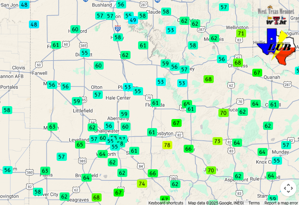
| Peak wind gusts measured on Tuesday (4 March 2025). The data are courtesy of the West Texas Mesonet (WTM). The maximum sustained wind speeds measured on Tuesday can be ACCESSED HERE. | |
| The intense winds did cause some damage, including downing trees and power lines, as well as causing roof damage in Dickens (and likely other spots). Thick blowing dust also contributed to a vehicle running into the ditch south of Paducah. The one positive was that the limited precipitation boosted low-level moisture levels and helped suppress the overall fire threat locally, mitigating the overall fire danger. Much farther south, over parts of Central and South Texas, where it was much warmer and drier, they were not so lucky, as the conditions supported numerous wildfires. | |
 |
|
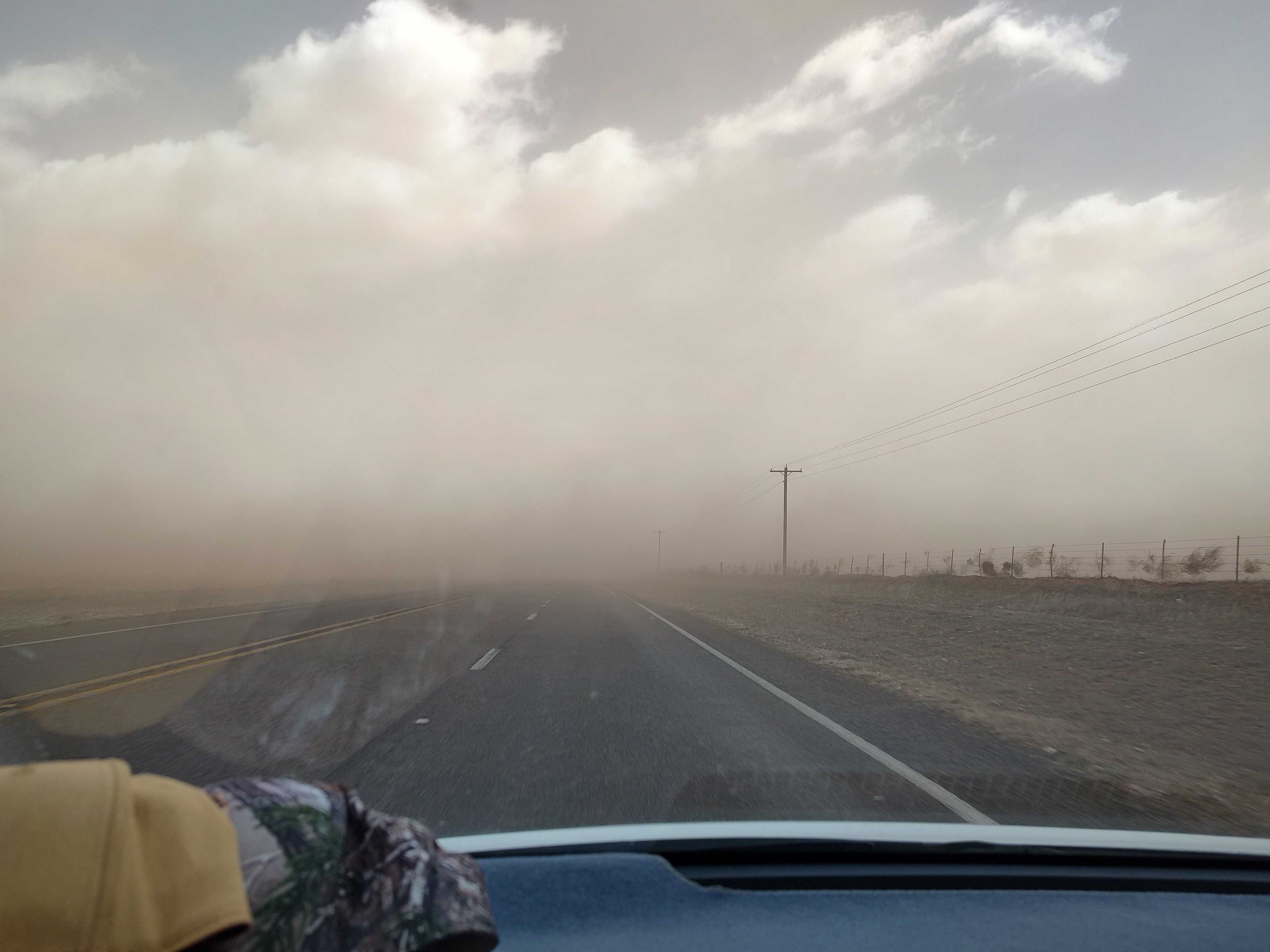
| Blowing dust affecting travel west of Brownfield Tuesday afternoon (4 March 2025). The picture is courtesy of Jim Tucker | |
|
The winds finally eased in earnest Tuesday evening as the sun set, vertical mixing decreased and the storm system responsible for powerful winds began to shift to the east of the region. A list of the preliminary storm reports collected over this unpleasant stretch of weather can be found below. |
|
Preliminary Local Storm Report...Summary
National Weather Service Lubbock TX
811 PM CST Mon Mar 3 2025

..TIME...   ...EVENT...      ...CITY LOCATION...     ...LAT.LON...
..DATE...   ....MAG....      ..COUNTY LOCATION..ST.. ...SOURCE....
            ..REMARKS..

0245 PM     Non-Tstm Wnd Gst 9 SW Earth              34.19N 102.56W
03/03/2025  M60 MPH          Lamb               TX   Mesonet

            Measured by the TTU mesonet.

0340 PM     Non-Tstm Wnd Gst 2 NE Friona             34.66N 102.70W
03/03/2025  M61 MPH          Parmer             TX   Mesonet

            West Texas Mesonet report.

0446 PM     Non-Tstm Wnd Gst 2 SSW Muleshoe          34.20N 102.74W
03/03/2025  M59 MPH          Bailey             TX   Mesonet

            West TX mesonet report.

0520 PM     Non-Tstm Wnd Gst 2 SSW Muleshoe          34.20N 102.74W
03/03/2025  M64 MPH          Bailey             TX   Mesonet

            West Texas Mesonet report.

0530 PM     Non-Tstm Wnd Gst 2 NE Friona             34.66N 102.70W
03/03/2025  M67 MPH          Parmer             TX   Mesonet

            West Texas Mesonet report.

0544 PM     Non-Tstm Wnd Gst 9 WSW Earth             34.18N 102.55W
03/03/2025  M67 MPH          Lamb               TX   Mesonet

            West Texas Mesonet report.

0554 PM     Non-Tstm Wnd Gst 2 NE Dimmitt            34.57N 102.29W
03/03/2025  M61 MPH          Castro             TX   Mesonet

            West Texas Mesonet report.

0606 PM     Non-Tstm Wnd Gst 1 NE Amherst            34.02N 102.40W
03/03/2025  M62 MPH          Lamb               TX   Mesonet

            West Texas Mesonet report.

0616 PM     Non-Tstm Wnd Gst 3 N Hart                34.43N 102.11W
03/03/2025  M65 MPH          Castro             TX   Mesonet

            West Texas Mesonet report.

