|
Arctic air brings bitter cold and a little wintry precipitation |
|
 |
|
|
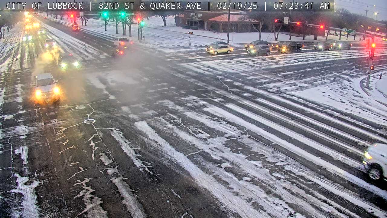
Frigid scene in Lubbock on Wednesday morning (19 January 2025). The image is courtesy of the City of Lubbock. |
|
|
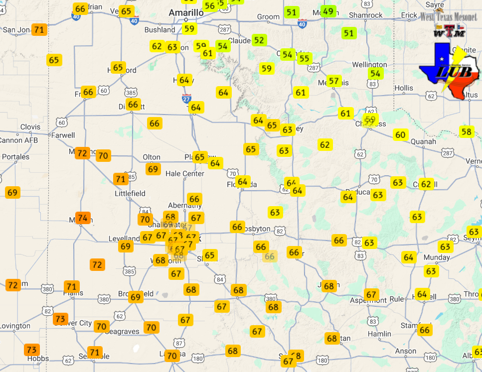
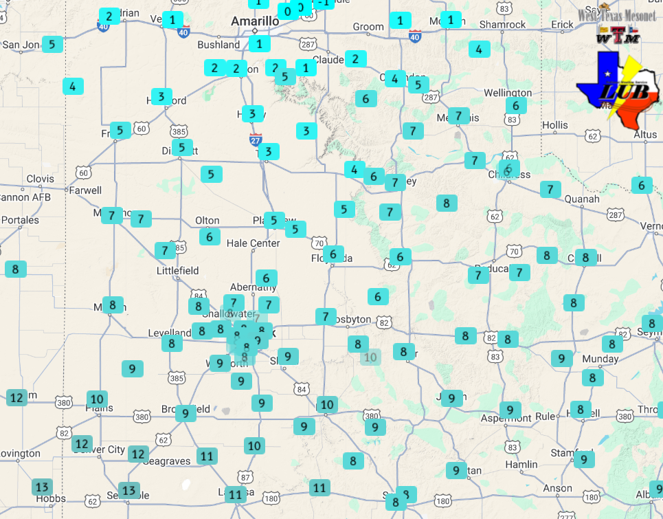
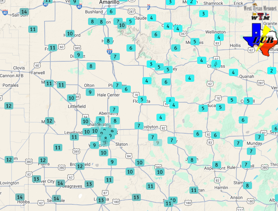
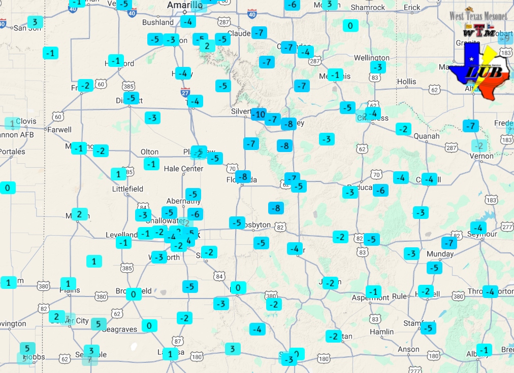
Following record warmth earlier in the month, and on the heels of a mild/warm President's Day (17 February), temperatures tanked behind an Arctic cold front early Tuesday morning (18 February). The bitter cold weather was accompanied by light wintry precipitation in many locations too. As the below plots illustrate, highs Monday afternoon ranged from the lower 60s to lower 70s, but temperatures tumbled into the teens and 20s behind the cold front by Tuesday afternoon. |
|
 |
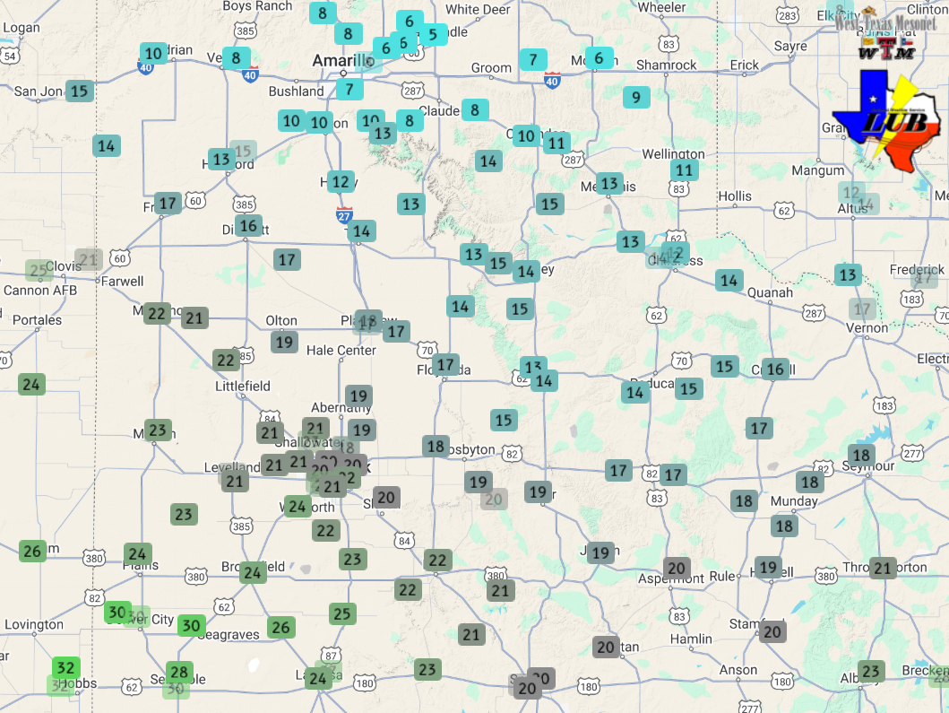 |
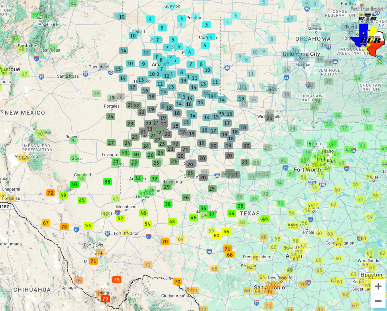
| (left) High temperatures measured on Monday (17 February 2025). (right) Temperatures observed at 1:15 pm on Tuesday (18 February 2025). For a larger regional view of temperatures early Tuesday afternoon CLICK HERE. The data are courtesy of the West Texas Mesonet. | |
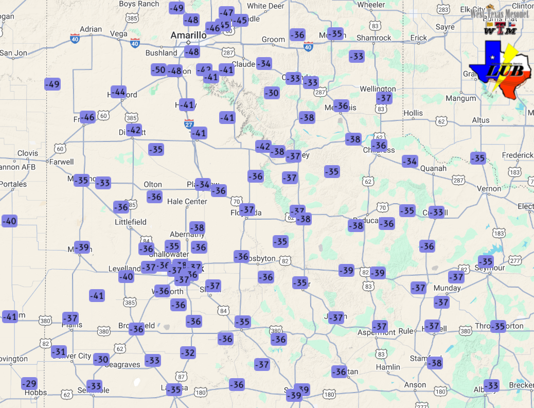
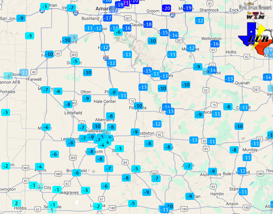
| The below image drives the chilling point home, showing afternoon temperatures plummeted 35 to 45+ degrees between Monday afternoon and Tuesday afternoon. | |
 |
|
| 24-hour temperature change, valid at 1:15 pm on Tuesday (18 February 2025). The data are courtesy of the West Texas Mesonet. | |
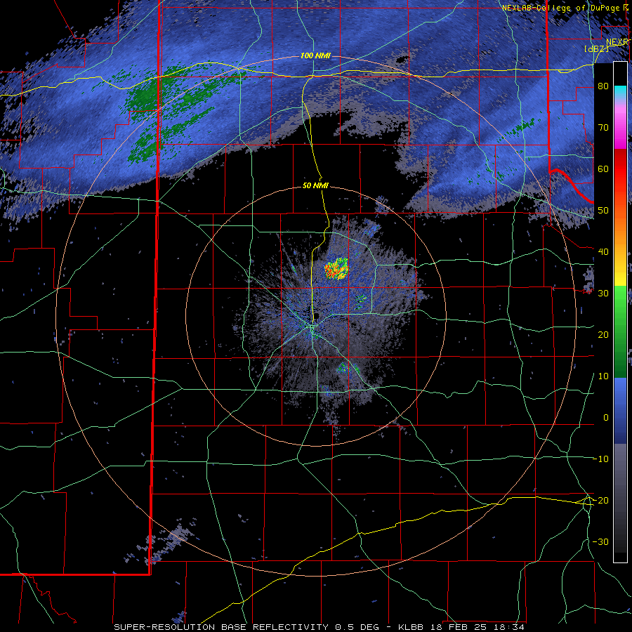
| As the cold air advanced southward, it was able to squeeze out just enough moisture to generate areas of freezing drizzle over portions of the southeast Texas Panhandle and northern Rolling Plains. Where this drizzle was heaviest, it created slick spots and tricky travel, despite the light amounts. | |
 |
|
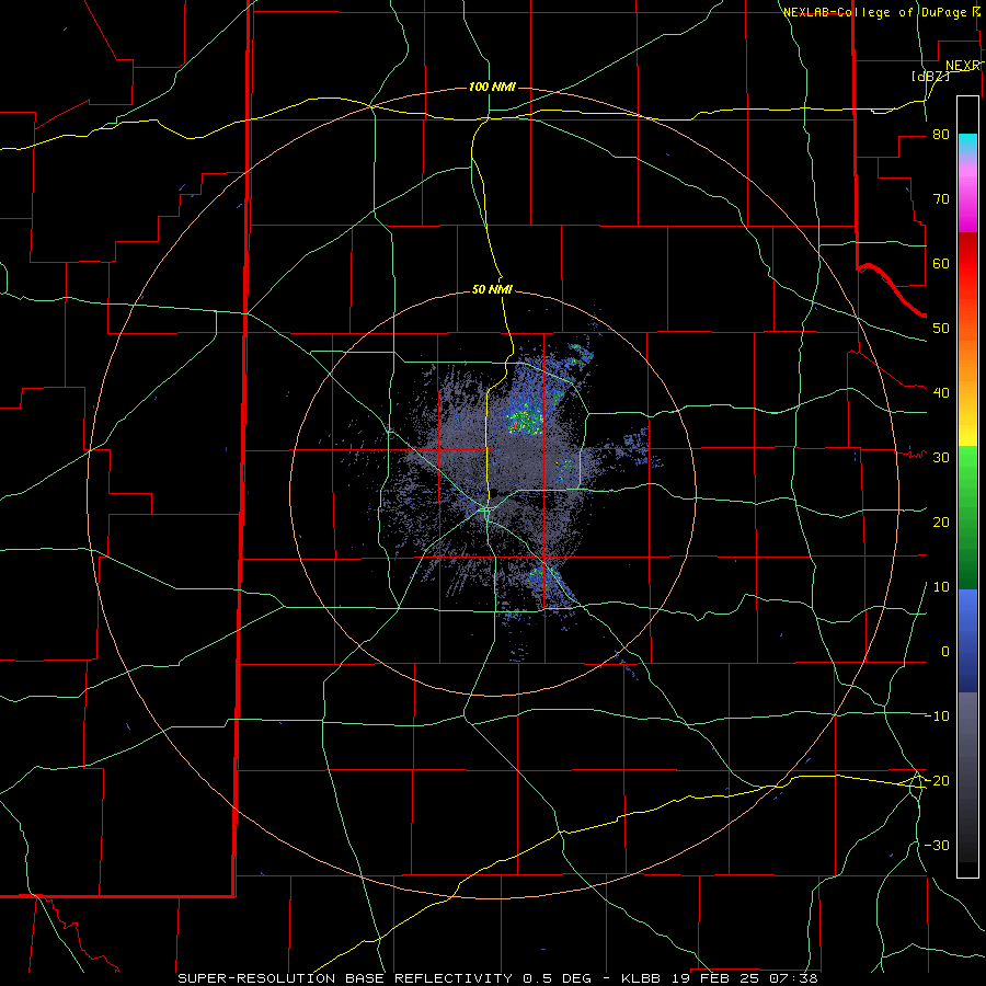
| Lubbock radar animation valid from 12:43 pm to 2:51 pm on Tuesday (18 February 2025). | |
| As the cold air deepened, the pockets of freezing drizzle switched over to light snow and flurries and expanded to affected many locations over West Texas. This snow created a dusting in spots, but generally didn't cause much in the way of travel troubles. | |
 |
|
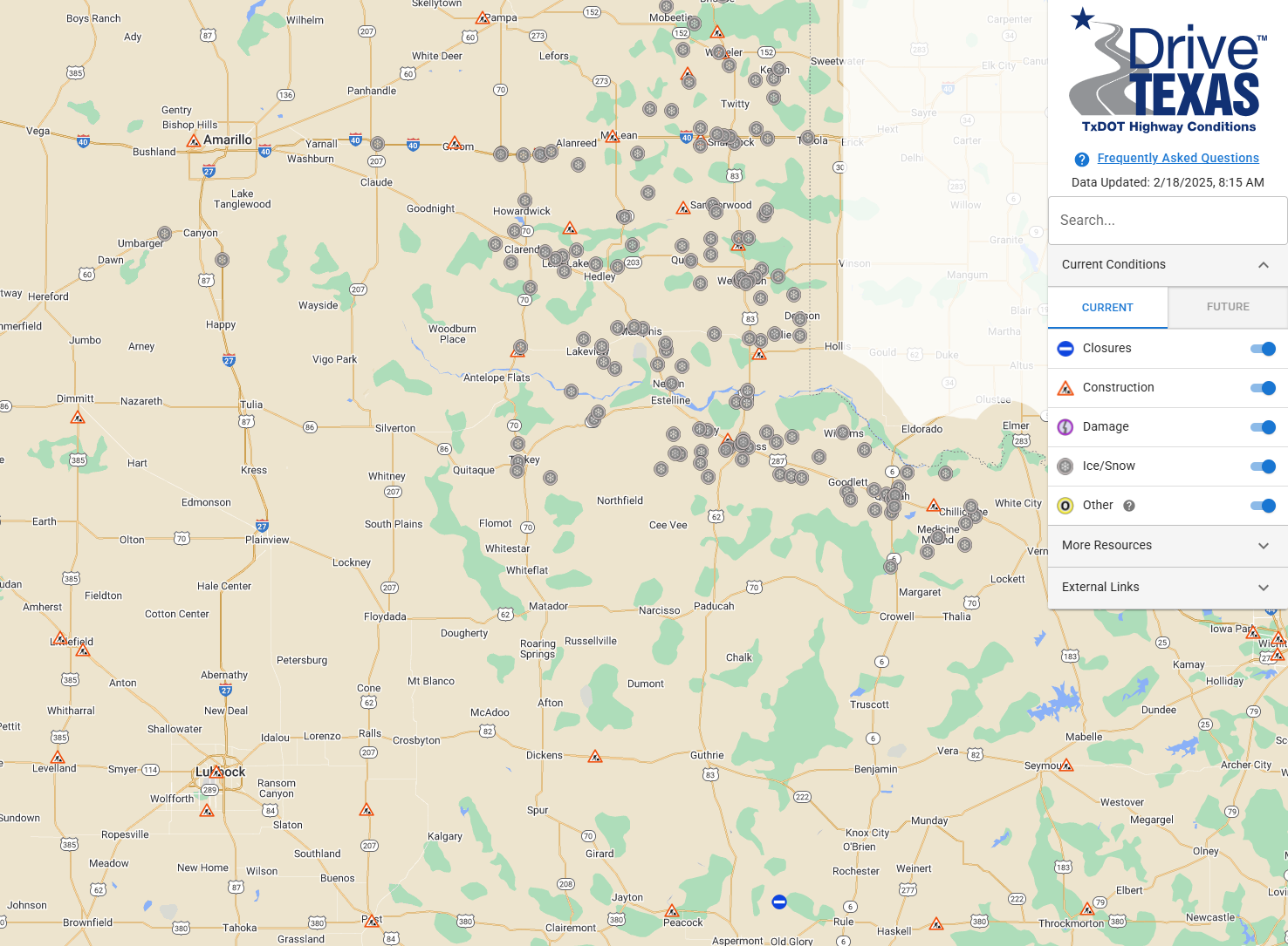
| Road conditions reported by TXDOT at 8:20 am on Tuesday (18 February 2025). | |
| The clouds persisted throughout Tuesday night and into Wednesday. In fact, additional flurries and light snow redeveloped in many spots, primarily on the Caprock, early Wednesday. Many people woke up to a dusting of snow, though with minimal moisture and temperatures in the single digits, the dusting was more of a nuisance and didn't have much impact on travel. | |
 |
 |
| Observed lows (left) and wind chill readings (right) Wednesday morning (19 January 2025). The data are courtesy of the West Texas Mesonet. | |
|
In addition to the light snow and cold temperatures, breezy northerly winds made it feel even colder. Sub-zero wind chill values were common across the entire region Wednesday morning, dropping down to negative 15 or lower across a large chunk of the Texas Panhandle and portions of the South and Rolling Plains. |
|
 |
|
| "RCB-True color" satellite animation valid from 8:26 am to 9:01 am on Wednesday (19 February 2025). An animation of the Lubbock radar, valid from 1:38 am to 7:24 am on the 19th can be VIEWED HERE. | |
| Temperatures only "warmed" into the upper teens and lower 20s Wednesday afternoon, as cloud cover held firm over most of the area. These chilly "highs" resulted in several daily record low maximums. Lubbock officially recorded a high temperature of 23 degrees on Wednesday, shattering the previous record low high for February 19th of 30 degrees, set back in 2019. Similarly, Childress shattered a record with its high of 19 degrees (previous record was 31 degrees, set in 2006). | |
 |
 |
| Observed lows (left) and wind chill readings (right) Thursday morning (20 January 2025). The data are courtesy of the West Texas Mesonet. | |
|
Many locations again experienced single digit lows Thursday morning (20 February). The only positive versus the previous morning was that winds weren't quite as strong, so it didn't feel quite as cold. That said, wind chills of 0 to -10 degrees were still common. |
|
 |
|
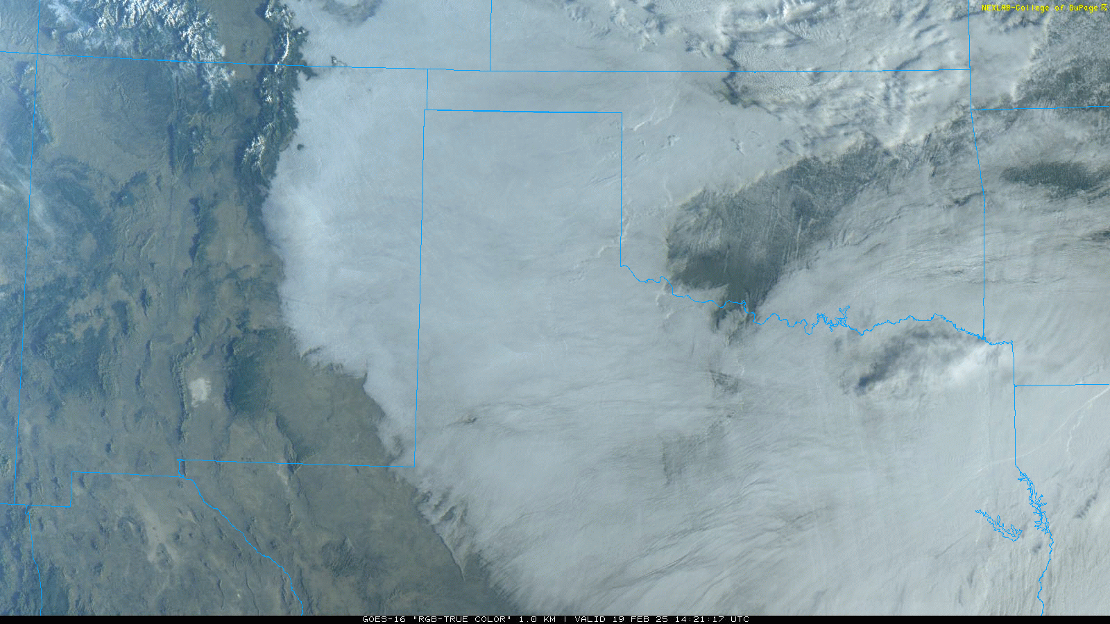
| Infrared satellite animation valid early Wednesday morning (19 February 2025). | |
|
The bitter cold was not only confined to our neck of the woods, but dominated much of the center of the nation. The above satellite imagery, which depicts colder objects (usually clouds) as purples, blues and greens, senses a broad area of stationary cold objects from the center of the United States into south-central Canada. These stationary cold areas are the cold ground in place (as opposed to the moving objects which are cold cloud tops high up in the atmosphere). Parts of the Dakotas into eastern Montana and Wyoming had temperatures near and below -20 degrees at this time! |
|

