|
Warm winds & dust followed by frigid air & light snow |
|
 |
|
|
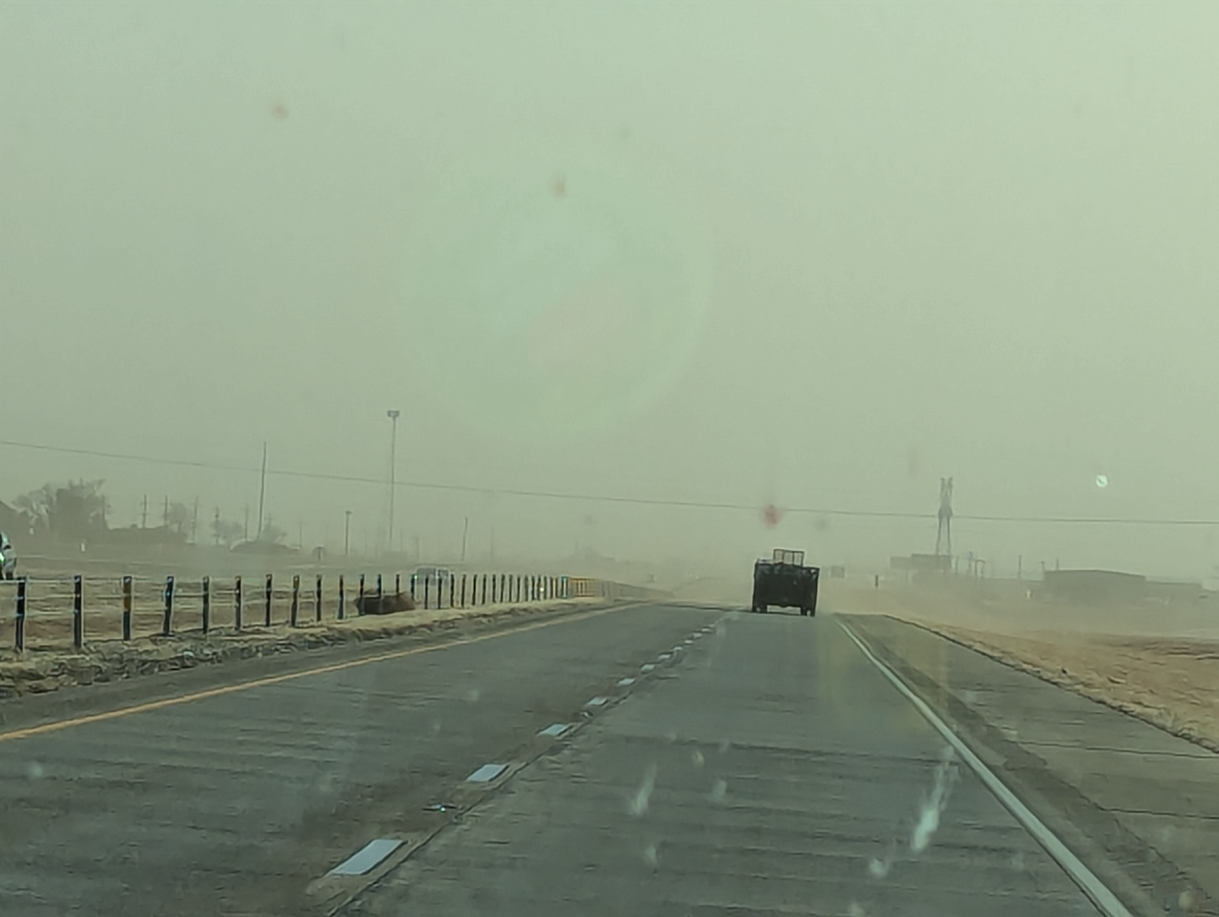
A dusty scene on I-27 north of Lubbock Friday afternoon (17 January 2025). |
|
|
Mid-January 2025 brought a drastic swing in the weather. The stretch kicked off with spring-like weather, with mild/warm, dry and strong westerly winds Friday afternoon (17 January). Unfortunately, the intense winds lofted copious amounts of blowing dust over a large chunk of the South Plains, Permian Basin and Far West Texas, as illustrated in the satellite imagery below. |
|
 |
|
| "RGB True Color" satellite animation from 1:01 pm to 4:56 pm on Friday (17 January 2025). | |
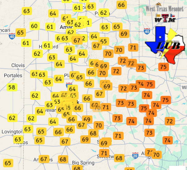
| On the positive side (at least for most), the downslope winds lifted temperatures well into the 60s, with lower and middle 70s found off the Caprock. | |
 |
|
| High temperatures measured by the West Texas Mesonet (WTM) on Friday (17 January 2025). | |
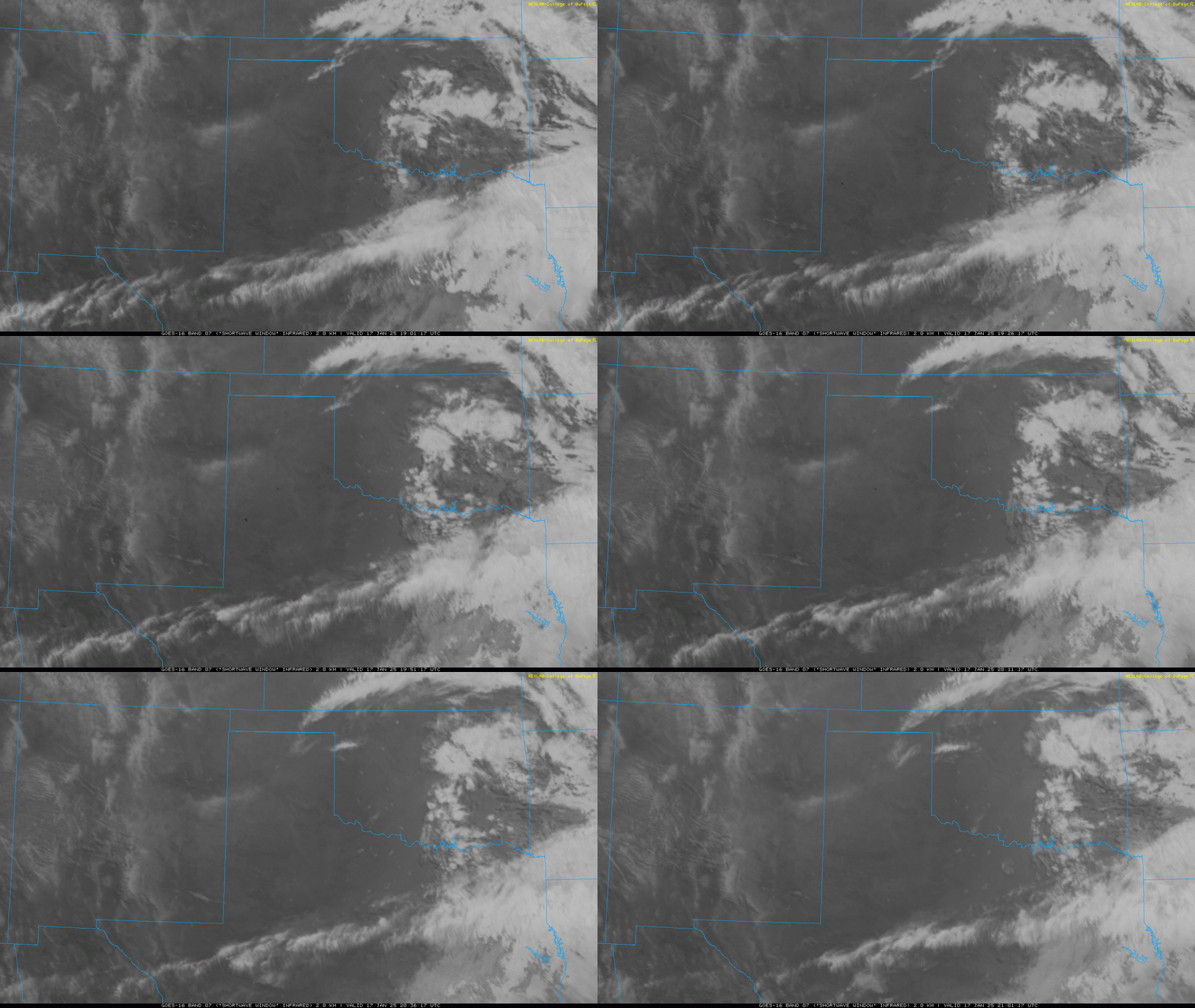
| On the negative side, the warmth, wind and dry conditions supported the ignition of a couple of wildfires Friday afternoon. Thankfully, the fires, which show up as dark "spots" on the satellite imagery below, were contained relatively quickly. | |
 |
|
| Infrared satellite animation from 1:01 pm to 3:01 pm on Friday (17 January 2025). | |
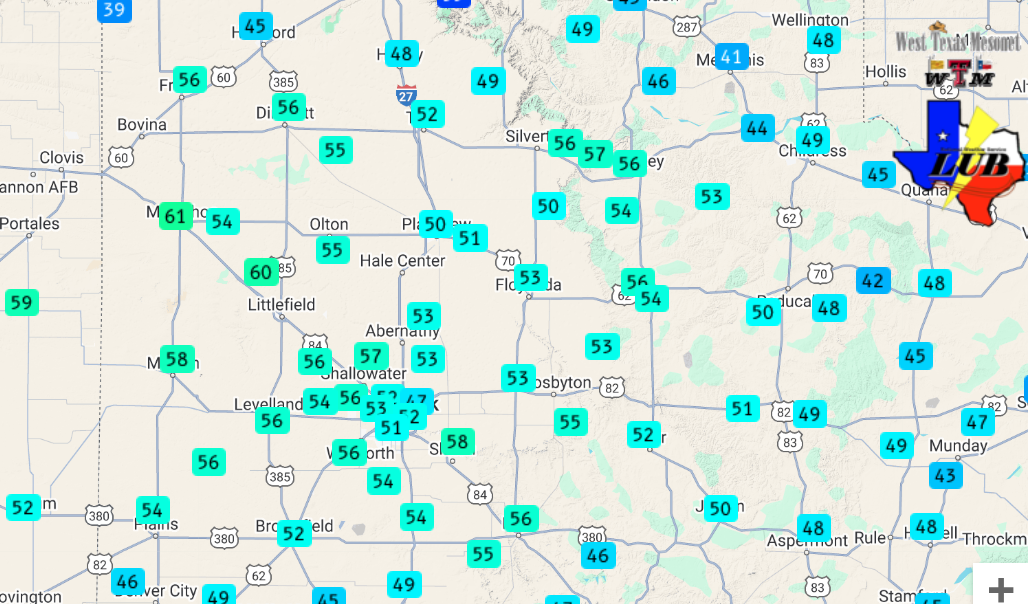
| Peak wind gusts of 50+ mph were common over much of the South and Rolling Plains Friday afternoon. A few spots across the western South Plains even touched 60 mph, including around Muleshoe and Littlefield. Blowing dust lofted by the winds caused the visibility to drop below 2 miles for a short period at the Lubbock Airport. | |
 |
|
| Peak wind gusts measured by the West Texas Mesonet (WTM) on Friday (17 January 2025). The highest sustained wind speeds measured can be VIEWED HERE. | |
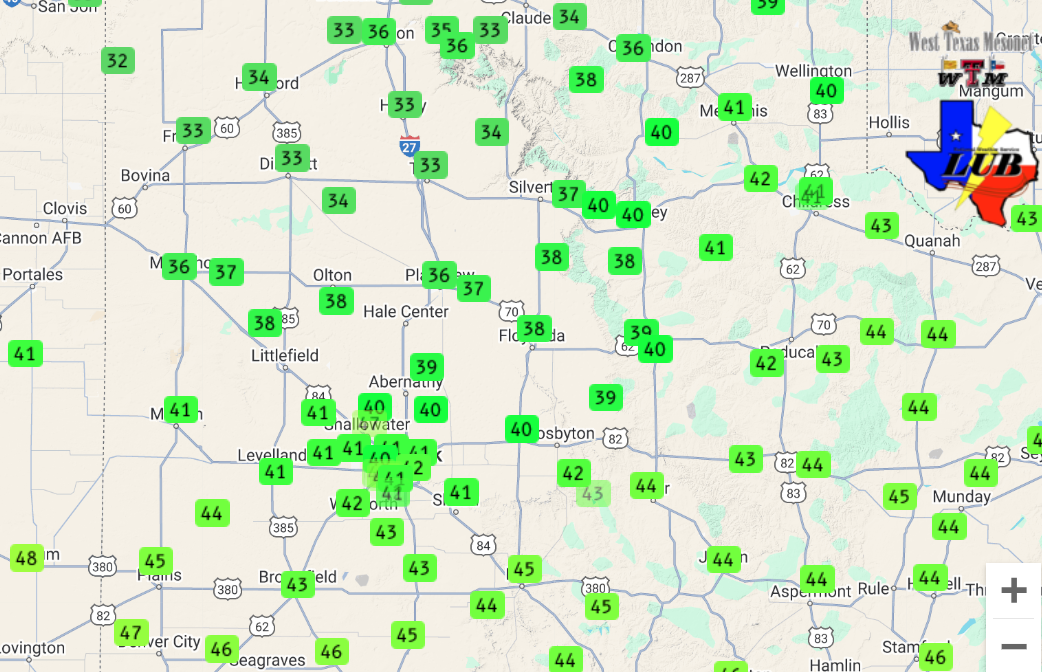
| The winds decreased by evening, but then turned to the north and increased to breezy levels as the first round of cold air came plunging southward. The initial cold front was fairly typical for this time of year in West Texas and dropped highs back down into the 30s and 40s on Saturday. | |
 |
|
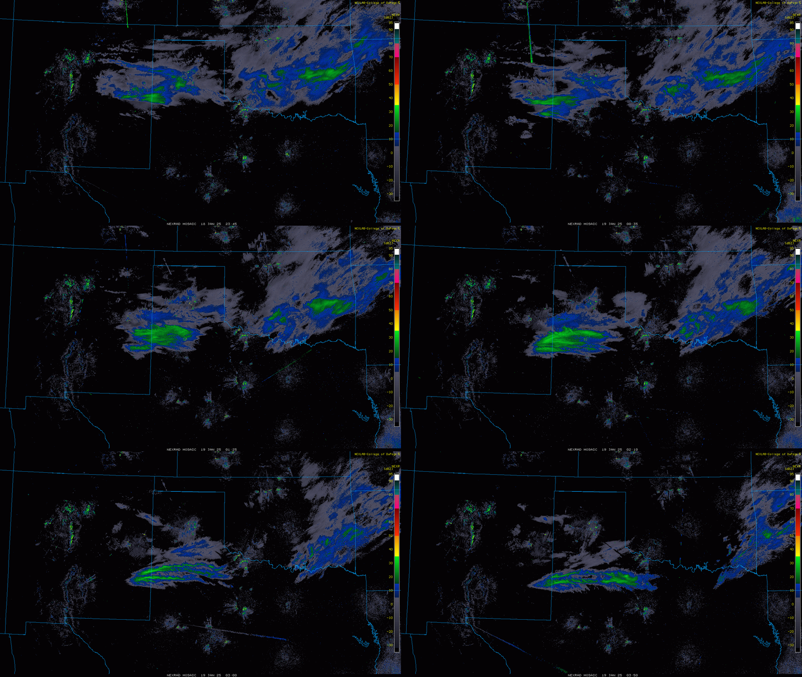
| Regional radar animation valid from 5:45 pm to 9:50 pm on Saturday (18 January 2025). | |
|
However, another surge of even colder air, originating in the Arctic, followed Saturday evening, dropping temperatures even further. This second surge of cold air was accompanied by just enough moisture and lift to squeeze out a little light precipitation. Although moisture totals generally only added up to a trace to few hundredths of an inch of liquid equivalent, this yielded a dusting to a half inch of snow for many locations of the South Plains. A few spots even measured totals around 1 inch, including around Post, Muleshoe, Shallowater and portions of Lubbock. |
|
 |
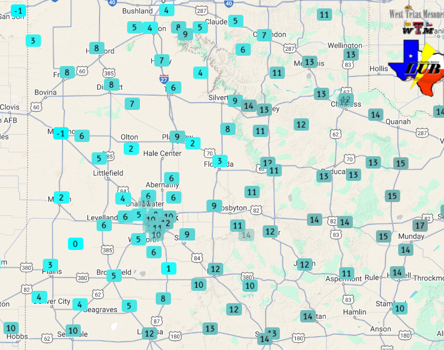 |
| (left) Highs observed on Saturday (18 January 2025) and (right) lows measured Sunday morning (19 January 2025). A regional view of the lows on the 19th can be VIEWED HERE. Wind chills measured early Sunday morning can be FOUND HERE. The data are courtesy of the West Texas Mesonet (WTM). | |
| The light snow quickly diminished and shifted southeastward after midnight Saturday night, giving way to clearing skies. The clear skies, light winds and fresh snow cover provided the perfect conditions for temperatures to tumble, with many spots on the Caprock experiencing lows in the single digits Sunday morning (19 January). | |
 |
|
| Closeup view of a snowflake that fell in Lubbock Saturday evening (18 January 2025). The snowflake is a sparce branched dendrite, and was captured by Harrison Sincavage. | |
|
Visible satellite Sunday morning (below) clearly showed snow (areas of white) covering much of the South Plains, with a strip of snow that extended into the southern Rolling Plains. Although light, the snow and ice created slick spots on area roadways Sunday morning, but improved after the sun rose and temperatures moderated. |
|
 |
|
| "RCB-True color" satellite animation valid from 8:36 am to 9:21 am on Sunday (19 January 2025). | |
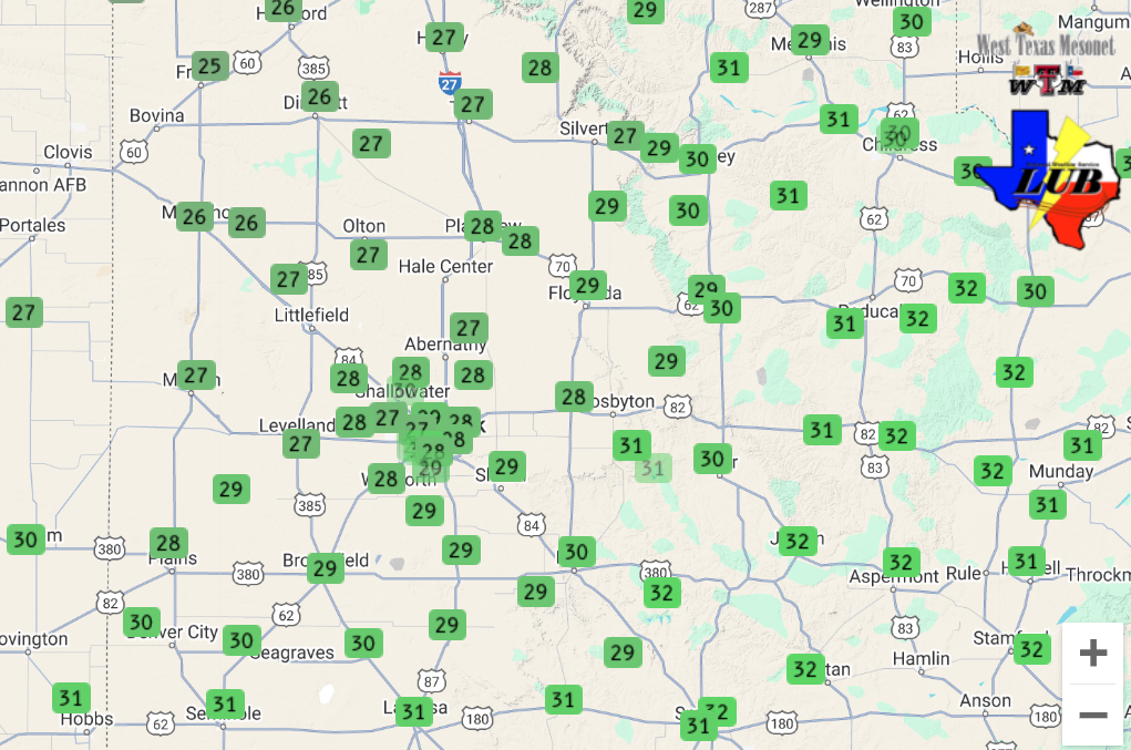
| Plentiful sunshine lifted temperatures into the 20s and lower 30s Sunday afternoon, and they "only" fell back down into the teens and lower 20s for most spots Monday morning. | |
 |
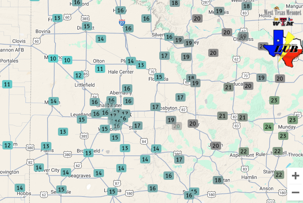 |
| [left] High temperatures measured on Sunday (19 January 2025) and [right] low temperatures measured Monday morning (20 January 2025). Both maps are courtesy of the West Texas Mesonet (WTM). | |
|
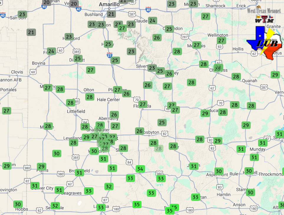
Despite the milder start to the day on Monday, highs only reached the 20s and lower 30s Monday afternoon, thanks, in part, to increasing cloud cover. To make matters worse, yet another surge of Arctic air spilled through the Texas Panhandle Monday afternoon, and through the South Plains Monday evening. This final surge of Arctic air spurred the development of a narrow, but heavy, band of snow that moved southward through the Texas Panhandle before diminishing as it approached the northern South Plains. |
|
 |
|
| "RCB-True color" satellite animation valid Tuesday morning (21 January 2025). Snow is seen covering much of the Texas Panhandle as well as adjacent states. | |
| A few locations, including in and around Silverton and Vigo Park did get a quick half inch as the decaying snow band moved through, with flurries or very light snow reported at a number of other locations farther south. The shot of snow was accompanied by about a 10 degree temperature drop, along with gusty northerly winds. | |
 |
|
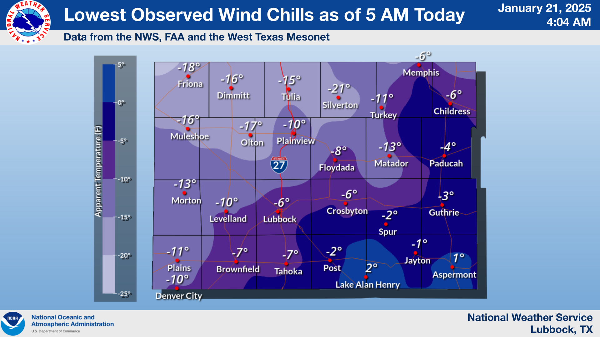
| Wind chills measured early Tuesday morning (21 January 2025). | |
| Skies cleared early Tuesday morning, and this allowed temperatures to drop into the single digits for much of the region. Sub-zero lows were even found over portions of the northwestern South Plains and much of the Texas Panhandle. In fact, a few locations across the northern Texas Panhandle saw the mercury drop to or below -10 degrees! The frigid temperatures, coupled with northerly breezes, made it feel even colder, with bitterly cold wind chills from around zero to near 20 below. | |
 |
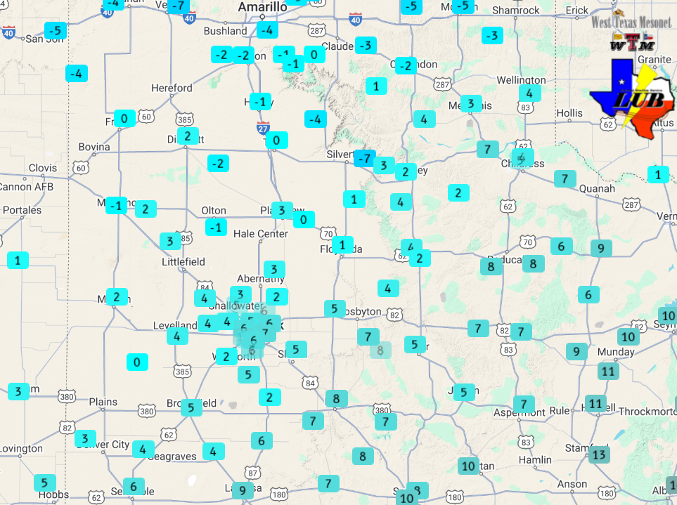 |
| [left] High temperatures measured on Monday (20 January 2025) and [right] low temperatures measured Tuesday morning (21 January 2025). Both maps are courtesy of the West Texas Mesonet (WTM). | |
| A return to southwesterly breezes Tuesday afternoon finally allowed temperatures to eclipse the freezing mark, for the first time since Saturday in many spots. Officially, Lubbock was below freezing for just under 68 hours (from 5:55 pm on Saturday to 1:50 pm Tuesday). This was the longest stretch of subfreezing temperatures in Lubbock since the brutal stretch in mid-February of 2021 (which started on 2/13/2021 and ended on 2/19/2021). | |
Preliminary Local Storm Report
National Weather Service Lubbock TX
330 PM CST Fri Jan 17 2025

..TIME...   ...EVENT...      ...CITY LOCATION...     ...LAT.LON...
..DATE...   ....MAG....      ..COUNTY LOCATION..ST.. ...SOURCE....
            ..REMARKS..

0115 PM     Non-Tstm Wnd Gst 1 NE Amherst            34.02N 102.40W
01/17/2025  M60 MPH          Lamb               TX   Mesonet

0134 PM     Non-Tstm Wnd Gst 1 ENE Morton            33.73N 102.74W
01/17/2025  M58 MPH          Cochran            TX   Mesonet

0150 PM     Non-Tstm Wnd Gst 2 SSW Muleshoe          34.21N 102.74W
01/17/2025  M61 MPH          Bailey             TX   Mesonet

0253 PM     Non-Tstm Wnd Gst 1 NNW Lubbock Int. Airp 33.67N 101.82W
01/17/2025  M58 MPH          Lubbock            TX   ASOS