|
Widespread heavy rain and spotty severe weather |
|
 |
|
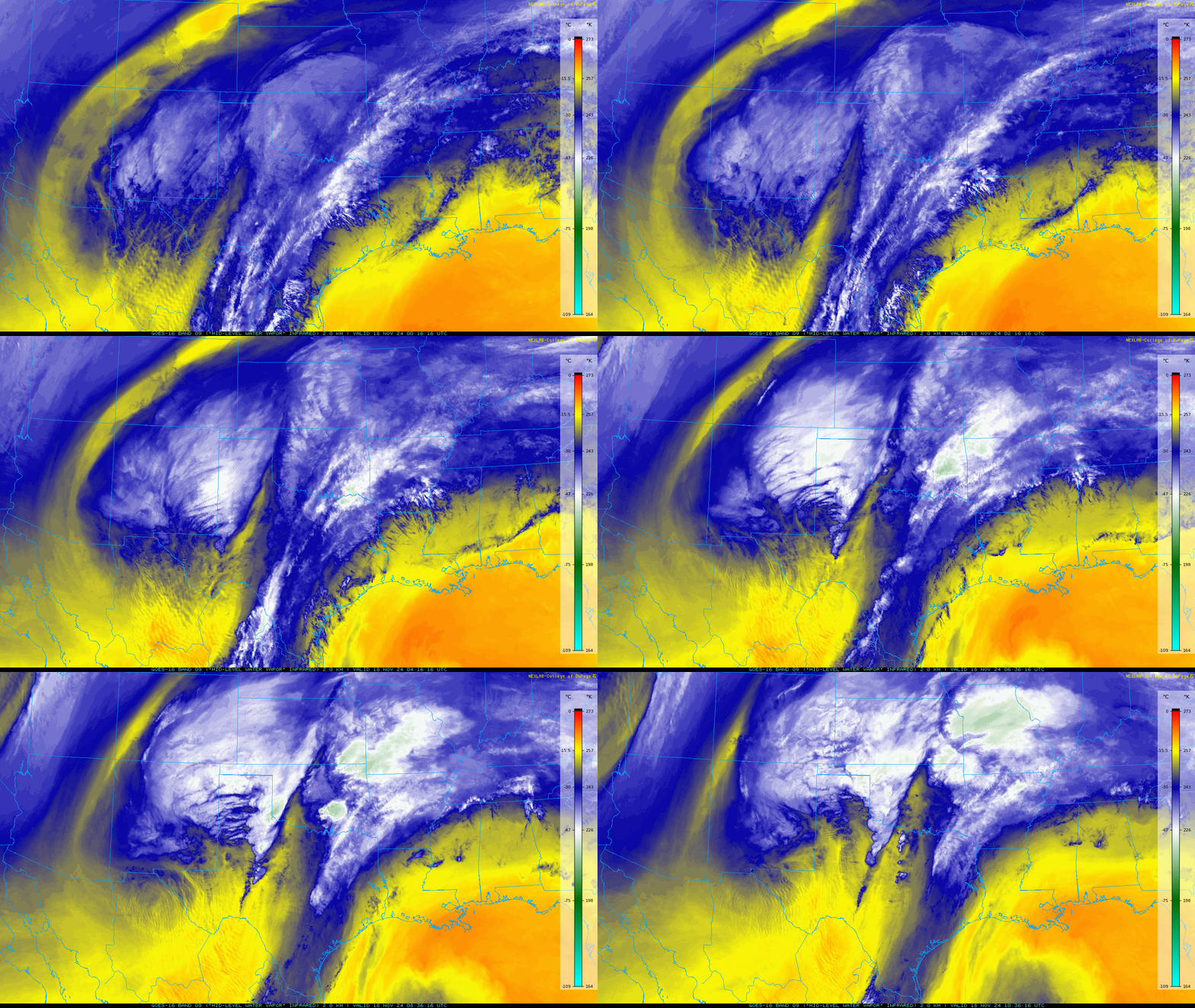
| Water vapor satellite loop valid from 7:16 pm on Sunday to 4:36 am on Monday (17-18 November 2024). An infrared satellite loop valid from 4:21 pm on Sunday to 4:41 am on Monday can be VIEWED HERE. | |
|
For the third time this November, widespread moderate to heavy rain fell on much of the South Plains region. Similar to the prior two events, the culprit was an intense mid-upper level storm system, in combination with abundant Gulf and Pacific moisture |
|
 |
|
|
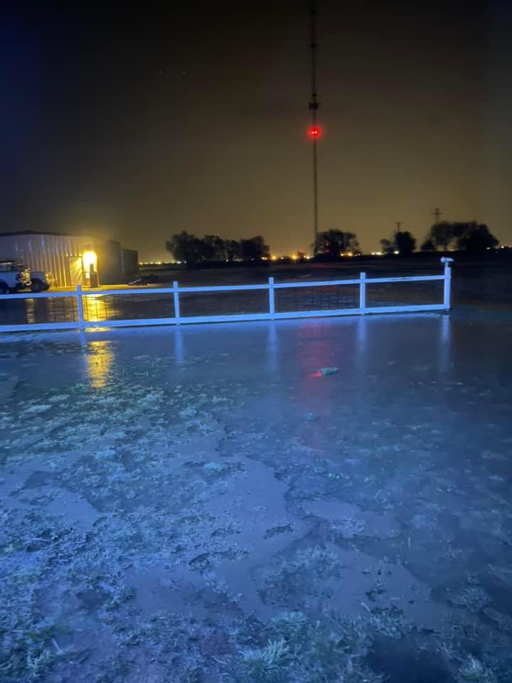
Flooding near Highway 114 just east of Smyer early Monday morning (18 November 2024). The picture is courtesy of Carolyn Wurtzler via Jacob Riley. |
|
| This storm system initially got its act together over southern California and the northern Gulf of California, where strong jet energy carved out a closed low. After forming, the low started moving eastward through northern Mexico on Saturday (17 November) before accelerating northeastward late Sunday, passing over Far West Texas and racing across the South Plains Monday morning (18 November). | |
 |
|
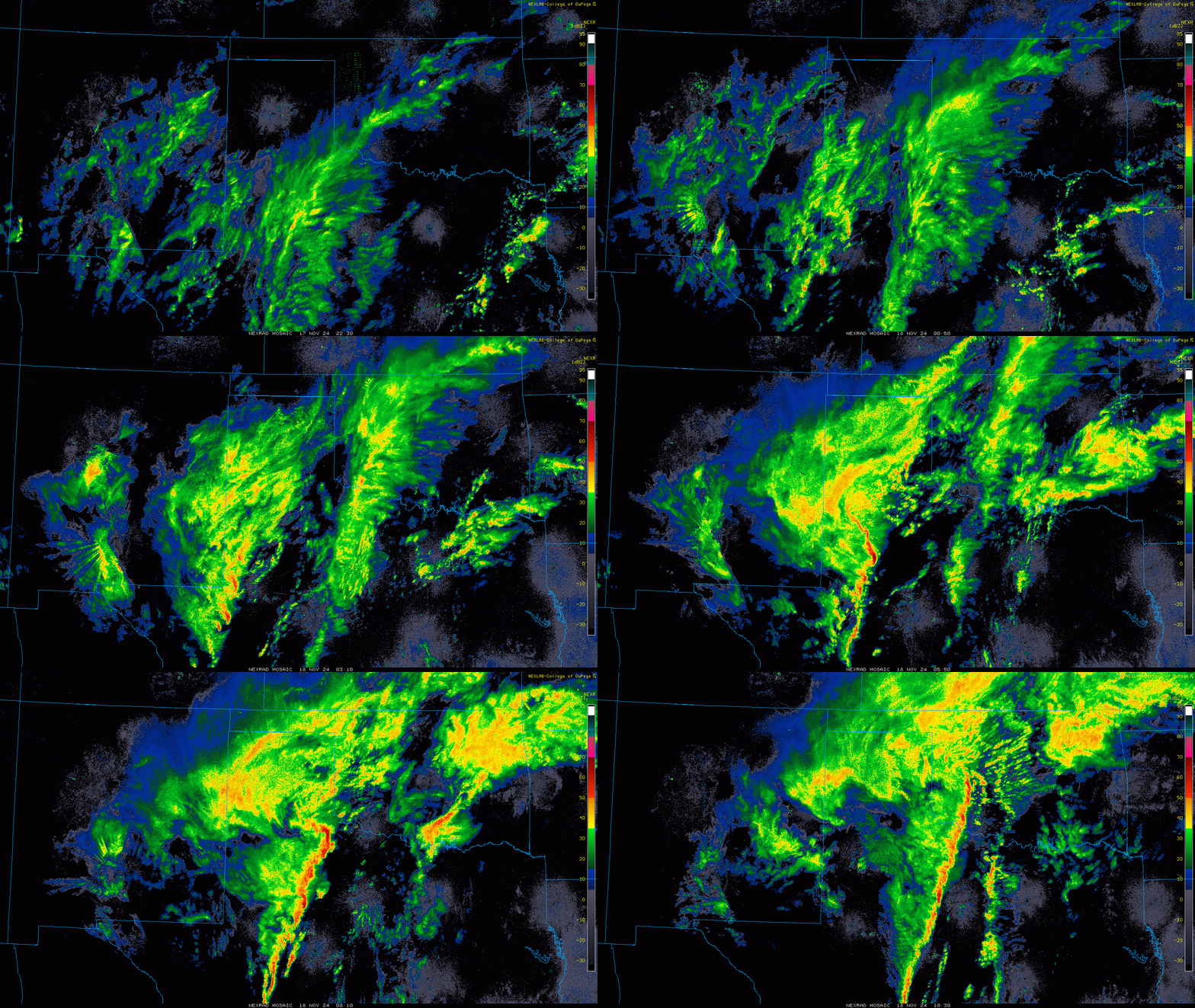
| Regional radar animation valid from 4:50 pm on Sunday to 4:30 am on Monday (17-18 November 2024). | |
| Initially, the system lacked low-level moisture, but as it approached the southern High Plains it tapped rich moisture streaming northward off the Gulf. Spotty and generally light showers during the day Sunday quickly grew in coverage and intensity during the evening as the moisture and lift worked in tandem. | |
 |
|
| Lubbock WSR-88D radar animation valid from 11:01 pm Sunday to 2:53 am on Monday (17-18 November 2024). Additional radar animation can be found at: 1:33 pm to 9:29 pm on Sunday; and 8:51 pm on Sunday to 3:20 pm on Monday. | |
| Widespread moderate to heavy rain formed over the Permian Basin and expanded and spread northward across the South Plains late Sunday evening. Meager instability limited the lightning production, but the deep and warm lower atmosphere (by November standards), more tropical like than fall like, didn't limit the rainfall coverage or intensity. | |
 |
|
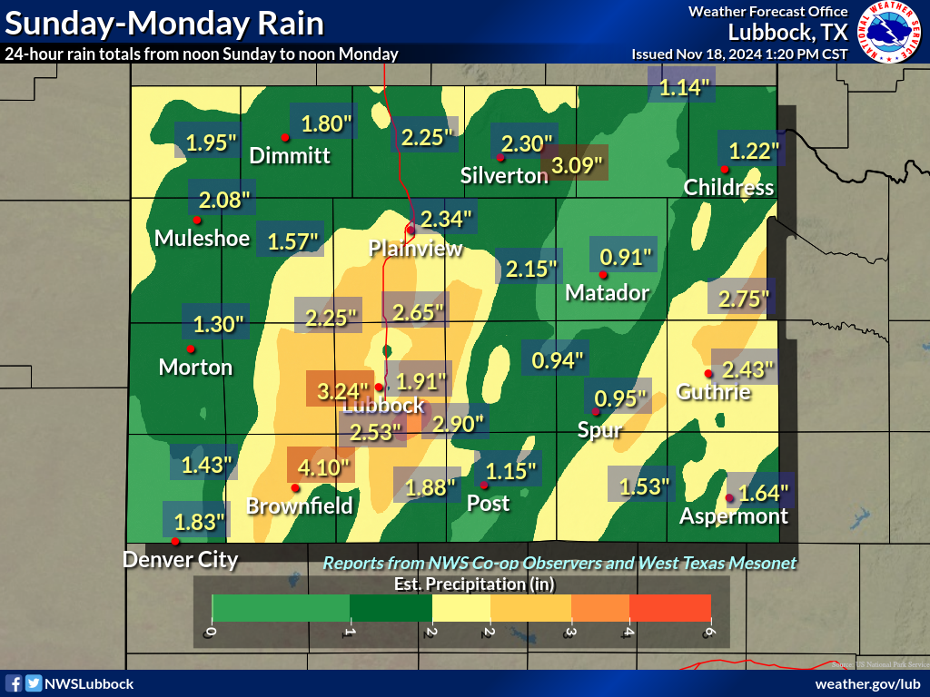
| 24-hour rain total ending at noon on Monday (18 November 2024). A larger view of the entire West Texas Mesonet domain can be FOUND HERE. | |
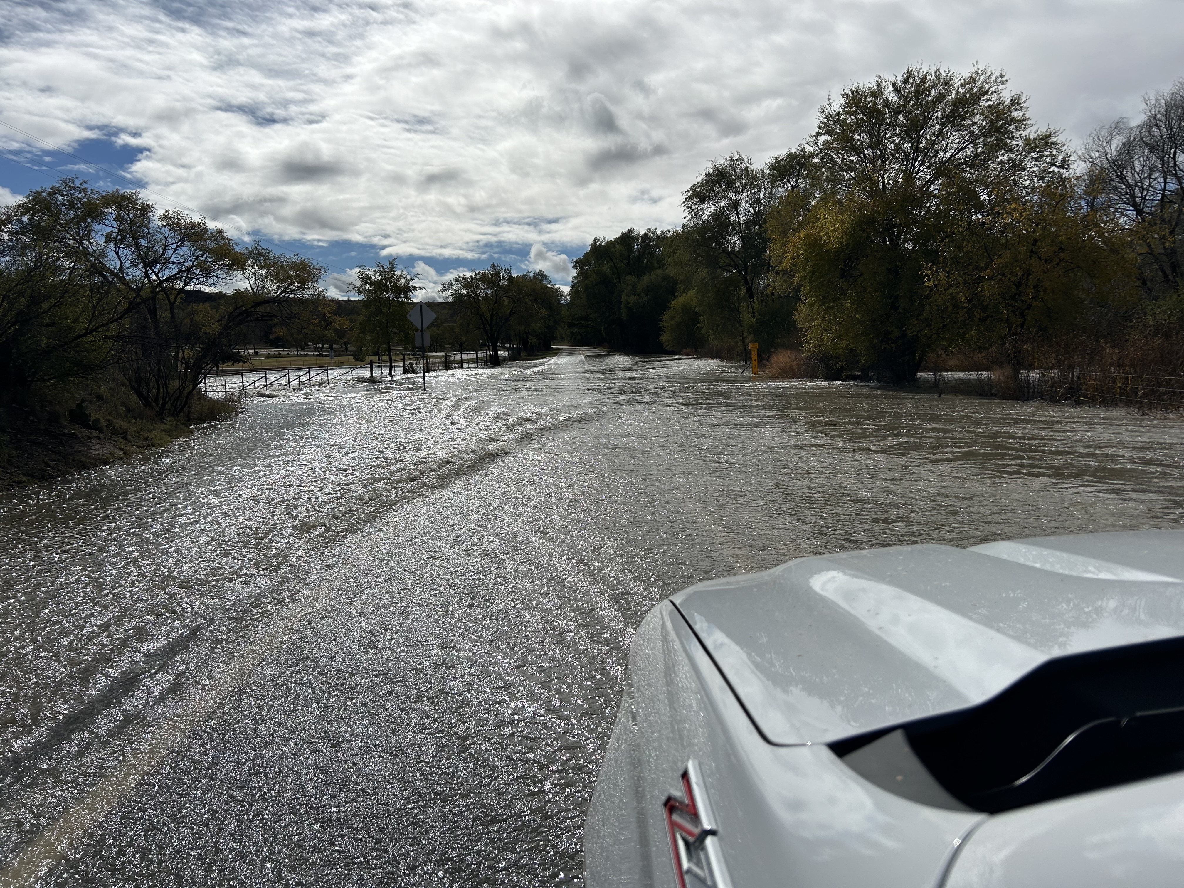
| Bands of the heaviest rain targeted parts of the central and southern South Plains, particularly along and near the Highway 62 Corridor from Seminole through Seagraves and Brownfield and up to Lubbock. Within this swath, 2 to 3+ inches of rain fell in short order, with areas around Brownfield to tallying around 4 inches. Runoff from the torrential downpours quickly resulted in flash flooding, and caused several roadways to become difficult to impossible to pass | |
 |
|
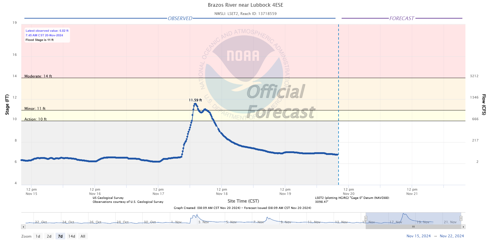
| Level of the Brazos River on the southeast side of Lubbock in mid-November 2024. | |
| The band of heavy rain gradually started to shift eastward around and after midnight as drier air began to advance into the region wrapping around the south side of the approaching storm system. As the line moved eastward, it encountered even richer low-level moisture and instability which allowed the thunderstorms to intensify, producing more lightning and strong to severe wind gusts as they advanced from the southeastern South Plains into the Rolling Plains. A few brief areas of low-level rotation even formed along the leading edge of the line as the increased instability interacted with the very strong wind fields just above ground level. In fact, one bowing segment produced several brief tornadoes, as identified by radar, in southwest Oklahoma between 3 and 4 am on Monday. | |
 |
|
| Flooding of FM 835 immediately upstream of Buffalo Springs Lake on Monday (18 November 2024). An additional picture of flooding here can be FOUND HERE. Both images are courtesy of Brandon Powell. | |
| On the positive side, although still dropping torrential rainfall, the line of storms moved faster and tended to cap overall rain totals farther east, mitigating the flooding potential. Even so, many locations off the Caprock still received 1 to 2 inches of rain, with a heavier swath, closer to 2.5 inches, from Lake Alan Henry through Guthrie, Grow and Hackberry. | |
 |
|
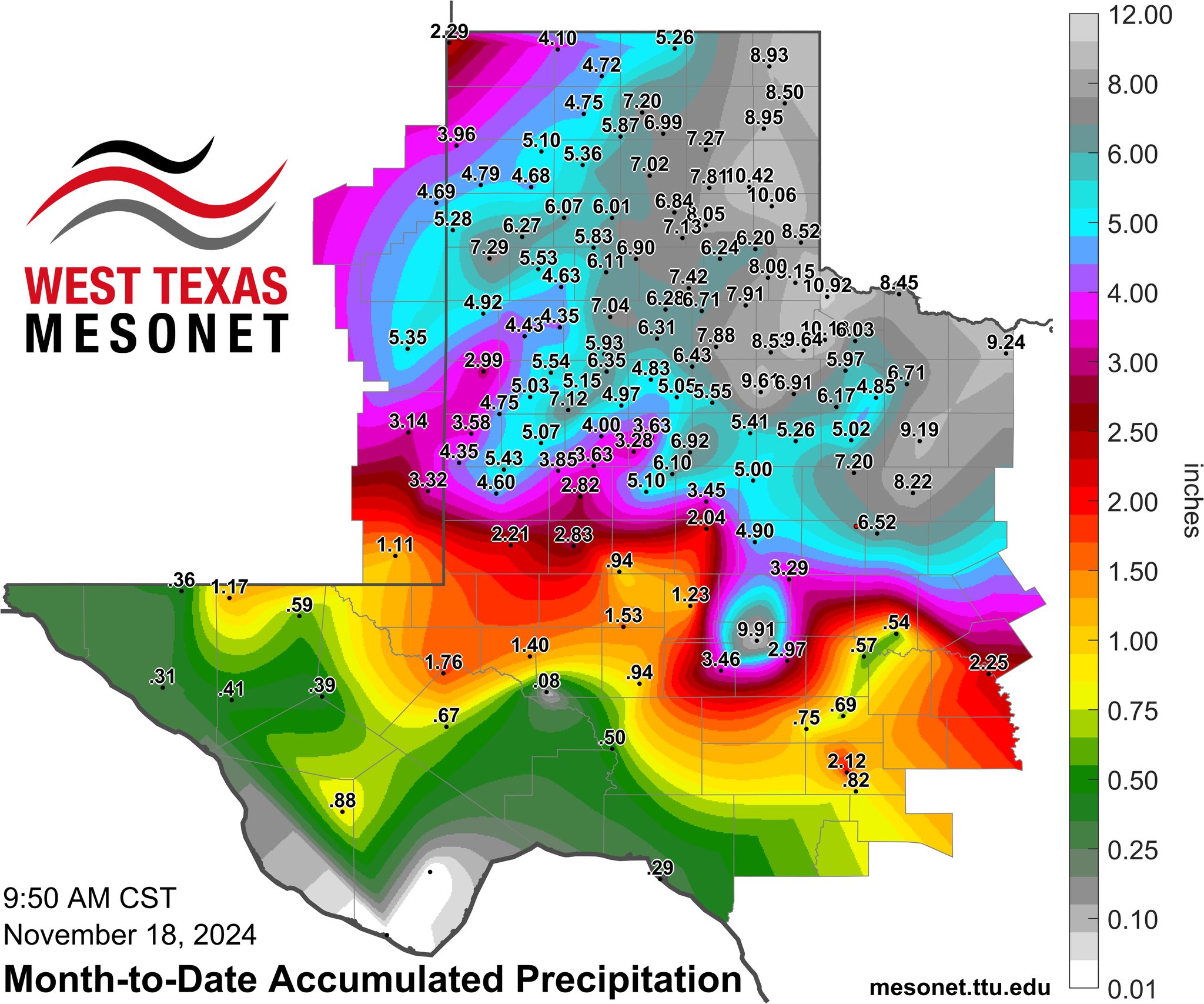
| Month-to-date rainfall for the entire West Texas Mesonet domain, valid through 9:50 am on 18 November 2024. | |
| The heaviest rain moved east of Rolling Plains by 4 am, ending the flash flooding risk. However, additional scattered lighter activity lingered through the Monday morning as the upper low passed directly overhead. By the time all was said and done, Lubbock measured another 1.91 inches of rain, including a daily record of 1.30 inches on November 17th. The rain also pushed the monthly total to 4.85 inches, making it the second wettest November on record, only trailing November of 2004 (6.65 inches). | |
 |
|
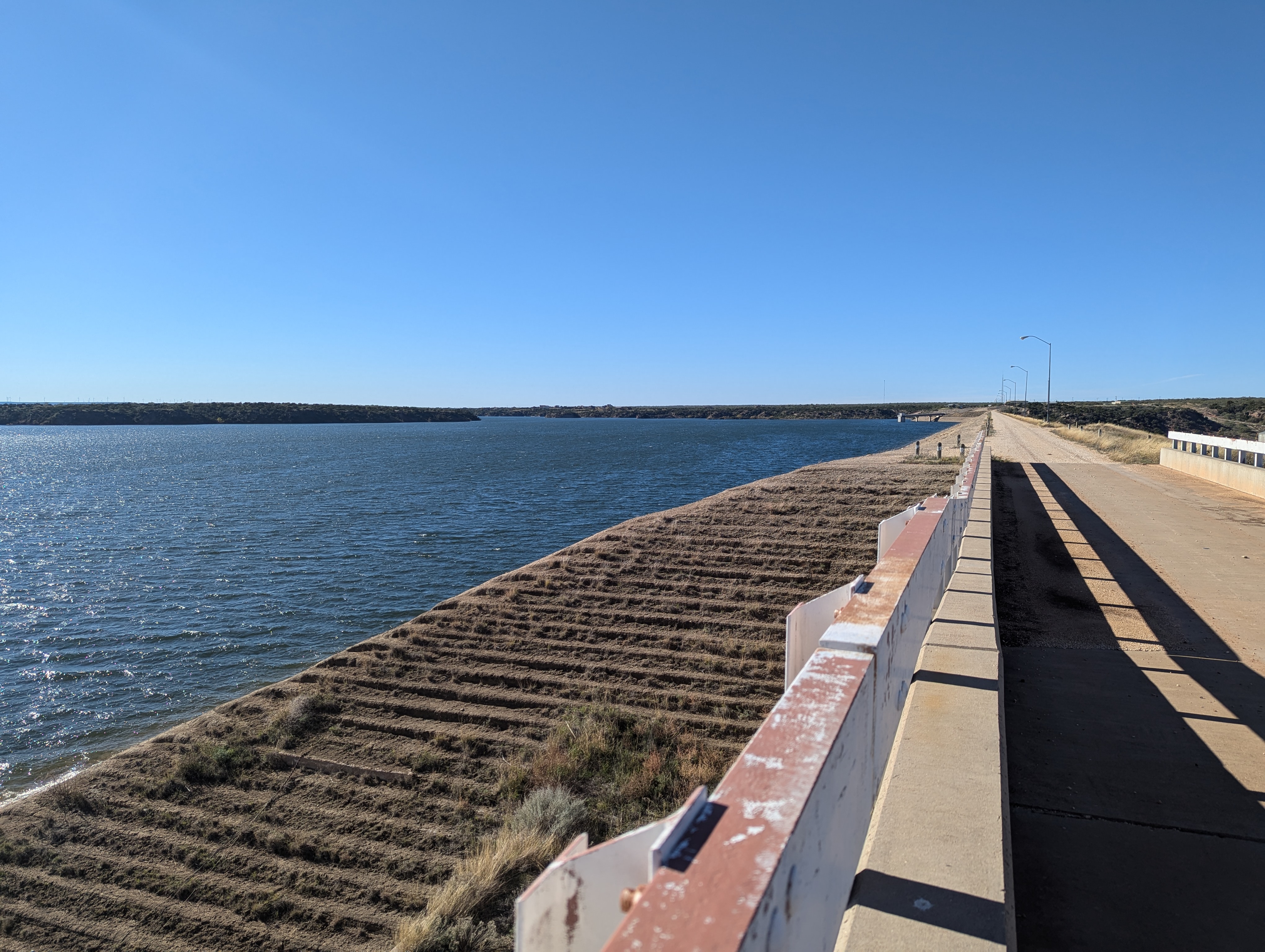
| A plump full Lake Alan Henry, as viewed from above the spillway on Tuesday afternoon (19 November 2024). | |
|
Runoff was enhanced in many spots since soils were already damp/wet from rains early in the month and that contributed to greater stream responses in some areas. The start of the Brazos, on the southeast side of Lubbock, spend several hours above action stage, with flooding over FM 835 immediately upstream of Buffalo Springs Lake. Another tributary of the Brazos passing through Justiceburg briefly breached action stage, with water from it dumping into Lake Alan Henry and causing about a 2 foot rise, keeping the lake above full conservation level. Even Makenzie Lake, which often shows little to no response, rose about 2 feet. Storm reports for this active mid-November can be found below: |
|
Preliminary Local Storm Report...Summary
National Weather Service Lubbock TX
928 AM CST Mon Nov 18 2024

..TIME...   ...EVENT...      ...CITY LOCATION...     ...LAT.LON...
..DATE...   ....MAG....      ..COUNTY LOCATION..ST.. ...SOURCE....
            ..REMARKS..

1127 PM     Flash Flood      1 SW Brownfield         33.17N 102.28W
11/17/2024                   Terry              TX   Public

            Report from mPING: Street/road flooding;
            Street/road closed; Vehicles stranded.

1207 AM     Flash Flood      2 W Lubbock             33.59N 101.87W
11/18/2024                   Lubbock            TX   Public

            Report from mPING: Street/road flooding;
            Street/road closed; Vehicles stranded.

1214 AM     Flash Flood      3 SW Lubbock            33.56N 101.89W
11/18/2024                   Lubbock            TX   Public

            Report from mPING: Street/road flooding;
            Street/road closed; Vehicles stranded.

1242 AM     Flash Flood      Lubbock                 33.58N 101.84W
11/18/2024                   Lubbock            TX   Law Enforcement

            Car submerged under the overpass of 19th and
            Interstate 27.

0900 AM     Flood            2 W Ransom Canyon       33.53N 101.72W
11/18/2024                   Lubbock            TX   Emergency Mngr

            Buffalo Springs Emergency Manager reported
            two feet of water flowing over FM835. Road
            closed.

1206 AM     Tstm Wnd Gst     5 SSW Graham            33.08N 101.52W
11/18/2024  M59 MPH          Garza              TX   Mesonet

            Reported by the West Texas Mesonet.

0158 AM     Non-Tstm Wnd Gst 2 NNE Floydada          34.01N 101.32W
11/18/2024  M60 MPH          Floyd              TX   Mesonet

            Measured by the West Texas Mesonet. The gust
            occurred well behind a line of thunderstorms
            where no rain was occurring. An additional
            gusty to 58 mph occurred at 1:56 AM.

1248 AM     Tstm Wnd Gst     1 SE Ralls              33.67N 101.38W
11/18/2024  M64 MPH          Crosby             TX   Mesonet

            Measured by the West Texas Mesonet. A gust
            to 59 mph also occurred at 12:46 AM.

0149 AM     Tstm Wnd Gst     10 SW Paducah           33.89N 100.40W
11/18/2024  M65 MPH          Cottle             TX   Mesonet

            Measured by the West Texas Mesonet. Another
            gust to 65 mph occurred at 1:48 AM, with
            severe caliber gusts from 1:46 to 1:50 AM.