|
Another Round of Widespread Heavy Rain |
|
 |
|
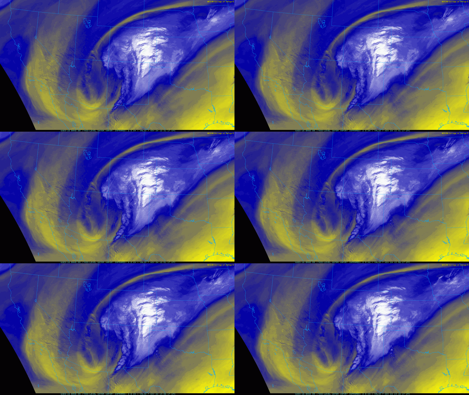
| Water vapor satellite loop valid from 6:31 am to 7:16 am on Thursday (7 November 2024). | |
|
The 7th and 8th of November brought another bout of widespread showers and thunderstorms, only days after the region's last widespread shot of heavy rain (2-4 November). Similar to its predecessor, this rain event was sparked by a powerful storm system churning slowly through the Four Corners, and eventually into the southern High Plains. |
|
 |
|
|
Regional radar animation valid from 6:05 am on Thursday to 12:25 pm on Friday (7-8 November 2024). |
|
| In advance of the system, a cold front plunged through the South Plains region Wednesday evening/night. The initial frontal passage was dry. However, that quickly changed as warm and moist air over Central Texas was drawn northward, up and over the cooler air in place, as the storm system centered over Arizona and western New Mexico began to edge eastward. | |
 |
|
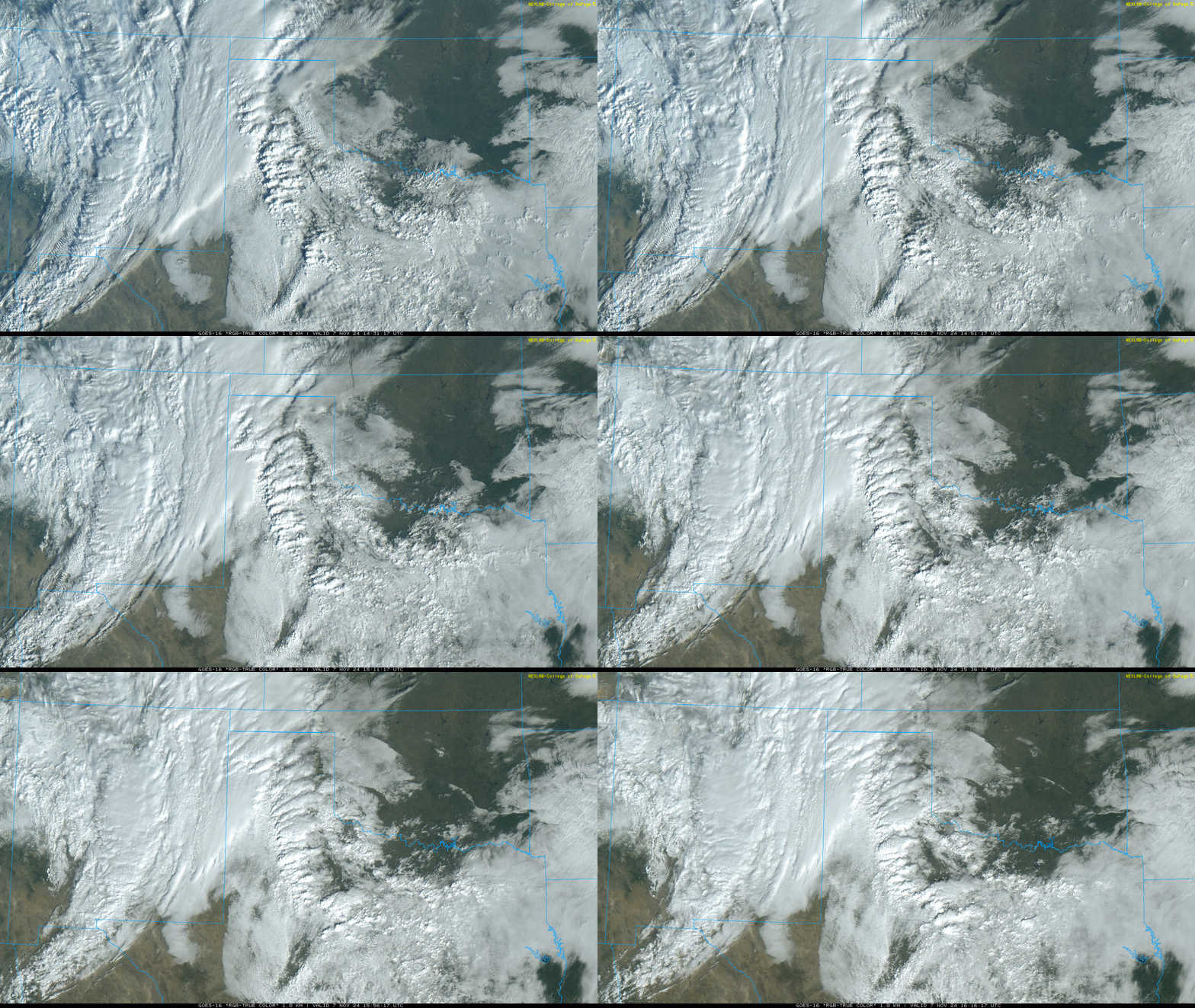
| "RGB-True Color" satellite loop valid from 8:31 am to 10:16 am on Thursday (7 November 2024). | |
| In response to the increased moisture and lift, clouds and showers and thunderstorms blossomed over the central South Plains Thursday morning. This activity gradually shifted to the northeast, leaving low clouds, fog and drizzle in its wake Thursday afternoon. However, as renewed lift for the approaching system spread over the southern High Plains, widespread showers and thunderstorms developed and spread across all of the South Plains, Rolling Plains and southern Texas Panhandle Thursday evening into Friday morning. The individual storm cells moved quickly, but they dropped very heavy rain as they moved by. The rain then gradually diminished, from west-to-east, by around noon on Friday. | |
 |
|
| Lubbock radar animation valid from 3:03 pm on Thursday to 7:25 am on Friday (7-8 November 2024). Additional radar animations from the Lubbock radar can be found at: 6:15 am to 2:47 pm on Thursday; and 4:46 am to 11:37 am on Friday. | |
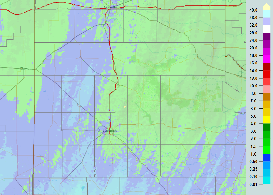
| By the time all was said and done, the entire region experienced another significant rain event. As the below image shows, the heaviest rain fell on locations near and off the Caprock, though everyone saw meaningful moisture. | |
 |
|
| Radar-estimated and bias-correct 3-day rainfall ending at 11 am on Friday (8 November 2024). A larger view, including much of Texas, can be FOUND HERE. | |
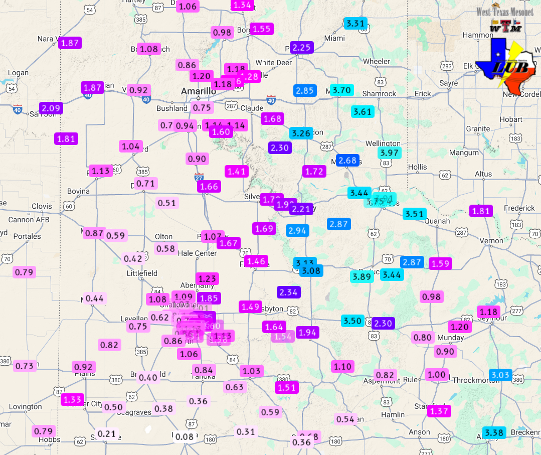
| Rainfall totals of an inch or more were common along and east of the Interstate 27/U.S. 87 Corridor as well as over the western Texas Panhandle. Over much of the southeast Texas Panhandle into the Rolling Plains, totals of 2 to 3+ inches were common. | |
 |
|
| 3-day rain totals ending at 11:30 am on Friday (8 November 2024). The data are courtesy of the West Texas Mesonet and National Weaver Service. A zoomed in view on the South Plains region can be VIEWED HERE. A close up on the Lubbock area can be FOUND HERE. | |
| Officially, the Lubbock Airport recorded 1.25 inches between November 7th and 8th, while Childress measured 3.39 inches (and 7.33 inches over the past week). | |
 |
|
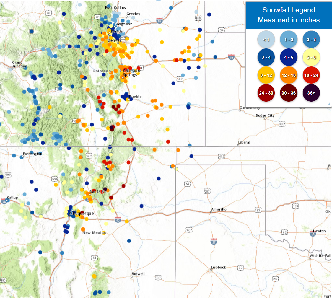
| 3-day snowfall totals through Friday morning (8 November 2024). | |
| The moisture wasn't limited to West Texas. In fact, where it was cold enough, widespread heavy snow fell from much of northeast-central and northeast New Mexico into much of eastern and southern Colorado. The heavy snow, and blowing snow, to the tune of 1-3 feet, brought travel to a standstill over that region. Thankfully, closer to home, the heavy rain did create runoff and minor flooding, though overall impacts were minimal. | |