|
A rare July cold front provides storms and natural fireworks |
|
 |
|
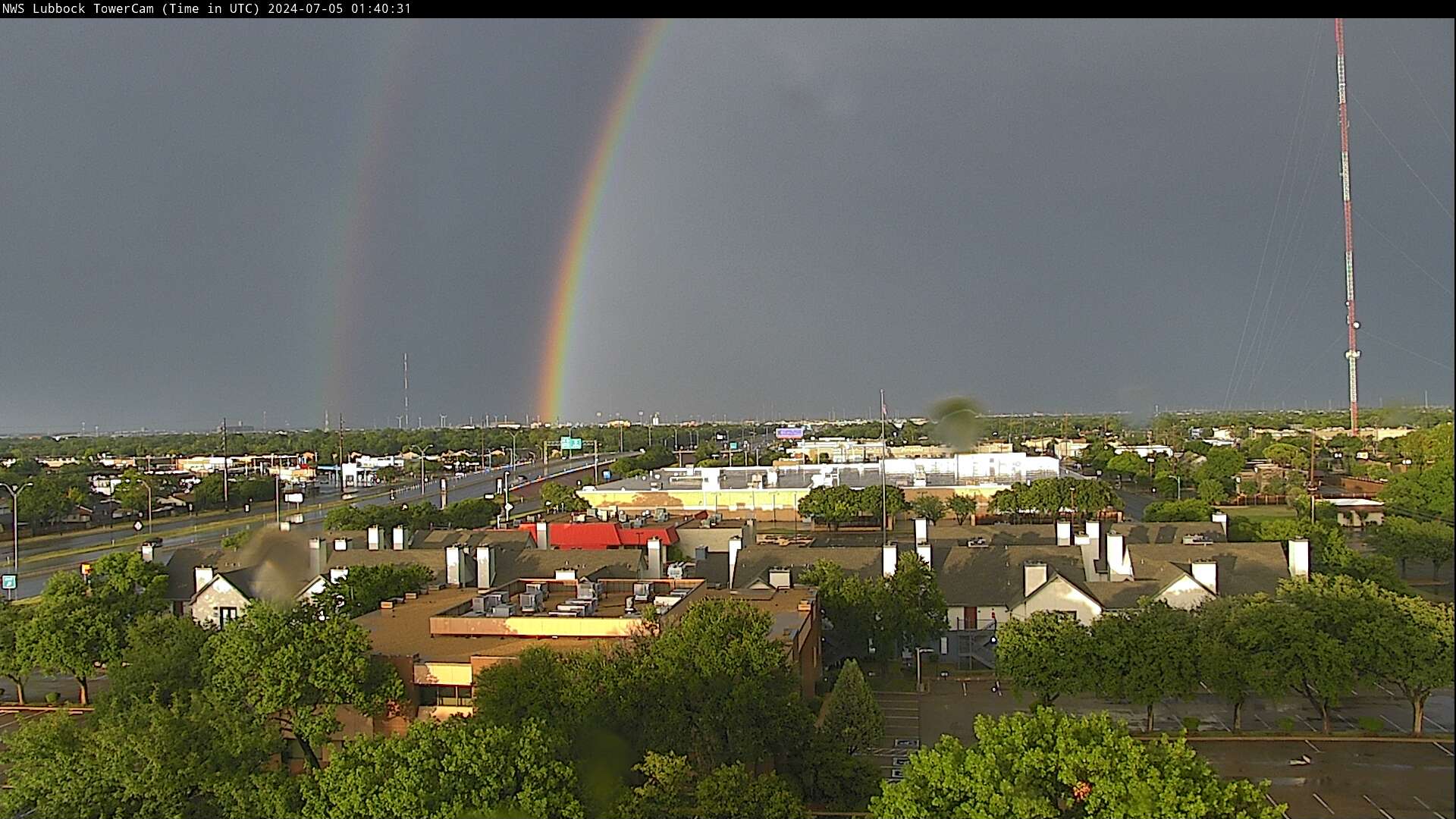
| Double rainbow Thursday evening (4 July 2024), as viewed from the south side of Lubbock. | |
|
The heat of late June and early July came to a dramatic conclusion as a cold front moved into the South Plains on Independence Day. The front served as a focus for rapid thunderstorm development during the mid-late afternoon, with showers and thunderstorms lingering well into the evening/night. |
|
 |
|
|
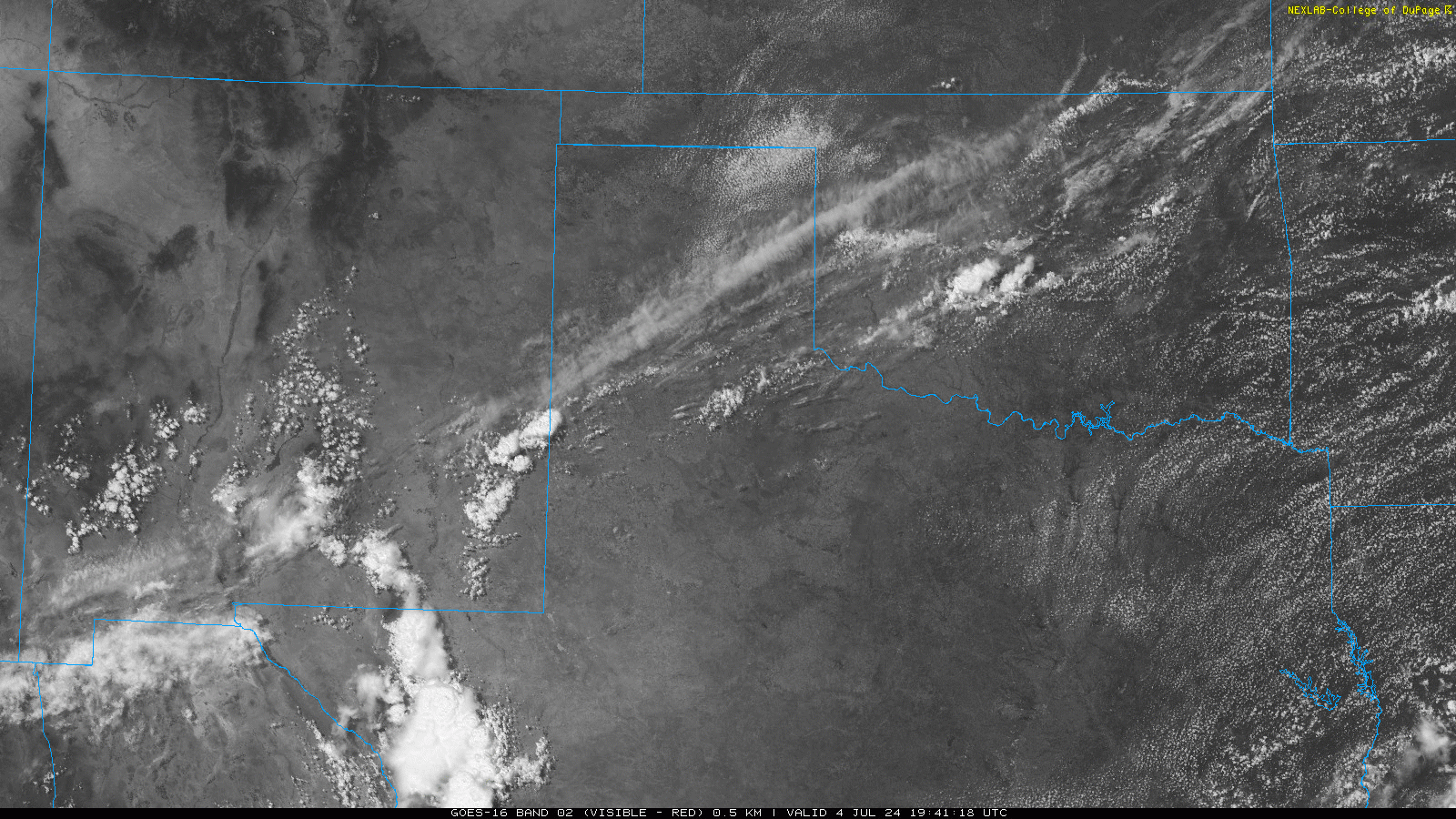
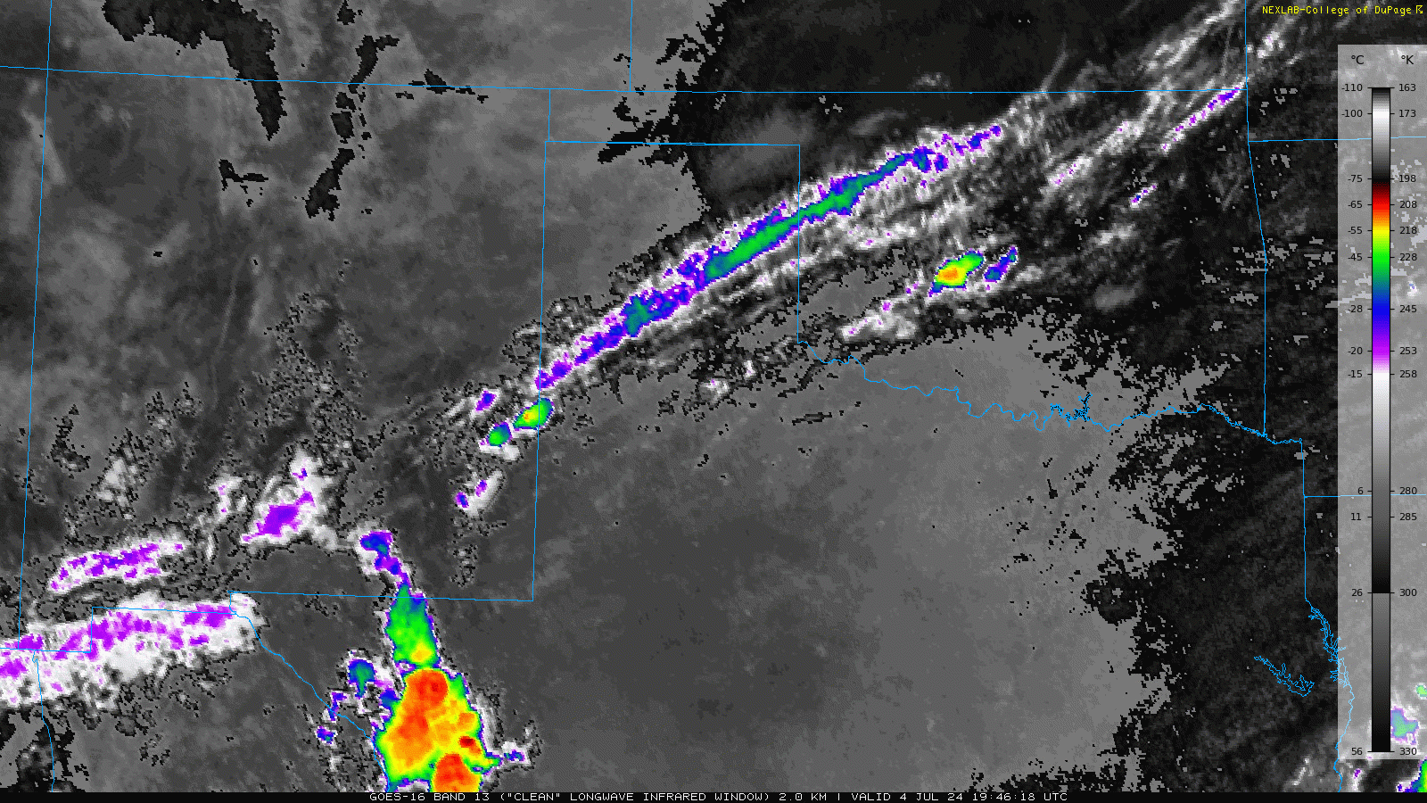
Visible satellite loop valid from 2:46 pm to 8:11 pm on Thursday (4 July 2024). An infrared satellite animation over this same period can be VIEWED HERE. |
|
| Thunderstorms initially developed near the state line, from the western South Plains into southeast New Mexico between 2 and 3 pm, with additional development farther northeast up the front into the southeast Texas Panhandle and into central Oklahoma. Temperatures near and above the triple digit mark, coupled with decent moisture levels, provided plenty of fuel for the thunderstorms. | |
 |
|
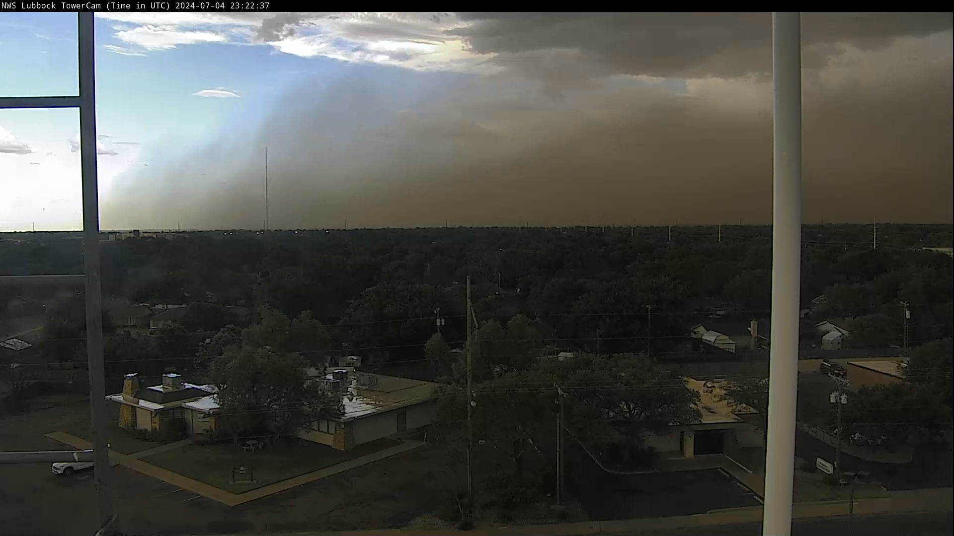
| Wall of dust and wind moving into Lubbock Thursday evening (4 July 2024). The image was captured from the south side of Lubbock at 6:23 pm. | |
| The hot, deeply mixed lower levels of the atmosphere, below the cloud bases, also supported plenty of potential for evaporative cooling as heavy precipitation fell into the layer from above. The rain-cooled air accelerated downward, creating strong to severe wind gusts as the air hit the ground and spread out. | |
 |
|
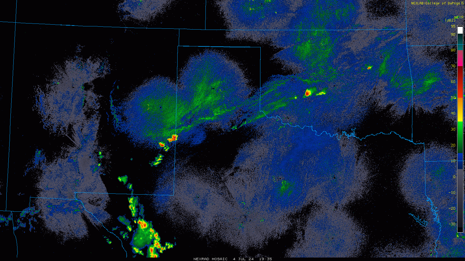
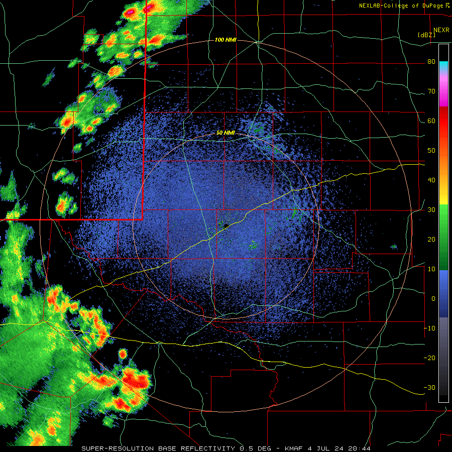
| Regional radar animation valid from 2:45 pm to 10:15 pm on Thursday (4 July 2024). Midland's WSR-88D radar animation valid from 3:44 pm to 10:35 pm this evening can be FOUND HERE. | |
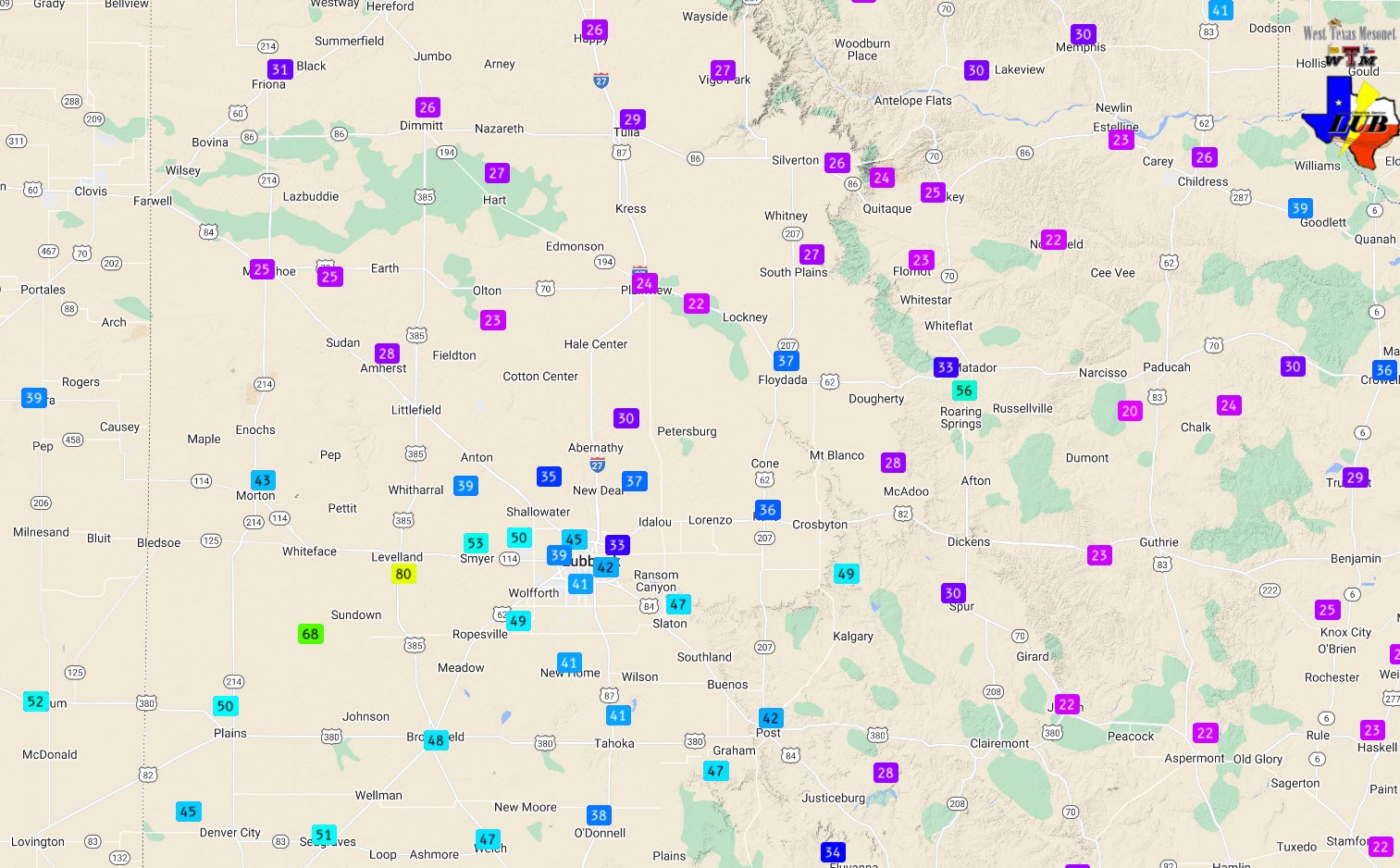
| The most intense wind gusts, as high as 80 mph, impacted areas south of Levelland to northwest of Ropesville, Thursday evening. The thunderstorms lost some zest as they spread eastward through the evening, but still managed to generate wind gusts of 40 to 50+ mph over much of the central and southeastern South Plains. One isolated cell near Roaring Springs also generated a rogue gust to 56 mph. In addition, a few locations experience small hail, including half inch diameter hail on the northwest side of Lubbock. | |
 |
|
| Peak wind gusts measured by the West Texas Mesonet (WTM) on Thursday (4 July 2024). | |
| The thunderstorms brought welcome rain to parts of the South Plains, including Lubbock. However, the ill-timed storms did wreak havoc with 4th of July celebrations in spots. The heavy rain, gusty winds and lightning forced Lubbock to cancel their concert and fireworks show. On the bright side, the rain did knock the heat back, with temperatures tumbling into the 70s after the rain-cooled air moved in. | |
 |
|
| Clearing skies west of Lubbock after the thunderstorms Thursday evening (4 July 2024). | |
| The thunderstorms began shifting east of Lubbock around sunset, just in time to produce some fine natural sky optics, including a colorful sunset (above) and fantastic rainbow (top of the page). | |
 |
|
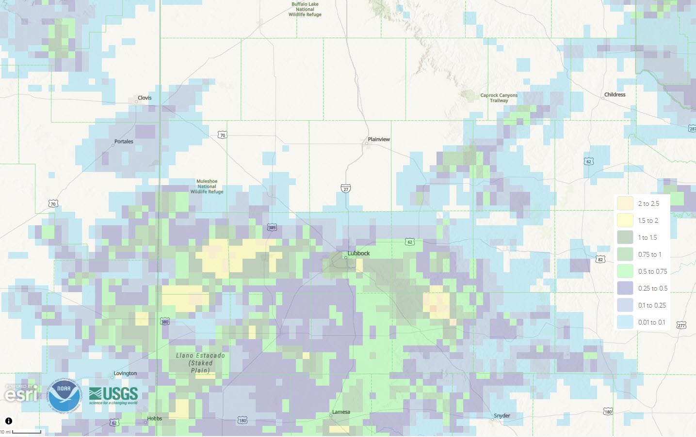
| 24-hour radar-estimated and bias-corrected rainfall ending at 7 am on Friday (5 July 2024). | |
| The rain was confined to portions of the central and southern South Plains. Denver City, Tokio, Levelland and parts of Lubbock all experienced heavy downpours. Rain totals of 1 to 2 inches were common in the heaviest cores, including at MacKenzie Park, where Lubbock's Independence Day Celebration was ongoing. The heavy rain caused minor flooding and broke up outside celebrations. | |
 |
|
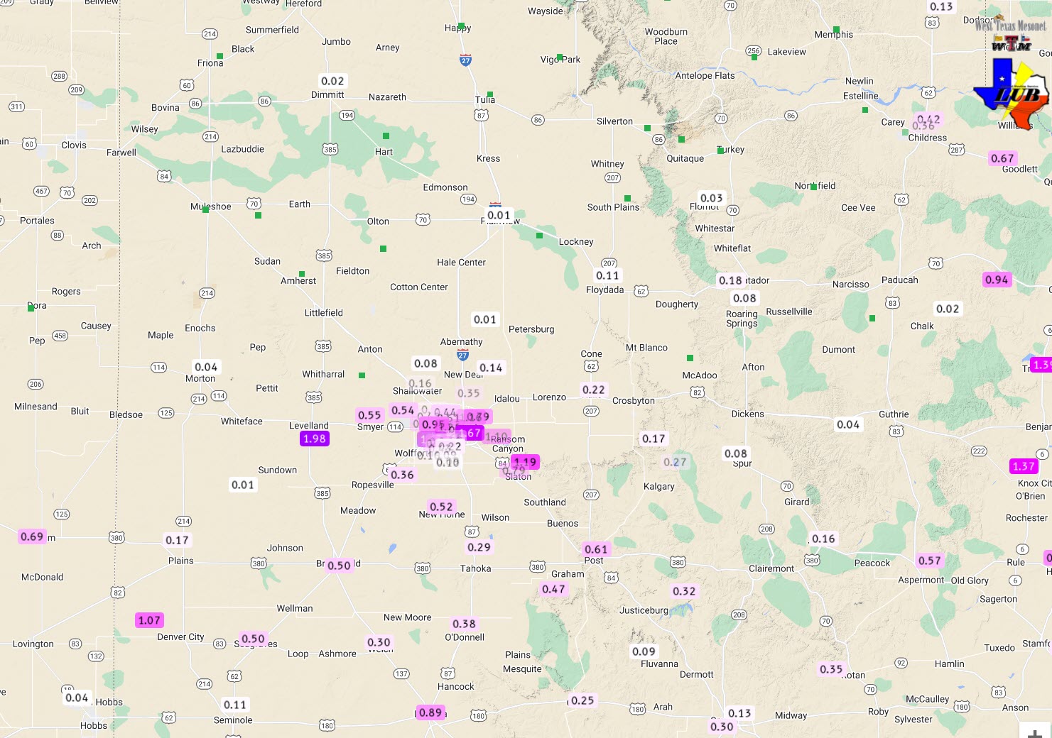
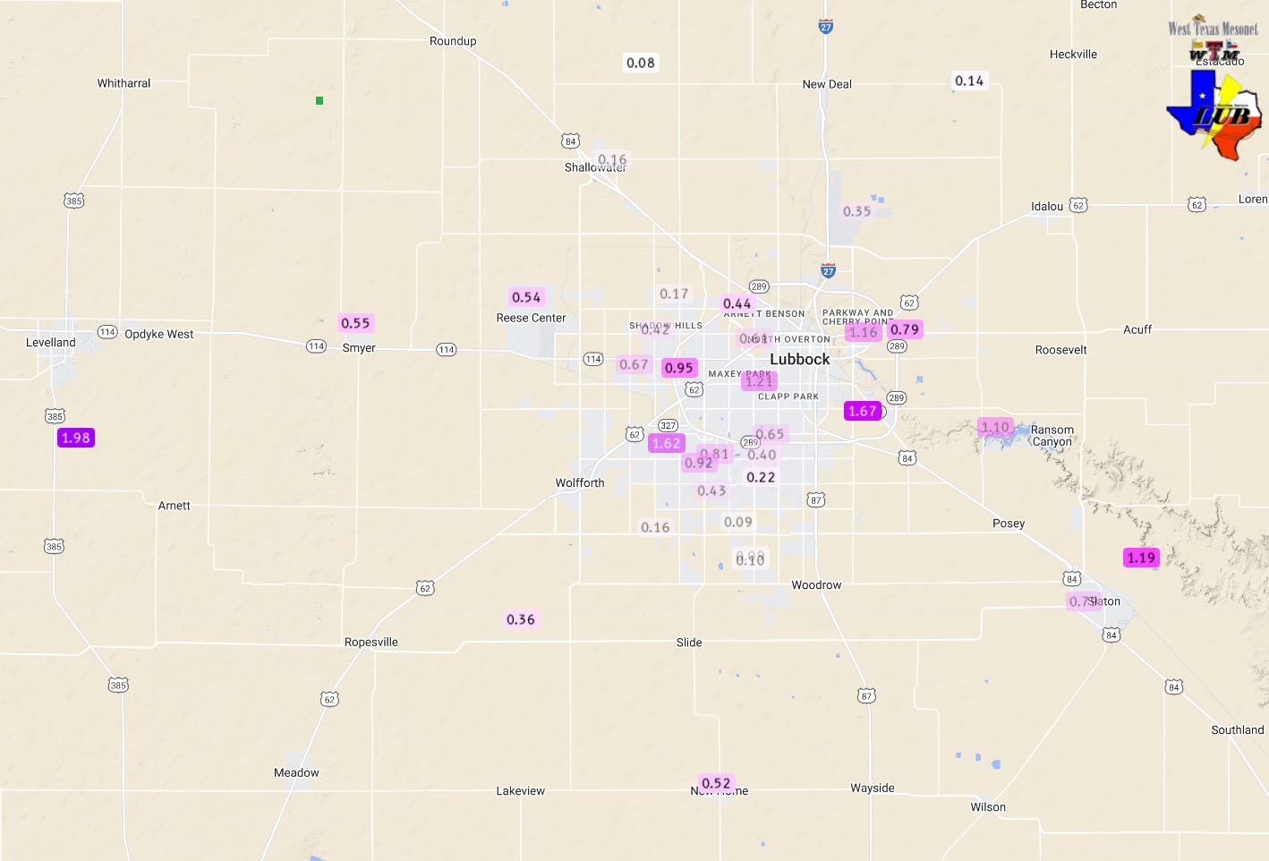
| 2-day rainfall measured by the West Texas Mesonet (WTM) and NWS ending at 6 pm on Friday (4 July 2024). A close up of the Lubbock area can be VIEWED HERE. | |
|
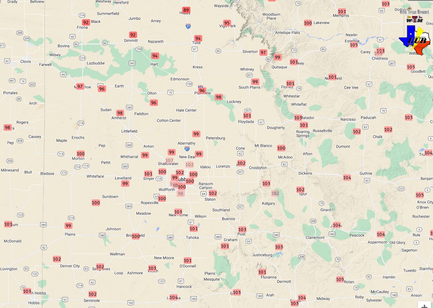
The thunderstorm activity, along with the cold front, brought a much-needed cool down to West Texas. Following triple digits for much of the South Plains and Rolling Plains on July 4th, high temperatures only reached the upper 70s to middle 80s on Friday, July 5th. |
|
 |
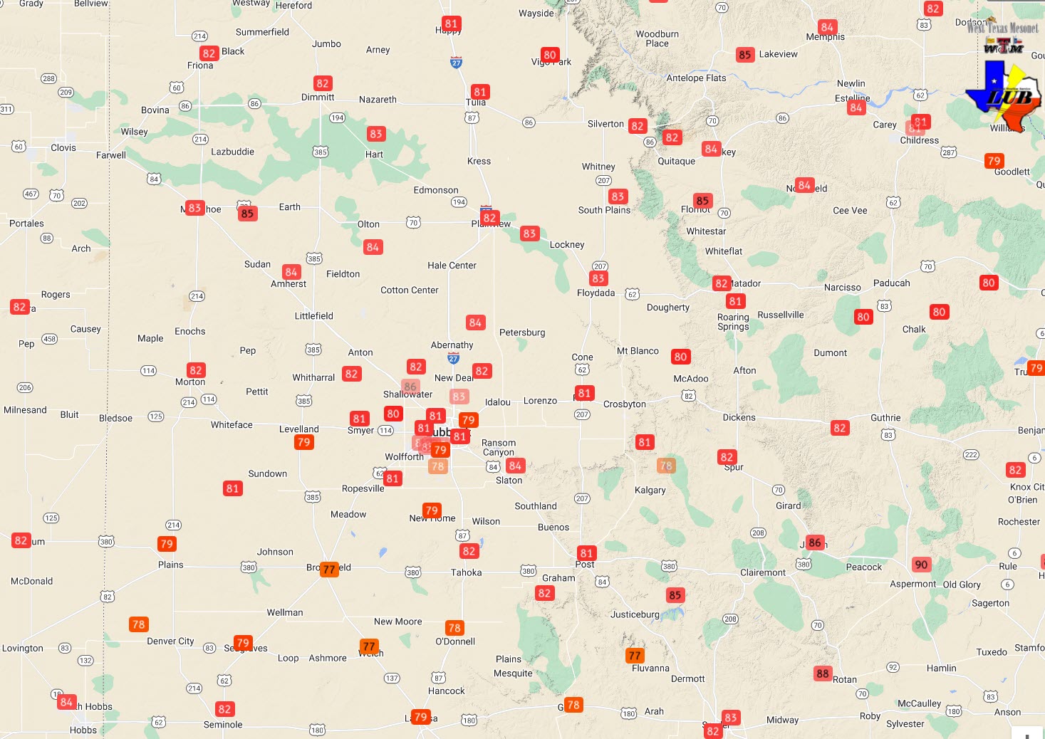 |
| (Left) High temperatures measured by the WTM on Thursday (left) and Friday (right), July 3rd and 4th. The 24-hour temperatures change, valid at 5:45 pm on Friday can be VIEWED HERE. | |
|
Storm reports for this active July 4th can be found below: |
|
Preliminary Local Storm Report...Summary
National Weather Service Lubbock TX
1019 PM CDT Thu Jul 4 2024

..TIME...   ...EVENT...      ...CITY LOCATION...     ...LAT.LON...
..DATE...   ....MAG....      ..COUNTY LOCATION..ST.. ...SOURCE....
            ..REMARKS..

0502 PM     Tstm Wnd Gst     8 SW Sundown            33.39N 102.61W
07/04/2024  M68 MPH          Cochran            TX   Mesonet

            Corrects previous tstm wnd gst report from 8
            SW Sundown. Measured by the West Texas
            Mesonet. Several wind gusts of 58+ mph
            occurred from 5:01 pm to 5:11 pm.

0538 PM     Tstm Wnd Gst     4 S Levelland           33.53N 102.36W
07/04/2024  M80 MPH          Hockley            TX   Mesonet

            The West Texas Mesonet measured numerous
            gusts of 58+ mph from 5:24 pm to 5:48 pm,
            with a peak gust of 80 mph at 5:38 pm.

0557 PM     Tstm Wnd Gst     6 N Ropesville          33.49N 102.19W
07/04/2024  E80 MPH          Hockley            TX   Trained Spotter

            Estimated peak wind gusts of 80+ mph. Lots
            of thick blowing dust too.

0614 PM     Tstm Wnd Gst     5 S Wolfforth           33.44N 102.02W
07/04/2024  E60 MPH          Lubbock            TX   NWS Employee


0619 PM     Tstm Wnd Dmg     2 NE Meadow             33.37N 102.19W
07/04/2024                   Terry              TX   Public

            Report from mPING: 1-inch tree limbs broken;
            Shingles blown off.

0619 PM     Hail             4 SE Reese Center       33.56N 101.96W
07/04/2024  E0.50 Inch       Lubbock            TX   Public

            Report from mPING: Half-inch (0.50 in.).

0624 PM     Hail             5 E Reese Center        33.56N 101.94W
07/04/2024  M0.50 Inch       Lubbock            TX   Public

            Report from mPING: Half-inch (0.50 in.).

