|
Thunderstorms bring widespread rain for the South Plains region |
|
 |
|
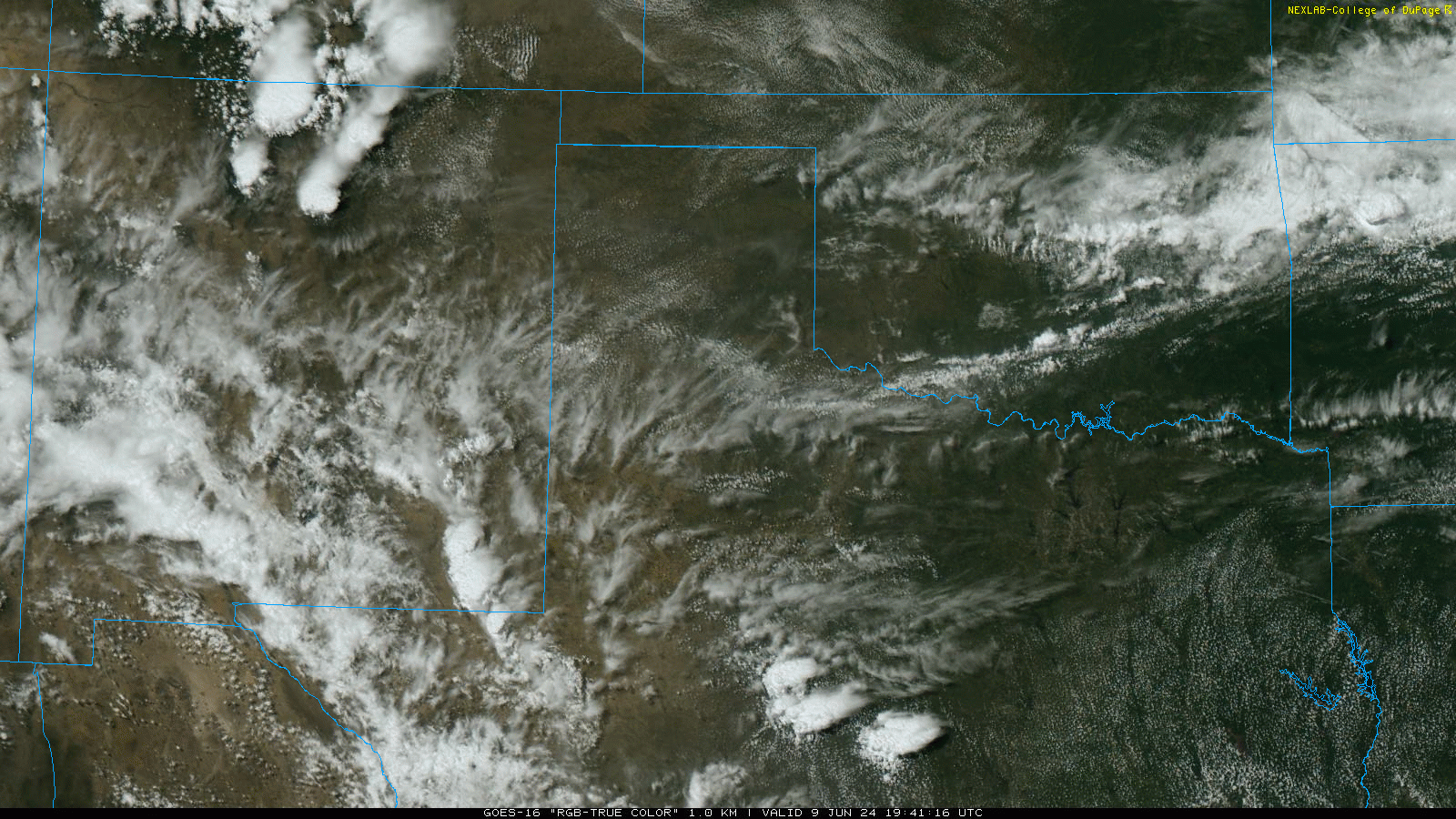
| RGB "True Color" satellite loop valid from 2:41 pm to 7:16 pm on Sunday (9 June 2024). | |
|
Following several hot days in a row in early June, including the first official triple digits of year for Lubbock, welcome relief from the heat came in the form of rain-cooled air Sunday afternoon and evening (9 June). Thunderstorm initially developed along several low-level boundary, fueled by deep, rich moisture and a weakness aloft. |
|
 |
|
|
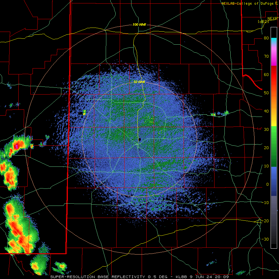
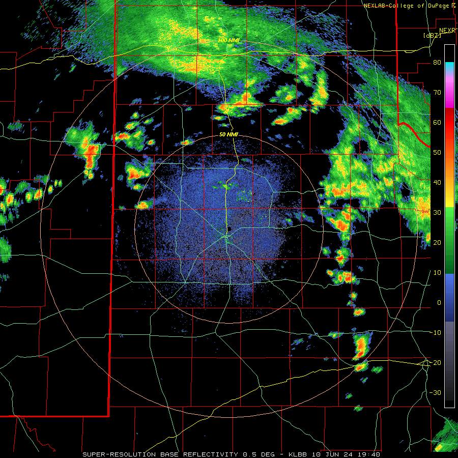
Lubbock WSR-88D radar animation valid from 3:09 pm on Sunday to 6:27 am on Monday (9-10 June 2024). |
|
| Numerous outflow boundaries roaming the South Plains region interacted throughout the late afternoon and evening, further sparking additional showers and thunderstorm development. Although vertical wind shear was on the weak side, decent instability did allow several storms to become strong to briefly severe. Pea to quarter size hail fell in a number of locations, including the south side of Lubbock and over Ralls, while several wind gusts in excess of 50 mph were observed. One rogue gust of 67 mph was even measured at the Lubbock Airport early Sunday evening. | |
 |
|
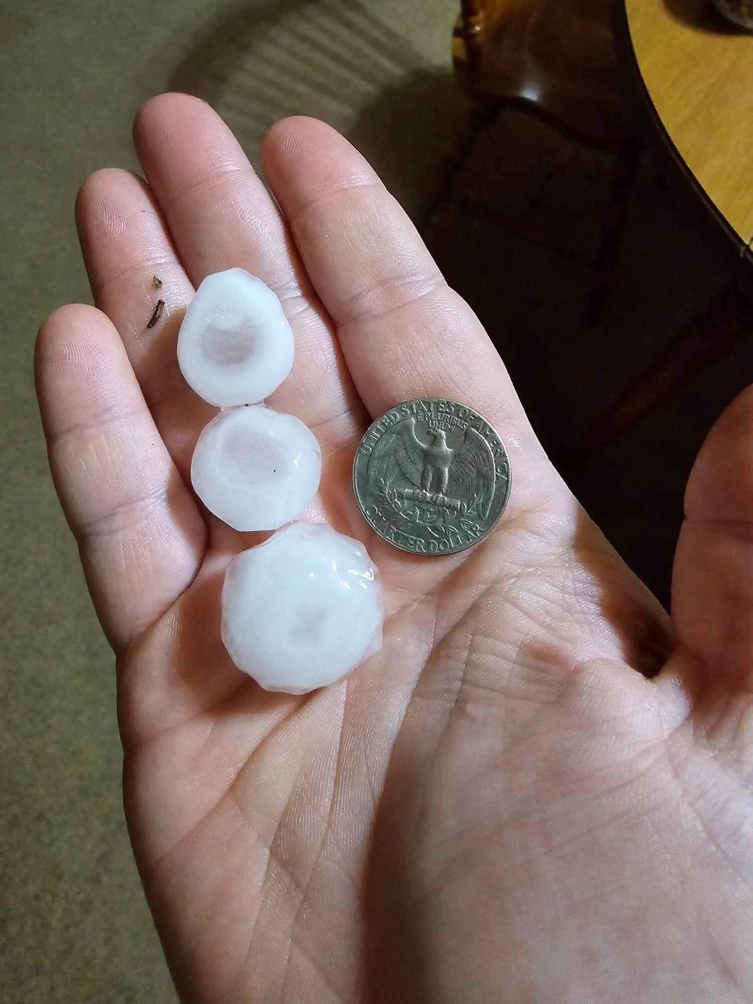
| Hail that fell in Ralls Sunday evening (9 June 2024). The picture is courtesy of Jacob Riley. | |
| More significantly, the abundant moisture supported efficient rain rates and widespread robust rain totals, which did lead to pockets of flooding and flash flooding. Several reports of street flooding and vehicles stranded were received from in and around Lubbock Sunday evening as a couple different rounds of very heavy rain targeted the area. | |
 |
|
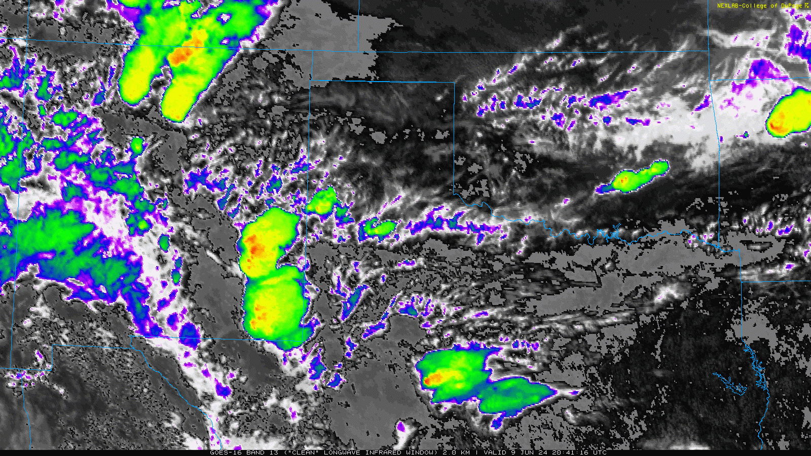
| Infrared satellite loop valid from 3:51 pm to 10:01 pm on Sunday (9 June 2024). | |
| The moderate to heavy rain wasn't confined to Lubbock, but impacted much of the South Plains, southern Texas Panhandle and Rolling Plains between late Sunday afternoon and early Monday morning. In fact, nearly every station on and near the South Plains saw at least a little rain over this active evening/overnight, with many spots measuring 1 to 2+ inches. | |
 |
|
| Lubbock WSR-88D radar animation valid from 2:44 pm on Monday to 6:31 am on Tuesday (10-11 June 2024). | |
| After a relative lull through the middle part of Monday, additional rounds of thunderstorms developed and tracked over the region Monday evening and overnight. A couple of these thunderstorms were strong to severe, but nearly all of the activity produced heavy rain, which fell on already saturated soils in spots. | |
 |
|
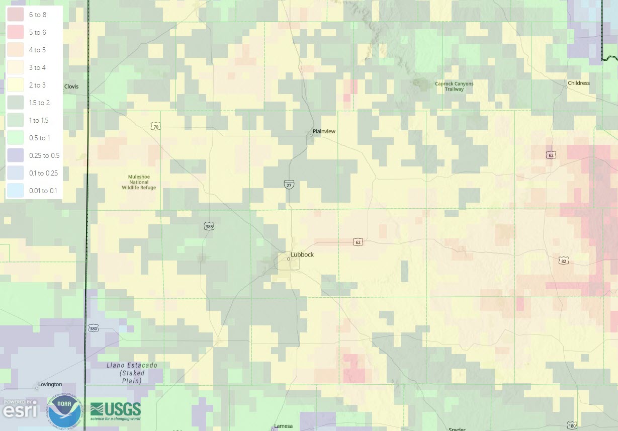
| 24-hour radar-estimated and bias-corrected rainfall ending at 7 am on Monday (10 June 2024). | |
| Areas in and around Lubbock generally measured 1 to 2.5 inches of rain between Sunday afternoon and early Monday morning, with another 1 inch or so falling Monday evening into early Tuesday. Officially, the rain gauge at the Lubbock Airport recorded 1.49 inches on June 9, setting a new daily record for the day (breaking the previous record of 1.46 inches, set in 1923). The 10th brought 1.05 inches, with another 0.51 inches falling in the predawn hours of the 11th. Altogether, the Lubbock Airport measured 3.05 inches over the 3-day mid-June stretch. | |
 |
|
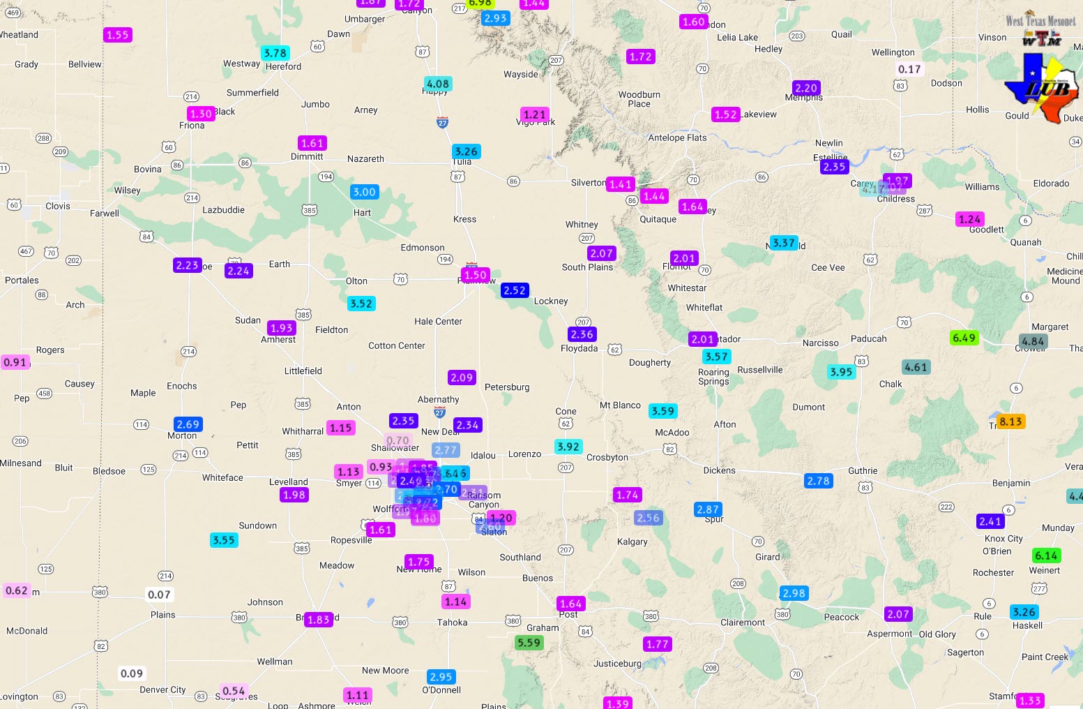
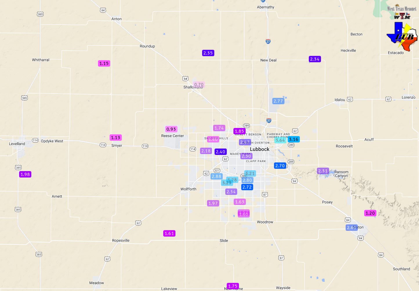
| 3-day rainfall measured by the West Texas Mesonet (WTM) and NWS ending at 7 am on Wednesday (12 June 2024). A close up of the Lubbock area can be VIEWED HERE. | |
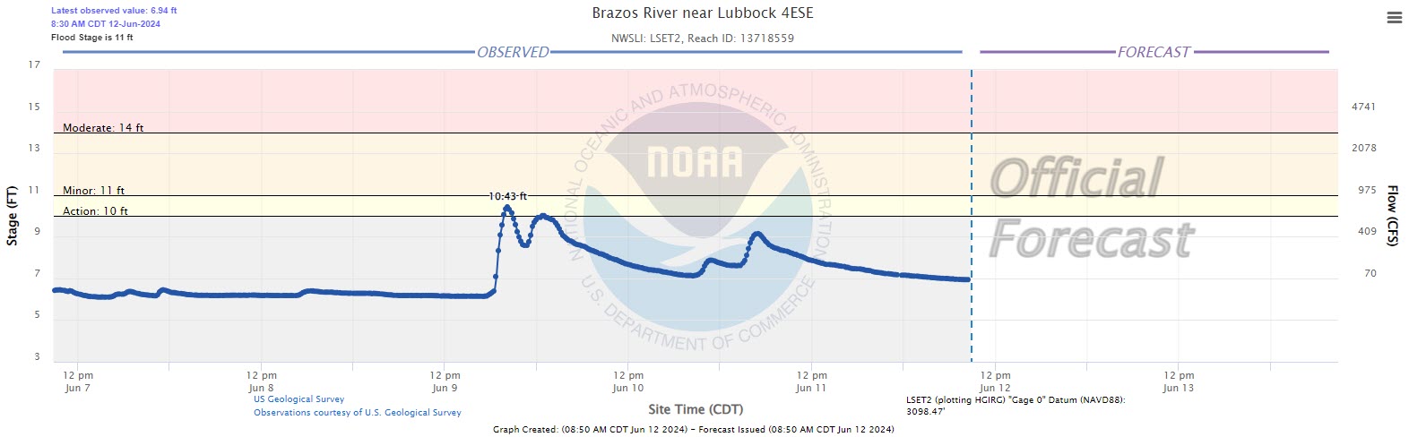
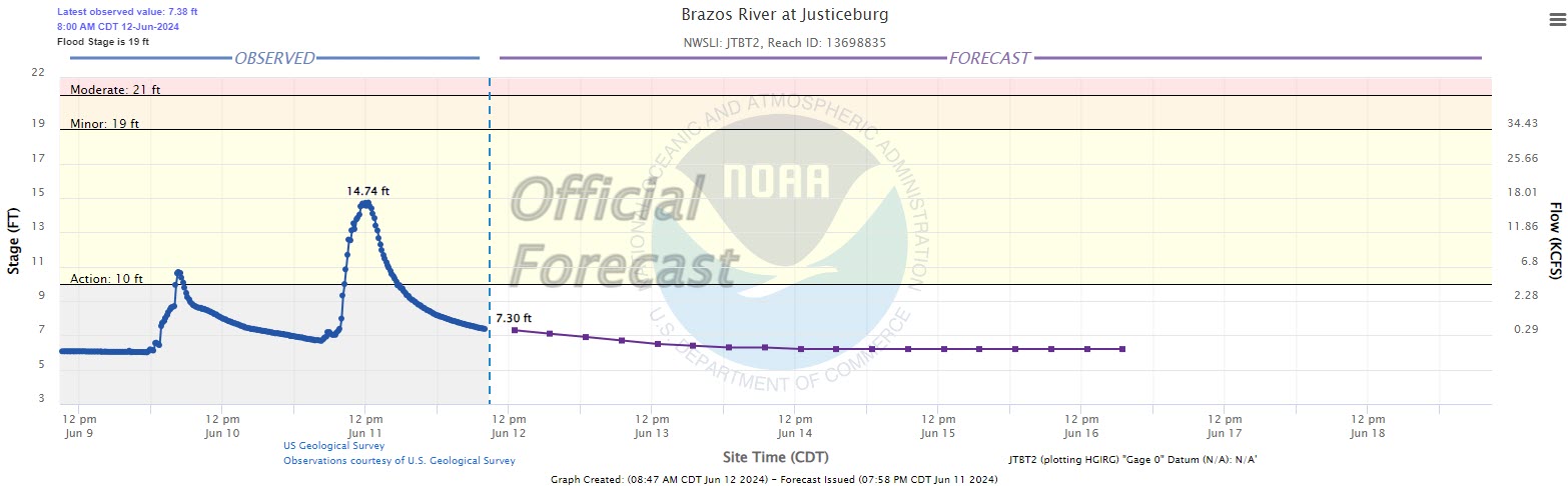
| Runoff from the heavy rain did cause a response on several of the area creeks and rivers, including the Brazos immediately downstream of Lubbock, and near Justiceburg, which both breached action stage twice. The runoff resulted in about a 3 foot rise on Lake Alan Henry, pushing it above 2,200 feet, which is conservation level, meaning the lake is at 100% capacity. | |
 |
|
| Plot of the Brazos River level near Lubbock 4ESE through Wednesday morning (12 June 2024). A plot of the Brazos River at Justiceburg over this same period can be FOUND HERE. | |
| Runoff from the heavy rain also caused the playa lakes in and around Lubbock to swell, and even caused water to spill over the Dunbar Lake Dam on Tuesday (11 June). | |
 |
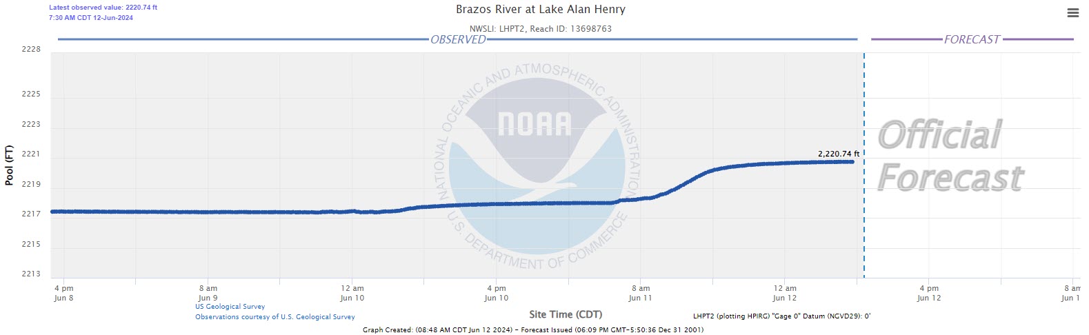 |
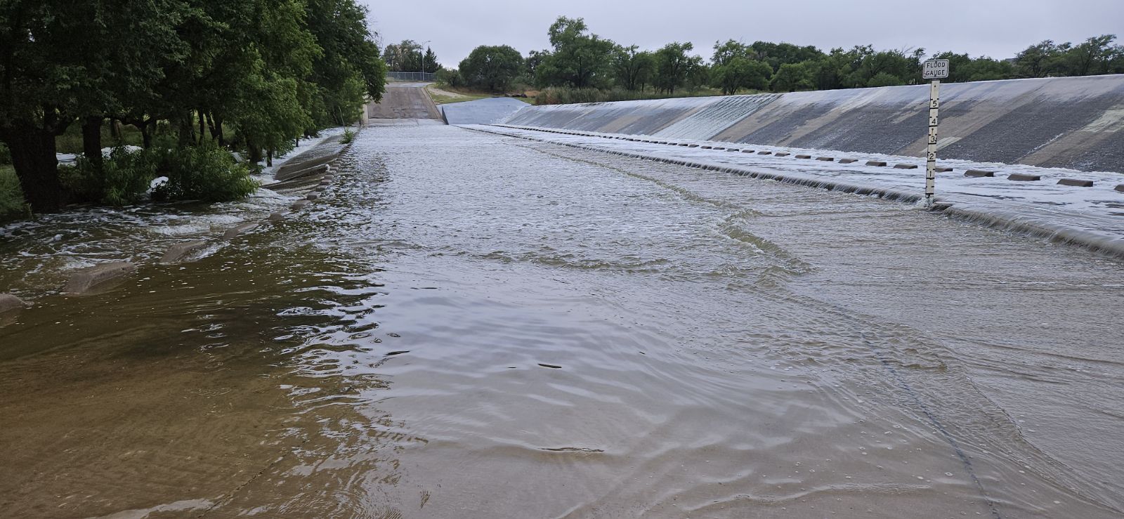
| (Left) Water spilling over the dam downstream of Dunbar Lake in eastern Lubbock on Tuesday morning (11 June 2024). The image is courtesy of Wood Franklin. (Right) Plot of the Lake Alan Henry water level in early June 2024. | |
|
Storm reports for these wet mid-June days can be found below: |
|
Preliminary Local Storm Report
National Weather Service Lubbock TX
242 AM CDT Mon Jun 10 2024

..TIME...   ...EVENT...      ...CITY LOCATION...     ...LAT.LON...
..DATE...   ....MAG....      ..COUNTY LOCATION..ST.. ...SOURCE....
            ..REMARKS..

0607 PM     Hail             Ralls                   33.68N 101.39W
06/09/2024  E1.00 Inch       Crosby             TX   Broadcast Media

0607 PM     Tstm Wnd Gst     KLBB                    33.66N 101.81W
06/09/2024  M67 MPH          Lubbock            TX   ASOS

0622 PM     Hail             4 SE Reese Center       33.56N 101.96W
06/09/2024  E0.75 Inch       Lubbock            TX   Public

            Report from mPING: Dime (0.75 in.).

0625 PM     Flash Flood      5 SW Lubbock            33.53N 101.91W
06/09/2024                   Lubbock            TX   Public

            Report from mPING: Street/road flooding;
            Street/road closed; Vehicles stranded.

0627 PM     Flash Flood      5 NE Wolfforth          33.55N 101.95W
06/09/2024                   Lubbock            TX   Public

            Report from mPING: Street/road flooding;
            Street/road closed; Vehicles stranded.

0640 PM     Flash Flood      3 E Reese Center        33.59N 101.97W
06/09/2024                   Lubbock            TX   Public

            Report from mPING: Street/road flooding;
            Street/road closed.

0727 PM     Hail             15 WNW Friona           34.73N 102.95W
06/08/2024  E1.00 Inch       Parmer             TX   Fire Dept/Rescue

            Corrects previous hail report from 9 NNW
            Bovina.

1010 PM     Flash Flood      5 SW Lubbock            33.53N 101.90W
06/09/2024                   Lubbock            TX   Law Enforcement

            Frontage road closed between Quaker and
            Indiana Ave. Water up to two feet deep.

1035 PM     Flash Flood      5 E Reese Center        33.61N 101.94W
06/09/2024                   Lubbock            TX   NWS Employee

            Water over one foot deep covering all lanes
            of Frankford Ave from Erskine St to Duke St.

1135 PM     Flash Flood      5 NW Woodrow            33.50N 101.90W
06/09/2024                   Lubbock            TX   Public

            Report from mPING: Street/road flooding;
            Street/road closed; Vehicles stranded.

