|
Tornadoes and giant hail impact the southern Texas Panhandle |
|
 |
|
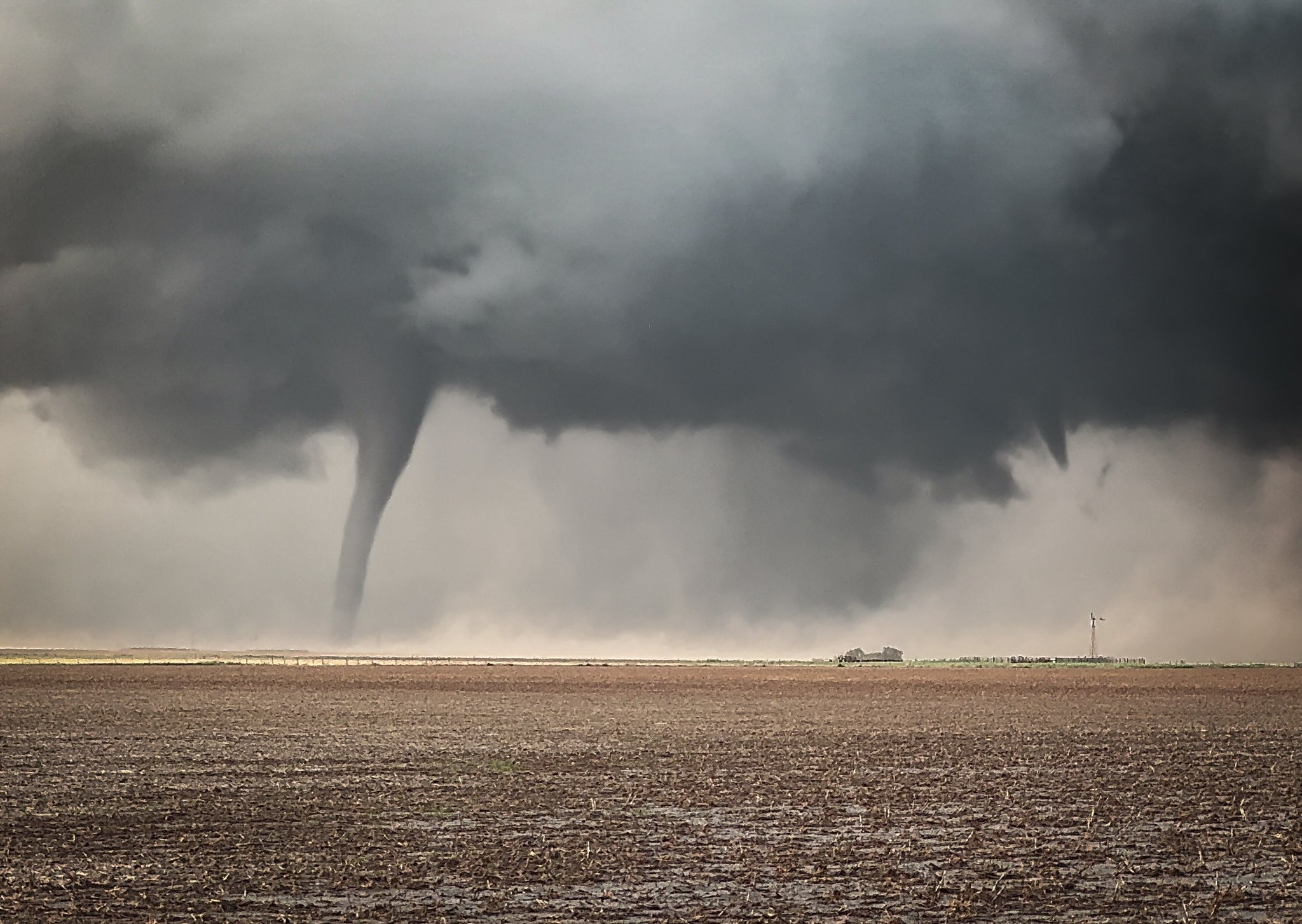
| Tornado and funnel cloud (possible second tornado) near Silverton Sunday evening. The picture is courtesy of Evan Occhino. | |
|
The first Sunday of June, and second day of the month, brought an intense storm to the south-central Texas Panhandle. The storm was spawned along the dryline over the southwest Texas Panhandle late Sunday afternoon, fueled by temperatures rising into the 90s. Moisture initially was on the moderate side, but that quickly changed, thanks to an outflow boundary advancing westward across the Interstate 27 Corridor. |
|
 |
|
|
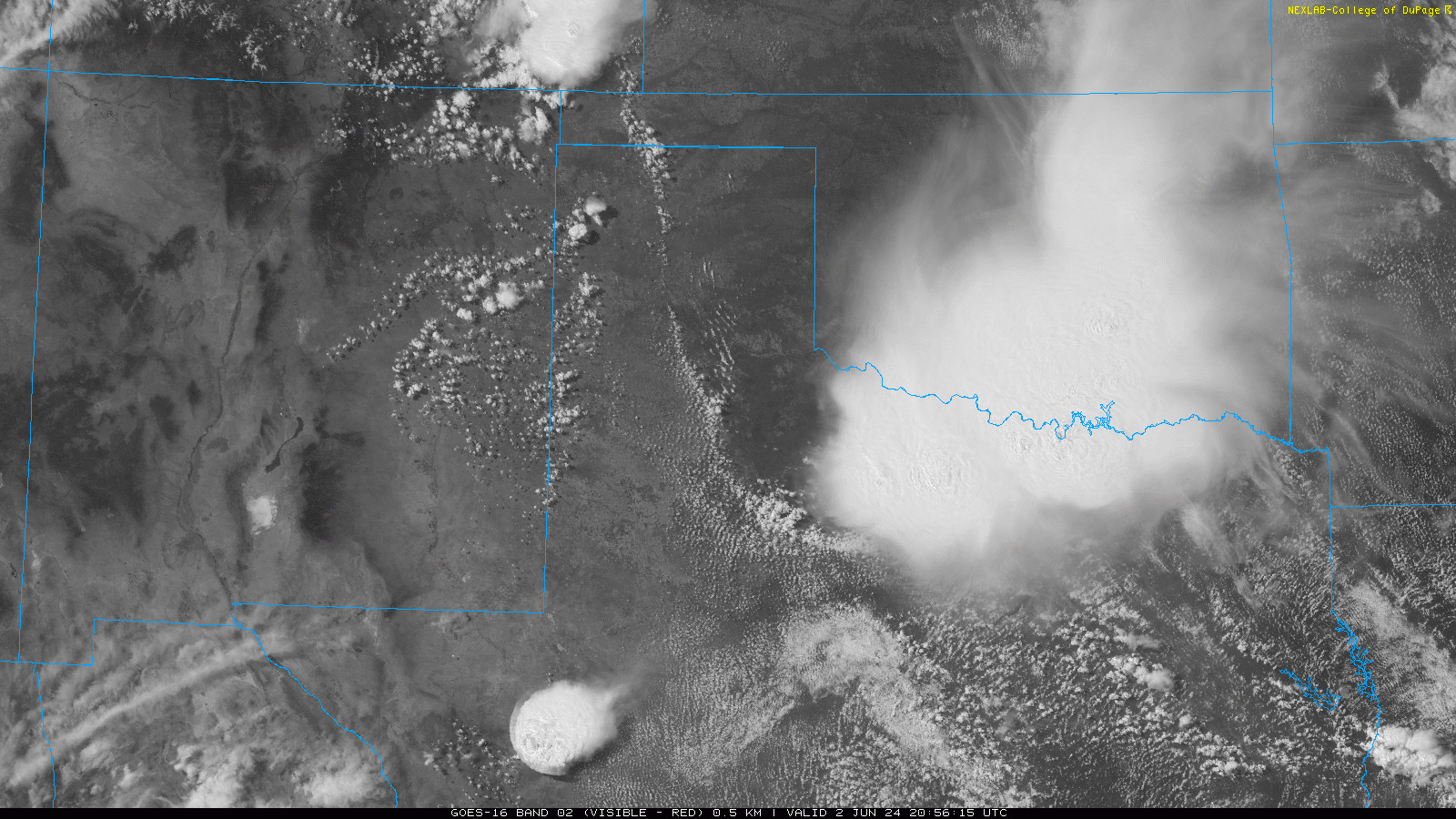
Visible satellite loop valid from 3:56 pm to 6:36 pm on Sunday (2 June 2024). |
|
| East of the outflow boundary, temperatures were a little cooler, but the air was very moist, thanks, in part, to a thunderstorm complex that moved across the eastern Texas Panhandle, western Oklahoma and much of North Texas earlier in the day. The outflow boundary did trigger a few morning and early afternoon thunderstorms from near Childress to south of Paducah to northeast of Aspermont. Some of these storms were on the strong side and produced brief torrential rain. | |
 |
|
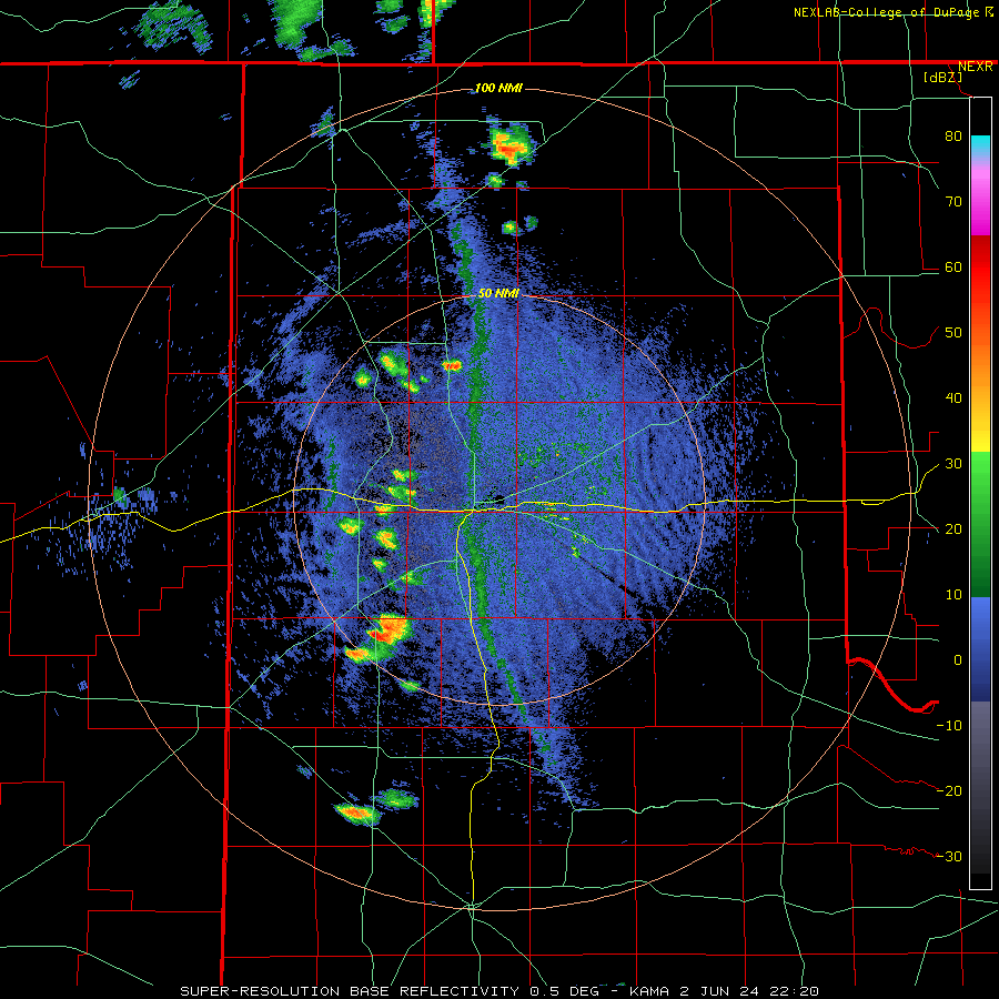
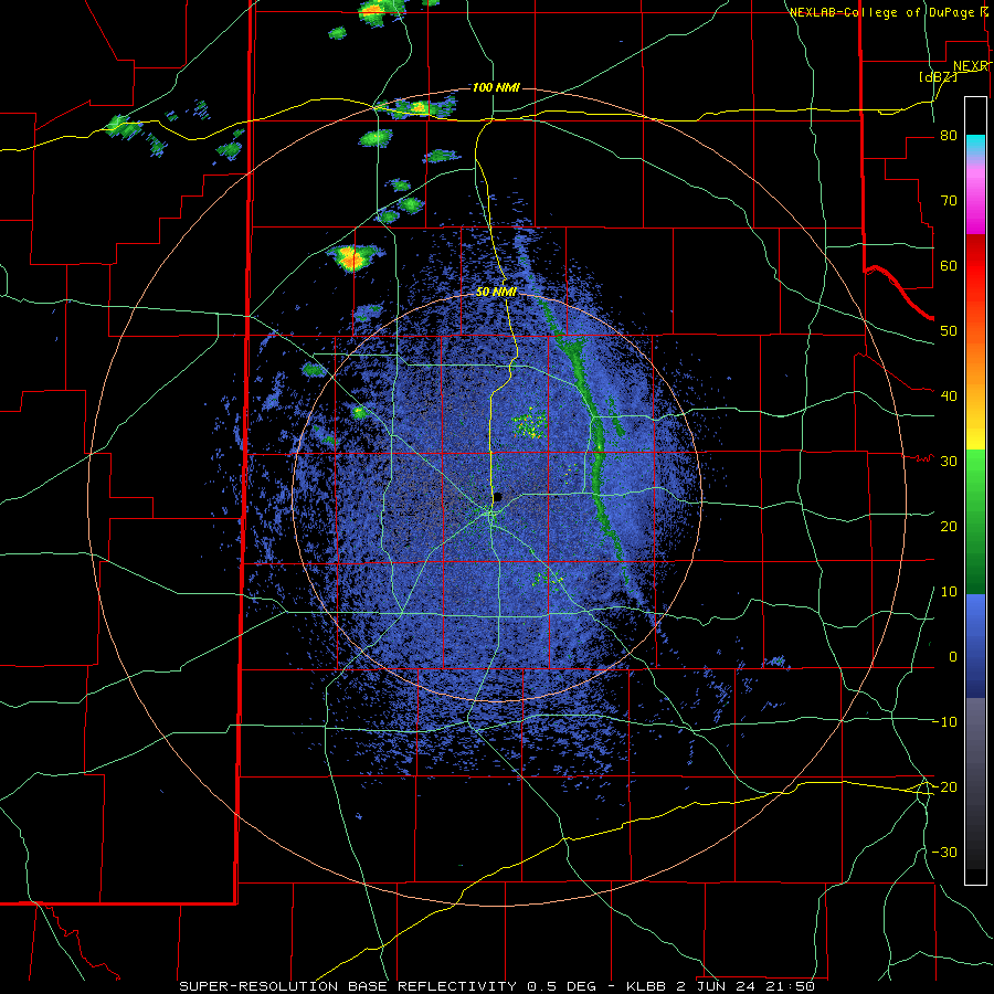
| Amarillo WSR-88D radar animation valid from 5:20 pm to 9:19 pm on Sunday (2 June 2024). An additional radar animation, from the Lubbock WSR-88D radar and valid from 4:50 pm to 9:21 pm, can be VIEWED HERE. A regional radar animation, valid from 6:06 pm on Sunday to 6:05 am on Monday (2-3 June), can be FOUND HERE. | |
| However, the main show in West Texas waited until the evening. Thunderstorms along the dryline were initially not well organized, but that quickly changed as they encountered the outflow boundary. The increased moisture and instability, in combination with stout southeasterly upslope winds (which increased the low-level wind shear), caused the thunderstorms to quickly organize and strengthen. | |
 |
 |
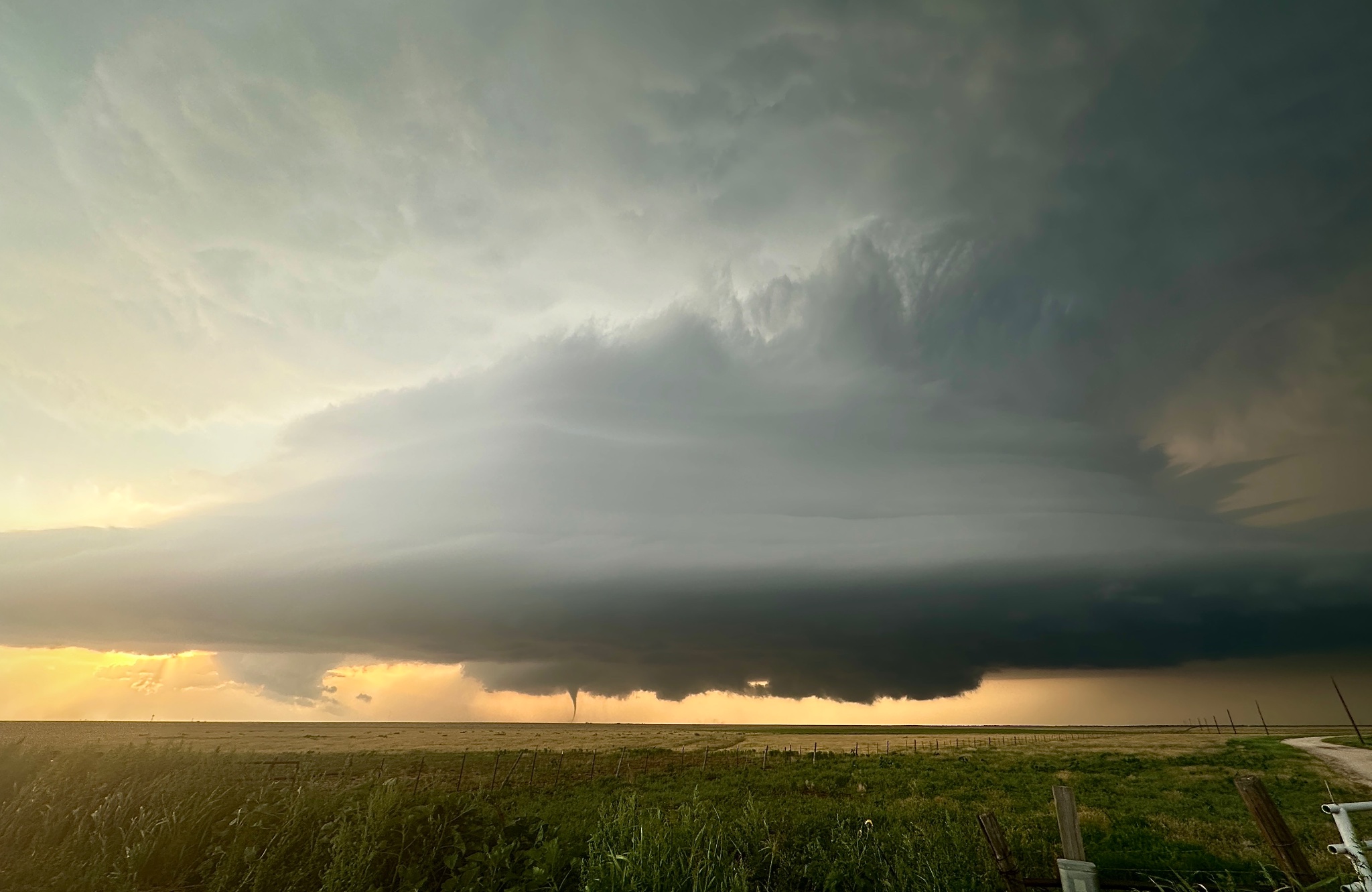
| Tornadic storm near Silverton Sunday evening. The pictures are courtesy of Devin Bissell. | |
| The dominate storm across the southern Texas Panhandle quickly intensified near Happy, Texas, with strong mid-level rotation developing. The cyclonic rotation strengthened and lowered with time as the storm tracked more easterly, then southeasterly. Extreme lift within the storm generated giant hail, while a wall cloud developed, lowered and produced a tornado after passing very close to Vigo Park. | |
 |
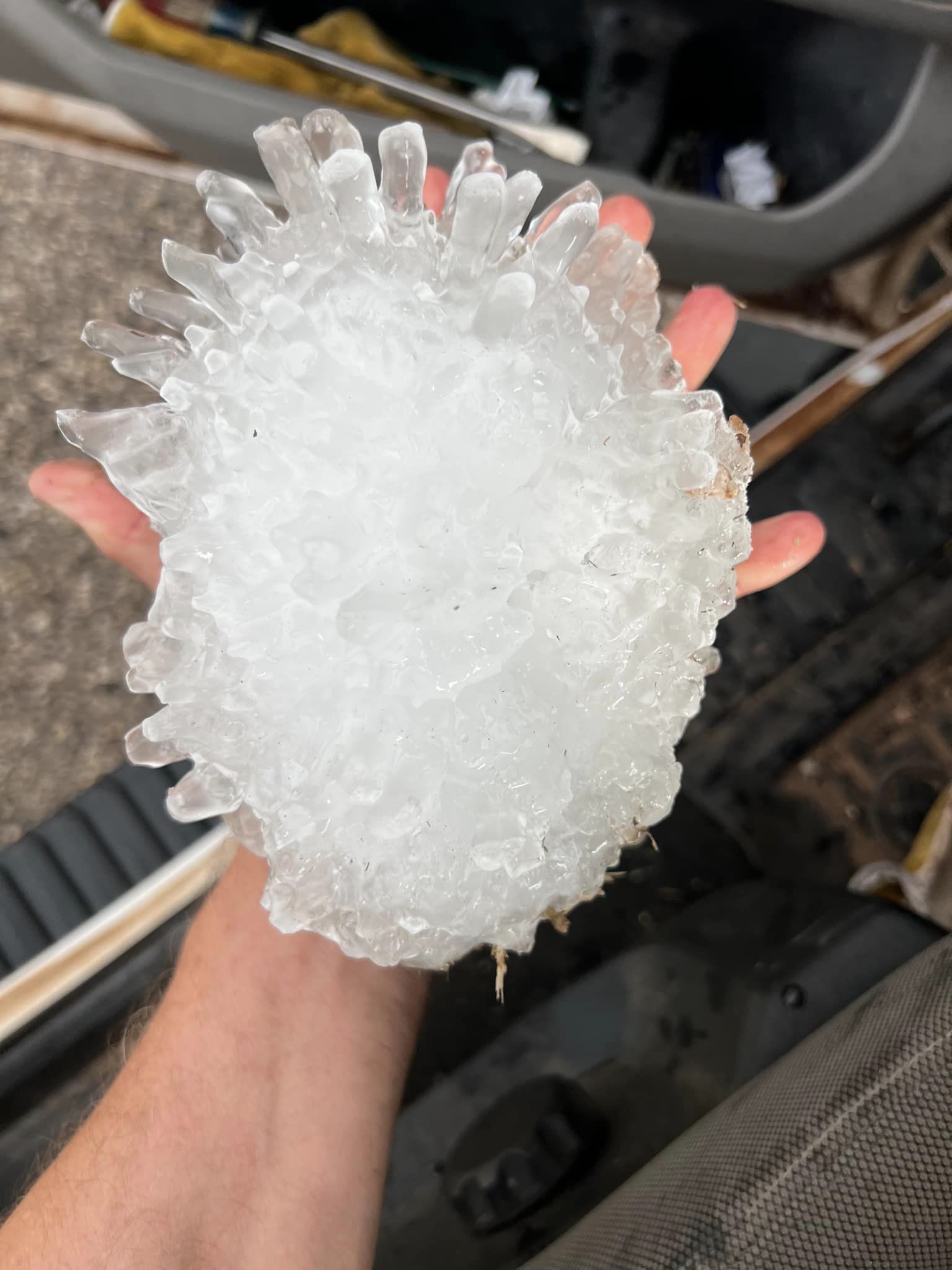 |
| Giant hail that fell near Vigo Park, TX, Sunday evening (2 June 2024). The pictures are courtesy of Val Castor. | |
| Huge hail fell from the storm, including the above 5 to 6+ inch diameter stone which was observed a few miles west-northwest of Vigo Park. If confirmed, this hailstone could set a new record for the largest in Texas, surpassing the current record with is 6.416 inches in diameter, and fell in Hondo in 2021. A complete report on the Hondo hailstone can be FOUND HERE. | |
 |
 |
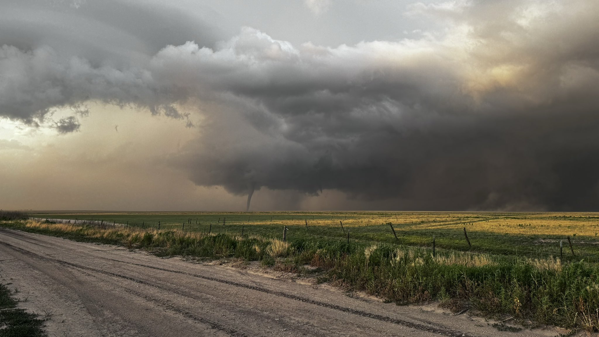
| Supercell thunderstorm and tornado near Silverton, TX, Sunday evening (2 June 2024). The images are courtesy of Andrew Dale (left) and Steve Thompson (right). | |
| After becoming tornadic, the storm continued to move southeastward, passing several miles to the north and northeast of Silverton. The first tornado gradually dissipated, but another tornado formed as this was occurring, with two tornadoes in contact with the ground for roughly 4 to 5 minutes. Thereafter, the newly formed tornado became the dominate tornado and persisted another 20 minutes before dissipating east of Highway 207 and north of Highway 86. | |
 |
 |
| Additional pictures of giant hail that fell 15 miles east of Silverton (left) and north of Quitaque (right) Sunday evening (6 June 2024). The pictures are courtesy of Tony Lyza (left) and @LonestarStateWx on X (right). | |
| Thankfully, by all accounts received, the tornado remained in open land and inflicted no known significant damage. The storm did continue to drop large hail as it moved near Caprock Canyons State Park, but quickly diminished in intensity during the late evening hours. | |
 |
|
| Texas Tech Ka-band Mobile Doppler Radar Reflectivity (left) and Radial Velocity (right) of the tornadic storm north-northeast of Silverton at 8:21 pm on Sunday evening (2 June 2024). The images are courtesy of Texas Tech's National Wind Institute (NWI) and Alex Schueth. | |
| Detailed tornado tracks, based on the Ka-band Mobile Radar, were constructed after the event and can be viewed below. In addition to the two primary tornadoes, a satellite tornado was observed during each primary tornado, with the latter satellite tornado rotating anticyclonically. | |
 |
|
| Detailed tornado locations based on TTU's Ka-band Mobile Doppler Radar scans Sunday evening (2 June 2024). The tornadoes are color coded, red is tornado 1, whereas blue is tornado 2. Tornado 1 had a satellite circulation labelled 1S, whereas tornado 2 had an anticyclonic tornado (2A) to its east that we barely caught the dissipation of. There are missing gaps of time due to range limitations, and completing RHI scans. The above map is courtesy of Alex Schueth. | |
|
Storm reports and the preliminary NWS damage survey for June 2nd can be found below: |
|
Preliminary Local Storm Report...Summary
National Weather Service Lubbock TX
436 AM CDT Mon Jun 3 2024
..TIME... ...EVENT... ...CITY LOCATION... ...LAT.LON...
..DATE... ....MAG.... ..COUNTY LOCATION..ST.. ...SOURCE....
..REMARKS..
0616 PM Hail 1 W Happy 34.73N 101.88W
06/02/2024 M0.75 Inch Swisher TX Public
Report from mPING: Dime (0.75 in.).
0620 PM Hail 1 W Happy 34.73N 101.88W
06/02/2024 E1.00 Inch Swisher TX Public
Report from mPING: Quarter (1.00 in.).
0716 PM Funnel Cloud 8 S Wayside 34.67N 101.55W
06/02/2024 Swisher TX Public
0720 PM Hail Aiken 34.15N 101.52W
06/02/2024 M0.50 Inch Floyd TX Public
Report from mPING: Half-inch (0.50 in.).
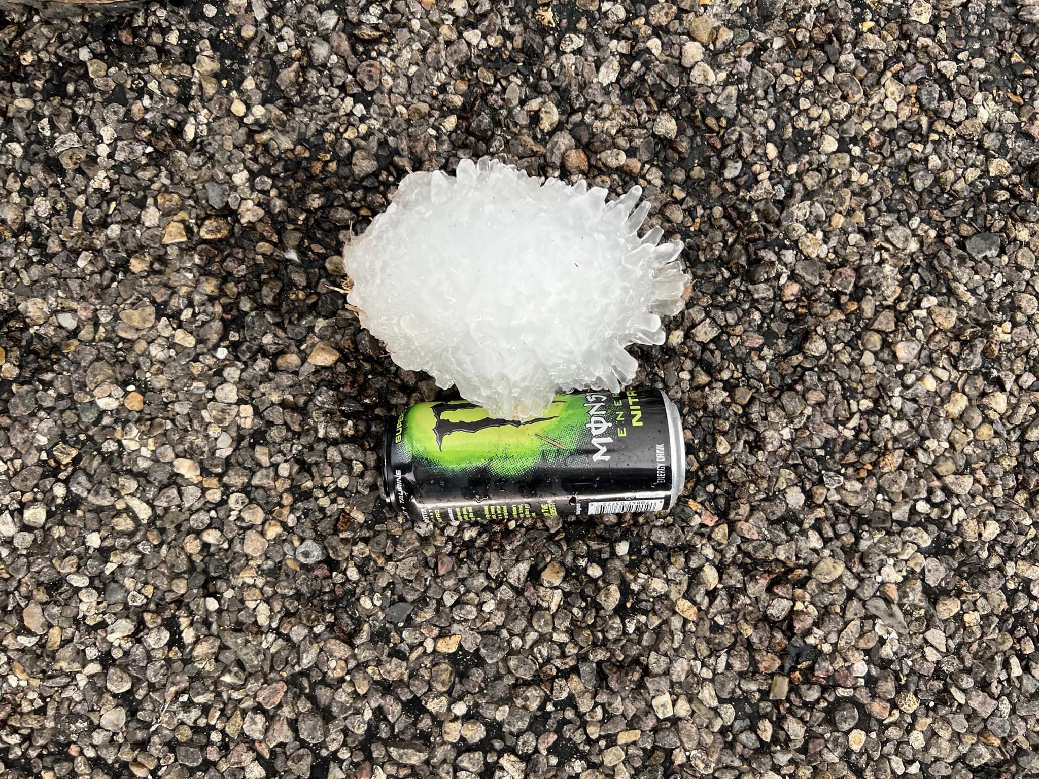
0737 PM Hail 10 NW Mackenzie Reservo 34.66N 101.55W
06/02/2024 E6.00 Inch Swisher TX Broadcast Media
Corrects previous hail report from 10 NW
Mackenzie Reservoir. Giant hail observed by
Broadcast Media chaser 3 miles
west-northwest of Vigo Park. The hail was 5+
inches in diameter. The hail appeared to be
as long as a 16 oz Monster Nitro Energy
Drink can.
0750 PM Hail 7 NNW Mackenzie Reservo 34.64N 101.50W
06/02/2024 M2.75 Inch Swisher TX Storm Chaser
Baseball size hail observed by storm chaser
on live video feed. Spotter was about 1 mile
east of Vigo Park.
0756 PM Tornado 10 NW Silverton 34.57N 101.43W
06/02/2024 Briscoe TX Storm Chaser
Location estimated by chaser.
0802 PM Tornado 7 N Silverton 34.57N 101.31W
06/02/2024 Briscoe TX Trained Spotter
This is another observation of the initial
tornado with this storm.
0820 PM Tornado 6 NNE Silverton 34.56N 101.27W
06/02/2024 Briscoe TX Storm Chaser
Tornado observed live on storm chaser video
feed.
0903 PM Hail 8 N Quitaque 34.48N 101.05W
06/02/2024 M3.40 Inch Briscoe TX Storm Chaser
Time and location estimated. Report from
storm chaser via social media.
0905 PM Hail 4 NNE Caprock Canyons S 34.50N 101.02W
06/02/2024 M4.50 Inch Briscoe TX Storm Chaser
At least 4.5 inch hail found on highway 256
after the storm passed with likely some
melting.
0907 PM Hail 4 NNE Caprock Canyons S 34.50N 101.02W
06/02/2024 M3.00 Inch Briscoe TX Storm Chaser
Photos via social media.
0914 PM Hail Caprock Canyons State P 34.45N 101.07W
06/02/2024 E1.75 Inch Briscoe TX Park/Forest Srvc
Golf ball size hail reported by TPWD Law
Enforcement in Caprock Canyons State Park.
0915 PM Hail 2 NE Caprock Canyons St 34.47N 101.04W
06/02/2024 M6.00 Inch Briscoe TX Storm Chaser
Corrects previous hail report from 2 NE
Caprock Canyons State Park Visitors Center
to change the time. Picture sent via chat of
a 6 inch hailstone measured with a tape
measurer.
1118 PM Hail Idalou 33.67N 101.68W
06/02/2024 M0.88 Inch Lubbock TX Broadcast Media

