|
Late May brings rounds of severe thunderstorms with wind and hail |
|
 |
|
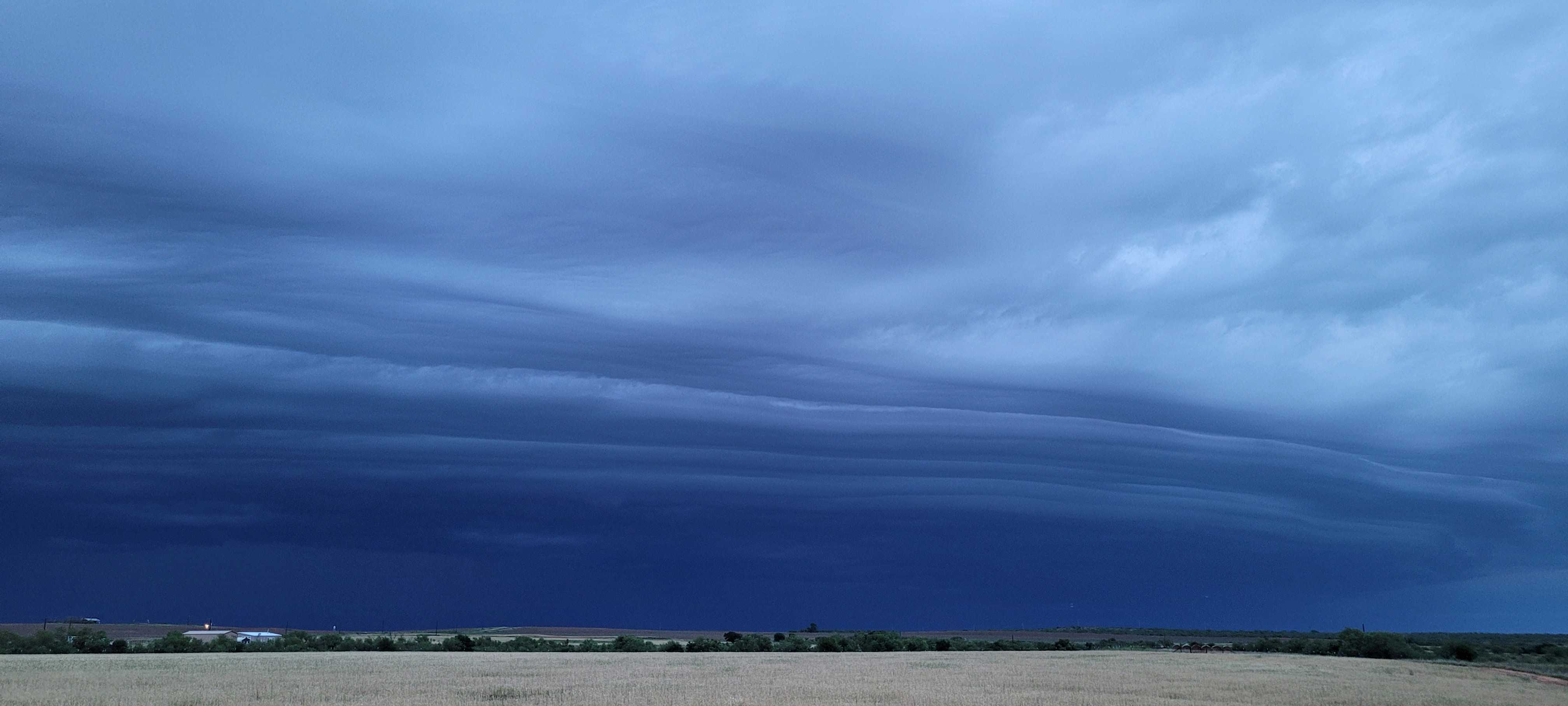
| Shelf cloud approaching the Estelline area from the northwest Thursday evening (30 May 2024). The image is courtesy of Farrah Holcomb. | |
|
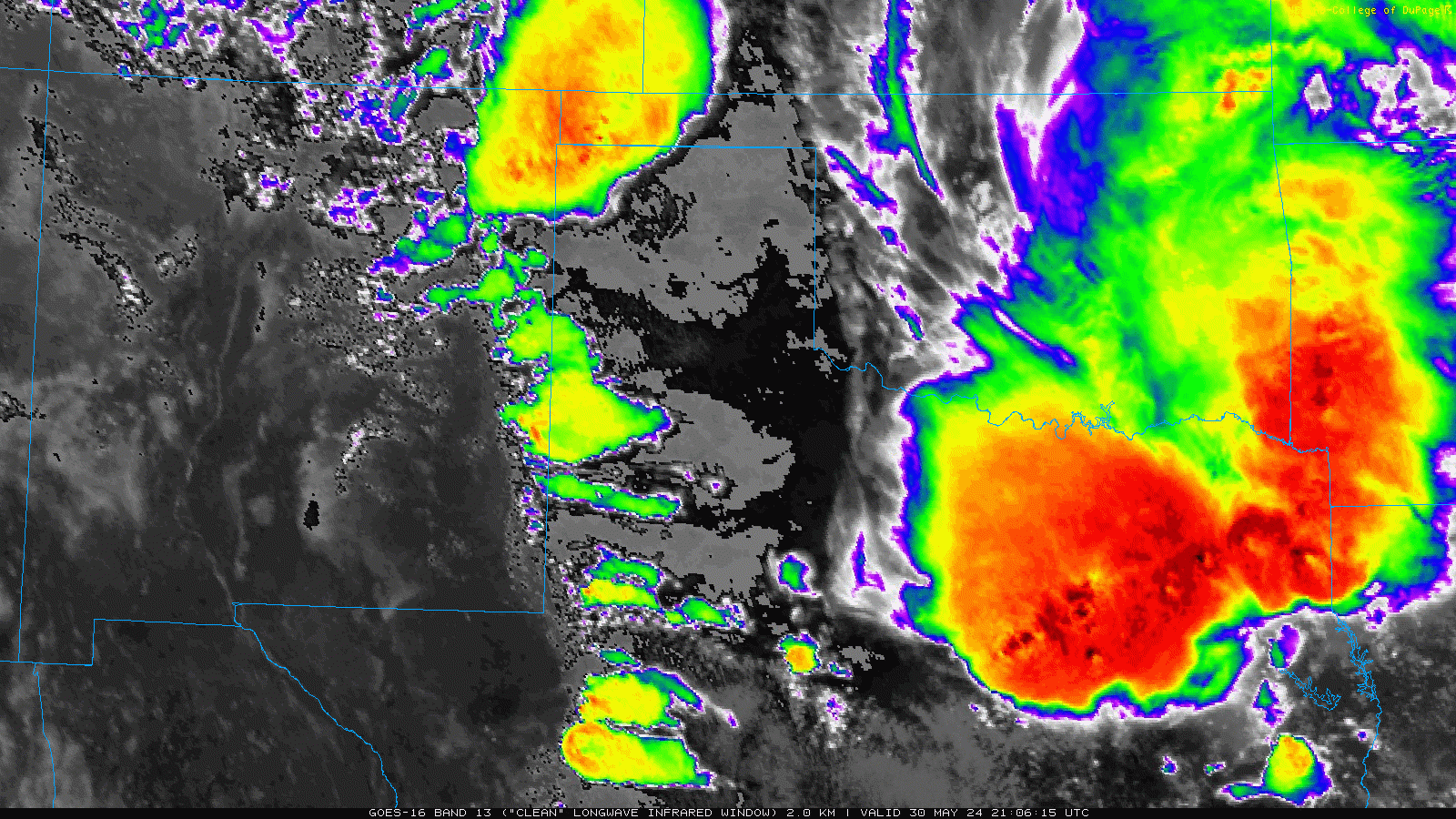
Thursday, May 30th, started on the active side as an area of thunderstorms developed across the southern Texas Panhandle in the predawn hours. Following quickly on the heels of this activity, a line of thunderstorms plunged southeastward across the southeast Texas Panhandle and into the northern and central Rolling Plains after daybreak Thursday. |
|
 |
|
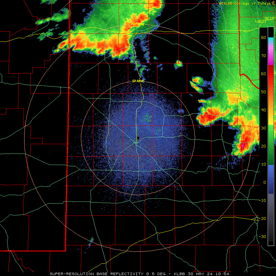
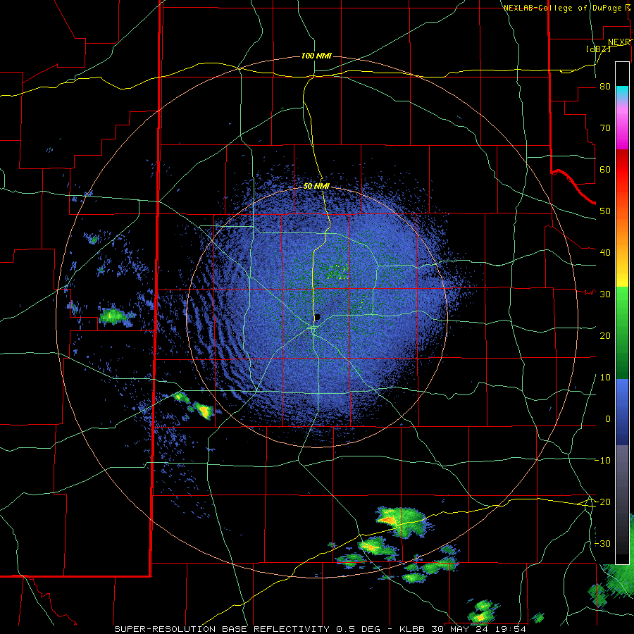
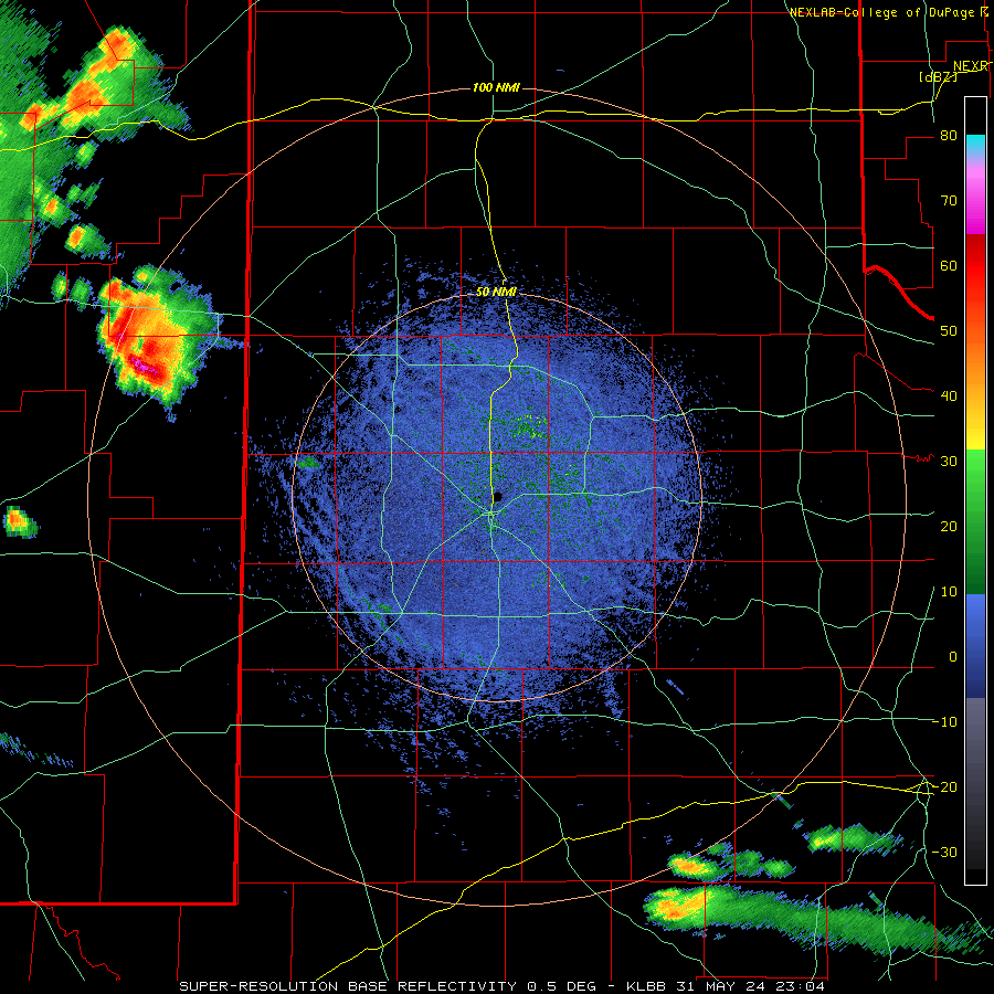
| Lubbock WSR-88D radar animation valid from 5:54 am to 11:07 am on Thursday (30 May 2024). An additional radar animation, valid from 8:43 pm on Wednesday to 6:23 am on Thursday (29-30 May), can be VIEWED HERE. | |
| The early-day activity brought heavy rain, along with several severe wind gusts. The West Texas Mesonet (WTM) site east of Silverton measured a peak gust of 59 mph at 2:43 am, only to be outdone by merging storms near Childress that generated an 81 mph gust at 8:44 am. The heavy rain and intense winds were also accompanied by hail as large as 1.25 inches in diameter in and near Childress. | |
 |
|
| Hail falling in Childress Thursday morning (30 May 2024). The picture is courtesy of Pantex. | |
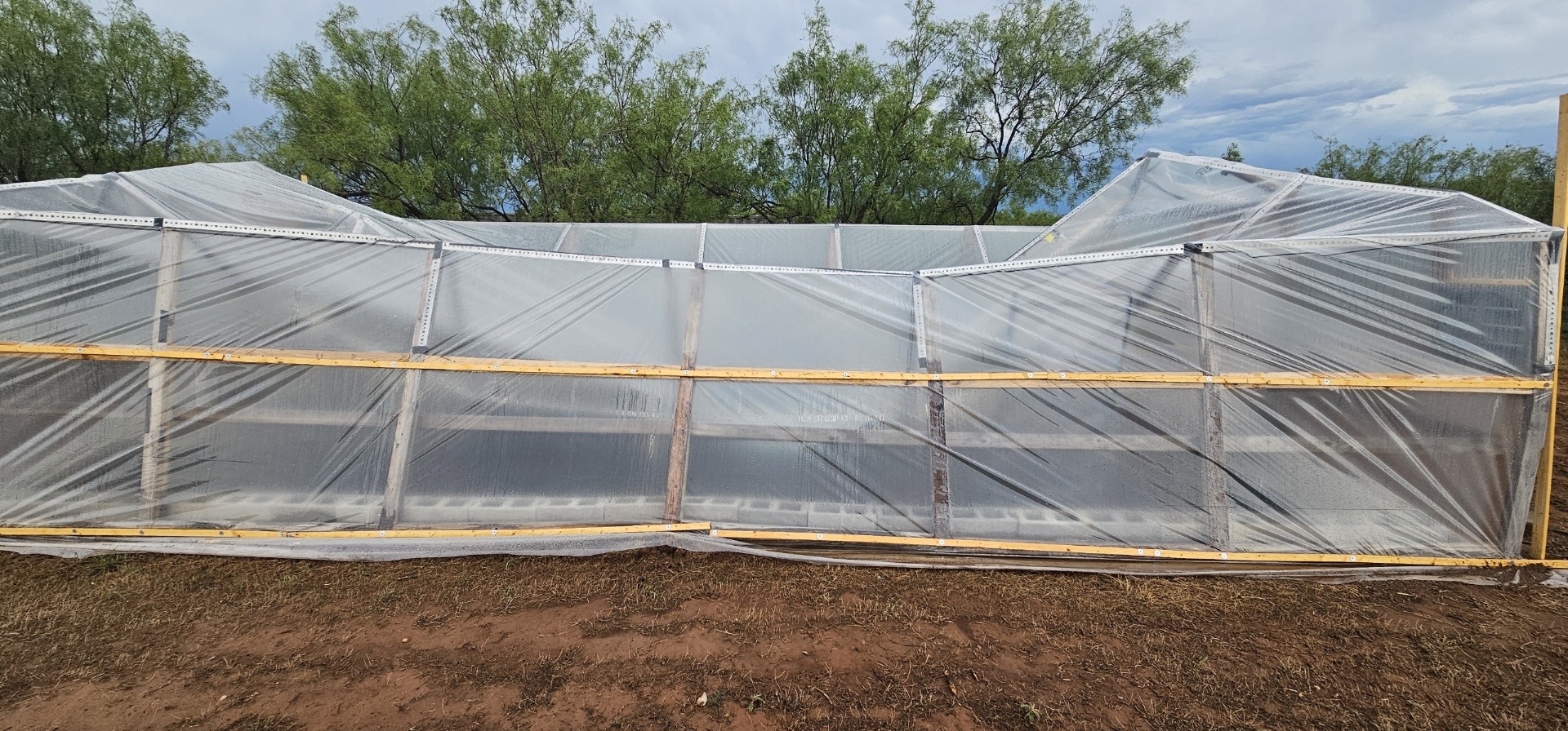
| The wind-driven rain and hail did cause spotty damage around Childress, including causing the partial collapse of the greenhouse seen below. | |
 |
|
| Greenhouse that was damaged by the strong winds that impacted Childress Thursday morning (30 May 2024). The picture is courtesy of Callum Smith. | |
| After a brief lull in activity late Thursday morning and early afternoon, the next round of thunderstorms developed near the Texas and New Mexico state line in the mid-late afternoon, focused on a southwestward moving boundary left over from the morning thunderstorms. Plenty of instability and sufficient wind shear allowed these thunderstorms to quickly organize, with a few becoming supercellular. | |
 |
|
| Regional radar animation valid from 2:35 pm on Thursday to 6:05 am on Friday (30-31 May 2024). | |
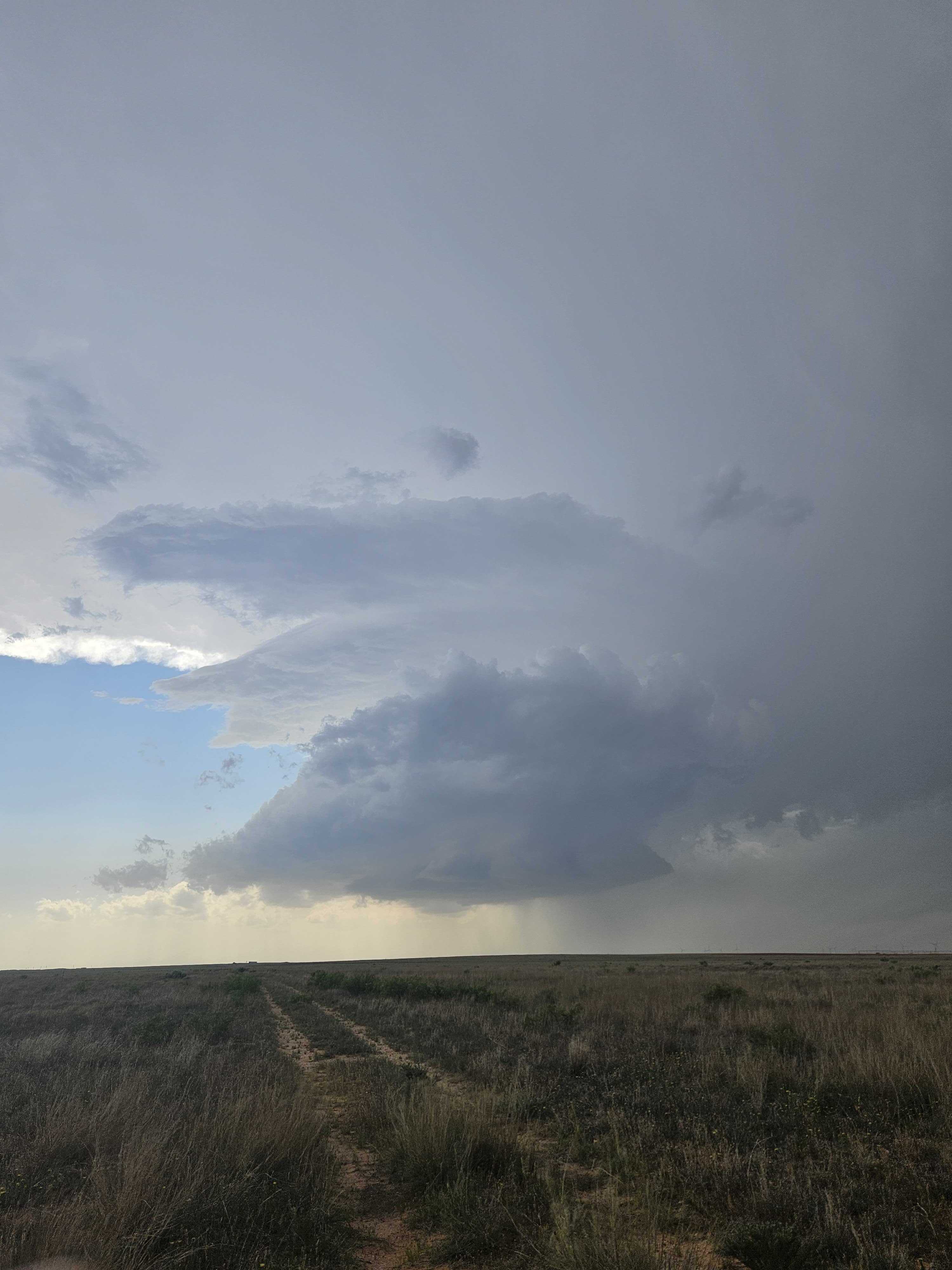
| These storms took on the classic look of a cyclonically rotating storm on the southern High Plains, as can be seen below. These storms are often proficient large hail producers, and this afternoon's and evening's activity did not disappoint. | |
 |
|
| Supercell thunderstorm near Bledsoe Thursday evening (30 May 2024). The image is courtesy of Joey Marino. | |
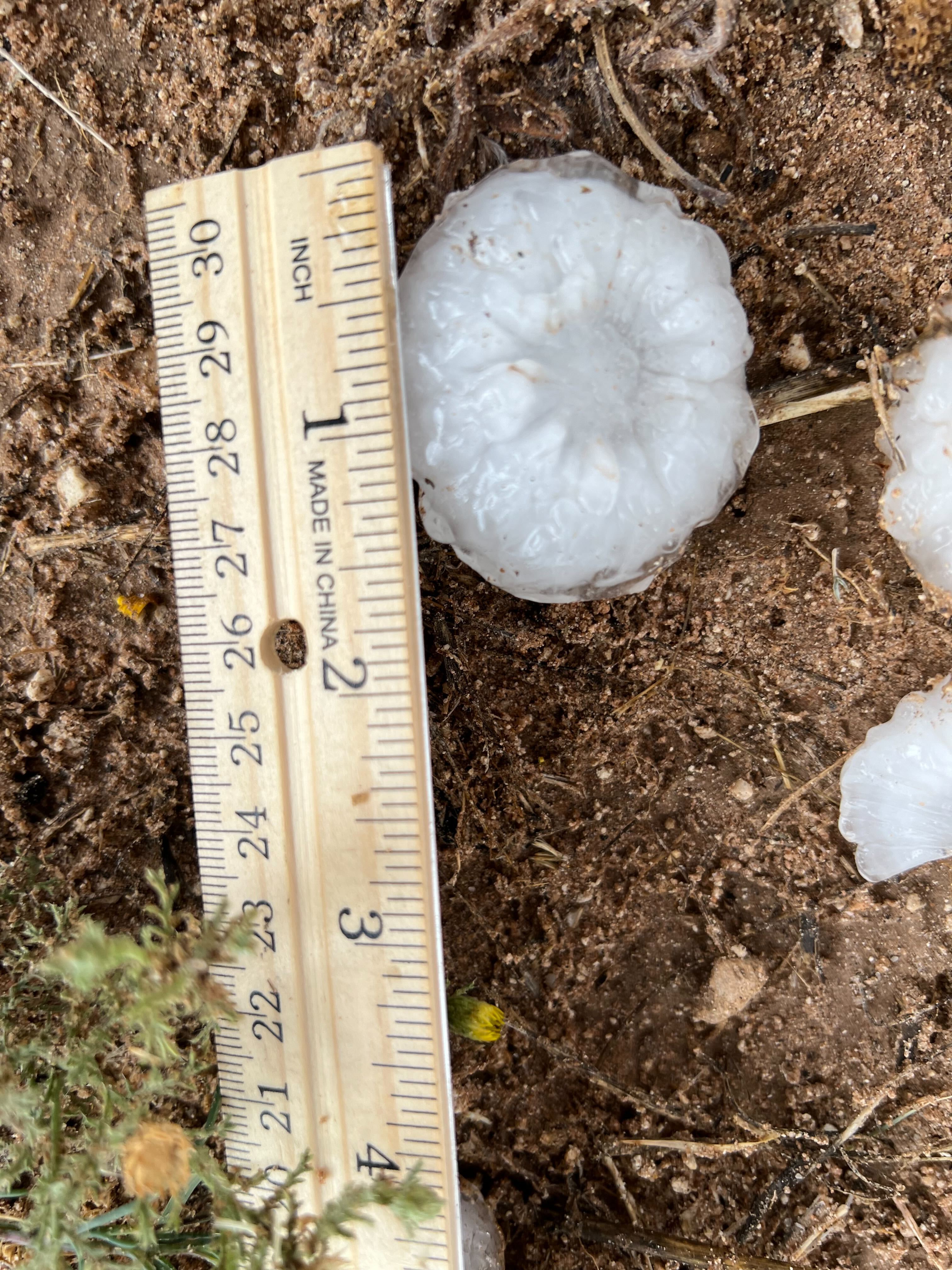
| The robust thunderstorms dropped plenty of golf ball sized hail, with swaths of hail larger than baseballs falling near Denver City. | |
 |
|
| Infrared satellite loop valid from 4:06 pm to 9:56 pm on Thursday (30 May 2024). | |
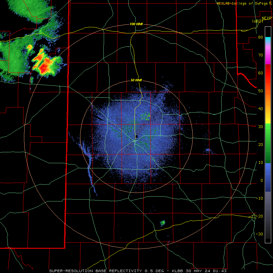
| Farther south, a particularly intense thunderstorms developed north of Midland and move southward, dropping giant hail and producing three confirmed tornadoes. The first tornado started very near the Midland weather office, and although it did miss the office, wind driven baseball to softball size hail did cause extensive damage. | |
 |
|
| Lubbock WSR-88D radar animation valid from 2:54 pm to 9:57 pm on Thursday (30 May 2024). | |
| Back north, the storms across the western South Plains gradually moved east and southeast through the evening, but lost intensity through the mid-late evening hours. At the same time, another line of storms plunged through the eastern Texas Panhandle, but gradually weakened as they moved into the southeast Texas Panhandle, around Childress, by late evening. | |
 |
|
| Hail that fell in Bledsoe early Thursday evening (30 May 2024). The picture is courtesy of Robin Tanamachi. | |
|
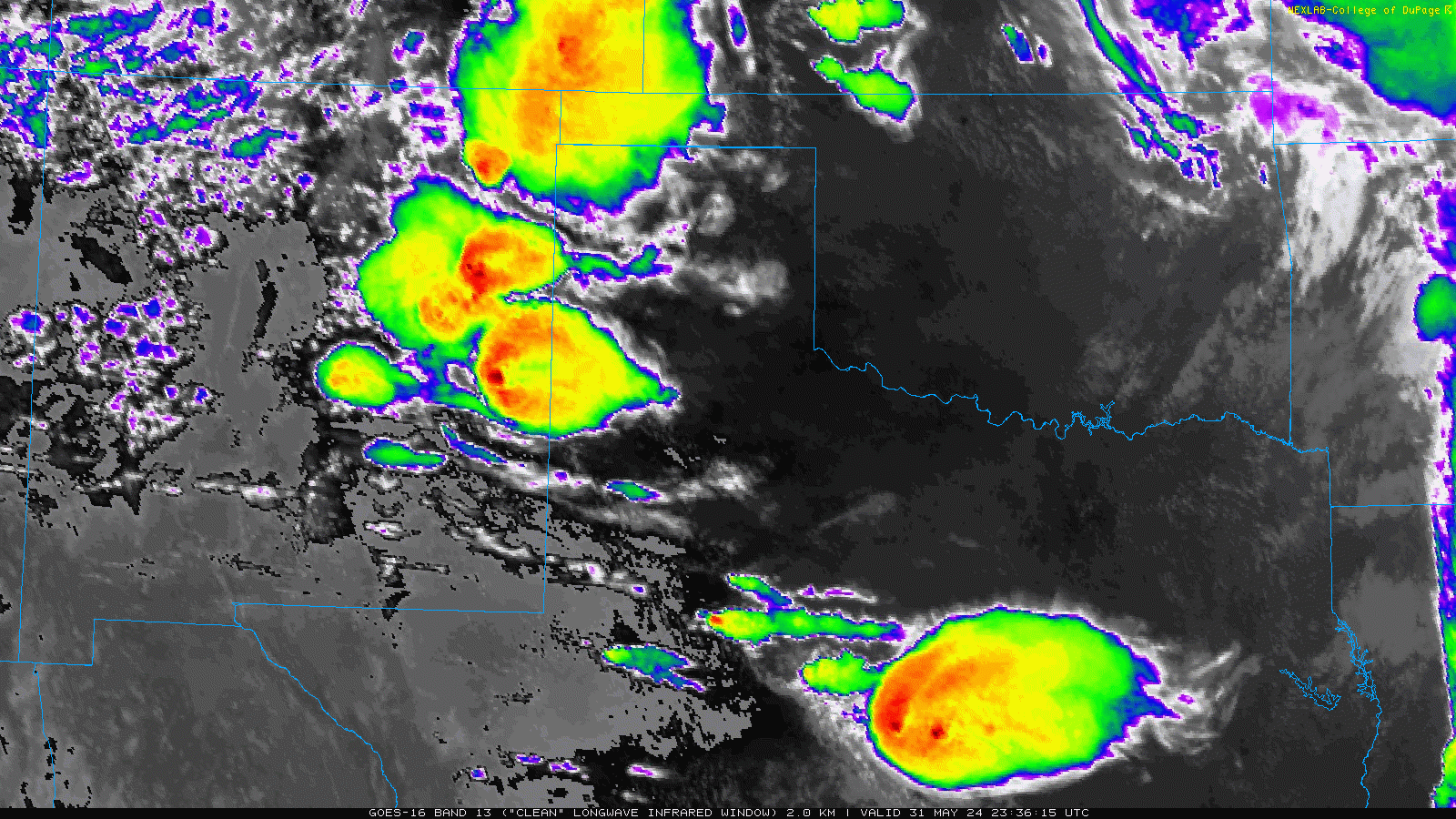
Unlike the previous day, Friday started off on the quiet side. That changed quickly during the evening as thunderstorms that developed over the higher terrain of eastern New Mexico spread across the state line. |
|
 |
|
| Infrared satellite loop valid from 6:36 pm on Friday to 6:16 am on Saturday (31 May to 1 June 2024). | |
| Additional thunderstorms quickly developed in advance of the cluster of activity propagating out of New Mexico across the western South Plains. These "newer" storms were proficient lightning producers, in addition to dropping heavy rain and pockets of hail. However, they were most notable for their ability to generate intense wind gusts. | |
 |
|
| Lubbock WSR-88D radar animation valid from 6:04 pm on Friday to 4:28 am on Saturday (31 May to 1 June 2024). | |
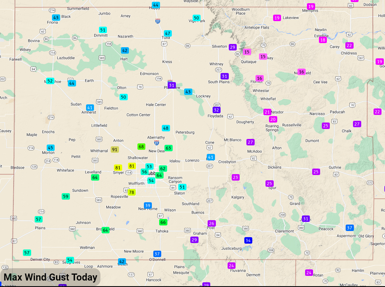
| One storm produced a wind gust to 91 mph as it moved across the WTM site 6 miles south-southwest of Anton. Additional wind gusts to 81 mph were measured at the Smyer and Reese Center WTM sites as the corridor of severe winds advanced quickly east and southeastward. Lubbock was fortunate to be spared from the strongest winds, though many spots still saw peak gusts in the 55 to 65 mph range. | |
 |
|
| Peak wind gusts measured by the West Texas Mesonet on Friday (31 May 2024). | |
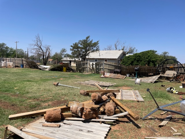
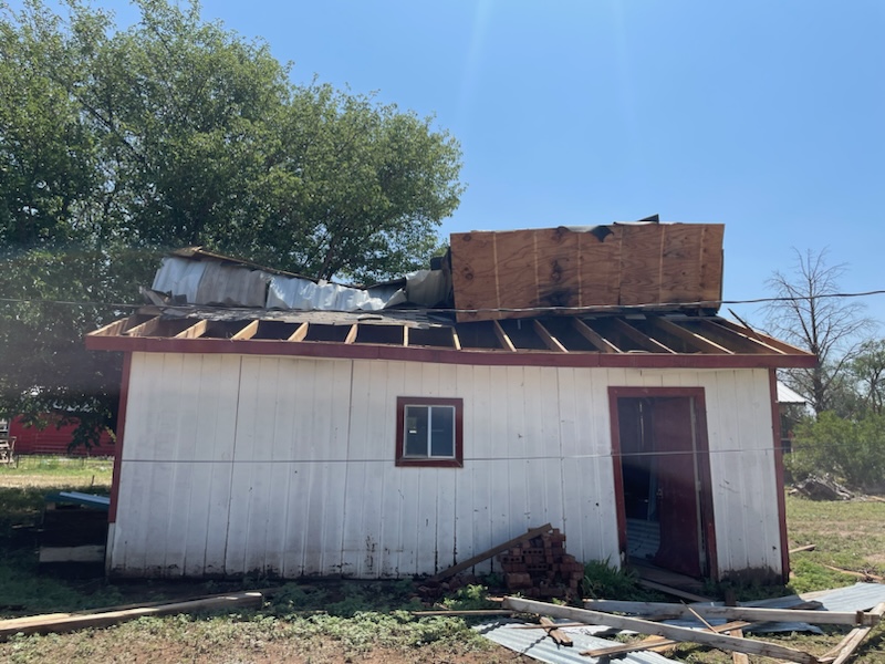
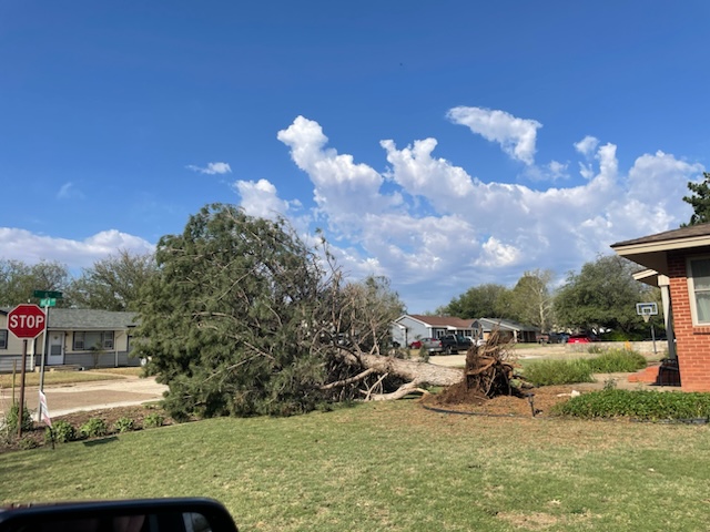
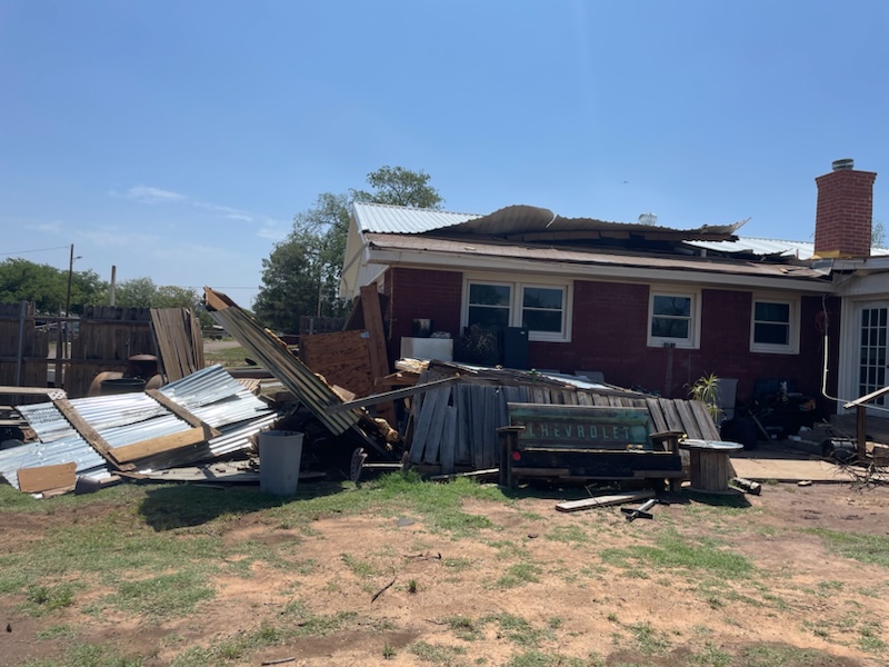
| The south side of Tahoka wasn't as lucky as intense winds caused significant damage to several properties, as seen below. Carports were damaged and destroyed, as were fences and some out buildings. | |
 |
 |
 |
 |
 |
|
| Damage observed on the south side of Tahoka. The pictures were taken by Pam Elrod Saturday morning (1 June 2024). | |
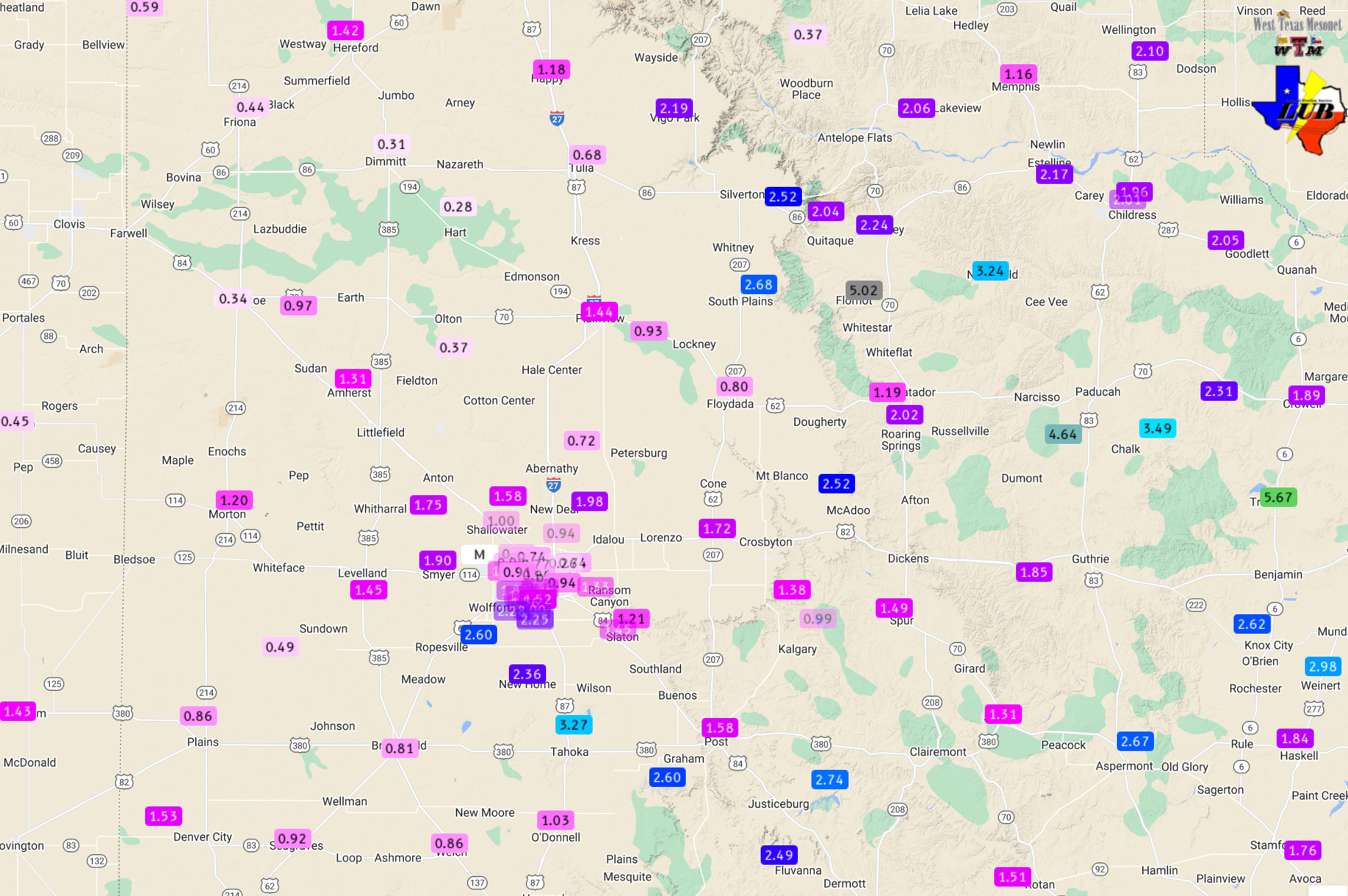
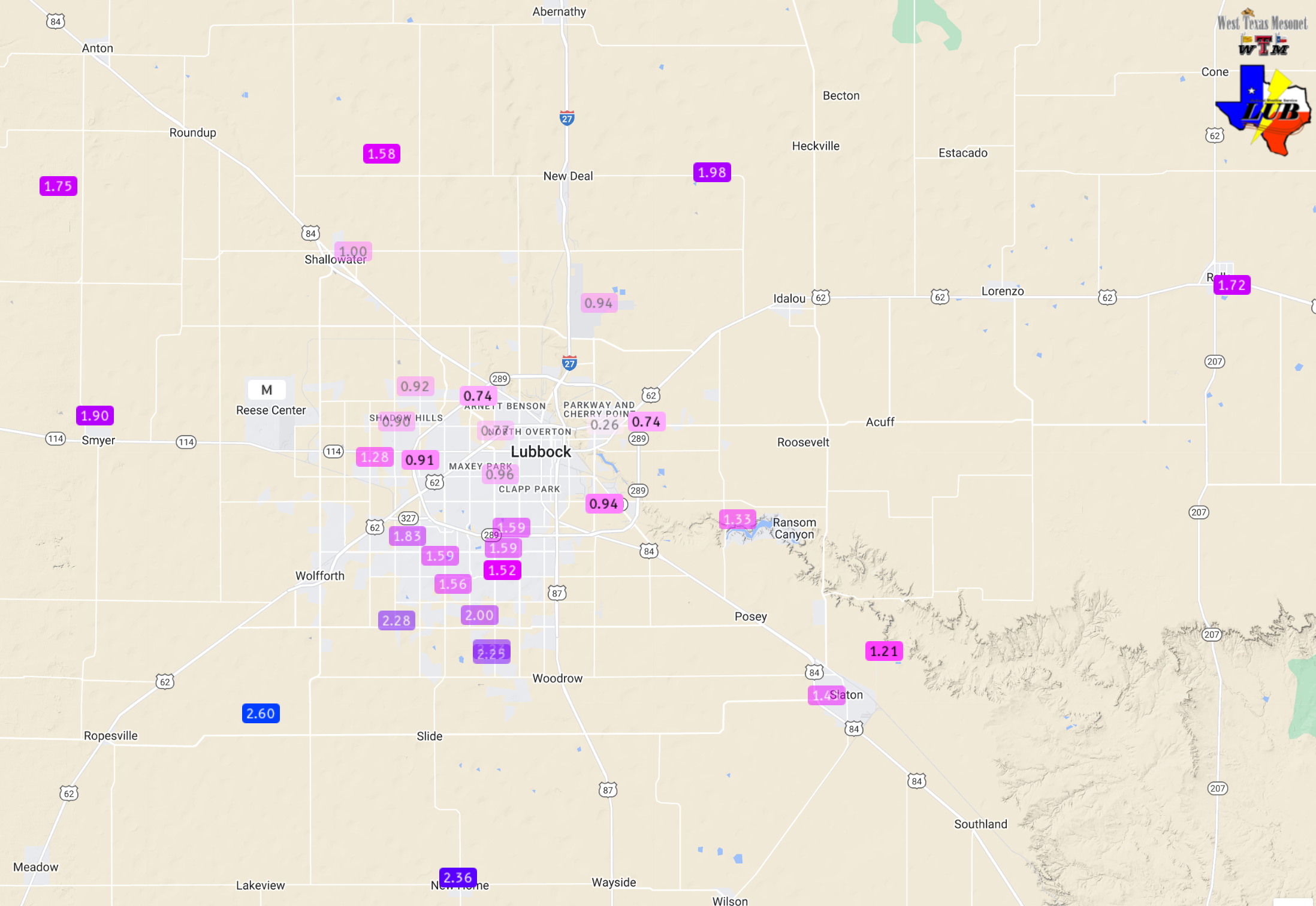
| One the positive side, the rounds of thunderstorms did provide widespread rainfall for the region. The below graphic shows roughly how much rain fell in the final several days of May. Many locations saw near or over an inch of rain, with several swaths of 2+ inches. The heaviest rain targeted spots from around Silverton and the community of South Plains southeastward through much of Cottle County. The Flomot WTM measured an impressive 5.02 inches, a majority of which fell during the early morning hours of Thursday (30 June). Another locally heavy swath of rain stretched from near Levelland through Tahoka, but this also came with a lot of wind and significant damage in spots. | |
 |
|
| 5-day radar-estimated and bias-corrected rainfall ending at 7 am on Sunday, 2 June 2024. The rain measured by the West Texas Mesonet over this same period can be VIEWED HERE, with a closer look at the Lubbock area FOUND HERE. | |
|
Officially, the Lubbock Airport measured 1.18 inches over the last four days of May, which boosted its year-to-date total (YTD) to 6.19 inches, putting it 0.49 inches above normal. Storm reports collected from this very active end of May can be found below: |
|
Preliminary Local Storm Report...Summary
National Weather Service Lubbock TX
659 AM CDT Fri May 31 2024

..TIME...   ...EVENT...      ...CITY LOCATION...     ...LAT.LON...
..DATE...   ....MAG....      ..COUNTY LOCATION..ST.. ...SOURCE....
            ..REMARKS..

1245 AM     Non-Tstm Wnd Gst 2 ENE Friona            34.65N 102.69W
05/30/2024  M66 MPH          Parmer             TX   Mesonet

            Also gusted to 59 mph at 1221 AM. Measured
            by the West Texas Mesonet.

0241 AM     Tstm Wnd Gst     7 ESE Silverton         34.45N 101.19W
05/30/2024  M58 MPH          Briscoe            TX   Mesonet


0243 AM     Tstm Wnd Gst     7 ESE Silverton         34.45N 101.19W
05/30/2024  M59 MPH          Briscoe            TX   Mesonet


0844 AM     Tstm Wnd Gst     2 NNE Childress         34.46N 100.20W
05/30/2024  M81 MPH          Childress          TX   Mesonet

            Also gusted from 61 mph to 79 mph from 841
            AM until 846 AM. Measured by the West Texas
            Mesonet.

0845 AM     Tstm Wnd Gst     4 W Childress           34.43N 100.28W
05/30/2024  M63 MPH          Childress          TX   ASOS

            Childress ASOS.

0845 AM     Tstm Wnd Dmg     1 ENE Childress         34.43N 100.20W
05/30/2024                   Childress          TX   Public

            Minor damage to greenhouse roof. Time
            estimated.

0845 AM     Tstm Wnd Dmg     1 WNW Childress         34.44N 100.22W
05/30/2024                   Childress          TX   Emergency Mngr

            Motel lost part of roof.

0851 AM     Hail             1 NW Childress          34.44N 100.22W
05/30/2024  M1.25 Inch       Childress          TX   Public

            Report from mPING: Half Dollar (1.25 in.).

0414 PM     Hail             Bledsoe                 33.62N 103.02W
05/30/2024  M1.50 Inch       Cochran            TX   NWS Employee

            Quarter to ping pong size.

0420 PM     Hail             2 W Bledsoe             33.63N 103.05W
05/30/2024  M1.00 Inch       Cochran            TX   Public


0431 PM     Hail             Bledsoe                 33.62N 103.02W
05/30/2024  E1.50 Inch       Cochran            TX   Public

            Report from mPING: Ping Pong Ball (1.50
            in.).

0432 PM     Hail             Bledsoe                 33.62N 103.02W
05/30/2024  E1.75 Inch       Cochran            TX   Public

            Report from mPING: Golf Ball (1.75 in.).

0549 PM     Hail             4 N Denver City         33.03N 102.83W
05/30/2024  M2.00 Inch       Yoakum             TX   NWS Employee

            Falling on Highway 214.

0556 PM     Hail             2 N Denver City         33.00N 102.83W
05/30/2024  M3.00 Inch       Yoakum             TX   NWS Employee

            On Highway 214.

0601 PM     Hail             4 N Denver City         33.03N 102.83W
05/30/2024  M3.50 Inch       Yoakum             TX   Trained Spotter

            Photo via social media.

0604 PM     Hail             1 NNE Denver City       32.98N 102.82W
05/30/2024  E3.50 Inch       Yoakum             TX   Storm Chaser

            Photo via social media.

0610 PM     Hail             1 SW Denver City        32.96N 102.84W
05/30/2024  E1.75 Inch       Yoakum             TX   Storm Chaser

            Shared via social media.

0618 PM     Non-Tstm Wnd Gst 1 NE Amherst            34.02N 102.40W
05/30/2024  M59 MPH          Lamb               TX   Mesonet

            Occurred with light showers. Measured by the
            West Texas Mesonet.

0623 PM     Hail             17 N Plains             33.43N 102.82W
05/30/2024  M2.00 Inch       Cochran            TX   Storm Chaser

            Sporadic coverage along Highway 214.

0715 PM     Non-Tstm Wnd Gst 6 S Olton               34.09N 102.12W
05/30/2024  M62 MPH          Lamb               TX   Mesonet

            Wind gusts of 58 to 62 mph from 715 PM to
            717 PM. Measured by the West Texas Mesonet.

0725 PM     Hail             Denver City             32.97N 102.83W
05/30/2024  E1.75 Inch       Yoakum             TX   Law Enforcement

            Ping pong to golf ball size from 725 PM to
            735 PM. Minor street flooding.

0734 PM     Hail             Denver City             32.96N 102.83W
05/30/2024  E1.75 Inch       Yoakum             TX   Public

